Introduction—Salt Creek and City Nature
To place Salt Creek geographically, imagine the state of Florida. Zoom in to the west central coast,1This multi-media essay has developed over a long period of time and thanks are due to my home university's Center for Civic Engagement, the Frank E. Duckwall Foundation, the Tampa Bay Estuary Program, and most of all, to my students. Thanks to my comrades at Friends of Salt Creek; my church community at St. Augustine's Episcopal Church (at Salt Creek's headwaters), who have taught me to see my adopted hometown in a new light; to videographer Devin Rice; to Allen Tullos and anonymous readers for Southern Spaces; to Julie Armstrong, Jack Davis, Ray Arsenault, Amanda Hagood, Ray Roa, Chris Meindl, and Jacqueline Hubbard, Esq. then go to St. Petersburg, a midsized city—the second largest in the Tampa Bay area. St. Pete holds down the bottom of Pinellas County, a peninsula upon a peninsula, bracketed by Tampa Bay to the east and the Gulf of Mexico to the west. Water is everywhere.
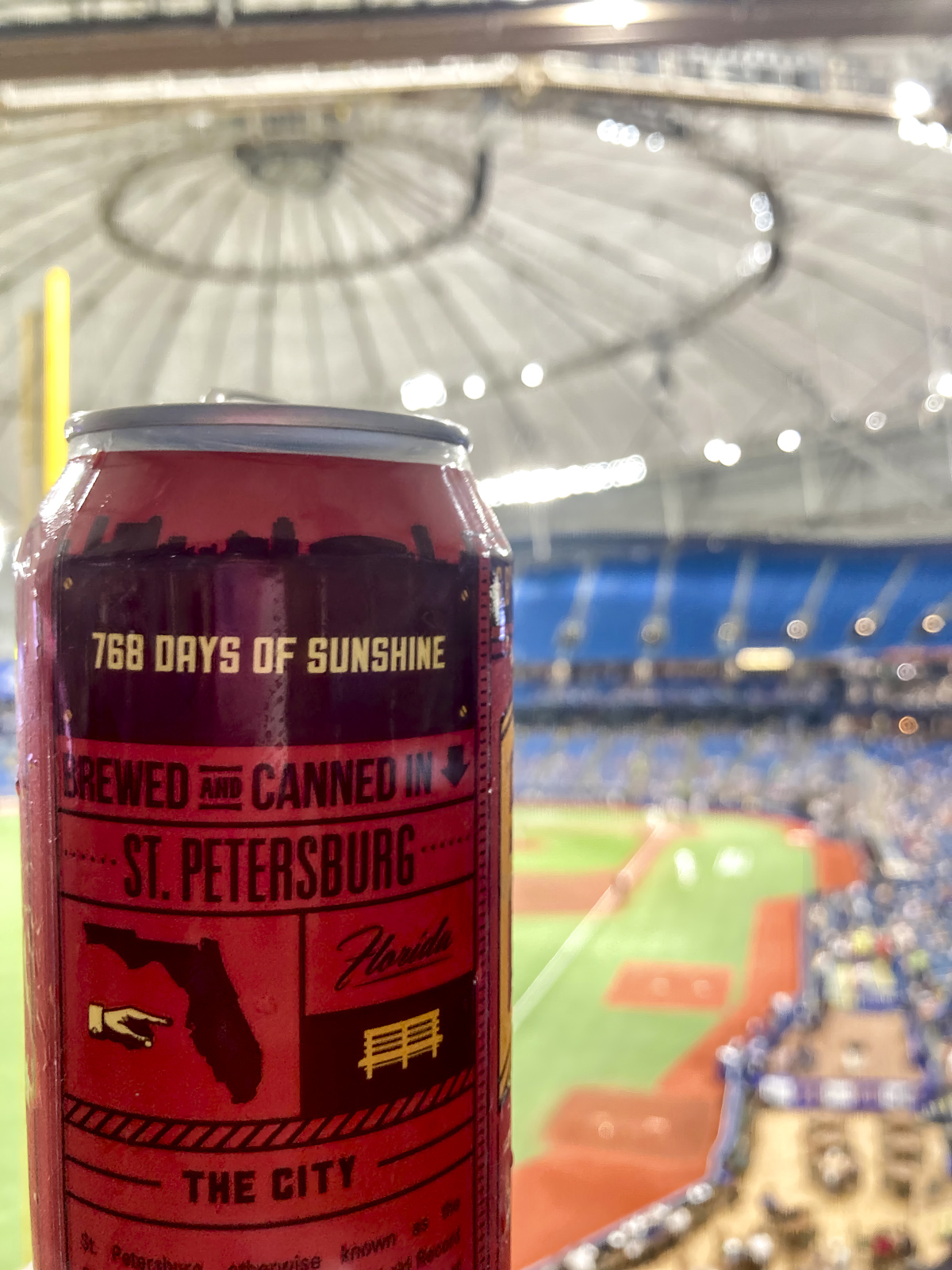
St. Petersburg has always been two things: a resort town and a product of the segregated South. Known affectionately as the Sunshine City, St. Pete claims the Guinness World Record for sunshine (as a can of local craft beer will tell you, 768 consecutive days). This winter haven boomed in the early twentieth century. White vacationers and retirees flocked here for the weather, often to relax on the green benches (hence the beer) that once lined Central Avenue, the city's main thoroughfare and longtime racial divide. African Americans first migrated here to build the railroad and work the tourist economy, building tight communities over time.
Off the tourist map, Salt Creek remains absent from view, for reasons both geographic and social. Because the water flows in a northeast direction, starting from the middle of Pinellas County then into Tampa Bay, the creek falls off the orderly cadastral map. Avenues go East-West and the streets North-South, while Salt Creek cuts a diagonal course. Most of the creek's banks are culverted, so its "nature" does not adhere to conventional labels of leisurely consumption. Racial divides further hide this fragmented waterway, and the environmental merges with the Sunshine City's flickering, all-too-easily-denied Jim Crow past.
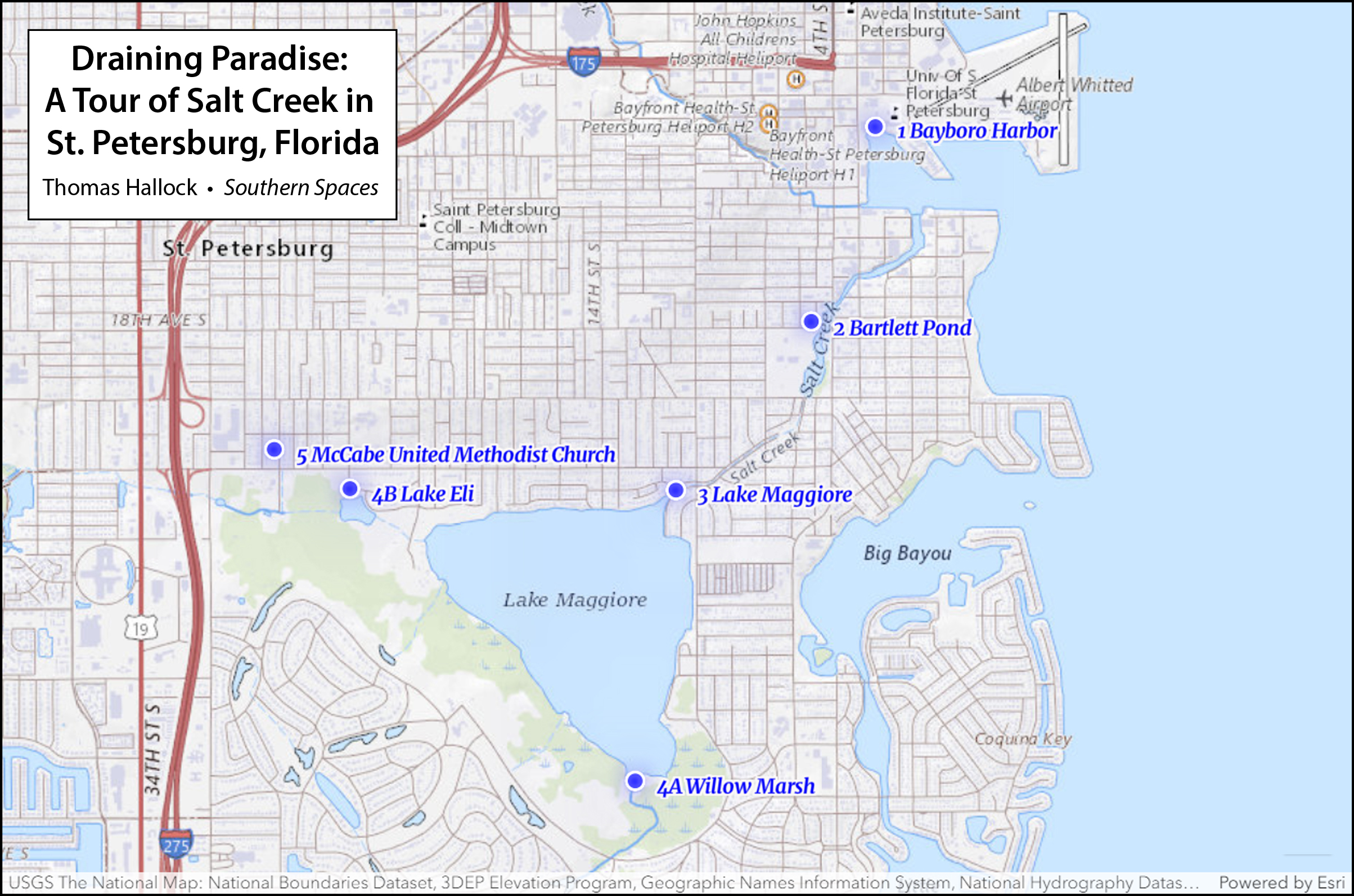
Today only a handful of locals can trace Salt Creek's full course. The best way is to start at the mouth, Bayboro Harbor, just south of the city's previously moribund but now skyrocketing downtown. As one journeys southwest, going upstream, the creek services a working port (properties now eyed for luxury housing). The creek passes under a mangrove cover and empty lots, owned mostly by absentee speculators. The city's sizeable population of street people, who use its shielded banks for shelter, are the principal stakeholders here. Under Fourth Street, a major north-south corridor, Salt Creek opens into mangrove-shrouded Bartlett Pond. Beyond the pond, it crosses under Twenty-Second Avenue South, also a major thoroughfare, before vanishing into a culvert through Harbordale, one of the poorest neighborhoods in Pinellas County. Dammed at the north-south running Dr. Martin Luther King, Jr. Street (or Ninth Street, to old timers), the channel opens into Lake Maggiore, historically an estuarine body of water, now maintained as fresh. Beyond the lake, finally, Salt Creek splits into several other unnamed sources.
Recovering an urban waterway is no easy task, as it requires travel across both time and space. This tour, "Draining Paradise," attempts to render visible our everyday—yet hidden—lives, where water meets land. Because Salt Creek pays no heed to squared-off boundaries or cornered streets, and because property claims trump natural processes, it suffers neglect. In a city founded upon leisure—moreover, with a disenfranchised working class needed to produce that leisure—what counts as "nature" inevitably falls along social, economic, and racial lines. A continuing legacy of inequity shapes environmental priorities. Yet Salt Creek's history is complicated. Water quality intersects with social structures, though not in any simple or straightforward way. The words and conventions we use to describe natural beauty fill in few gaps, nor do current models of environmental justice fully apply. This aquatic system passes through several different neighborhoods—white and Black, rich and poor, protected and industrialized, through parts of town in clear neglect and others in good health. The social constructs fragment the hydrology until a citizenry can no longer see itself in nature. So how do we teach ourselves to see the parts as one whole? Can we come together as a community by cognitively remapping a forgotten stream? If so, what terms do we use? What's the storyline for a creek that has become a ditch?
I first stumbled upon my problem quite by accident, as an extension of my job as an English professor at the University of South Florida's St. Petersburg campus. I came to USF as a part-time instructor, tasked with developing a course called "Rivers of Florida." For several semesters, I ventured with students in canoes and kayaks onto the state's many spectacular wild and scenic rivers—traveling hours for peak nature experiences amid awesome alligators, long legged wading birds, and floodplains filled with cypress—waving trails of Spanish moss over the slick obsidian water. Despite the beauty of our surroundings, student essays from the "Rivers" classes were mostly pedestrian paeans to the "real Florida" and laments for a vanishing nature. Tired of burning class time and fossil fuels, and bored with cliché writing, I turned to nature close to home—Salt Creek, whose mouth empties right onto our campus.
With little initial support, I threw myself into a curriculum that built nature around the city. The project came to consume my work as teacher, writer-researcher, citizen, and activist. The early stages were marked by confusion and indifference. The problem, from a pedagogical standpoint, starts with semantics. What happens when a stream or creek becomes a culvert or ditch? Why do those words matter? We urban dwellers, who seek out nature close to home, are linguistically bereft: there is no term to describe the successful interface of natural and built environs. Outside cities, we have any number of categories for describing natural landscapes. The "wilderness" and "preserve" define parks, without people; the "georgic" or "bucolic" covers farmland; a "pastoral" is where classical shepherds tended their flock while reflecting upon the corruption in Rome, and today denotes cherished spaces of imagined innocence—like a baseball diamond or the Andy Griffith Show. But nature in the city presents an absence. To address this problem, I set up a classroom model. I founded a fictional group, "Friends of Salt Creek," built a website, and started exploring with my students.2For a timeline see Friends of Salt Creek, Accessed April 11, 2023, https://friendsofsaltcreek.org/; for an example on how the critical terminology overlooks city nature, see survey in Greg Garrard, Ecocriticism (New York: Routledge, 2012), which is organized around a series of chapter-keywords (pollution, wilderness, apocalypse, dwelling, animal, earth), but no urban terms. Like a generation of environmental humanists, I first recognized the shortcomings of advocacy strategies and literary conventions after reading the edited collection by William Cronon, Uncommon Ground: Rethinking the Human Place in Nature (New York: W.W. Norton, 1996); more recently, I discuss cultural categories of nature writing, and the challenges of teaching city nature, see "City Creeks: Lessons in Sustainable Environmental Discourse from a Florida Boom Town," Spaces in-between: Cultural and Political Perspectives on Environmental Discourse, ed. Mark Luccarelli and Sigurd Bergmann (Leiden, Netherlands: Brill Rodopi, 2015), 88–101. Using searchable newspaper articles and government documents, we cobbled together a storyline.
The next step was to theorize. Environmental writer Jenny Price details "Thirteen Ways of Seeing Nature in LA," a classic re-examination of the least "natural" of all places, the Los Angeles River. On the East coast, meanwhile, landscape architect Ann Whiston Spirn has combined activism, teaching and writing in a recovery of Mill Creek, a buried stream that threads through West Philadelphia before feeding the Schuylkill. These models and others provided a conceptual groundwork. Over time, I accumulated equivalents. A trip to New York City took me to the Gowanus Canal, a Superfund site where Walt Whitman once ate oysters. I learned how tourists in London will lay out ten pounds each (five for kids) to slip down the culverted Fleet River, now a covered source but a notorious ditch from the reigns of Queens Elizabeth to Victoria. A sixteenth-century mock epic by Ben Jonson, "On the Famous Voyage," recounts a journey up the filthy Fleet: the open sewer runs foul with "grease, and hair of meazled [leprous] dogs; / The heads, houghs [hocks], entrailes, and hides of hogs."3Jenny Price, "Thirteen Ways of Seeing Nature in LA" (Part 1), Believer 33 (April 1, 2006); Anne Whiston Spirn, "Restoring Mill Creek: Landscape Literacy, Environmental Justice and City Planning and Design," Landscape Research 30, no. 3 (2005): 395–413; Ben Jonson, "On the Famous Voyage," in Complete Poetry, ed. William B. Hunter, Jr. (New York: NYU Press, 1963), 72. The same waterway carries away the cannibalistic offal of Stephen Sondheim's Sweeney Todd, "the demon barber of Fleet Street."
Patterns came together. Urban waterways offer a Realometer, as Thoreau wrote, places where you stand right to face the facts.4Henry David Thoreau describes the "Realometer," distinguished from the "Nilometer" (a gauge to measure the mythologized Nile), in the penultimate paragraph of the chapter "Where I Lived, and What I Lived For," from Walden, or A Life in the Woods (Boston, MA: Ticknor and Fields, 1854). Our city creeks mark charismatic, if uncomfortable points of context between activism and disaster fetish, economics and racial inequity, lost memory and recovery, cool-credibility, and very real marginalization. The more I traveled my own channelized waterway, the more analogs I discovered. Friends and colleagues started volunteering their own favorites. The Chicago River (a graduate school buddy reminds me) previously served as a portage between the Great Lakes and the Mississippi. A stunningly illustrated article in the New York Times charts the harrowing impact of sea level rise on this area.5Dan Egan, "A Climate Crisis Haunts Chicago's Future. A Battle Between a Great City and a Great Lake," New York Times, July 7, 2021, https://www.nytimes.com/interactive/2021/07/07/climate/chicago-river-lake-michigan.html. A colleague who graduated from Columbia's school of journalism reminded me that vestiges of Minetta Brook flow under Minetta Street in Greenwich Village. My writing partner for a series of #Creekshed essays in our local alt-weekly, Amanda Hagood, sent vacation photos of Ala Wai Canal in Honolulu. Another traveling colleague, a classicist, Facebook messaged me a photo of the vestigial Eridanos, Greece—the literal path to Hades—which runs through Athens' Monastiraki Metro stop. The community relations person on my campus insisted I walk the C&O canal on my next trip to to Washington, D.C. And while researching an academic memoir about her hometown of Birmingham, Alabama, my colleague and partner Julie Armstrong traced the entirety of Village Creek—a polluted stream that drains both industrial sites and a neighborhood park where she played as a child.6See Thomas Hallock and Amanda Haygood, "#Creekshed Story Map," May 5, 2022, https://storymaps.arcgis.com/stories/b664d097ee3e408c8eacf5a424075af8; for more information on the Ala Wai canal, a lagoon off Waikiki that displaced wetlands used by island Natives for fishing and agriculture in Waikiki, see Sophie Cocke, "Ala Wai Canal: Hawaii's Biggest Mistake?," Honolulu Civil Beat, May 20, 2013, https://www.civilbeat.org/2013/05/ala-wai-canal-hawaiis-biggest-mistake/; a display of Minetta Brook, which used to run through the lobby of a hotel-apartment, is no longer operable, though reference can be found at "Minetta Green," NYC Parks, Access April 11, 2023, www.nycgovparks.org/parks/minetta-green/history; Village Creek Environmental Human & Environmental Justice Society, Accessed April 11, 2023, https://villagecreeksociety.org; Julie Buckner Armstrong, "Two Days along Village Creek," Learning from Birmingham: A Journey into History and Home (Tuscaloosa: University of Alabama Press, 2023). East Lake was the white working-class neighborhood where Julie grew up. Through the post-civil right's era, it was mostly African American. Because of its increasingly coveted real estate, it became a focal point for the A&E program Flipping Down South.
Why this passion? And why is this work necessary? The recovery of an urban waterway can feel like a very vexed homecoming. Even though social history and economics have shaped our aquatic environs, current land use practices erase the very past that brings value, coherence, justice, and yes, even happiness to our communities. City creeks have a particular way of taking one both to the edges and into the heart of where we now live. We are habituated, as geographer Yi-Fu Tuan reminds us, to link memory and place. Tuan's term, "topophilia," is a well-known coinage for the memories that accrue across space. A crack in the sidewalk carries us back emotionally; a whiff of wisteria fosters connection, and one hopes, concern for a given locale.7Yi-Fu Tuan, Topophilia: A Study of Environmental Perception, Attitudes, and Values (New York: Columbia University Press, 1990). Though simple on the surface, the concept is tough to pin down; topophilia, Tuan reminds us, is not just patriotism, childlike nostalgia, or the marketing copy on a beer can. It means coming to grips with both the pleasures and the problematic.
Take the green bench, which is the name of my local brew of choice, but also a hurtful symbolism. As noted in a recent study of systematic racism in the city, green benches lined the main thoroughfare of Central Avenue from 1916 to 1960. For white residents, these benches were a "symbol of hospitality and place to socialize" on a pleasant winter afternoon; for African Americans, not being allowed to sit there served as an "everyday reminder" of humiliating segregation.8Tuan, Topophilia; Ruthmae Sears et al, "Building Bridges & Racial Equity in St. Petersburg Florida" (Tampa: University of South Florida, 2021), 52. City creeks, likewise, sit uneasily in our idea of nature. They do not offer simple recreation or respite. The active search for broken connections instead takes us beneath the placid surface of a city's daily life.
As a white northern transplant, I have learned how a recovered past opens channels for seeing a difficult present. Every metropolitan area holds its own hydrologic history, buried or forgotten. What I offer in this short trip is a lesson in how cities render nature invisible; how what we count as nature is either valued or subject to abuse, and how those decisions follow social lines; and how past, present, and future landscapes intersect. To cross into our fragmented waterways, I must add, requires humility. The divisions rendered in our shaping of the natural world remain. And so the fundamental challenge: to come together, as one community, cleaning our rivers and streams, while at least recognizing—if not starting to heal—the rifts between us.
Bayboro Harbor
Start at Bayboro Harbor, at the campus where I teach. Faculty, staff and students can rent a kayak, paddleboard, sailboat, or canoe at the waterfront office, and here, I typically begin my nature writing classes. Once called "Fiddler's Paradise," for the crabs foraging in the surrounding mangrove and spartina, this former bayou is where Tampa Bay meets Booker and Salt Creeks—two of the major drainage systems for lower Pinellas. The Gulf Coast of Florida has been home to a series of loosely-defined, overlapping cultures, more local polities than "tribes"; these include "archaic" groups, the Weeden Island culture (300CE–1000CE), followed by the Safety Harbor culture (900CE–1500CE), then Tocobaga (the residents of Tampa Bay who most likely met Spanish explorers in the sixteenth century). Florida's first people fished and gathered crustaceans. The refuse from this bounty formed middens and mounds, many of which appear on early postcards from the city. As St. Petersburg boomed through the twentieth century, during the early years of car culture, these shell mounds were looted for road fill. The Indian works, reminders of a successful synthesis of built and natural environs, remain buried under a hospital's out-parcels and parking garages.9Robert J. Austin, "'Its Origin Steeped in Mystery': The Sorry Saga of St. Petersburg's Shell Mound Park," The Florida Anthropologist 73, no. 2 (June 2020): 113–39; the ongoing status of Native remains, held at the Smithsonian and elsewhere, including (until recently) my university's anthropology department is reviewed in "Notice of Inventory Completion: Department of Anthropology, University of South Florida, Tampa, FL," National Archives Federal Register, Sep. 27, 2011; and Gene Demby and Kumari Devarajan, "Skeletons in the Closet," NPR Code Switch, Oct. 13, 2021, https://www.npr.org/transcripts/1045518876.
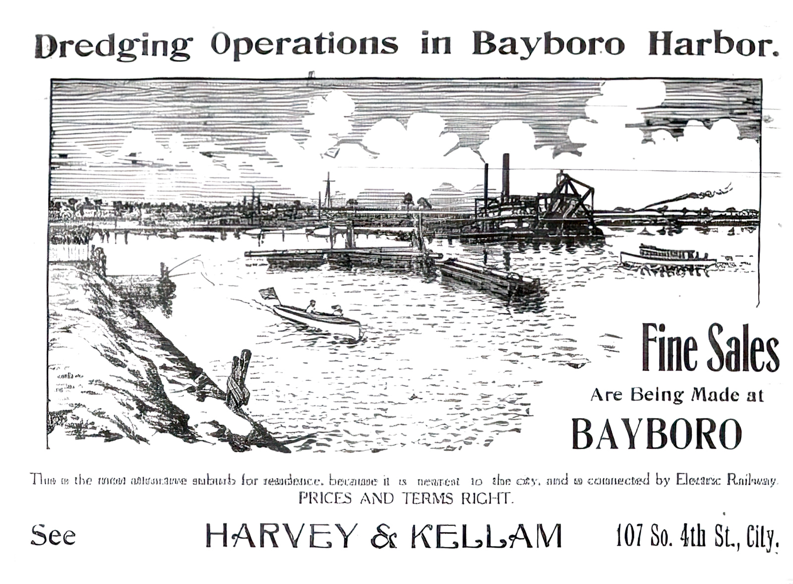
Salt Creek, meanwhile, tells the classic Florida story of transformation and rapine. The waterway formerly known as "Salt Run" drains lower-lying land, never particularly suited for human habitation. Starting in 1908, a group called the Bayboro Investment Company (supported by local boosters, fat with congressional pork) oversaw the harbor's dredging, which continued for several years. Imposing steam-fueled engines churned the roots, sand and gravel over bulwarks, carving a fifteen-foot channel from the shallow bayou, transforming the "marshy waste" into "valuable lands." Both Salt and Booker Creeks were straightened and deepened for the purposes of top-down economic interests: to connect with a rail depot one mile to the north, plus harborage for "pleasure yachts." Where there had been "naught but a marsh, inhabited by undesirable tenants" the St. Petersburg Evening Independent boasted, soon would "arise a beautified landscape occupied by happy homes of mankind." Four years later, with more federal funding, the city cleared frontage for a harbor and marina.10"The Bayboro Improvements," St. Petersburg (FL) Evening Independent, March 26, 1908, 1; "Deep Water Harbor Ordinance Up Tonight," St. Petersburg (FL) Daily Times, Aug. 14, 1912, 1.
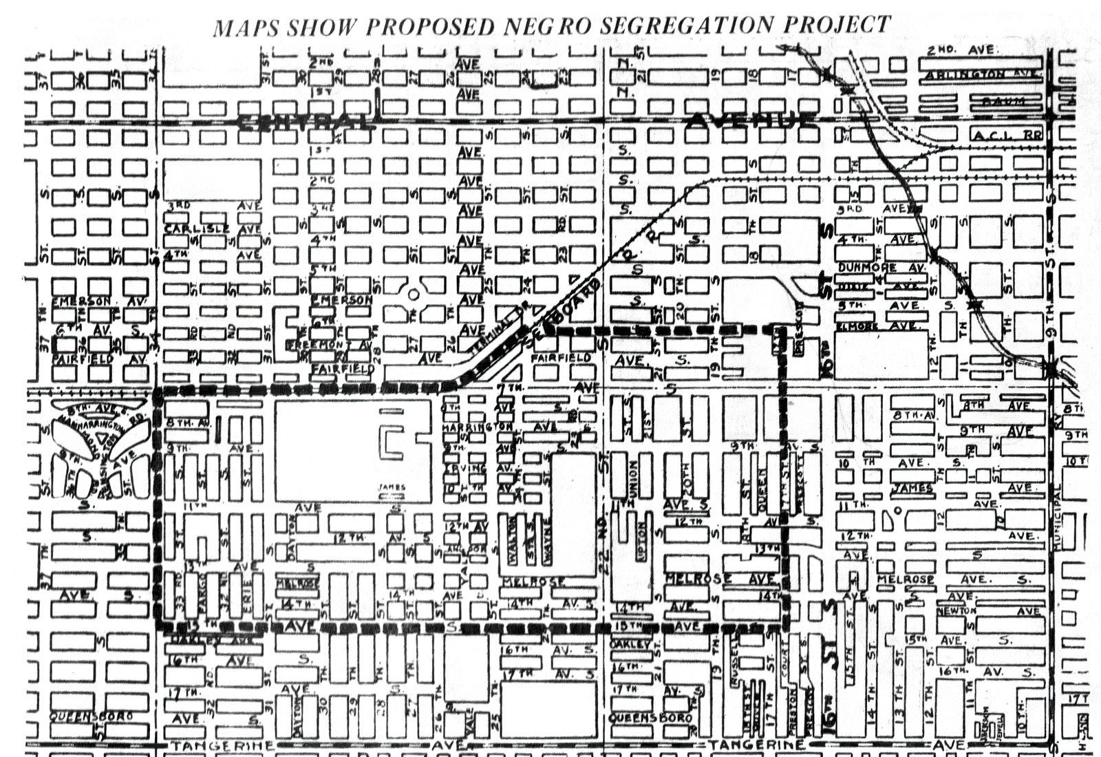
The creek's industrialization had begun. In 1913 the dredgers worked their way further up the channel, yoking the tidal "Salt Run" to Florida's violently enforced economic and social order. As standard histories recount, the area boomed through the first decades of the twentieth century, with a soggy landscape shaped to property developers who then marketed an affordable paradise for white tourists and transplants; this same paradise needed a labor force, and segregation shaped the landscape as much as the pleasures of outdoor leisure. An invisible line along Central had already divided the city into north (white) and south (African American) sides. African Americans moved to St. Petersburg in search of work and the city council sharpened boundaries where people of color could live. A 1931 charter amendment sought "to establish and set apart in said city separate residential limits or districts for White and negro residents." This redlining, impossible to enforce and revised many times, imprinted the city's demographics permanently, shaping everything from voter registration to school funding and supermarket locations.
Has the creek been subject to the same racial violence as Black bodies? It depends on who you ask, though this much is true: segregation in St. Petersburg remains unfinished business. Redlining language remained in the city charter until 1963; through the Jim Crow era, three lynchings were reported in Pinellas County (low for bloody Florida); and various groups such as Pinellas Remembers (which successfully placed an Equal Justice Initiative marker at the site of a 1914 lynching) continue the important, uphill work of healing. Environmental and social histories undoubtedly intertwine—the question is "how?"
From its early boom years, access to nature came through a front and back door. North of Central Avenue, tourists enjoy Instagram-worthy waterfront parks, showcasing urban amenities alongside Tampa Bay. Today, these parks receive the overwhelming bulk of public funding and remain fiercely guarded by a proud citizenry. The adjacent working waterfront to the south was slated for industry, and set on a course for exploitation. Starting in the 1920s, city leaders commissioned engineering studies, supported business and secured federal money to construct an "industrial harbor." Salt Creek housed oil storage tanks (inevitable spills to follow) and just upstream, a dairy and flash-freeze seafood plants. As industry left in the 1970s, the creek would serve as a site for drugs and illegal sex and squatters, and now, for fast food and a Salvation Army support center. Locals recognize the creek (if at all) from a sharply-arched bridge over Third Street known as "Thrill Hill," or as the place where a sleeping homeless woman tumbled off a seawall and lost her arm to an alligator.
Such are the long string of anecdotes—the stories of drug runners and petty crime, childhood kicks, vagrancy and chicken thieves—that populate the creek's history.11City Council minutes were printed in St. Petersburg (FL) Times, Feb. 14, 1931, 2–3; see also "Open Waters in Salt Creek" St. Petersburg (FL) Times, June 16, 1921, 10. Most recently, the city revised building codes to accommodate Miami developers, who schemed to build high-density housing on the flood plain. That bubble having burst, the area remains scraped.12"Report of Port Exports Announced by Commission," St. Petersburg (FL) Evening Independent, Sept. 16, 1926, 7; "Dairy Concern Adds to Plant on Salt Creek," St. Petersburg (FL) Times, Jan. 1, 1937; "Yacht Basin Boats Face Clampdown," St. Petersburg (FL) Times, Feb. 3, 1960; "Salt Creek Squatters Trouble City Again," St. Petersburg (FL) Independent, Aug. 28, 1961; Jack Alexander, "Drug Raids Nab 11," St. Petersburg (FL) Independent, May 18, 1968.
Salt Creek activists suffer fatigue, even disillusionment, from fighting the combined forces of city hall, Jim Crow's intractable legacy, and poor decisions rationalized by free market economics. Two episodes from the past century illustrate the challenges of turning back the tide. The creek's path traces a low-lying area, or swale. In any other scenario, land this vulnerable to flooding would be set aside for parks and greenspace. Every good planner that has studied a topo map has, in fact, reached that conclusion. In the 1920s John Nolen, the preeminent city planner of his generation, prepared St. Petersburg Today, St. Petersburg Tomorrow—a design that would be considered progressive if it were adopted even now.13John Nolen, City Planning Report: St. Petersburg Today, St. Petersburg Tomorrow (St. Petersburg, FL: St. Petersburg City Planning Board, 1923), https://friendsofsaltcreek.org/wp-content/uploads/2022/02/St-Petersburg-Today-St-Petersburg-Tomorrow-1923-Nolen-Plan-1.pdf; St. Petersburg Conceptual Plan (City of St. Petersburg, FL, May 1974), https://friendsofsaltcreek.org/wp-content/uploads/2022/03/Conceptual-Plan-St.-Petersburg-1974.pdf: 31–32. Nolen suggested a parkway, using Salt Creek to connect gulf to bay with a chain of green "around the lower end of the peninsula." Voters rejected the Nolen plan, however, citing the imposition on private property rights as well as Nolen's reluctance to tighten emerging redline laws. One could blame this shortsightedness on the times. Nolen worked in the shadow of the Rosewood massacre, but fifty years later, the city reached the same conclusion.
Dusting off many of John Nolen's ideas, a 1974 Conceptual Plan also proposed a "green open space network," which included the "natural swale" between Tampa and Boca Ciega Bay. In short, a park along the Salt Creek channel.14R. Bruce Stephenson, Visions of Eden: Environmentalism, Urban Planning, and City Building in St. Petersburg, Florida, 1900–1915 (Columbus: Ohio State University Press, 1997), 65. Neither proposal, almost fifty years apart, made the leap to policy. A common good for the city (sustainable development, equitable access to open space) will lose to private, mostly white interests every time.
In the creek, I confront my own ambivalence towards Florida. I revel in the completely undeserved, over-the-top natural beauty. I also feel overmatched by the state's ugly, obdurate social history. When my own patience runs out, I drop a kayak near the mouth and make a favorite circuit. I enter by the harbor, paddle through the marina, then under the bridges at Third and Fourth Streets, into a hidden wilderness. Past the last dredge line, not far beyond the old trolley bridge, ice cream plant or seafood fast-freeze facility, the docks and crumbling piers give way to a mangrove tangle. Under Thrill Hill, Salt Creek is both wilder and more polluted. The paradox is striking, even in its own way, charismatic. The overlooked canopy serves as a bird sanctuary, where long legged waders roost and nest. Styrofoam and plastic bottles meld with mangrove prop roots. Fecal bacteria levels spike well past acceptable levels. We are still trying to figure out the cause—excrement from the street population, which the city pushed from parks in the tourist center to the poorer southside; guano, which accumulates in the concrete channel because seawalls and dam upstream block the tidal flow; or maybe broken sewer lines.
My route takes me roughly halfway to Lake Maggiore, mostly by industrialized lots left abandoned for speculation. Past the Dollar General and McDonalds, I push through the choking mangroves, then slip under another low-slung bridge at Eighteenth Avenue South. From here the creek opens into Bartlett Pond, a small aperture all but choked off due to overgrowth. I have seen snook roil below the black, murky surface. I've also seen a prize game fish, floating ominously on the surface of the muck. Osprey watch from their nests in the light posts by the athletic fields. Were it not for the hum of traffic, I could be in the 10,000 Islands of the Everglades. Instead I have found Nature in the heart of a city.
This is not where one expects to find a kayak. Citing water quality, Parks and Rec officials have ignored my suggestions to install a put-in off Bartlett Pond. So I engineer my own exit, grabbing the sewer line off a bridge on the opposite side, nudging a gunwale to the shoreline, and throwing my fifty-seven-year-old self onto the muddy bank. From Bartlett Park, I portage back across Fourth Street, past a gas station at the busy intersection of Fourth Street and Twenty-Second Avenue South, back to my once gay and racially-mixed, increasingly gentrified neighborhood. This circuit is not easy, scenic, accessible, or even encouraged. But I find the paddle into every day nature restorative. Wilderness has been erroneously thought of as an escape, rather than as engagement with the here and now. "In wildness is the preservation of the world," Thoreau mused, wandering the clearcuts around Concord. The best wilderness is always close to home.15Henry David Thoreau, "Walking," The Atlantic, June 1862, https://www.theatlantic.com/magazine/archive/1862/06/walking/304674/.
Bartlett Pond
At Bartlett Park, tucked behind Twenty-Second Avenue and Fourth Street, Salt Creek opens into a muddy pool. This little pond adjoins two of St. Petersburg's main thoroughfares, but badly eutrophied and surrounded by mangroves, rarely merits a second look. My wife Julie has lived three blocks away and driven past Bartlett Park for twenty years, but did not know there was actually water behind the brush. A little fishing dock used to provide access on the east side, away from the street and from the park's interior. Vandals, or maybe the homeless on a cold night, burned the outer decking. Repairs to the dock then came slowly and were poorly done. After I called to complain, the parks department blocked off the charred sections, shortening the entire structure.
Environmental racism takes many forms—big and small, from legislation to microaggressions. A perspective at water level renders visible the "slow violence" of local policy, to use Rob Nixon's memorable phrase: the damage "that occurs gradually and out of sight … dispersed across time and space [and] typically not viewed as violence at all." Leisure may not register as a health concern. At least on the surface. But in this city, defined by slow violence, differences in life expectancy across race are measured by decades.16Rob Nixon, Slow Violence and the Environmentalism of the Poor (Cambridge, MA: Harvard University Press, 2011), 2; Sears et al., "Building Bridges," 123. Hypertension kills, green spaces heal.
St. Petersburg and Pinellas County pride themselves on their parks, yet the allocation of amenities follows a classic script in inequity. A Pinellas County park map is literally a reverse image of racial demographics. Docks served by the county's white residents include ADA-compliant handrails, fish cleaning stations, and overhead shelters to protect visitors from the harsh sun or sudden rain. Residents in south St. Pete's poorer Black neighborhood instead get this charred shell, over an overgrown pond my spouse never even knew existed—where health officials deemed the water unsafe to fish or swim.
Economics and social history shape the landscape, but because the history is forgotten and on-the-ground-economics vanish into everyday life, that landscape is tough to read. Bartlett Park embodies this contradiction. Behind the stump of a dock, tennis balls thwock back and forth at the St. Petersburg Tennis Center. Founded in 1926, the municipal courts are a vestige from the early twentieth century, when the neighborhood afforded vacation cottages for winter residents and renting tourists. The court's location seems anomalous, though like every other chapter of the city's history, it can be explained through the local lodestars of leisure and race. The center serves as a throwback to St. Petersburg's peak years as a populist paradise, when white northerners suffering from cold found relief in the mild climate, bay breezes, the foliage, and sport.
The same boom drew African Americans, mostly from across the South, who came here to work a growing service economy. The zoning measures set out to keep the Black population both accessible and cordoned off; these measures, from the middle third of the past century, limited where Blacks could work, live, and travel after dark. African Americans forged communities in neighborhoods that still resound in local lore—the Deuces, Pepper Town, Gas Plant, Campbell Park, Methodist Town. After the waning of de facto segregation, in the early 1970s, once tight communities fanned out across the southern side of the city.17Rosalie Peck and Jon Wilson, St. Petersburg's African American Neighborhoods (Charleston: History Press, 2008), 15–18; Sears et al., "Building Bridges," 108. Black families settled in formerly white neighborhoods on the south side of town, including Bartlett Park. White people moved out, abandoning the neighborhoods, then decades later returned to the same sections—displacing Black families who have now lived there for at least a generation.
The contradictions and shifting dynamics across time and space make Salt Creek difficult to explain. Lime green tennis balls lob over the chain link fence, down the sidewalk, and into the watershed. Environment and community relations cannot seem to find the same page. I struggle personally with my own blindness, fumbling with good intentions. After several years of my teaching along this waterway, graduate students culled together a self-produced book called Salt Creek Journal. During an Earth Day celebration at Bartlett Park, I palmed a copy of the paperback to my city council representative. She actually read the book, then convinced me to form a real group with the same name as the pedagogical fiction—Friends of Salt Creek. For several years, pulled into service, I led the group. We defined goals, calling ourselves a community group centered around nature, not so much preservationist. We met small, consistent successes. Foundation money flowed our way, though before we were logistically prepared to take on projects; we had a grant before we had a bank account. For clean ups, environmental groups like Tampa Bay Watch and the Tampa Bay Estuary Program (who do admirable work advocating for marine health) bring enthusiastic white volunteers from outside, though our constant reminder has been to build from within the neighborhood. The local Keep America Beautiful office wants to drop in cypress trees without asking people who live there.
Conventional narratives of environmental justice, Ellen Griffin Spears observes, have "left out many constituencies—women, workers, indigenous populations, people of color, immigrants—and as a result left out the social justice roots of environmental reform." And so we see the broader trends unfold in local arenas. White environmentalists are not "looking at the community," observes Jacqueline Hubbard, an African American attorney whose family has owned a lakeside home in the area for decades; the result "is a lack of communication and trust."18Ellen Griffith Spears, Rethinking the American Environmental Movement Post–1945 (New York: Routledge, 2020), 4; In my informal interview with Jacqueline Hubbard (Sept. 2, 2022), she mentioned the importance of environmentalists reaching out to churches and groups with well-established records in civil rights; my hope as the author of this article, an online tour, is to have a ready-made program for community presentation.
In retrospect, the lesson feels obvious: restoring the environment starts with community. The questions must always start with, "for whom?" For whom are we working? With whom and why? Bartlett Pond brings fault lines into stark relief. After a long period of asking, the city secured external funds to dredge the eutrophied pond. The mostly white Friends of Salt Creek continue to test waters around the park, hoping to locate the sources of fecal bacteria. But why now? Will the dredging serve the neighborhood's current, mostly Black residents? What will dredging a pond mean for those experiencing homelessness? Is "improvement" merely a bellwether of high-end development downstream? And how does one fight back cynicism? During a May Day clean up, an African American fraternity, the Sigma Betas, led a tree-planting effort that involved local teenage boys. When construction in the park cut off an irrigation line, however, the newly planted trees dried up and died. This story is nothing new. Landscape theorist Anne Whiston Spirn recounts similar frustrations with Philadelphia's Mill Creek. She describes how she led eighth graders along the creek's buried course, then asked the teenagers to develop a landscape plan. The students (more familiar with the realities of the streets than an Ivy League professor) refused to believe any plan they implemented would be suggested. "It won't happen," a student told her; "Someone will wreck it."19Spirn, "Restoring Mill Creek," 404. How do you explain to teenage boys in St. Petersburg, likewise, that the city failed to water plants they put in the ground?
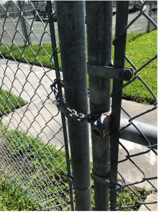
Advocacy puts well intentioned theory to the test. We have to pull out the Thoreauvian "realometer." In our rhetoric and scholarly discourse, one might wax optimistic about bringing together environmental and social justice, building what my local Sierra Club chapter calls a "Black-Green" alliance. But in practice, we learn the hard way, starting by acknowledging the depth of the rift of our divides. We can get the grants but we cannot exact meaningful change. As a white-led group, Friends of Salt Creek seems to have a offered a strategic wedge for easy volunteerism; our group checked the box for "underserved community." Over summer 2021, we drew from a Tampa Bay Estuary Program grant to support an artist in residence program at the local community center. Four artists (two white, two African American) met under a central pavilion, working most closely with kids. The children here are predominantly Black, with many coming from foster homes. White kids go to tennis camp, steps away, taking after-school lessons for $200 per week. Kids from the adjacent Frank Pierce Center are not accustomed to access. The pavilion where we met backs onto the chain-link fences of the neatly rolled courts. At one point, a child passed a gate left open, usually locked, leading to the public court. "Wait," the child asked, "can we go in there?"
The same could be said for the pond. Our entry points to nature are shaped by economics, power, and race. The points of access disclose social boundaries. Where equivalent parks offered sheltered docks and piers, the only dock here is a burnt out stub. The city clears and maintains lakes in other parts of the city, opening code-compliant "windows" through the mangrove; here, the water remains hidden—out of sight and degraded.
This is no accident. Past Bartlett Park, through a hidden gap in the mangroves, Salt Creek cuts diagonally, continuing to run southeast, through one of the poorer parts of the city. Neighborhoods along the creek tumble precipitously from coastal-slash-suburban to impoverished. Median household incomes drop in predictable blocks, as one moves from waterfront from properties along Tampa Bay and west into the city: $78,875 in the mostly white Old Southeast neighborhood, to $44,474 in the Bartlett Park area, to $12,096 in the more African American Harbordale section. A closer analysis provides a much more nuanced intersection of economics and race, not captured by simple caricature, though a trend exists. The city-data website reflects what anyone who lives in St. Petersburg already knows: economics fall along sharp racial lines, effecting in turn, health, access to fresh food, experiences with education and law enforcement, the possibilities of upward mobility, and of course, green space.20"St. Petersburg Florida: Income map, Earnings map, and Wages data," City-Data, Accessed March 31, 2023, https://www.city-data.com/income/income-St.-Petersburg-Florida.html. Structural racism study; see also Sears et al., "Building Bridges," 203-08.
Racial demographics and water quality intersect. At the end of legalized Jim Crow, as African Americans moved into the Harbordale neighborhood, the city let water quality sink. Low oxygen levels during the 1960s resulted in fish kills. Locals likened the smell at low tide to a badly operating sewage plant, the newspaper reported; outsiders (not residents) used the creek as an unlicensed trash pit. The rust colored water tested at almost eight times accepted levels for coliform bacteria. The city was no longer calling this waterway a stream or creek; in newspapers and press conferences the creek was now a "drainage area," or worse, a "ditch."21Willard Cox, "Tests Show [Red] 'Tide' Not Cause of Kills," The Evening Independent, July 6, 1965; "A Fishy Smell at Salt Creek," The Evening Independent, May 2, 1966; "Salt Creek Flow Sickly," The Evening Independent, Sept. 14, 1973; Bill Marden, "Trash, Tide A Problem," The Evening Independent, July 16, 1971. Racism did not cause environmental abuse; water quality was abysmal throughout Tampa Bay. A generation of activists, overwhelmingly white, have "saved the bay"—dramatically improving estuarine health. The poorer areas drained by Salt Creek, following script, are the last to see remediation.
Lake Maggiore
Semantics shape stewardship. At MLK (formerly Ninth, a major north-south street), a dam divides Salt Creek from Lake Maggiore. I am now in the middle-bottom part of the Pinellas Peninsula, on what used to be "Salt Lake," an estuarine habitat typical for coastal Florida. The name changed, however, alongside usage. In the 1920s real estate promoters began pitching new developments around a shallow, still tidal estuarine habitat. A fanciful origin story in the St. Petersburg Times provided the much-needed fiction. The newspaper, upholding real estate interests, staked a dubious claim that "Salt Lake" was discovered by Italian buccaneers, who called it "Maggiore" after a similar body of water on the Swiss-Italian border. In an act of rhetorical desalination, the hucksters presented the Italian as the earlier toponym; the sailors had first found fresh water, though mistakenly, the label "Salt Lake" stuck on later maps. Fiction and finances thus conspired to justify a dam. The Times cited a "peculiar condition" (or what the rest of us call tides) that allowed saltwater species to intrude from the bay. In 1930 a more permanent dam was built, making "Maggiore a freshwater lake for bass fishing." It would remain as such, until no one could recall when the brackish lake was part of an estuarine tidal run. By the 1980s the alligators were so pervasive that water skiers chased them off the slalom course. Neither bass nor gators belong in "Salt Lake," of course, as freshwater species have found their invasive niche in this badly translated Alpine lago.22"Lake Maggiore Believed to be Named by Pirate—To Be a Beautiful Section," St. Petersburg (FL) Times, April 5, 1925; "Lake Maggiore Dam Proposed," St. Petersburg (FL) Independent, Sept. 25, 1930. I am indebted to Jack E. Davis, who grew up on Lake Maggiore and who read a draft of this essay, for the observation about water skiing.
The folly, this not-just-semantic amnesia, has been expensive. Newspapers chronicle a twenty or thirty year cycle of restoration and waste. Eutrophication, fish kill, dredge Crisis, quick fix, repeat. In 1940, ten years after construction of the new dam, the city's Evening Independent would report:
City sanitation crews were burying hundreds of pounds of dead mullet and trout along the eastern shore of Lake Maggiore where they washed up after being killed by what [is] believed to be excessive vegetation gases in the shallow waters of the lake.
The newspaper described a horrific scene. Fish up to two feet long, panting in the grass; sanitation workers removing the rotting carcasses; the city vowing to install a screen to keep saltwater species out of the now-freshwater lake. Again, in 1963, the state game commission concludes that ecologically, the lake has become "old and not conducive to bass reproduction." Fish kills returned in 1968 and 1970, when the city detected chloride, a negatively charged ion that indicated "somehow salt water was getting into" Maggiore. In 1991, the headlines repeat: "Lake Maggiore Sick from Pollution," this time from high concentrations of run-off nitrogen and phosphorous. The following year, sanitation workers hauled off three-hundred pounds of dead menhaden (a coastal and estuarine species), snook, redfish, and yellow fin. Starting in 2004, the city spent two years scraping 1.3 million tons of sediment from the lake bottom. Trucks ran sixteen hours a day, five days a week, transferring the muck to a sod farm and developing area in the swampier part of the county's north end. After high levels of arsenic were detected in the soil, however, the city found itself in a sticky legal battle with the developer who used the fill, eventually settling with a million dollar contamination claim.23"Tons of Fish Die in Lake Maggiore," The Evening Independent Aug. 1, 1940; "Lake Maggiore: Fight Against Aging," St. Petersburg (FL) Times, June 25, 1971; Sue Landry, "Lake Maggiore Sick from Pollution," St. Petersburg (FL) Times, Jan. 16, 1991; "Natural, Normal Fish Kill Hits Lake," St. Petersburg (FL) Times, Nov. 2, 1992; Waveney Ann Moore, "Contaminated Soil to Cost St. Petersburg $1 million, 15 Years after Dredging Project," Tampa Bay (FL) Times, April 12, 2019; Southwest Florida Water Management District, "Final Phase of Lake Maggiore Restoration Project in Full Swing," Water Matters, May–June 2005, https://www.swfwmd.state.fl.us/blog/watermatters-magazine/11/final-phase-lake-maggiore-restoration-project-full-swing. Despite the added cost, toxicity, and history of repeating problems, officials declared victory. "This project attempts to set back the clock on a long history of water quality problems at Lake Maggiore," the Southwest Florida Water Management District (Swiftmud) triumphantly claimed. The irony is deafening. A plan has been set in place, with no heed for the existing pattern of waste. If the clock was "set back," as Swiftmud boasts, then only for the same problems to repeat.24Water Matters, "Final Phase."
The lake remains awash in contradiction, mismanaged and lexically confused. The dam along MLK seeks to split salt and fresh water. Circle south, past some houses, by a fire station, and a mostly abandoned park. Spin further southwest and much of the land is sheltered by a beloved sanctuary, Boyd Hill Nature Preserve. Along the same tract, adjacent to the preserve, a city dump turns over mulch. At the base of Twenty-Second Street, historically the central corridor for St. Petersburg's African American population, sits a park. The north section fronts Maggiore Shores, originally a white neighborhood, then middle-to-upper-class Black, and today, increasingly white again. Each of the stakeholders holds a claim to the park—some smaller, some larger. Mostly white environmentalists aligned with Boyd Hill argue for removing the dam and restoring the ebb and flow of "Salt Lake." Older home owners in the Maggiore Shores neighborhood (to the north) want cattails around the edges cleared to improve their view; the current water management plan keeps salinity down and serves as flood protection. The only unifying factor is the cattails circling the lake, indicating low water quality. The common denominator is eutrophication; the argument is how to solve the problem. Renamed with a faux history, mispronounced, and managed against its natural flow, this once-tidal lake suffers from being something it is not.
Willow Marsh
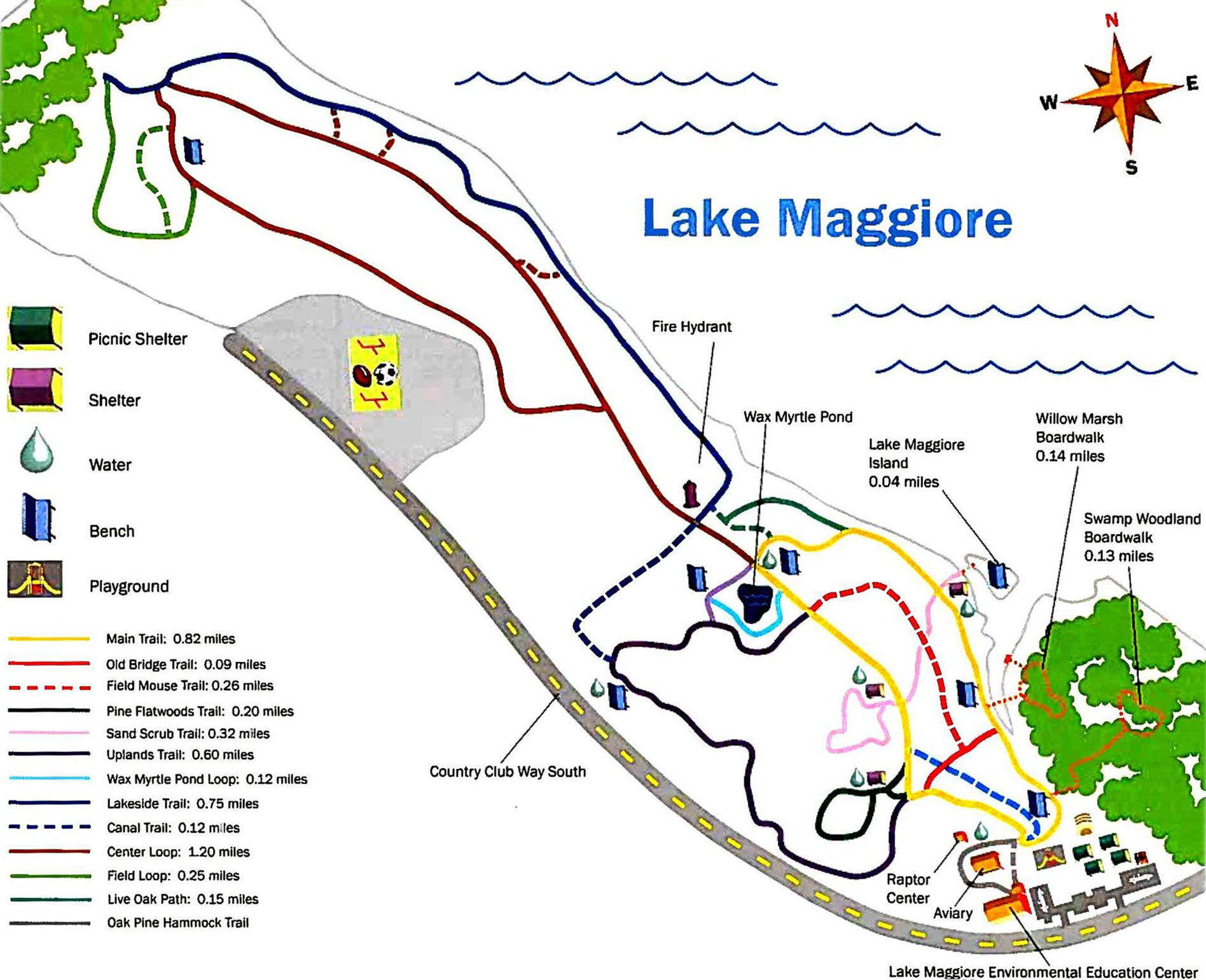
On the south shore of the same Lake Maggiore, Salt Creek changes names (again). Then it disappears (again). The precise point of disappearance, ironically, occurs in a beloved nature park, Boyd Hill Nature Preserve, at one of the finest visual prospects in the entire city. A boardwalk on the Willow Marsh Trail faces North, towards downtown. Off in the distance, beyond the lake, cumulus clouds tower over one another, dramatically framing a vast blue horizon and restless skyline. Anhinga roost in a nearby island, and below, any number of species of ducks, moorhen and long-legged waders nudge through spatterdock and duckweed. Common sights are marsh rabbits and alligators, the mother gator often with her yellow-striped young brood. The visitor's map to the preserve marks this particular boardwalk as part of the Willow Marsh Trail, which presumably would make this area "Willow Marsh." Technically, the water forms part of a Salt Creek branch. Trail maps to the preserve, however, do not even mark a stream.
City nature has no place in a "nature preserve." At a point where an urban waterway should be most visible, even celebrated, the comedy of hide-and-seek intensifies. A waterway (now flowing due South) switches names. By the semantically confused lake, it disappears from the map altogether. Why? Because discursive "Nature" and the natural hydrology do not align. Near the Boyd Hill visitors center, hikers have unknowingly crossed Salt Creek. It is the little brook that trickles past an outdoor classroom, by the raptor rehabilitation center, and eventually reaches back to the edge of the nature preserve, where it runs under a chain link fence. Here, the creek becomes a culvert. And with subtle semantic shift, stewardship declines.
The aquatic thread snaps. We lose the connection. In a wealthy suburban neighborhood, the headwaters of Salt Creek runs through a maze of backyard overgrowth, accessible only with permission. To trace the creek now is to trespass. Care falls to individual whim or the conscience of private owners. One particularly zealous environmentalist has dutifully planted native cypress in the bottom, hoping to stabilize the sandy banks and restore habitat; elsewhere, the low-lying area remains mostly a jungle of invasive taro and wild ginger. Further south, where the planner John Nolen proposed a green corridor along the area's natural swale, the St. Petersburg Country Club has engineered the creek's headwaters into a series of water hazards for its golf course. Landscapers mow up to the edges of the artificial ponds along the golf course's back nine.
The hydrology has become impossible to visualize as one piece. Because the waterway is fragmented, no one connects the link from fourteenth fairway to Tampa Bay. Grass clippings run straight into the ditch, Lake Maggiore, into Salt Creek, and eventually into our beloved bay—feeding algae and toxic blooms that have undermined our quality of life, ruined countless fishing trips, and cost the state dearly in tourist revenue.25 The Tampa Bay Regional Planning Council set the loss of tourism revenue for a 2018 red tide bloom at $130.6 million; see The Ripple Effects of Florida Red Tide, (Pinellas Park, FL: Tampa Bay Regional Planning Council, 2019), https://tbrpc.org/wp-content/uploads/2019/01/The-Economic-Ripple-Effects-of-Florida-Red-Tide_unsigned.pdf; A more thorough study set the loss for the same bloom at double the cost, $317 million, see João-Pedro Ferreira, et al. "Impact of Red Tide in Peer-to-Peer Accommodations: A Multi-Regional Input-Output Model," Tourism Economics, March 1, 2022, https://journals.sagepub.com/doi/10.1177/13548166211068276. The neglected stream passes over a dingy concrete weir, amounting to little more than a one-stroke penalty for golfers and repository for lost Titleists.
Again, the aquatic thread splits. There are actually two larger branches feeding Lake Maggiore, the second no easier to trace. In its western course, the stream feeds a lake from a city tract along Dell Holmes Park. From here, it runs due West down a channel, where it parallels a public golf driving range. Canoes and kayaks rarely paddle this channel. The alligators are unusually large. One could go missing here altogether. If I am to put in at Lake Maggiore, I double check my life preserver.
The unnamed, culverted west branch cuts anonymously across public land. I can paddle upstream, with a city mulch processing plant to the left, and a drop-off site for brush to the right. The stream parallels the east-west running Twenty-Sixth Avenue South. Chain-link divides the landfill and private property, in this case two of the more prosperous historically Black churches in the city—St. Augustine's Episcopal and McCabe United Methodist. The location of these churches, or more accurately their relocation, figures into the last half century of city history. Both congregations served Jim Crow neighborhoods closer to the center of town, the middle class Campbell Park and poorer Gas Plant communities. Both neighborhoods were razed in the 1970s and 80s. Following a national trend, in which federal roads targeted Black areas, Interstate i-175 cut the Campbell Park neighborhood in half, running straight over homes where pillars of the African American community lived.
Ten years later, as if by design, the city razed the Gas Plant in the name of urban renewal, leveling a neighborhood to construct a domed stadium. The Tampa Bay Rays (Raze?) now play in the dome, Tropicana Field. But the team's owners (buttressed by city government and a newspaper that depends upon sports for daily copy) declare the thirty-year-old dome obsolete. Once again, the area awaits real estate redevelopment, with little probable return for the people displaced under the banner of "urban renewal" and promises to "get it right." St. Augustine's Episcopal relocated during the 1970s, moving from property now near the interstate, away from a community that has since scattered, and rebuilding on the rich soil of a former nursery near the head of Salt Creek's long swale.
Lake Eli
Where the creek ends remains an open question. According to an environmentalist friend who lives along the south shores of Lake Maggiore, the creek was historically sheet flow, tracing without record or immediate course through pine flatwoods. If I push a kayak further west, past Lake Eli, I trace the drainage ditch, almost to the churches that run along Twenty-Sixth Avenue. Just north of an arrow-straight culvert alongside the parking lot of McCabe United Methodist, the stream unceremoniously ends. The culvert takes a sharp turn at the boundary of church and city land, then runs north, along a straight ditch to north-south running Twenty-Sixth Street. On the other side of the street, Salt Creek finally disappears into underground maze of sewers. And from there, who knows?
Conclusion—Fragmented Headwaters
McCabe's presence at the headwaters embodies a painful chapter of St. Petersburg's history. The congregation of this century old church coalesced around segregated areas, along the eastern edge of the Gas Plant neighborhood. The congregants built the former church themselves, laying their spiritual home on the Black side of a segregation boundary. The interstate and dome destroyed the old structure, and today, the site is now a nondescript concrete parking garage. The current pastor, Reverend Jana Perkins-Hall, speaks clearly of the betrayal:
Black people got together, during that particular time of economic disenfranchisement, pooled their resources and physically built, brick by brick, this place of worship. They were there for fifty years before they were relocated . . . For what?
Perkins-Hall, though not a native, speaks powerfully on behalf of her parishioners: "So what kind of message does that send — spiritually, emotionally, psychologically — to the people who worked for free? That now, in place of a community they called home, is a parking garage?" There is no historical marker, even though stories continue to tell, "that this was once a place of sacred worship." The dislocation remains an unacknowledged erasure. A more visible reminder would at least acknowledge the hurt.26Jana Perkins-Hall spoke at a community forum about Booker Creek and the Tropicana Field site redevelopment, held at the University of South Florida's St. Petersburg campus on Feb. 15, 2019; see, Anna Maria Lineburger, Kelly Kennedy, and Dyllan Furness, ed., Voices of Booker Creek (St. Petersburg: University of South Florida, 2020), 29–30. Just as the teenage boy said to the Penn professor Anne Whiston Spirn: "someone will wreck it."
McCabe United Methodist Church
At McCabe, the unbaptized remnants of Salt Creek disappear into a sewer line, across from the church, at the corner of Twenty-Sixth Avenue and Twenty-Eighth Street. It is smack-dab in the middle Pinellas County, just east of the low sand ridge (a relic dune) that divides the peninsula. How and where the waters ran before development remains a question. Early histories and even the occasional map suggest that the outer reaches of Salt Creek mingled with a bayou to the west, possibly trading headwaters from both the swamp and bay' this memory of an earlier hydrology, however, remains repressed.27Walter Fuller, St. Petersburg and Its People (St. Petersburg: Great Outdoors Publishing Co., 1972), 5. The creek might have run straight across, serving as a liquid connector now lost.
Cities that bury their habitats sacrifice a bit of collective soul. Environmentalists in Los Angeles lament the failure to recognize the human, natural, and even cinematic history of the concretized Los Angeles River. Tourists are drawn to the Fleet River. New Yorkers still want to see the waters that bubbled under Minetta Street in lower Manhattan, and my archaeologist-art history friend clearly felt a connection when she stumbled onto the Eriadnos. With sea level rise, social scientists attend to the psychic costs of disappearing landscapes, citing what they call solastagia or "environmental grief."28Ellis Neville and Ashlee Cunsolo. "Hope and Mourning in the Anthropocene: Understanding Ecological Grief," The Conversation, April 4, 2018, https://theconversation.com/hope-and-mourning-in-the-anthropocene-understanding-ecological-grief-88630; Gren Albrecht et al., "Solastagia: The Distress Caused by Environmental Change," Australasian psychiatry: Bulletin of Royal Australian and New Zealand College of Psychiatrists 15 (2007); Ashlee Cunsolo and Neville R. Ellis, "Ecological Grief as a Mental Health Response to Climate Change-Related Loss," Nature Climate Change 8 no. 3 (2018): 275–281; L.P. Galway , T. Beery, K. Jones-Casey, K. Tasala "Mapping the Solastalgia Literature: A Scoping Review Study." Internal Journal of Environmental Research and Public Health 16:15 (July 2019). The social-historical context adds another layer. My partner Julie walked Birmingham's Village Creek in an effort to connect place and current-day race relations in this iconic civil rights setting. When I trace Salt Creek, I too seek this connection.
Hydrologic systems carry us into our history. They uncover buried pasts, helping us to explain unhealthy divides. Despite Florida's myths of paradise, we remain disconnected from the natural world, from the past that has built itself around us, from one another. Environmentalism needs community, and we best find community in a city's liquid heart. We need to know where the waters run. 
About the Author
Thomas Hallock received his PhD from New York University. He is the author of From the Fallen Tree: Frontier Narratives, Environmental Politics and the Roots of a National Pastoral, 1749–1826 (Chapel Hill: University of North Carolina Press, 2003) and the co-editor of Early Modern Ecostudies: From the Florentine Codex to Shakespeare (New York: Palgrave Macmilian, 2008), William Bartram, the Search for Nature's Design: Selected Art, Letters and Unpublished Manuscripts (Athens: University of Georgia Press, 2010), and Travels on the St. Johns River: John and William Bartram (Gainesville: University of Florida Press, 2016). He recently published a series of travel and place-based essays that explain why he loves teaching the American literature survey, A Road Course in Early American Literature: Travel and Teaching from Atzlán to Amherst (Tuscaloosa: University of Alabama Press, 2022).
]]>The Great South
From 1873–74, towards the end of Reconstruction, journalist Edward King travelled the former Confederacy attempting to unpack the meaning of "the Great South" (1875) for largely northern readers of Scribner's magazine.1See King, "This book is the record of an extensive tour of observation through the States of the South and South-west during the whole of 1873, and the Spring and Summer of 1874" (i). Along with Scribner's publishers and illustrator J. Wells Champney, King aimed to provide "the reading public a truthful picture of life in a section" recovering from the ravages of war (i). King divided his documentary travel narrative into serialized segments largely along state and town lines.2See King's subtitle: "A Record of Journeys in Louisiana, Texas, the Indian Territory, Missouri, Arkansas, Mississippi, Alabama, Georgia, Florida, South Carolina, North Carolina, Kentucky, Tennessee, Virginia, West Virginia, and Maryland." King's empathetic analysis brought to light many of the problems (political, racial, economic) afflicting the still-occupied former Confederacy; "The South can never be cast in the same mould as the North," he wrote (793). One had to experience it to understand it. King's work reified and reinforced conceptions of how the idea of the South functioned in the American imaginary of that time: an exotic "other" land to be penetrated, explored, known, purposed.3See Jennifer Greeson, Our South: Geographic Fantasy and the Rise of National Literature (Cambridge, MA: Harvard University Press, 2010). Nearly 150 years later, despite numerous changes and persistent discussions of the demise of distinctly southern ways of being and doing, scholars and popularizers continue to debate and deploy variations of King's Great "Southern question" (794).
, 312. Courtesy of Documenting the American South, University of North Carolina–Chapel Hill. Image is in the public domain.")
In different ways, both John Wharton Lowe's Calypso Magnolia and Joshua Jelly-Schapiro's Island People descend from King's documentary travel memoir. While Lowe's Calypso Magnolia is written in an academic idiom, he extends The Great South to a larger Circum-Caribbean geography, proposing a movement across and not simply within. In contrast, Jelly-Schapiro's Island People draws from the well of Caribbean thinkers and documentarians in enacting theories of place through the practice of experience. Lowe travels imaginatively through literary texts. Jelly-Schapiro travels literally to examine histories and cultures of the islands he visits. However, like King, both ask readers big, overarching questions—what and where is the Great (circum)Caribbean?—and, more importantly, does it matter?
"Hyphenating Waters": Calypso Magnolia and the circumCaribbean

Lowe approaches these questions through a diligent analysis of books spanning the Mexican-American War (1846–1848) to the more recent Cuban American writing of the 1980s–90s. He invests substantial energy in altering the grand, exceptionalist narrative of southern literary studies, which goes (reductively) something like this: for decades after the Civil War, the South was a "Sahara of the Bozart," devoid of anything resembling "high" culture, until the arrival of native (white) sons such as William Faulkner4"The emergence of William Faulkner as the centerpiece of narrowly focused notions of Southern identity seemed to crystallize the inward-looking aspect of the discipline" (5). and the Nashville Agrarians, who almost single-handedly were responsible for a cultural Renaissance that proved "the South" to be a place of great, autochthonously conceived and produced, art. Like much other recent scholarship, including Candace Waid's excerpt in Southern Spaces which challenges the idea of the white exceptionalist Southern Renaissance, Calypso Magnolia seeks to rethink the South and southern literary history through specific attention to movement and migration across geographic and imaginary borderlands, and against any essentialist, bounded notion of "the South," southern racial demographics, or "southern culture." Lowe aims to "cross artificial boundaries," "to unlock old geographical and cultural restrictions," to "help us see ourselves anew" (ix, xi). Lowe invites us, as readers and scholars, to "reconfigure the South and the Caribbean" (11). These are large tasks that Calypso Magnolia sets and achieves to varying degrees.
Lowe's work enters existing scholarly conversations in what some have called the "New Southern Studies."5In a June 2001 special issue of American Literature, Houston A. Baker, Jr. and Dana D. Nelson coined the phrase "new Southern Studies" as an "emerging collective already producing a robust body of work" in rethinking southern culture (231). Baker and Nelson cite Patricia Yaeger's Dirt and Desire (2000) as one of these works. Baker's Turning South Again (2001) represents his own venture at this scholarship. In responding to the article which formed the basis of Lowe's book-length study, Kimberly Nichele Brown firmly places "Calypso Magnolia" within this scholarly trend: "the South" becomes "unmoored from its local or provincial connotations" and "finds its rightful place within transnational discourses" (82). Like others before him, Lowe uses an aquatic metaphor, "crosscurrents," in his scholarly act of drawing connections between "the South" as traditionally conceived and the broader circumCaribbean.
Lowe models his frame—"circumCaribbean"—after the "circum-Atlantic" work of Paul Gilroy and Joseph Roach, among others.6Lowe cites Glissant, Foucault, Bhabha, and Brent Staples as further influences. See Paul Gilroy, The Black Atlantic: Modernity and Double-Consciousness (Cambridge, MA: Harvard University Press, 1995); Joseph Roach, Cities of the Dead (New York: Columbia University Press, 1996). One can see Lowe approaching the term "circumCaribbean" in his earlier article on these subjects; in writing of Roach's "path-breaking" work, Lowe praises him for adumbrating "a culture of performance that circles around the Caribbean rim" (71). See Lowe, "'Calypso Magnolia': The Caribbean Side of the South," South Central Review 22, no. 1, 54–80. Spatially, writes Lowe, the circumCaribbean "embraces the coastal Gulf and the Caribbean, as well as the islands that dot the seas and the western Atlantic" (xi). Lowe moves around and within, creating a geography that is boundary crossing and somewhat nebulous by definition and limitation. In such a vast space, what is the rationale for the foci of individual chapters? Admitting the difficulty of language barriers and distinctions, Lowe opens the conversation to other scholars with greater proficiency in the non-English speaking locales of this circumCaribbean (11).


He begins with the Mexican-American War via southern writers who wrote about it, William C. Falkner (great-grandfather of that Faulkner), Arthur Manigault, and Raphael Semmes. Next, he presents two enigmatic figures of the nineteenth century—Lucy Holcombe Pickens and Martin Delaney—as writers who "saw the affinities of the coastal South with the Caribbean lands and had their characters crisscross Gulf waters" to and from Cuba (60). For Lowe, Pickens and Delaney were writers of the Caribbean imaginary who saw, from different worldviews, equal benefits in this crisscross movement. Calypso Magnolia then follows the seismic shift of the Haitian Revolution in subsequent literature. Lowe centralizes the work of Floridians Zora Neale Hurston and James Weldon Johnson and Tennessean Madison Smartt Bell, but he is careful to include non-US southern writers such as Victor Séjour, C. L. R. James, and Alejo Carpentier. Lowe then turns to the travel writing of northerner Constance Fenimore Woolson and the peripatetic Lafcadio Hearn, who "limned a new sense of the circumCaribbean" (18). His chapters five and six offer comparative readings of contemporaneous authors: Zora Neale Hurston through the prism of Claude McKay, and Richard Wright through George Lamming. Calypso Magnolia closes with the experience of Cuban American writers in south Florida largely in the final decades of the twentieth century.
Lowe is exhaustive and syncretic, weaving disparate strands across multiple locales from multiple perspectives. He is a close reader from the outset, and his copious plot summaries serve as helpful entrances into unfamiliar texts.
As necessary and vital as Lowe's molecular moves are to thinking anew about "southern" literature and scholarship, the overarching narrative still favors a certain way of perceiving. At the beginning of this project, before Lowe coined circumCaribbean and was talking only about the "Caribbean Side of the South," he aimed "to rupture the artificial boundaries of region and nation to reach out to the Caribbean" ("Calypso Magnolia," 60). Why must the US South "reach out"? Why must the "South" have a "Caribbean Side"? What if the Caribbean has no desire to be reached out to? What if there's no South to reach out? What if the gaze was reversed? Arguably, Lowe's impulse teeters on making the Caribbean an exotic "side-chick" to the central story. Why centralize Hurston and Johnson and Smartt Bell in a discussion of the Haitian Revolution? Why read Wright through the prism of Lamming and not complicate this impulse more thoroughly?
. Courtesy of Wikimedia Commons. Image is in public domain.")
Lowe aims "to pursue narrative as it cuts across maps that create artificial lines around peoples and cultures" (7). Why not, then, make more radical departures in authorial choices and texts? For example, why not read Reinaldo Arenas's pre-exile La Vieja Rosa/Old Rosa (1980) as a "southern" text clearly speaking back to Faulkner's Absalom, Absalom! from a distinctly Cuban-to-US South direction?7Lowe broached this type of critical move at moments. In his final chapter, he posits a reading of Cristina García's The Agüero Sisters alongside Faulkner's Absalom, Absalom!. However, the aims of Calypso Magnolia seem to be more syncretic and surveying (317). As Kimberly Nichele Brown writes, "What would it mean to southern literary studies to cast Faulkner not just as a southern writer, but as a Caribbean one?" (86). How would such a reversal in perspective "cut across" more disruptively and make us rethink cultural hegemony more deeply? Such questions persist in a work that could justify its organizational logic more forcefully in conjunction with its larger aims. The "currents" of the Caribbean, after all, flow in multiple directions.
Additionally, Lowe writes, "I mean to suggest through the term 'Calypso Magnolia'" a "kind of cultural overlapping" (67). Overlapping seems to imply a one-directional filter that places something "new and fresh" atop a foundational norm, simultaneously rethinking and reifying it. Consider what Lowe labels "the overarching pattern of [his] book":
the movement of Southerners both physically and imaginatively, out of the constructed boundaries of the Southern United States into the wider world of the circumCaribbean, a process that unsettled notions of exceptionalism and nationalism alike, while simultaneously, and paradoxically, creating a vision of a new Southern empire, which would conjoin slave-owning states with the plantations and territories of the Caribbean, Central America, and beyond (22).
Aside from political and economic implications, what are we to make of the imperial cultural ramifications evident in this statement of the larger "pattern" of Calypso Magnolia? Throughout, Lowe brilliantly elucidates what "Southern" writers gain from such a physical and/or imaginative movement. What do those writers or thinkers "beyond" gain from this movement? The book lays "out the myriad ways the 'South of the South' has affected the inhabitants of the U.S. South," and attempts gestures in the opposite direction (1). However, the whole remains too linear and one-directional. Calypso Magnolia could benefit from a more circular, messier approach.
A weightier "Introduction" might have offered a firmer sense of what Lowe means by "crosscurrents" as an organizing principle. This is a substantial missed opportunity. Current is a term of physical movement. In more directly defining "crosscurrents," Lowe might have pulled together his circumCaribbean frame with other critical movements and interventions. As is, Calypso Magnolia leaves us with currents as an aquatic, uniting metaphor:8As Brown writes in her review of Lowe's earlier "Calypso Magnolia," "I can see many benefits of using the sea… to find points of connection between the South and the Caribbean" (83). where all is "tied… together across and upon the currents of the great sea" (19).

Lowe asks readers to cross those currents via his case studies. Calypso Magnolia's final and most exciting chapter, "Southern Aijaco: Miami and the Generation of Cuban American Writing," addresses crossings as they impact identity, pondering what it might mean to feel "crossed" or hyphenated in southern-Caribbean-ness. Spatially, Florida seems the perfect confined locale for Lowe's larger study: not quite "southern," not quite "Caribbean," but somehow a cross of both. He considers the work of Cuban-Americans of the "'one-and-a-half' generation," such as Gustavo Pérez Firmat's Life on the Hyphen and Next Year in Cuba, Cristina García's The Agüero Sisters, Virgil Suarez's Going Under, and Roberto Fernández's Holy Radishes! (293). Lowe's readings of Cuban American fiction and memoir, often "in and on the liminal space of the hyphenating waters between Cuba and Florida," are some of the most original and engaging in Calypso Magnolia (332). In reading lives on the hyphen, Lowe opens the door for future studies of hybridity modeled after his circumCaribbean framing. Despite my concerns, Lowe's writing is careful and specific, and always exemplary. As it seeks to shift the kinds of questions we ask, Calypso Magnolia's "crosscurrents" will help readers think beyond and across hyphenating waters.
"So Many One Night Stands": Island People and Island Hopping

In Calypso Magnolia's chapter on Woolson and Hearn, Lowe mentions Edward King's The Great South as making "extravagant claims as to the novelty of its 'discoveries,' which were achieved through 'penetration' and 'investigation'" (147). The Great South helped a nascent American empire "train the eye southward" as testing ground for its global ambitions and depicted in its illustrations stereotypes of African Americans and poor whites (147, 167). Unlike Lowe, Joshua Jelly-Schapiro's Island People: The Caribbean and the World never mentions The Great South. Similarly, many of the figures discussed by Lowe are not mentioned in Jelly-Schapiro's travel narrative. There are two small exceptions. While Lowe devotes half a chapter to Lafcadio Hearn, Jelly-Schapiro casually mentions a parking garage in Fort-de-France named in Hearn's honor; while Lowe seems to primarily read George Lamming only in relation to Richard Wright, Jelly-Schapiro reads Lamming directly in relation to Barbados, casually nodding to Wright in describing Lamming as a "native son" (341, 287). Otherwise, one should not approach a comparison of Calypso Magnolia and Island People via the figures they mention and/or study but the ideas and questions they elicit.9Other than a passing reference to Faulkner's Mississippi, the only traditionally defined "southern" writer to appear in Island People is Georgian Flannery O'Conner, whose relationship to depictions of race is mentioned in reference to Jean Rhys (12, 367). For US readers, Jelly-Schapiro's Island People again trains "the eye southward," to the "South of the South." However, unlike The Great South, Jelly-Schapiro does not present the Caribbean as a place of discovery, penetration, or investigation. Island People is an experiential travel narrative in which orientalism and exoticism are mostly resisted and the Caribbean is firmly centered.
What is Jelly-Schapiro's idea of the (circum)Caribbean? And why does it matter in/to the "World" of his subtitle?
While Edward King is understandably absent in Island People, another titan of travel writing hovers over many of its pages. Patrick Leigh Fermor's The Traveller's Tree: A Journey through the Caribbean Islands (1950) seems Island People's singularly most direct antecedent. Both are "pitched neither strictly at scholars nor at holiday makers" but at a general readership (Island People 11). Jelly-Schapiro returns to The Traveller's Tree throughout as he narrates his travels sometimes in relation to Fermor's own 1940s-era perceptions; it comes as little surprise to learn that Jelly-Schapiro wrote a new introduction to the 2011 reissue of Fermor's classic.10Joshua Jelly-Schapiro, "Introduction," in The Traveller's Tree: A Journey through the Caribbean Islands (New York: New York Review of Books, 1950, 2011), ix–x. The genealogical link is apparent. Like Fermor, Jelly-Schapiro is, among many other things, a travel writer. Like Fermor, Jelly-Schapiro comes from elsewhere.

Fermor is not the most important figure looming over Island People. As a Caribbeanist thinker, Jelly-Schapiro is influenced largely by C. L. R. James. In fact, Island People begins and ends with James and feels like an epic homage to him: "But the Caribbean, James argued, was unique" (5); "I had… adopted C. L. R. James as a kind of intellectual hero and style icon alike" (401). For Jelly-Schapiro, James was "his first big intellectual crush," and it is easy to see James's influence on Island People (401). In James, Jelly-Schapiro finds a great syncretic thinker who brought together disparate strands of philosophy, culture, and history into a coherent narrative in which the Caribbean was central (not marginal) to "the larger telos" of modernity, capitalism, and democracy (3). Island People, in its structure and vastness, also aims to be a syncretic work mapping and describing the central importance of the Caribbean in the world.
Unlike Lowe, Jelly-Schapiro is not a literary critic but a geographer, and in large part, Island People reads as a much more "centered" and "bounded" investigation. Like Calypso Magnolia's "circumCaribbean-South," Island People considers its subject, "the Caribbean," as both "place" and "idea" (6). Although Jelly-Schapiro mentions the full range of Caribbean thinkers, Island People feels more invested in specificities of place and practice than theories or philosophies. "The abstraction was also a place," he writes (335), and "This book ponders not merely what the Caribbean is but where it is as well" (12, emphasis provided). Unlike Lowe, Jelly-Schapiro does not move around the circumCaribbean rim, but dwells on the subaquatic link of islands that form the Greater and Lesser Antilles. He "centers on the islands," viewing the "Caribbean as an archipelago: as a 'sea of islands'" (13). Whereas Lowe aims to move around and form connections, Jelly-Schapiro island hops, with nearly every chapter focusing on a singular island in the archipelago.
. Courtesy of Wikimedia Commons. Image is in public domain.")
As a result, Island People often reads like a disjointed narrative of island hopping tourism, a text structured around what José Quiroga calls "scattered" islands that form "so many one night stands."11José Quiroga, Tropics of Desire: Interventions from Queer Latino America (New York: New York University Press, 2000), xiii. Like Fermor's Traveller's Tree, the structural logic lies in sections divided by island nations: part one, the "Greater Antilles" of Jamaica, Cuba, Puerto Rico, and Hispaniola; part two, the "Lesser Antilles," including Martinique, Dominica, and Trinidad. While Jelly-Schapiro often makes a joke of Caribbean tourists, some in thrall to "stories about how Papa Hemingway" got drunk on daiquiris on a Havana barstool "after a day of marlin hunting in the Florida Current," the lingering effect is of so many island-hopping one night stands in which the experience is fleeting even if fulfilling (117). The power of Island People is that it attempts to be something other than that story. It is a documentary effort to let the islands, their peoples, histories, and cultures, speak for themselves, from the Caribbean to the World.
Island People's textual logic constantly reminds readers that this is a book in which an outsider, a tourist, is describing, probing, and organizing a narrative to tell the rest of the "world" about it. No matter his affinity, deep care and carefulness, Jelly-Schapiro is still a traveler leaving traces in his archipelagic tour. You can, for example, follow his trail of hotels throughout.12The reader follows Jelly-Schapiro from Kingston's Myrtle Bank Hotel (44) to Havana's Hotel Nacional (99) and Havana Hilton (100) to San Juan's Condado Vanderbilt Hotel (175) to La Romana's Casa de Campo (216), Port-au-Prince's Hotel Oloffson (260), George Town's unnamed Hotwire.com recommendation (281), Grenada's Heliconia guesthouse (296), to Antigua's Sandals and "Florida-style condos" (309), St. John's Heritage Hotel (310), Fort-de-France's Hotel L'Imperatrice (336), Dominica's Pointe Baptiste (369), and finally, Jelly-Schapiro's last stop, Trinidad's "ugly new Hyatt" (400). As historically well-researched, fiercely intelligent, and superbly written as Island People can be, readers never stop travelling. You may choose to "enter" at the island of your choice. (I began with Cuba). All of this amounts to what can feel like a lack of foundation for important claims and moments to resonate.
Island People is immensely satisfying. If it often fails to resonate, it constantly reverberates. We learn about Brand Jamaica, run with Usain Bolt, hear Bob Marley, Pete Tosh, and Lady Saw, find Stella's groove, and search for the "moments of filial love" and the "ghosts of colonial violence" (49, 58); in Cuba, we enter the "empire of vice" (99), find cubanidad, Fernando Ortiz, El Taino y la yuma, José Martí, Carpentier, Batista, Che and Castro, have a "love affair with spandex" (113) and phallocentrism, meet Eleggua and Abakuá, Antonio Maceo and Bola de Nieve, Assata Shakur and Carlos Moore, and many more. And so on and on across the islands13A small list of Island People's inhabitants: in Puerto Rico (via the Bronx), we find Rita Moreno, Pedro Albizu Campos, Luis Muñoz Marín, Tito Puente, "El Cantante" Héctor Lavoe all sharing the same island; in the Dominican Republic, we read about tigueres, the Coliseum of Cockfighting (208), the "sex economy" (206), Trujillo, "los morenos" and a lack of "pride" in "racial hybridity" (221, 203), perejil and el corte; in Haiti, centered in the text, "at the core of the Caribbean story" (226), again revealing C. L. R. James's influence, the same perejil and el corte, Kreyol, the Massacre River, Toussaint L'Ouverture, Dessalines, the Citadel and Henri Christophe, Boukman, the Duvaliers, Tonton Macoutes, Carnival of Flowers and earthquakes where the "'earth moved like a wave and all was ruined'" (261), Titanyen and bodies, Wyclef Jean, Cité Soleil, Katherine Dunham, and "people's invisibility to their own state" (265); in the Lesser Antilles, we read about George Lamming and Rihanna, Paule Marshall, Jamaica Kincaid, Maurice Bishop, Barbuda's "breeding myth" (308), Montserrat's "volcano crisis" (315), Martinique's Aimé Césaire, Glissant, Fanon, Chamoiseau, and other "literary riches" (358), Jean Rhys and Dominica's "Candy Land for lovers of nature and calm" (365). until finally, Trinidad gives us Beyoncé (yes, that one), Eric Williams, Derek Walcott, "soul calypso," New Orleans and the rim of Carnival, Palance, "queer subcultures" and "gay-bashing norms," the "Black Power Killings," Stuart Hall, and the inevitable return to C. L. R. James.

Jelly-Schapiro's exhaustive, four hundred page, highly syncretic, travel narrative is indeed full of people, places, things, and historic events. Yet, in breaking the Caribbean into its disparate parts, Island People falls short in crafting coherent meaning—realistic, theoretical, or phantasmagoric—of the Caribbean idea. Perhaps this is an impossible request due to sheer scale, genre (travel narrative/history), and intended audience (general). However, many a Caribbean thinker has articulated a central argument for the basin's meaning and function—Edouard Glissant's Poetics of Relation, Antonio Benítez-Rojo's Repeating Island, Kamau Brathwaite's tidalectics, Wilson Harris's cross-culturality, Stuart Hall's "home of hybridity," and Derek Walcott's "sea is history," to name a few. Jelly-Schapiro touches on many of them in Island People, revealing both his deep knowledge of his subject and his recognition of the almost sheer impossibility of unifying the Caribbean idea into any original tidy narrative.
Is the Caribbean exceptional or relational? Island People does not seek to answer this question. Instead, in refusing to form concrete connections between the islands of the Caribbean and other comparative sites, Jelly-Schapiro follows his hero C. L. R. James in extrapolating Caribbean history and meaning to make larger claims about modernity and "the World" of his title: "It was in the Caribbean that many of the salient characteristics of the Americas at large—traumatic histories of colonialism and genocide and slavery; migration and creolization as facts of life; the persistent sense of cosmopolitan possibility and newness inherent to a New World—were brought into starkest relief" (8). Whereas Lowe's Calypso Magnolia works to rethink traditionalist readings of southern literary culture, Jelly-Schapiro's Island People refutes V. S. Naipaul's claim that "History is built around achievement and creation, and nothing was created in the West Indies" (11). In its aim to center the Caribbean in the World and document the West Indies as crucible of syncretic creation and significant global influence, Island People succeeds tremendously.
Wade in the Crosscurrents
Together, Lowe and Jelly-Schapiro have written one important work: Calypso Magnolia-Island People. Where Lowe is sometimes too lofty in his desire to bridge, Jelly-Schapiro is often too reductive in his discrete articulation of separate island spaces. Jelly-Schapiro's justification of a book solely about the Caribbean can seem too specific and isolationist. Lowe's constant syncretic desire to move across raises questions of positional privilege and universalist tendencies. In reading them side-by-side, readers can wade in the crosscurrents and decide for themselves what and where the (circum)Caribbean is.

The conversation between Calypso Magnolia and Island People benefits all who join it. In an era when a US travel ban seeks to curtail the movements of individuals and groups of people and much is made of walls and constructed borders, Lowe and Jelly-Schapiro remind us of the history of colonization, enslavement, exploitation, exoticization, narrativization, and migration at the heart of all histories of the Americas. Lowe cuts across the "artificial borders" confining the US South to rethink national borders and cultural restrictions; Jelly-Schapiro invites us on a journey in which America signifies much more than the myopic vision of any one nation-state and the Caribbean, place and idea, takes center stage in a history of all of the Americas.
Understanding what we mean when we say "South," "(circum)Caribbean," or "America" matters as our definitions and limitations directly affect those who get included and those who get excluded from our spaces and our ideas of place. Jelly-Schapiro writes, the "ways in which a place is imagined, especially by those with power to act on it, matters" (7). Both Calypso Magnolia and Island People help put into perspective how our ideas of place matter and reverberate locally and beyond.
About the Author
Eric Solomon earned his doctorate in English from Emory University. Dr. Solomon is an independent scholar living in Atlanta, Georgia. He is currently revising his first manuscript.
]]>
In the early hours of June 29, 2014, a Bourbon Street shootout left twenty-one-year-old Brittany Thomas, a visitor to New Orleans, dead and nine other bystanders injured.1Ken Daley, "Bourbon Street Shooting Leaves 10 Wounded, 2 Critically, Tourism Image Scarred," NOLA.com, June 30, 2014, http://www.nola.com/crime/index.ssf/2014/06/bourbon_street_gunfight_leaves.html; Helen Freund, "Bourbon Street Shooting Victim, 21, Dies," NOLA.com, July 2, 2014, http://www.nola.com/crime/index.ssf/2014/07/bourbon_street_shooting_victim.html. For many, the recent rise of gun violence on Bourbon Street, and in the city's tourism districts more generally, threatens a booming industry. Richard Campanella's Bourbon Street: A History, published three months before the tragedy, places recent gun violence within a much longer history of social, political, and environmental threats that have failed to effect Bourbon Street's oft-predicted demise: "It has survived Prohibition, the Depression, wars, recessions, fires, hurricanes, floods, mobsters, raids, crackdowns, segregation, integration, white flight, hippies, rappers, evangelists, the oil bust, the dot-com bust, and relentless cycles of cultural tastes" (257), a testament, Campanella argues, to Bourbon Street's resilience and to its cultural and economic significance.
A prolific, award-winning author and commentator on New Orleans's historical geography, Campanella has made a career of heralding the significance of the city's cultural and historic neighborhoods. In Bourbon Street, he turns his attention to the city's most iconic thoroughfare and its development from "pedestrian, unpretentious, and utterly unexceptional" (21) origins as Rue Bourbon in the eighteenth century to its present-day renown as "a signature street, one that [speaks] on behalf of the whole city to the nation and the world" (222). The book is divided into three parts: "Origins," "Fame and Infamy," and "Bourbon Street as a Social Artifact."
"Origins" reprises Campanella's previous studies on the environmental, topographical, and social conditions that shaped the early cityscape from the French colonial period to the antebellum era. As part of the original urban core, Bourbon Street's relatively high elevation and proximity to the river, the "front of town," made it much more economically and environmentally sound than the flood-prone, low-lying swampy areas of the "back of town" (34). In this period, Bourbon Street also represented the "ironic spatial integration" of New Orleans (36), which, as a major port city and the largest slave market in North America, thrust together a diverse, yet socially stratified population.
"Fame and Infamy" forms the heart of the book, tracing the reciprocal evolution of Bourbon Street's international notoriety and the upsurge of the modern tourism industry. Campanella pinpoints "the birthplace and birthday of modern Bourbon Street" (107) as the opening of Maxime's nightclub in January 1926, and chronicles the social, cultural, and economic changes that created the atmosphere of "beachy tropicality and Caribbean escapism" that characterize Bourbon Street's continuous parade in the twenty-first century (228). In between, he traces fluctuating attitudes about the Street as, at turns, "dirty, depressed, and dodgy" (74) and as a successful "stable social and economic space" that fuels the local economy and leaves an indelible imprint on national and global culture (250).
In the book's final section, "Bourbon Street as Social Artifact," Campanella attempts to uncover how cultural and social practice has constructed the street. He provides an ethnography of work and workers, maps the circulation of Bourbon Street as metonym for "pedestrian-scale drinking, eating, and entertainment districts" throughout the world (308), and charts the emergence of "anti-Bourbons"—entertainment zones that offer a putatively more authentic alternative. In the process, Campanella shows how geographic, demographic, and economic features shape the Street's character and success, parses debates over authenticity between critics and aficionados, and touts the recovery following Hurricane Katrina.
Because much of Bourbon Street's social and cultural history is a synthesis of other New Orleans histories, including Campanella's, the book's most original and compelling contribution is a delineation of the Street's changing cultural geography. Campanella chronicles several social and cultural developments that helped transform the strip: racial segregation and desegregation, the changing soundscape, the ubiquity of souvenir shops, the popularity of female public nudity, the demarcation of queer space, and the innovation of the go-cup that supplanted nightclubs and "completely rewire[d] the social and economic dynamics of Bourbon Street" (211). Campanella's meticulous archival and cartographic research draws on a wealth of primary sources—including census records, city directories, maps, and police reports—to demystify Bourbon Street and reveal its inner workings.
In his descriptions of mid-twentieth-century Bourbon Street, Campanella becomes the ultimate tour guide, immersing readers in the spectacular, cacophonous, and malodorous sensory experience of the booming vice district. He directs readers past racially stereotyped tap dancers and blackface performers on the strictly segregated Street. He offers a sneak peek at the burlesque performances—and far less glamorous dressing rooms of—Evangeline the Oyster Girl, Rita Alexander the Champagne Girl, and Alouette LeBlanc the Tassel Spinner, so named for her skill at "twirling in opposing directions four tassels attached to her breasts and buttocks" (167). Campanella introduces a colorful cast of characters, such as Gaspar Gulotta, the "Little Mayor of Bourbon Street" (146), who mediated between the various factions and personalities that held a stake in the Street's economic and cultural advancement. He takes an unexpected jaunt through Chinatown, where Chinese merchants established themselves during the Great Depression. Campanella also draws on his own primary research—interviews, photographs, observations, and painstaking analyses of pedestrian traffic and balcony occupancy—to give readers a contemporary experience. Campanella shows how by the late twentieth century, Bourbon Street had transformed from a multigenerational, ethnically and racially diverse, working-class, mixed residential and commercial milieu to a tourist strip with "fewer children, fewer blacks, fewer ethnic whites, more transplants, higher housing prices, and higher incomes" (185). Certainly, Bourbon Street's transformation had significant cultural, social, and political implications for the rest of New Orleans, particularly for the African Americans, ethnic whites, and working class families that could no longer afford to live there. But Campanella's study is less concerned with illuminating this mutuality than in promoting Bourbon Street as the quintessential American success story.
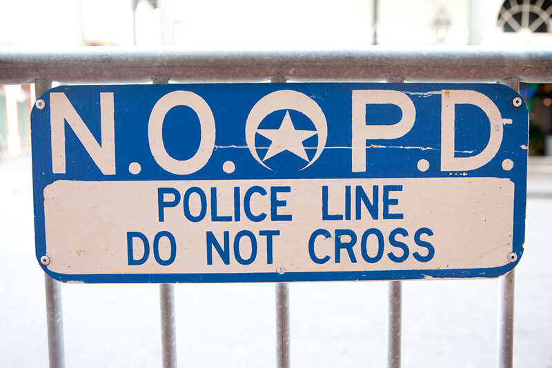
Campanella celebrates the "ethnic white working class of downtown New Orleans," whom he credits with Bourbon Street's fame and financial success. The meteoric rise is all the more commendable because it occurred with "no consolidated administration, no president, no coordinator, no lobby, no marketers, and no corporate funding. Bourbon Street as we know it today effectively invented itself, locally, from the bottom up, with each constituent entity experimenting individually and adopting innovations laterally via competitive forces" (146). This American success myth, described by film scholar Julie Levinson as incorporating "the dream of rags-to-riches, the image of the can-do American, the credo of self-reliance, the doctrine of individual enterprise, and the faith in meritocracy" is based on the faulty proposition that "we are unbound by the past, by social identities, or by economic circumstances."2Julie Levinson, The American Success Myth on Film (New York: Palgrave Macmillan, 2012), 11–12. However, Campanella's documentation of a long history of racism and sexual exploitation suggests that the exclusion and subordination of some groups, such as African Americans and women, were as integral to Bourbon Street's success as entrepreneurial experimentation and innovation. Further, Bourbon Street: A History presents myriad examples of special zoning ordinances, exemptions from code-enforcement and litigation, sympathetic task forces and commissions, disproportionate investment in infrastructure and policing, and other accommodations that subsidized economic development. As historian J. Mark Souther and others have shown, these subsidies to the city's tourist core came at the expense of other neighborhoods, "leading to the increasing spatial differentiation into privileged and disadvantaged districts."3J. Mark Souther, New Orleans on Parade: Tourism and the Transformation of the Crescent City (Baton Rouge: Louisiana State University Press, 2006), 226. Political scientist Paul A. Passavant makes a similar argument in "Mega-Events, the Superdome, and the Return of the Repressed in New Orleans," in The Neoliberal Deluge: Hurricane Katrina, Late Capitalism, and the Remaking of New Orleans, ed. Cedric Johnson (Minneapolis: University of Minnesota Press, 2011), 87–129. Campanella's own evidence undermines the free-market fundamentalist premise that on Bourbon Street "those who don't flexibly adapt to demand go bankrupt; those who survive must be effectively and efficiently giving the people exactly what they want" (303).
Campanella even attributes Bourbon's Street's post-Katrina recovery to this type of flexibility and efficiency, explaining that "brave Bourbonites incentivized the first businesses to return, and seeded the re-formation of an economy—not just Bourbon's, but that of the entire city. . . . Unlike so many other entities, Bourbon Street recovered with little if any federal aid and zero charitable assistance. Bourbon Street was not only New Orleans's most successful invention, it was also its most resilient and self-reliant" (310, 311). Yet, as scholarship on post-Katrina New Orleans chronicles, the city's market-driven approach to recovery has been unevenly and inequitably administered, exacerbating an already "uneven landscape of risk and resiliency."4Kevin Fox Gotham and Miriam Greenberg, Crisis Cities: Disaster and Redevelopment in New York and New Orleans (Oxford: Oxford University Press, 2014), viii. For other examples of recent scholarship critical of the market-driven approach to post-Katrina recovery, see Vincanne Adams, Markets of Sorrow, Labors of Faith: New Orleans in the Wake of Katrina (Durham: Duke University Press, 2013); John Arena, Driven from New Orleans: How Nonprofits Betray Public Housing and Promote Privatization (Minneapolis: University of Minnesota Press, 2012); Cedric Johnson, ed., The Neoliberal Deluge: Hurricane Katrina, Late Capitalism, and the Remaking of New Orleans (Minneapolis: University of Minnesota Press, 2011); Lawrence N. Powell, "What Does American History Tell Us about Katrina and Vice Versa?," Journal of American History 94, no. 3 (December 2007): 863–876; Lynnell L. Thomas, Desire and Disaster in New Orleans: Tourism, Race, and Historical Memory (Durham: Duke University Press Books, 2014), 158–173. Black studies scholar Clyde Woods used the apropos phrase "neo-Bourbon/neoliberal agenda" to refer to the political, social, legal, and economic policies that created and maintained this landscape that prioritized tourism interests and private profits over community needs and social justice initiatives.5Clyde Woods, "Katrina's World: Blues, Bourbon, and the Return to the Source," American Quarterly 61, no. 3 (2009): 448. Bourbon Street: A History rejects this type of criticism and sets up a rigid binary between those who appreciate Bourbon Street as "a delectable mélange of historicity and hedonism" and haters who view it as "iniquitous, crass, phony, and offensive" (xiii). This reductive pro-/anti-Bourbon framework elides the complicated, reciprocal processes of touristification and criminalization that prompts investment in tourist spaces and containment of other neighborhoods.6Passavant, "Mega-Events, the Superdome, and the Return of the Repressed in New Orleans."
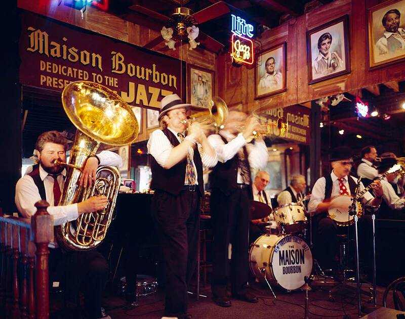
Although Campanella claims to offer "a nonjudgmental analysis of a complex phenomenon from many angles" (xvi), he levels his most strident criticism against "the cultural elite and their aspirants—image-conscious doyens, urbanophiles and preservationists, literati and academics, music connoisseurs and foodies, insecure transplants proving their bona fides, college students making a statement" (297). Their disdain for Bourbon Street, Campanella maintains, rests on elitist and ahistorical notions of authenticity. In contrast, Campanella proposes a relativist notion of authenticity: "Everything is real. Bourbon Street today is just as authentically part of real New Orleans culture as Storyville was a hundred years ago, and as Social Aid and Pleasure clubs, the housing projects, Creoles, and Tremé are today – no more, no less" (300). Yet, Campanella's authority to determine what is real and who is qualified to judge that reality rests, in part, on his own status as a New Orleans insider whose experiences trump the criticisms leveled by the progressives he disparages.7For an analysis of the implications of Campanella's privileging of experience-knowledge, see Emma Lirette, "Category 3 Gentrification: On New Orleans's Population Trends and the Hostility of Internet Commenters," Southern Spaces, April 17, 2013, https://southernspaces.ecdsdev.org/blog/category-3-gentrification-new-orleanss-population-trends-and-hostility-internet-commenters.
Campanella's characterization of black New Orleanians is as problematic as his sweeping condemnation of progressives. Working-class African Americans escape the pitfalls of the authenticity debate because they supposedly "have all the authenticity they need" (297). In a similarly puzzling assessment, Campanella categorizes local nonwhites on Bourbon Street who are neither working in one of the establishments nor passing through on the way home, as being there to "loiter, beg, bicker, and settle scores among each other" (266). One is left to wonder about the experiences of local African Americans (and other groups) who go to Bourbon Street to witness the spectacle and indulge in the free entertainment, those who visit with out-of-town guests, socialize with attendees at black conventions and festivals, celebrate during Mardi Gras or after Saints games, or—as my own son did recently with a group of local black college-age friends—bring in the New Year. While Campanella offers the perspectives of informants who stereotype all black patrons as poor tippers, enact racially discriminatory policies, and deride an outing with high black turnout as "ghetto night" (273), he rarely presents the voices of black New Orleanians or black tourists or examines their complicated relationship to Bourbon Street.
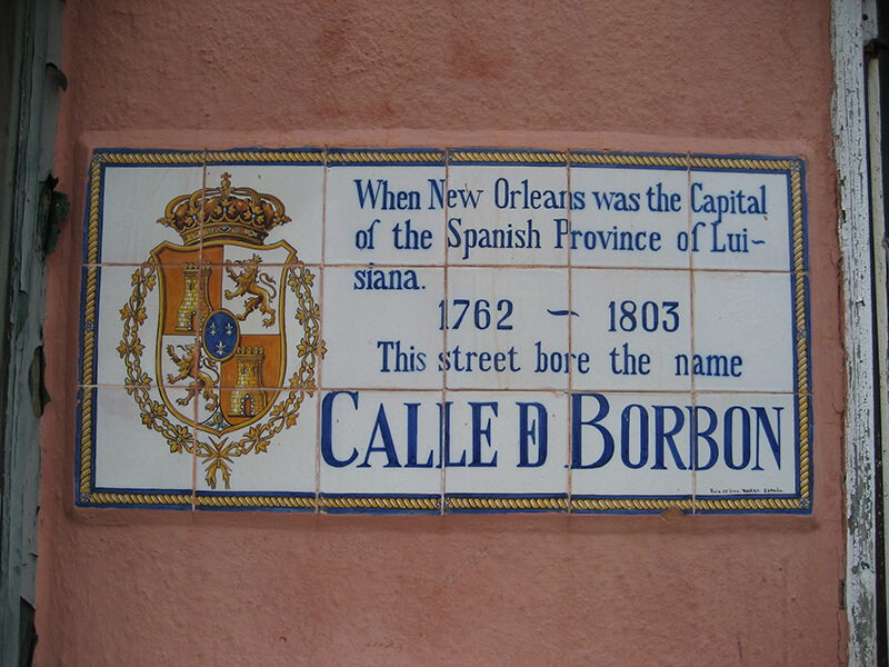
Campanella does an excellent job of mapping "geographies of pleasure" (99) that have made the tourist promenade such a central part of New Orleans's economic and cultural identity. What the senseless Bourbon Street shooting death of African American tourist Brittany Thomas illuminates is that these geographies of pleasure are inextricably linked to the geographies of pain that have also powerfully shaped the city's economy, geography, and historical memory.8By a cruel irony, the June 2014 Bourbon Street shooting occurred just outside Johnny White's bar, the same bar that famously stayed open during and after Hurricane Katrina. The fact that this Bourbon Street institution has served as both a symbol of the city's rebirth and a reminder of its rampant violence and criminalizaton highlights the relationship between geographies of pleasure and pain. See, Benjamin Alexander-Bloch, "Bourbon Street Shooting Sent Bystanders Rushing into Nearby Businesses," NOLA.com, June 29, 2014, http://www.nola.com/crime/index.ssf/2014/06/as_bourbon_street_shooting_occ.html; Richard Campanella, Bourbon Street: A History (Baton Rouge: Louisiana State University Press, 2014), 310.
About the Author
Lynnell Thomas is associate professor and chair of American Studies at the University of Massachusetts Boston. Her research interests include New Orleans tourism, popular culture, and African American history and literature. A native of New Orleans, Lynnell Thomas is part of the post-Katrina diaspora, which informs her teaching and scholarship. Her research is also concerned with the diverse backgrounds and experiences that constitute and contest American identity and values. Her most recent scholarship has examined post-civil rights era tourism, the HBO series Treme, and post-Katrina New Orleans.
]]>Review
 |
Tammy Ingram explores both more and less than the history of the Dixie Highway, built between 1915 and 1926 as a six-thousand-mile loop from Chicago and other Lake Michigan towns to Miami Beach and back. Dixie Highway foregrounds the political challenges in conceiving and creating an integrated, cross-country road in an era when the United States lacked a coordinated system of federal or state funding or planning for road building and when the affected states (especially in the South) had little to no bureaucratic, professional, or labor infrastructure to help plan, build, or manage such projects.
As a vehicle for examining America's transportation and modernization politics at a key moment of the country's rail-to-auto transition, the Dixie Highway project is quite useful. Passing through ten states on both sides of the Mason Dixon line, the highway invites comparison of how politics at the state level shaped transportation debates. Spanning the years during which the first federal aid highway acts were passed, a major war reshaped and reframed transportation needs, and automobile ownership surged, the Dixie Highway's story illuminates many of the planning, construction, and maintenance challenges of twentieth century highway network development.
Ingram opens with a discussion of the nation's chaotic transportation system at the dawn of the twentieth century, noting that until the advent of the automobile, roads and railroads coexisted uneasily. Railroads received considerable congressional investment and dominated long-distance and even regional travel and freight transit. Meanwhile, an anemic "spokes-on-a-wheel" system of ill-funded, mostly unimproved local-destination roads filled in the gaps from farm to railroad depot and enabled horse and wagon travel where railroads didn't go.
Ingram recounts how farmers and merchants chafed at the railroads' control over freight cost and time schedules and at the difficulties of navigating poor surrounding road infrastructure. By the late nineteenth century, road development partisans began to coalesce into a national "Good Roads" movement. A weak federal Office of Road Inquiry was established in 1892, but had no real authority or budget. Federal promises in the 1890s to develop an elaborate Rural Free Delivery system failed to materialize. Dixie Highway details how Good Roads activism (fueled by a fragile coalition of farmers, businessmen, and the nascent automobile industry) accelerated nationwide after 1910 when affordable automobiles vastly expanded the potential for an upgraded road network to present a viable alternative for long-distance travel. Good Roads activists began to lobby for a federally-funded highway system, and, after 1914, planning for the Dixie Highway commenced.
The idea for the highway, Ingram notes, came from Indianapolis automotive headlights manufacturer Carl Fisher, who had plowed his fortune into the Indianapolis Motor Speedway, and later into promoting long-distance roads, including the earlier Lincoln Highway. The Dixie Highway—one of a number of "marked trails" of this era—would join existing local roads into a long-distance highway linking north and south. Not coincidentally, it would connect the metropolitan North with Fisher's new real estate venture in the mangrove swamps of south Florida—Miami Beach. Despite Fisher's self-interested agenda, the idea attracted broad support from farmers, businessmen and tourism promoters, automobile enthusiasts, and state officials. The Dixie Highway Association, founded in 1915 by Fisher and other businessmen, spearheaded their lobbying and planning efforts.
 |
| Outline of the Dixie Highway, The Dixie Highway Association, 1915-1927. Courtesy of Wikimedia Commons. |
Bringing Dixie Highway to fruition at this moment when there was no political consensus about road building proved arduous. Ingram explains how disagreements erupted over routing, state and gubernatorial power to designate routes, and concerns about funding and labor sources. At a major meeting in Chattanooga in 1915 "[e]veryone wanted to be involved in planning the Dixie Highway," Ingram quips, "but no one knew how to do it" (76).
In Ingram's narrative, the thorniest questions concerned the need for federal money and more centralized state control. Having inaugurated the project by raising insufficient funds from counties, after 1915 the Dixie Highway Association joined the growing national chorus calling for federal highway aid. Such efforts spurred passage of the first Federal Aid Road Act in 1916 with, Ingram notes, the strong support of southern congressmen. The Act, limited in scope, mandated creation of highway departments in states that wanted to receive federal funds, but lacked other provisions that would have allowed it more fully to support efforts like the Dixie Highway.
Ingram presents World War I as a key turning point. The war bolstered the new state highway departments and calls for expanded federal involvement in road building by revealing the severe limitations of both the nation's railroad and highway infrastructure (which could not handle increasing truck traffic). Advocates of the Dixie Highway and similar routes began to cast their projects as national defense investments rather than just commercial or tourist amenities.
Meanwhile, the growth of domestic tourism during wartime spurred demand not only for road improvements, but also for standardized signage, maps, and travel guides. One wishes that Ingram had explored drivers' early experiences on the Dixie Highway in relation to the larger politics.
The country moved haltingly towards a national highway system. While the Dixie Highway Association advocated "expert engineering, paid labor, and modern machinery" (131) for road construction, many southern states remained committed to a chain gang labor system using (mostly) black convicts. Although the chain gang system was inefficient and ineffective in building quality roads, Ingram says that southern states clung to it as a pillar of (localized) racial control, as well as a way to avoid levying new fees or issuing road-building bonds.
Ingram writes that even after passage of an enhanced Federal Aid Highway Act in 1921, "[t]raditional racial politics collided with the modernizing impulses of the Good Roads Movement along the Dixie Highway" (132). Rifts opened in the movement, and progress on the highway lagged. But national sentiments were changing. In the 1920s, the roads movement culminated in the Bureau of Public Roads' designation of a national system of numbered federal highways. This system subsumed named routes like the Dixie Highway and, Ingram observes, "symbolized a significant transfer of power from local governments to a new centralized highway administration run by unelected state and federal bureaucrats" (174).
Meanwhile, in Georgia, the impulses to retain local control and resist bond- or license-driven statewide funding of highway construction reigned supreme. Ingram details how voters in the 1926 gubernatorial election elevated a pay-as-you-go advocate and highway department critic to the top of state government. "In many ways," Ingram concludes, the race "placed the massive success of the Dixie Highway campaign up for a popular vote, and it lost" (192).
In other southern states, too, "voters recoiled at the power and the cost of the state and federal institutions necessary to implement actual road construction" (193). This sentiment, Ingram argues—relying on data from South Carolina only—prevailed across the South until the 1950s, when the 1956 Federal Aid Highway Act mandated the interstate system based on the centralized, coordinated, national road building ideas that had underlain the Dixie Highway.
In using the Dixie Highway's history to map the contours of early twentieth century US highway politics, Ingram's book is successful. Yet, even on its own terms, the book feels partial and incomplete.
 |
| Logo for the Georgia Dixie Highway Association and 90-mile Yard Sale. © Dixie Highway 90-Mile Yard Sale, 2015. |
The most significant shortcoming is that, while positioning itself as a history of the cross-country interstate "Dixie Highway," substantial parts of the book focus on internal politics in just one state: Georgia. Ingram defends this choice on the basis that Georgia had more Dixie Highway mileage than most other states, was heavily populated but poorly served by improved roads, was the "gateway to Florida" (10, 58), and provides a useful window into larger debates about centralization, planning, funding, and labor.
Dixie Highway's tendency to use Georgia as a proxy for "the South" seems unwarranted, as does the contention that attitudes in "the South" (towards highway expansion or anything else) were generally shared, uniquely shaped by racism, or differed fundamentally from those elsewhere. Discussions of problematic systems in Georgia (e.g. chain gang labor) find no parallel explorations or robust comparisons to labor or funding arrangements in other Dixie Highway states. What were the differences? Besides the chain gang, did other racial (or class) dynamics play out elsewhere along the Dixie Highway (e.g. in terms of route, travelers, accommodations, etc.)?
Regarding attitudes toward state-sponsored highway building, North Carolina's history presents a productive counter-narrative. In the early 1920s, that state issued bonds for an aggressive state-managed road construction program, bucking prevailing trends in Georgia, Virginia, and other southern states and earning the state the "Good Roads" moniker. Although North Carolina had only a small piece of the Dixie Highway, its distinctly different approach to road building finds little representation in Ingram's analysis of "the South."
Equally troubling is the absence from the narrative of Florida, a major Dixie Highway state and the road's southern destination. With the highway a key to south Florida's 1920s real estate and tourism boom (and with both state and private developers sponsoring other road projects like the Tamiami Trail and Tampa's Gandy Bridge), how did Florida state politics compare with Georgia's, where the social and economic context was very different? Ingram makes only cursory attempts at linkages between southern states but implies a broad consensus: "white southerners viewed the creation and expansion of a new highway bureaucracy with a mixture of enthusiasm and caution" (163).
 |
| Dixie Highway in the Tampa Bay region. Photograph by the Burgert Brothers, 1925. Courtesy of Burgert Brothers Collection of Tampa Photographs and the University of South Florida Tampa Library, Florida Studies Center Gallery, Image 167. |
The book's conceptualization of key components of Dixie Highway history also betrays the expansive title. Ingram affords scant attention to those who traveled the highway, the expansion of tourism or commerce along the road, anything related to the road's effects on property owners, or the cultural and social dynamics of road development beyond their impact on construction-related state political debates. Dixie Highway's potential to use the road's history to explicate "the making of the modern South" is limited.
The work's potential is also limited by the constraints of the book as a mode of presentation. Could a topic such as highway history be better executed in a media rich, online format? Especially with regard to the Dixie Highway's fundamentally spatial stories of alternative routes, travel, urban-rural divides, state-based differences, and a massive physical transformation of a large swath of the US landscape, readers would benefit from interactive, dynamic maps (showing the halting progress of construction); layered geo-referenced overlays (that would relate the highway, now largely vanished, to the present landscape); infographics (comparing funding, labor, improved road mileage, and other factors across the states, and allowing visualization of regional differences); and plentiful video and images (postcards, advertisements) from the Dixie Highway's golden era.
There are now many models for web and video interpretation of spatial and highway histories; see, for instance, the 2013 film, Paving the Way: The National Park-to-Park Highway, which presents the history of a contemporaneous project to the Dixie Highway or my own Driving Through Time: The Digital Blue Ridge Parkway project. Tools like Neatline, DH Press, and others permit geospatial presentation of historical materials. Given the possibilities, Dixie Highway's selection of some twenty images (concentrated in the chapter on World War I) and limited set of maps (some of which—crucially the 1926 national highway system map on pages 190–191, and the official Dixie Highway map, which appears only on the dust jacket—are very difficult to see) seems unequal to the task.
One hopes, given these exciting possibilities, that Tammy Ingram's Dixie Highway could spur further examinations in multiple formats of this crucial transitional period in American transportation history.
About the Author
Anne Mitchell Whisnant is adjunct associate professor of history and American studies at the University of North Carolina at Chapel Hill. She also serves as deputy secretary of the faculty in the office of faculty governance. Her publications include Super-Scenic Motorway: A Blue Ridge Parkway History (Chapel Hill: University of North Carolina Press, 2006). Whisnant is the scholarly advisor for "Driving Through Time: The Digital Blue Ridge Parkway in North Carolina," a grant-funded digital, geospatial history collection developed collaboratively with the Carolina Digital Library and Archives, part of the UNC libraries system.
]]>The government blew the levees /
I used that Katrina water to master my flow.
—Hollygrove Mikey, "Make Medicine Sick"1"Hollygrove Mikey, The Ca$hius Clay Tape," http://hollygrovemikey.bandcamp.com/.
 |  | |
| Lil Wayne plays the guitar, Washington, DC, January 15, 2008. Photograph by Flickr user Georgetown Voice. Courtsey of Georgetown Voice, Creative Commons License CC-BY-NC-SA 2.0. | Big Freedia at Bootleg Theater, Los Angeles, California, January 26, 2012. Photograph by Flickr user Mikey Walley. Courtesy of Mikey Wally, Creative Commons License CC-BY-NC-ND 2.0. |
New Orleans rap is everywhere and nowhere. Lil Wayne reigns as a global superstar. Big Freedia is a critical darling of bounce, New Orleans's dance-centric rap genre. Cash Money bling remains lodged in the pop culture psyche while Young Money, though now more closely associated with Miami than New Orleans, entertains a new generation. New Orleans bounce twerking became a mainstream topic in 2013 via Miley Cyrus's controversial career reinvention.2Nico Lang, "Cultural Appropriation Is a Bigger Problem than Miley Cyrus," Thought Catalog, August 26, 2013, http://thoughtcatalog.com/nico-lang/2013/08/cultural-appropriation-is-a-bigger-problem-than-miley-cyrus/. For Big Freedia's response to Miley Cyrus, see Jason Newman, "Bounce Queen Big Freedia Slams Miley Cyrus' Twerking," FUSE TV, August 18, 2013, http://www.fuse.tv/2013/08/big-freedia-miley-cyrus-twerk. Two archival projects have brought further attention to New Orleans rap: the Where They At bounce exhibit by Alison Fensterstock and Aubrey Edwards,3Archival photographs and audio excerpts of accompanying oral history interviews can be found at "Where They At," http://wheretheyatnola.com/. which was featured at the Smithsonian-affiliated Ogden Museum of Southern Art in 2010, and the NOLA Hip-Hop Archive, which I founded in 2012 and is housed at the Amistad Research Center.4The NOLA Hip-Hop Archive is the first university-affiliated rap archive in the Deep South: "NOLA Hip-hop Archive," http://www.nolahiphoparchive.com. The Amistad Research Center is the nation's oldest, largest, and most comprehensive independent archive specializing in African American history: "Amistad Research Center," http://www.amistadresearchcenter.org. Greater interest in New Orleans rap and bounce post-Katrina, with increased attention to the musical styles' connections to the city's rich history of African American expressive culture,5Matt Miller, Bounce: Rap Music and Local Identity in New Orleans (Amherst: University of Massachusetts Press, 2012), 172. has resulted in a slow but steady incoming stream of writers and filmmakers to document the scene. And yet New Orleans rap has remained, in important ways, marginal within the city's dominant culture: limited in venue bookings, performance opportunities, and insurance for events;6This is one of many recurrent themes taken from my interviews with artists for the NOLA Hip-hop Archive. under-studied by scholars;7A notable exception is the spate of scholarly work on New Orleans "sissy bounce" and gender politics. Two recent monographs engaging with mainstream rap and bounce in New Orleans are Matt Sakakeeny, Roll With It: Brass Bands in the Streets of New Orleans (Durham: Duke University Press, 2013) and Miller, Bounce. and covered by only a handful of local writers.8Notable exceptions include the work of writers Alison Fensterstock (Times-Picayune), Alex Woodward (The Gambit), Keith Spera (Times-Picayune), Scott Aiges (Times-Picayune, New Orleans Jazz and Heritage Festival and Foundation) and Ned Sublette, The Year Before the Flood: A Story of New Orleans (Chicago: Lawrence Hill Books, 2009). Writing in 2006, New York Times contributor Kelefa Sanneh argued that the snubbing of New Orleans rap appeared exceptional, particularly in light of the fact that rap as a genre had gained increasingly undisputed institutional and cultural validation elsewhere in the country.9Kelefa Sanneh, "New Orleans Hip-Hop Is the Home of Gangsta Gumbo," New York Times, April 23, 2006, http://www.nytimes.com/2006/04/23/arts/music/23sann.html. But while the tension between the ubiquity and invisibility of New Orleans rap remains a continued reality, the precarity of rap in the city has undergone a noticeable shift since the time of Sanneh's writing. There has been a visible increase in rap and bounce bookings for local festivals,10French Quarter Fest is one of many local festivals that has shown a noticeable increase in local rap and bounce bookings. Jazz Fest includes more rap and bounce artists in their Allison Miner Music Heritage Stage programming, in particular. for example, and bounce, in particular, is showing signs of a full-blown revival.11Holly Hobbs and Alison Fensterstock, "New Orleans Hiphop and Bounce Storytelling, Preservation, and Place in Post-Katrina" (paper presented at the Music of the South conference, Oxford, Mississippi, April 2–3, 2014). New Orleans's famed jazz venue, Preservation Hall, began booking rap and bounce artists for the first time in 2013 with DJ Jubilee,12Alison Fensterstock, "DJ Jubilee Makes History with Acoustic Bounce Show at Preservation Hall," Nola.com, November 9, 2013, http://www.nola.com/music/index.ssf/2013/11/dj_jubilee_makes_history_with.html. followed by former No Limit recording artist Fiend and producer Nesby Phips.13Alison Fensterstock, "PressHall Brass Backed Fiend and Nesby Phips for a Wild Midnight Show at Preservation Hall," Nola.com, March 2, 2015, http://www.nola.com/music/index.ssf/2015/03/preshall_brass_backed_rappers.html. Back in 2003, DJ Davis Rogan was (in)famously fired for, among other things, playing local rap on New Orleans's listener-supported community radio station, WWOZ 90.7FM.14See Scott Jordan, "The Rap on WWOZ," The Gambit, August 19, 2003, http://www.bestofneworleans.com/gambit/the-rap-on-wwoz/Content?oid=1241861. Rogan was an inspiration for Steve Zahn's DJ Davis McAlary character in David Simon's Tremé on HBO. While there are two commercial hip-hop/R&B radio stations in New Orleans at the time of writing—93.3FM and 102.9FM—both must abide by regulations set by the stations' corporate parents limiting local rap and bounce play, though both have made important advances in getting local rap on the air. See 93.3FM radio star Wild Wayne's oral history interview at http://www.nolahiphoparchive.com. Today, WWOZ's official policies regard rap and bounce as part of the New Orleans music canon, and WWOZ employees were instrumental in the release of B Is for Bounce, the first vinyl LP reissue of bounce artist Ricky B's15Ricky B, interview by Holly Hobbs, NOLA Hip Hop and Bounce Archive, July 7, 2012, http://www.louisianadigitallibrary.org/cdm/compoundobject/collection/p16313coll68/id/117/rec/39. classic local hits.16Alison Fensterstock, "Bounce Originator Ricky B Celebrates Album Release at Blue Nile April 5, along with the Stooges Brass Band," Nola.com, April 2, 2013, http://www.nola.com/music/index.ssf/2013/04/bounce_originator_ricky_b_cele.html. Actual airplay for New Orleans rap and bounce on WWOZ, however, remains minimal. "Katrina wiped the palette clean in New Orleans," says Nesby Phips, New Orleans rapper/producer and grand-nephew of Mahalia Jackson. "It ushered in a new era of music, musicians, and perspectives. But the sound is diluted now. And we've lost the original players. Some things are better, other things are worse."17Nesby Phips, interview by Holly Hobbs, NOLA Hip Hop and Bounce Archive, July 13, 2014, http://www.louisianadigitallibrary.org/cdm/compoundobject/collection/p16313coll68/id/117/rec/39.
 |
| Table at GRASSROOTS!, New Orleans, Louisiana. Photograph by Larry Legaux. Courtesy of Larry Legaux. |
While it is clear that the status of rap in the New Orleans public imagination is shifting, as evidenced by increased festival bookings, a wider array of opportunities across the board, and the movement of rap into historically non-rap spaces (the Ogden Museum of Southern Art, Tulane University Digital Library, the Amistad Research Center, Preservation Hall, WWOZ, and so on), on-the-ground realities for most rappers in the city remain slow to change. Despite its takeover of the charts in recent years, southern rap in general––especially the musical output of particularly marked underclass communities—continues to fight for credibility and change under a low ceiling of critical respectability.18See, among others, Insanul Ahmed, "Hate of the Union: When New York Disses The South,"Complex Magazine, July 1, 2010, http://www.complex.com/music/2010/07/hate-of-the-union-when-new-york-disses-the-south/; Darren E. Grem, "'The South Got Something to Say': Atlanta's Dirty South and the Southernization of Hip-hop America,"Southern Cultures 12, no. 4 (2006): 55–73; Ali Colleen Neff, Let the World Listen Right: The Mississippi Delta Hip-Hop Story (Jackson: University of Mississippi Press, 2009); Roni Sarig, Third Coast: OutKast, Timbaland, and How Hip-Hop Became a Southern Thing (New York: Da Capo Press, 2007); and Ben Westhoff, Dirty South: OutKast, Lil Wayne, Soulja Boy, and the Southern Rappers Who Reinvented Hip-hop (Chicago: Chicago Review Press, 2011). Key is how this relates to an artistic dedication to an underclass sensibility untranslatable to the mainstream, for which New Orleans (and its microcosms) has often functioned as a symbolic center.19Travel writers and scholars have long characterized New Orleans as the most African of US cities, see Gwendolyn Midlo Hall, "The Formation of Afro-Creole Culture," in Creole New Orleans: Race and Americanization, ed. Arnold R. Hirsch et al. (Baton Rouge: Louisiana State University Press, 1992), 58–87. Anthropologist Melville Herskovits argued that "those aspects of the African tradition peculiar to this specialized region have reached their greatest development [in New Orleans]" in The Myth of the Negro Past (New York: Harper and Brothers, 1941), 245. If, as Congolese scholar V. Y. Mudimbe has written, the representational function of Africa operates as a "sign of something else," then New Orleans, fetishized, exoticized, and romanticized ad nauseum, is a "sign of something else" writ large in the American psyche. See The Invention of Africa: Gnosis, Philosophy, and the Order of Knowledge (Bloomington: University of Indiana Press, 1988), ix. For an extended discussion of these dynamics, see Lewis Watts and Eric Porter, New Orleans Suite: Music and Culture in Transition (Berkeley: University of California Press, 2013), 5. As mass mediated images of Katrina "refugees" have informed much of the world's knowledge of black New Orleanians, these paradigms have become even more pronounced. See Zenia Kish, "Hiphop as Disaster Recovery in the Katrina Diaspora," American Quarterly 61, no. 3 (2009): 671–692. Writing about the systemic precarities of New Orleans rap and bounce artists requires thinking about multiple histories, as well as the cross-racial and cross-class desires that, as Lewis Watts and Eric Porter put it, cherish traditional culture bearers in a tourist economy while simultaneously ignoring or breeding hostility toward those members of poor communities of color not engaged in more "accepted" forms of cultural work.20Watts and Porter, New Orleans Suite, 7. See also Sakakeeny's discussion of New Orleans musicians and the tourism economy in Roll With It, 69–107. Ethnographic studies of New Orleans rap and bounce can still be counted on one hand.21See Nik Cohn, Triksta: Life and Death and New Orleans Rap (New York: Alfred A. Knopf, 2007); Daron Crawford and Pernell Russell, Beyond the Bricks, (New Orleans: Neighborhood Story Project, 2009); Miller, Bounce; and Sakakeeny, Roll With It, along with the work of journalists mentioned in note 8. In what follows, I provide an extended ethnographic introduction to one corner of the New Orleans rap scene in order to better understand the ways in which some musicians are navigating the post-Katrina city.
GRASSROOTS!
 |
| Truth Universal at the Congo Square Festival, New Orleans, March 24, 2013. Photograph by Holly Hobbs. Courtesy of Holly Hobbs. |
Led by New Orleans emcee Truth Universal and developed and supported by youth with limited resources, the GRASSROOTS!22Capitalization derived from Truth Universal's preferred marketing of the event. monthly performance event was held from February 2002 until December 2012, with a year-long, post-Katrina hiatus.23GRASSROOTS! was begun by Truth Universal in 2002 at the Neighborhood Gallery Theater on Oretha Castle Haley Boulevard in the Central City neighborhood of New Orleans. At that time, the Neighborhood Gallery was a vital part of the city's black community-based business network. Begun by Sandra Berry and Joshua Walker in their living room on Soniat Street, the Neighborhood Gallery permanently closed after Hurricane Katrina. Truth relocated GRASSROOTS! to the Dragon's Den in 2007, where it remained until its final show in December of 2012. The ongoing effects of natural and man-made disasters and the institutionalized structural inequities that give rise to violence, premature death, and foreclosed life chances are a constant strain on many of New Orleans's rap publics. My account describes one of the final GRASSROOTS! events, in the wake of 2012's Hurricane Isaac, as a site of power, critique, mediation, and healing. As Zenia Kish notes in "My FEMA People," post-Katrina rap was instrumental in asserting a politics of voice against a regime of representation in which "black and poor suffering bodies were everywhere seen, but very rarely heard from."24Kish, "Hiphop as Disaster Recovery in the Katrina Diaspora," 672. Now nearly a decade removed from Katrina, the explicit resistance politics in New Orleans rap and bounce songs in the immediate aftermath of the storm25See Kish, "Hiphop as Disaster Recovery in the Katrina Diaspora," for a detailed account of post-Katrina rap and activism. have broadened into a general politics of vigilance, with many artists working to link their struggles with those of other activist groups both in New Orleans and throughout the world. I offer here an ethnographic introduction to New Orleans rap as cultural production that continues to work to stabilize sites of disaster.26Representation is always a fraught proposition. Visit the NOLA Hip-hop Archive to hear artists speak about the complexity of representation in their own words.
 |
| Dee-1 with his mother, New Orleans, Louisiana, April 25, 2014. Photograph by Flickr user kowarski. Courtesy of kowarski, Creative Commons License CC-BY 2.0. |
It's Saturday night in New Orleans.27The ethnographic moment presented here is an excerpt from my forthcoming dissertation, "'Shake Fo' Ya Hood': Hip-Hop and Recovery in Post-Katrina New Orleans." The first day of September 2012 has arrived in usual fashion, with people breathing an audible sigh that the oppressively hot summer will soon come to a close. I drive down Claiborne Avenue from my house uptown, attempting to bypass the French Quarter, where sirens are blaring. There's debris and trash along the road and the night is dark and eerily still, as it always is after a storm. Hurricane Isaac has just hit South Louisiana on the anniversary of the terrible storm that changed the city and the Gulf South.
Hundreds of thousands of residents of South Louisiana have been without power for the duration of Isaac. The final tally would count nearly 59,000 homes damaged.28"Hurricane Isaac Damaged 59,000 Homes in Louisiana, Officials Estimate," Associated Press, September 28, 2012, http://www.nola.com/hurricane/index.ssf/2012/09/hurricane_isaac_damaged_59000.html. Experts talk about the changes to the levee system using terms like "cost-benefit analysis."29John Schwartz and Campbell Robertson, "New Orleans Levees Hold, and Outsiders Want In," New York Times, September 6, 2012, http://www.nytimes.com/2012/09/07/us/new-orleans-levees-hold-and-outsiders-want-in.html. In this post-Katrina world, the levees protect the city of New Orleans more securely, but increase the risk of damage to surrounding coastal areas.30Bob Marshall, "Hurricane Isaac Lays Bare the Painful Economics of Flood Protection," The Lens, September 2, 2012, http://www.nola.com/hurricane/index.ssf/2012/09/hurricane_isaac_lays_bare_the.html. This time, New Orleans has escaped relatively unscathed, and the calls people place to their families and loved ones as phones begin to work again have allowed everyone to breathe normally for the first time in a week. Outside the city, mandatory evacuations forced many to leave their homes while others who chose not to leave, or could not, were forced into boats and attics. The parents of New Orleans rapper Dee-1 relocated to the small community of LaPlace after Hurricane Katrina, believing they would be safer there than in New Orleans. Dee-1 tried to get in touch with his parents during the storm, only to find out that they had been trapped in the attic of their house for days before being rescued by boat.31KVLE, "Studio Life: How Dee-1's Parents Were Saved," 3 Little Digs, September 3, 2012, http://3littledigs.com/blog/2012/09/03/studio-life-dee-1/. Dee-1 remembers,
Hurricane Isaac, that stuff, that stuff really . . . that stuff was unexpected. My parents lost their house, they lost both of their cars. I could just tell that, you know they staying strong as they can but I could just tell, it did something to them. It reminds me of how my grandparents felt after Katrina, you know. My grandpa took Katrina so hard, like personally took it hard, and you know, my parents, they taking this kind of hard. They staying optimistic as much as they can, though. And they . . . they . . . they are . . . trying their best to shake back from it. They lost their crib, lost all the contents inside, and they were trapped. And that was like a real stressful day for me because I was in Atlanta when the storm hit. I left. And I asked anybody if they wanted to come and everybody was like nah, we're good, we're gonna stay here, this is not gonna be a big deal. So I was like aight, cool. I was more worried about my grandparents than my parents, cuz my grandparents still live in the East. And when I found out from my little sister that my parents' house was flooding and that they were trapped inside, yeah, that stuff . . . I had to really come to grips with . . . I had to really rationalize the thought that my parents might die, you know, they might die today. And it's not like you just get bad news and you hear it unexpectedly, I had to become content with that thought because I for so long I couldn't get in touch with them and all I knew was that flood water was rising and they were still in that house. And I'm so far away. So. Um. It actually ended up being a blessing though, cuz it showed me how many people really care . . . a lot of people came to my assistance, either prayed or personally wished me well or actively did something to help them get rescued. So Hurricane Isaac is yet another chapter in the saga of this life that I'm living right now. You know. It's just another chapter, man.32Dee-1, interview by Holly Hobbs, NOLA Hip Hop and Bounce Archive, September 15, 2012, http://cdm16313.contentdm.oclc.org/cdm/singleitem/collection/p16313coll68/id/4/rec/9.
The stoplights aren't working as I drive down Esplanade Avenue, its grand old buildings only visible in shadowed relief. I'm in the Marigny neighborhood, adjacent to the French Quarter and backed by the Bywater and the Lower 9th Ward. For a Saturday night, I find a parking place easily and make the short walk to the Dragon's Den, the venue of GRASSROOTS! since its post-Katrina return in 2007. Most people have been without electricity in ninety-five-degree heat for a week, and we look it. It's after ten, early by New Orleans standards––and it'll be another hour before people start trickling in the door.
 |
| The Dragon's Den, New Orleans, Louisiana. Photograph by Holly Hobbs. Courtesy of Holly Hobbs. |
Hazy red light from paper lanterns strung over the Dragon's Den bar shines through the windows out onto the near-empty street. The brick building, dating to 1862,33The earliest act of sale for the building dates to 1882, although according to the Bourbon Group, the building was likely built twenty years before that date. was originally a family residence built on a plot of land once referred to as Esplanade Ridge.34Mary Louise Christovich, Sally Kittredge Evans, and Roulhac Toledano, New Orleans Architecture: The Esplanade Ridge (New Orleans: Pelican Publishing, 1995), 18. Its two stories are covered with creeping ivy and a second floor balcony with colonial ironwork remains closed these days, sagging under weight and time. A narrow corridor leads to an open-air courtyard and an even narrower stairway that winds its way up to the second floor, where the booming bass of an EDM show echoes down the stairs and spills out onto the street below. Tonight GRASSROOTS! is being held downstairs, where a small bar turns a profit slinging drinks to show-goers and tourists who amble in from adjacent Frenchman Street. The evening's DJ, New Orleans-born/Houston-raised Jay Skillz, is busily setting up equipment on the small stage while Truth Universal assembles his merch table, carefully folding t-shirts and setting out CDs.
Truth Universal, born Damian Tudor in Trinidad, moved as a child with his family to New Orleans in the late 1970s. People have been coming and going between New Orleans and the Caribbean for centuries, but Truth wouldn't think much about that until later, when he began to write poetry. Growing up in the downtown 7th Ward neighborhood and New Orleans East, he came to music with dreams of being a DJ. After school, he and friends would rush to the house of the only friend in the neighborhood who could afford a turntable. There, they spent many hours practicing, telling stories, and going through records. After early encouragement and a few successful informal performances in college, Truth decided to pursue a career as an emcee. Over the next few years, he built a small following and a reputation as a talented performer and community activist. His career has flourished over the last decade, featuring performances with internationally recognized acts such as The Roots, Mos Def, Afrika Bambaata, Talib Kweli, and Alanis Morisette. Although signed to national labels Dragon's Breath and Guerilla Funk, with Atlantic briefly expressing interest, Truth is far better recognized as a New Orleans hip-hop community leader.35Alex Woodward, "Truth Universal Discusses His New Album and Politics in Hip-hop," The Gambit, September 10, 2013, http://www.bestofneworleans.com/gambit/universal-appeal/Content?oid=2250160. Music writers label him "conscious hip-hop," but Truth's music is a lot of other things, too. Over the course of his career, Truth feels that the "conscious" label has tended to prove limiting. On this Saturday night in September, Truth hangs his banner across the edge of his merch table and looks at his watch.
The Dragon's Den sits at the tourist crossroads of Frenchman Street and Esplanade. It is not a local African American neighborhood space—all the rappers who perform at GRASSROOTS! have traveled from other parts of the city to get here. On a normal evening, DJs, EDM kids, ravers, tourists, Rastas selling jewelry, students, and itinerants wander through the space next to men cooking oysters and meats on makeshift grills. But tonight is quiet. Lyrikill from Delhi, Louisiana, in Richland Parish, is the featured artist for the evening. He relocated to Houston earlier in 2012 but made the six-hour drive back to New Orleans tonight. He stands with friends and other rappers in the courtyard, wondering if he will have anyone to perform for. Unlike second lines or jazz funerals, or even a few blocks away on St. Claude Avenue for the "sissy bounce"36I use quotes to denote widespread ambivalence about the use of the term. shows of the early 2010s,37"The Urbanist's New Orleans: What To Do," New York Magazine, April 1, 2012, http://nymag.com/travel/features/new-orleans-entertainment-2012-4/. there are no journalists at the Dragon's Den tonight. I'm taking notes about the show but I'm also working the door, as my duties with Truth Universal over the years have included manager, friend, and promoter. About half of the people who come through complain about the $5 cover.
DJ Jay Skillz has started the night with a set of southern rap mixed with radio hits of the month, transitioning adeptly from "Burn" by hot-rapper-du-jour Meek Mill into "Damn!" by Atlanta-based rappers YoungBloodZ, featuring Lil Jon. By 11:15 pm, Truth gets on the mic and announces that he's about to start the show. The crowd is disappointingly small, and Truth laments the fact that the hurricane has kept people away. He makes the decision to stop charging at the door, hoping to get a better crowd. After a few more minutes, Truth moves through the audience and takes the stage, and with his trademark baritone says, "It's GRASSROOTS!" The crowd, well-versed in this familiar call-and-response, responds, "It's GRASSROOTS! Let's go."
 |
| Rapper Asim, New Orleans, Louisiana. Photograph by Stefan Henry. |
Asim is up first, a rapper with long dreads wearing headphones over a stocking cap, despite the ninety-degree night air and oppressive humidity. Raised in Virginia and California, Asim moved to New Orleans in 2009, where he says he found the poetic community he had been seeking. For many here, rap creates a sense of place realized through participatory performance. Tonight, Asim has given the DJ a jump drive with three of his tracks, and he quickly takes the stage and launches into the first––a heavy, fuzzed-out bass line under a looped melody over which he raps in rapid-fire time.
Sample from Asim, "Keep Light Moving," 2015.
Dream of being kings but we are driven to floss
Bling rings, sell drugs and wind up in Sing Sing
All for the attention and fame these things bring
Gotta keep light moving . . .
After his performance, I ask him why he'd chosen the tracks he did. Asim replied, "I wanted to get loud tonight. A lot of stuff has happened this week. I wanted to get loud."
Asim's pensive songs often center around the lures of hustling, but his lyrics tonight are not nearly as important to him as demanding attention through sheer sound—a reminder that placing an emphasis on lyrical analysis can discount the ways in which voice and sound have the ability to produce self and community identity within the deep, polyrhythmic framework of southern hip-hop bass.
Truth claps for Asim and announces that due to the storm, several of the other booked performers won't make it. Truth usually books one to two headliners and leaves spots available for four to seven other performers, ensuring that the performance platform works for as many artists as possible each month. Those who aren't able to perform usually remain afterward for an informal free-style session. As Asim exits the stage, Jay Skillz cues Truth's song, "Serve and Protect," and Truth goes into one of the crowd's favorites:
Sample from Truth Universal, "Serve & Protect," Dragons Breath Records, 2008.
People hate police all over the planet,
property of the rich they protect and manage
violence and repression, only things they respect,
they serve, protect, and break your fuckin' neck . . .
 |
| GRASSROOTS! flyer advertising September 1, 2012 show with Lyrikill and Elespee. |
The song, produced by an artist named NO Bricks, samples Willie Hutch's 1974 "Theme of Foxy Brown." Many performers here tonight will use beats heavily laden with samples from the African American soundscape of the 1970s, an aesthetic George Lipsitz has termed "the long fetch of history"38George Lipsitz, "Introduction: The Long Fetch of History; or, Why Music Matters," in Footsteps in the Dark: The Hidden Histories of Popular Music (Minneapolis: University of Minnesota Press, 2007), vii–xxv. in his discussion of the deep cultural resonance of songs and eras that reflect pivotal historical and cultural change. Lyrically, Truth uses the collective first-person to critique police brutality in "Serve and Protect" as a strategic tool to connect the local experience to that of the greater Black Atlantic.
Rapper Elespee, a towering figure with kind eyes, performs next. He's part of a loosely organized music production crew along with a producer named Prospek and rapper Impulss, an artist from Michoud, Louisiana—located at the very edge of the Ninth Ward built on what was once a sugar plantation. Years ago, Impulss was in talks to sign to Def Jam South, but a series of contentious meetings and disagreements about how he should be marketed landed him back in New Orleans, where he continues to record and perform.39Impulss, interview by Holly Hobbs, NOLA Hip Hop and Bounce Archive, June 4, 2012, http://cdm16313.contentdm.oclc.org/cdm/singleitem/collection/p16313coll68/id/14/rec/22. Tonight Elespee performs alone, fighting back sweat and displaying a commanding presence onstage. Tonight, Prospek makes his beats, an artist who has made a name for himself as an innovative hip-hop producer in a city full of independent musicians. Elespee's songs are rich with old soul samples and a 1970s aesthetic that the rapper matches in his own style.
Sample from Elespee, "Crescent City Sunrise," the Trip EP. Produced by Prospek, 2012.
Word to Ricky B,
They still 'Shakin' For They Hood'
Hollygrove, Uptown, Brick City to Inglewood,
Where all they ever wanted was a little leather and wood
And to occupy the space where fallen stars once stood . . .
Here, the bounce-music convention of calling out neighborhoods and wards through song, highlighted through the reference to bounce legend Ricky B's classic track, works within a lyrical framework that purposefully connects New Orleans (Hollygrove, Uptown) to New Jersey (Brick City) and Inglewood (California). The repeating two minor chords in the beat underscore the song's memorial for the things, places, and people that have been lost or forever altered. Elespee's performance takes on deeper meaning for a crowd that has just suffered through a week of uncertainty and stress at the hands of the storm.
Although there are no female performers here tonight (there often are), and despite the seemingly hypermasculine setting, women's participation is central to musical performance here. Female audience members' speech and verbal skill feature prominently in the evening's tenor, and one woman will later compete in the late-night freestyle session after the formal close of the show. To date, researchers have largely ignored women's integral roles in New Orleans rap as writers, performers, dancers, audience members, producers, and facilitators.40The writing of Alison Fensterstock, Matt Miller's work on Mia X, and Zenia Kish are notable exceptions to the erasure of women in New Orleans rap.
 |
| Rapper Lyrikill, New Orleans, Louisiana, September 1, 2012. Photograph by Larry Legaux. Courtesy of Larry Legaux. |
Some time after midnight, Lyrikill balances on the edge of the stage, waiting to perform. From upstairs, we can hear a dubstep DJ's bass rattling the venue's ancient windows, making everything buzz dully on the downbeat. Since we stopped charging some time earlier, a few young people from upstairs trickle in, and while they're unfamiliar with the artists, Lyrikill is grateful he doesn't have to perform to an empty room. Minutes before he starts, a small crowd of regulars begins to appear, along with a few newcomers, some standing at the bar or hanging out by the stage, others taking up positions at Dragon's Den's few uncomfortable chairs and tables. Lyrikill grins and grabs the mic to lead the audience in a hurricane-inspired call–and–response:
"Fuck Isaac!"
The crowd yells back "Fuck Isaac!"
Lyrikill launches into his set, moving quickly through some of his better-known songs, "This Moment" and "I Am That Dude," singing, "I got to see heaven / I seen hell already." "Yes Inf**kingdeed,"41David Dennis, "Lyrikill—'Yes Inf**kingdeed' Video," The Smoking Section, August 30, 2011, http://uproxx.com/smokingsection/2011/08/lyrikill-yes-infkindeed-video/. is one of his biggest songs to date, but he soon realizes that he's only brought the finished version of the song and not an instrumental-only show disc. He makes a preemptive joke on the mic, knowing that this insider rap crowd will ridicule his performing over backing vocals. The minimalist beat of "Yes Inf**kingdeed" centers around two sustained organ chords (a minor tonic [i] and major supertonic [II]) created by producer Prospek to compliment Lyrikill's slow drawl:
Sample from Lyrikill, "Yes Inf**kingdeed," More Heart More Sole, by Elevated Minds Music Group, 2011.
Once the lights get low, a pro show rocker
Flow so proper, just have all of my dollars,
I'ma hang around and holla, ain't frontin' like no baller,
I'ma take your girl number, I know I'll never call her
Ain't turnin' down nothin' but my collar . . .
Truth climbs onstage with him to perform "The GRASSROOTS! Campaign" to close out the show:
Sample from Truth Universal, "The GRASSROOTS! Campaign," Guerilla Business, by Root70Lounge, 2010.
Breathe to this, bleed to this
or concede revolutionary seeds to this
The shrill violin from the NO Bricks-made Electric Light Orchestra's "Livin' Thing" sample pushes the bars forward into a frenetic pace. Everyone's adrenaline and emotion is in the air, vibrating with an intensity that Truth and Lyrikill sense from the stage and incorporate into the show. Tricia Rose put it most simply: "Hip-hop gives voice to the tensions and contradictions in the public urban landscape during a period of substantial transformation . . . and attempts to seize the shifting urban terrain, to make it work on behalf of the dispossessed."42Tricia Rose, "A Style Nobody Can Deal With: Politics, Style and the Postindustrial City in Hip Hop," in Microphone Fiends: Youth Music and Youth Culture, ed. Andrew Ross and Tricia Rose (New York: Routledge, 1994), 72. But at times like these, it is clear that acts of performance don't simply mirror real life or social reality, but they actively create them.43See Kelly M. Askew, Performing the Nation: Swahili Music and Cultural Politics in Tanzania (Chicago: University of Chicago Press, 2002), 23.
Sometime after 1:00 am, Truth closes the show with the GRASSROOTS! call-and-response. Jay Skillz is putting beats in a queue to play for the rappers lining up to participate in a freestyle session. I count the money—seventy dollars—and hand it to Truth at his merch table, selling t-shirts made by the GRASSROOTS! and New Orleans Soundclash beat battle organizers that read "Hip-hop Is Alive!".
 |
| Merchandise table at a GRASSROOTS! event, New Orleans, Louisiana, September 1, 2012. Photograph by Holly Hobbs. Courtesy of Holly Hobbs. |
Tonight's performances have all emphasized intense locality, what Murray Forman has termed the "extreme local" sensibilities of contemporary rap44Murray Forman, The 'Hood Comes First: Race, Space and Place in Rap and Hip-Hop (Middletown: Wesleyan University Press, 2002), xvii. and what Matt Miller has called the "stubbornly and self-consciously local approach that runs throughout the history of rap in [New Orleans]."45Miller, Bounce, 1. As is generally true in local rap and bounce performances, the artists here tonight name-checked their ward/neighborhood and referenced sounds and lyrical conventions of foundational songs in the New Orleans rap canon. The artists also reframed their performances to reference Hurricane Isaac, which in turn metonymically referenced Katrina. Natural, environmental, and man-made disasters in New Orleans have caused ongoing rupture, loss, and displacement. Socio-historical disasters have created racialized, institutionalized poverty, geospatial marginalization, and violence. Most musicians here tonight have lost friends, family, places, possessions, and touchstones that ground the human experience. But, in Marcyliena Morgan's words, "hiphop redraws the urban grid and transforms ideal spaces into problematic ones and decaying spaces into fertile, creative landscapes."46Marcyliena Morgan, The Real Hip-hop: Battling for Knowledge, Power and Respect in the LA Underground (Durham: Duke University Press, 2009), 5. In this context, and through a plurality of positions and perspectives, rap performance is doing the important work of both producing and stabilizing self, community, and place, creating a safe, creative space to redraw boundaries and renegotiate power.
After Ward
The day following GRASSROOTS! is a sunny Sunday, September 2, 2012. The annual Hurricane Katrina commemoration and second line has begun in the Lower 9th Ward.47The event had been rescheduled from its usual August 29th date due to Hurricane Isaac. The second line is led by New Orleans 9th Ward-native rapper and activist Sess 4-5, who grew up in the Desire housing project, and members of The Stooges brass band. Although not yet noon, it is blisteringly hot. I feel for the sousaphone player, already sweating under the weight of his instrument. The marchers cross the bridge and pass the Dollar General on the right, making the turn to end the second line at Bunny Friend Park for an all-afternoon event featuring Partners-n-Crime, Choppa, Keedy Black, 8-9 Boyz, Iris P, 10th Ward Buck, 5th Ward Weebie, Hot 8 brass band, Free Agents brass band, and Truth Universal.
GRASSROOTS! had now entered into its final days as a monthly event, with only two more shows before the final one in December 2012, marking the end of a decade of the city's longest running monthly hip-hop performance platform.48Alison Fensterstock, "December 1 Edition of Truth Universal's 'Grassroots' Will Be Hip-hop Showcase's Last Monthly Event," Nola.com, November 30, 2012, http://www.nola.com/music/index.ssf/2012/11/dec_1_edition_of_truth_univers.html. After the Katrina commemoration, I ask Truth Universal how he feels. "Tired," he says, and laughs. "I just look at how the event influenced the way people operate. I see Marcel P. Black, Slangston, Lyriqs, A. Levy—cats involved with GRASSROOTS! heavy over the last few years. They do their own events now, but not just for themselves. They're sharing with the people they host. I'm proud of that. Seems like maybe all this has done something."
About the Author
Holly Hobbs is a PhD candidate in ethnomusicology at Tulane and the founder/director of the NOLA Hip-Hop Archive, a digital archive of hip-hop oral histories housed at New Orleans's Amistad Research Center. Hobbs has researched and written on grassroots music traditions in the American South, the west of Ireland, and East Africa. She currently writes for KnowLA: the online encyclopedia of Louisiana Music and Culture, Music Rising, UNESCO's Collection of Traditional Music via Smithsonian Folkways, and the urban music and culture website, The Smoking Section.
]]>Introduction
 |  |  |
| Figures 1–3. Holly Goldstein, Public Market in the Plaza de la Constitución, three views, St. Augustine, Florida, 2012. Figure 1. View from behind and left. Figure 2. View from front. Figure 3. View from behind and right. | ||
At the center of the historic quarter in St. Augustine, Florida, stands the "old slave market," an open-air pavilion where enslaved Africans were bought and sold (Figures 1–3). Since its construction in the early nineteenth century, the waterfront structure has transformed from marketplace to leisure plaza to a locus for civic festivals and political protests. Largely ignored by locals and overlooked by tourists, the market sits empty in the center of America’s oldest continuously inhabited, European-established city. Despite its changing purposes, it remains best known by the vernacular name "slave market," a tangible reminder of slavery. Although the structure was initially built to house the exchange of foods and commercial goods, newspaper reports and city records document slave sales here. In the late nineteenth and early twentieth century, entrepreneurs depicted the pavilion as a "slave market" in postcards, photographs, and guidebooks to entice tourists. Denials by local whites flew thickly. In a 1914 letter to The St. Augustine Record, J. Gardner writes,
I have seen the legend of the old slave market. I want to state that this is a fabrication, to pander to the morbid tastes of a certain class that come or came down to our section with the hope and desire to see only the revolting and objectional side of the picture. This market when I knew it stood near the plaza, if my memory serves me, and only fish meats and vegetables were sold there.1J. Gardner, letter to the editor, St. Augustine Record, July 14, 1914. Public Market Clippings File, St. Augustine Historical Society Research Library.
Accurate and sensationalist, the designation "slave market" stuck to this contested site.
The earliest photographs of the market, made in the 1860s and 1870s, depict the pavilion as a destination for incoming ships' cargo and a pleasant place to gather. In the 1880s and 1890s, when new hotels and a railroad developed by Henry Flagler incited a tourist boom, enterprising photographers sold images of a "slave market" that attracted northerners eager to glimpse something of the antebellum South's oppressive past. Depicted on postcards and illustrated in post-bellum guidebooks as a must-see tourist attraction, the "slave market" was a chilling and nostalgic relic. Through the first half of the twentieth century, as St. Augustine became a fashionable winter resort and a bustling tourist destination, the market retained its association with slavery. In the 1960s, commemorating those who were traded on its steps, civil rights protestors including Martin Luther King, Jr., and Andrew Young led nightly marches around the market, enduring physical violence and arrest. The "slave market" became the focal point for the 1964 St. Augustine Movement—a clash between nonviolent protestors and segregationists—prior to President Lyndon Johnson's signing the Civil Rights Act.2Dan R. Warren, If it Takes All Summer: Martin Luther King, the KKK, and States' Rights in St. Augustine 1964 (Tuscaloosa, AL: The University of Alabama Press, 2008). In 2011 St. Augustine installed its first public civil rights monument adjacent to the market, honoring the struggle for equality on this site of white terror.
St. Augustine's Plaza de la Constitución, the town square on which the market sits, hosts monuments for each stage in the city's history, from an 1813 colonial Spanish obelisk, to Civil War cannons, to the 2011 St. Augustine Civil Rights Foot Soldiers Monument. Loaded with meaning, the architecture of the "slave market" represents hurt and healing, repression and reparation.
St. Augustine, the "Slave Market," and the Plaza de la Constitución
Seeking the fountain of youth, the Spaniard Juan Ponce de León explored the St. Augustine area in 1513. Pedro Menéndez de Avilés founded the colonial city after sighting land on August 28, 1565 (the feast day of Saint Augustine of Hippo). Spanish rule lasted for two hundred years, ending in 1763 when the Treaty of Paris ceded St. Augustine to England. Spanish rule returned in 1784. After the 1821 Adams–Onís Treaty created the Florida Territory, St. Augustine became an American possession.3Michael Gannon, ed., The New History of Florida (Gainesville: University Press of Florida, 1996).
Fortified on Matanzas Bay by the stalwart Castillo de San Marcos, St. Augustine withstood centuries of conflict between Spanish, British, and French troops, and harbors a history of invasion. Sixteenth-century colonists displaced the indigenous Timucua population, and the Second Seminole War erupted in 1835.4Jerald Milanich, Florida Indians and the Invasion from Europe (Gainesville: University Press of Florida, 1995). Spanish settlers in St. Augustine owned some of America's first slaves.5Jane Landers, "Spanish Sanctuary: Fugitives in Florida, 1687–1790," Florida Historical Quarterly 62, no. 3 (1984); Jane Landers, ed., Against the Odds: Free Blacks in the Slave Societies of the America (London: Frank Cass, 1996); and Margo Pope, "Slavery and the Oldest City," The St. Augustine Record, December 2, 2001. Fort Mose, founded in 1738, was the first legally recognized free community of ex-slaves in what was to become the United States.6See Kathleen Deagan and Darcie MacMahon, Fort Mose: Colonial America's Black Fortress of Freedom (Gainesville: University Press of Florida, 1995); and Jane Landers, "Gracia Real de Santa Teresa de Mose: A Free Black Town in Spanish Colonial Florida," American Historical Review 95, no. 1 (Fall 1990). While traces of these cultures remain in St. Augustine—British flags fly, an excavated Timucua village is a "Fountain of Youth" sightseeing attraction—the history on display largely evokes Spanish colonial style.7For histories of black and indigenous cultures in the southeastern coast region, see Jane Landers, ed., The African American Heritage of Florida (Gainesville: University Press of Florida, 1995); and Kathleen A. Deagan, "Mestizaje in Colonial St. Augustine," Ethnohistory 20, no. 1 (Winter 1973): 55–65. Colonial and modern buildings line narrow streets. The historic district features T-shirt shops and ice cream parlors. Sightseers ride trolleys, visit wax museums and the original Ripley's Believe It or Not, patronize "authentically old" and recently constructed sites. The Excelsior Museum and Cultural Center located in historically black Lincolnville (established by former slaves in 1866), and the self-guided ACCORD Freedom Trail educate visitors about the city's role in the civil rights movement.8David Nolan, "Lincolnville, once called 'Africa,' Developed Following Emancipation," The St. Augustine Record, February 23, 2004.
 |
| Figure 4. Public Market in the Plaza de la Constitución, St. Augustine, Florida, 1893. Appearance of rebuilt market after 1887 fire. Photonegative of a cyanotype. Courtesy of the State Archives of Florida. |
St. Augustine has always had a public market. When the sixteenth-century Spanish founded the city, meat and vegetable stalls occupied the waterfront site where today Cathedral Place and King Street intersect with Highway A1A. A central public plaza was part of the colonial city plan, in accordance with King Phillip II's Spanish Royal Ordinance of 1573 mandating an official plan for all colonial towns.9According to the Royal Ordinance, the plaza, surrounded by the most important governmental and ecclesiastical buildings, was to function as the principal recreational and meeting area. In 1598 Governor Gonzalo Mendez de Canzo wrote to the Spanish crown, "After my arrival I caused a market place to be established, where there would be weight and measure, which heretofore had been lacking." From the Florida Master Site File for the public market, found in the Historic St. Augustine Preservation Board Historic Properties Inventory Form. Public Market Clippings File, St. Augustine Historical Society Research Library. Commercial, ecclesiastical, and government institutions bordered the Plaza de la Constitución. A fence formerly divided the "plaza" from the "market" to separate the sale of meat and produce—where horse-carts could unload goods—from the town's assembly site, government house, and gardens. The British erected a marketplace (with a bell and beam scales) that occasionally served as a guardhouse.10J. Carver Harris, ed., "The Public Market Place," El Escribano: The St. Augustine Journal of History 54 (October 1964): 1–18. The Spanish previously used the market as a guardhouse. A masonry structure with four bays under heavy piers and a pitched roof, built by city leaders in 1824, provided the first permanent sanitary space for selling food. The city constructed the current six-bayed structure in 1888, one year after a devastating fire (Figure 4).
The waters of Matanzas Bay originally reached almost to the market's steps (the boat basin was filled in 1900), making it an easy shipping destination (Figure 5).11In 1840 a commercial boat basin was created in Matanzas Bay to provide easier ship access to St. Augustine's port. The basin was filled in 1900 and a bridge has spanned the waterway between St. Augustine and Anastasia since 1985. The Bridge of Lions, still standing today, dates to 1927. Two photographs depict the 1824 market and plaza before the 1887 fire. The first known photograph of the market, made with a long exposure by Civil War photographer Samuel Cooley in winter 1864, presents the relatively unpopulated port's commercial waterfront (Figure 6). Developing glass negatives in a traveling darkroom, Cooley created a photographic survey of cities and forts for the US Army's Department of the South.12Photographers Clippings File, St. Augustine Historical Society Research Library. Atop the public market (at right) is a cupola with a bell to announce market days. A weathervane erected a few years later would boast the image of a bull, signaling the meat sold there. Directly to the left of the pavilion at the water's edge is the wooden fish market standing on stilts. Further left, government and commercial structures border the plaza. In the distance, Trinity Church's spire marks the beginning of St. Augustine's skyline. An 1884 photograph depicts a boat with a load of oranges ready for sale (Figure 7). A stereocard from the late 1800s depicts food carts next to the pavilion, empty after a day of selling (Figure 8). While many images of the market show no people, an 1895 photograph of horse carts on the road and patrons inside the market reveals a bustling scene (Figure 9). The city's meat and produce market eventually moved indoors, and the era of daily food for sale in the waterfront pavilion came to an end.13Harris, ed., "The Public Market Place."
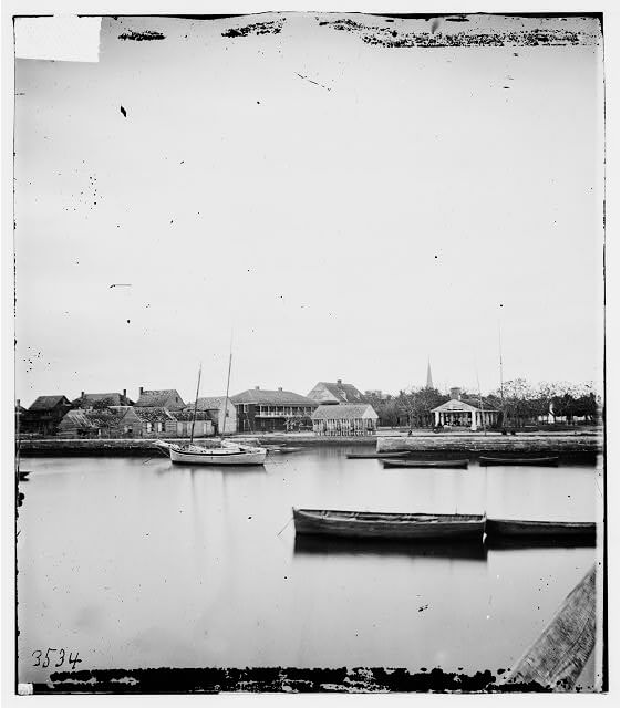
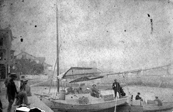
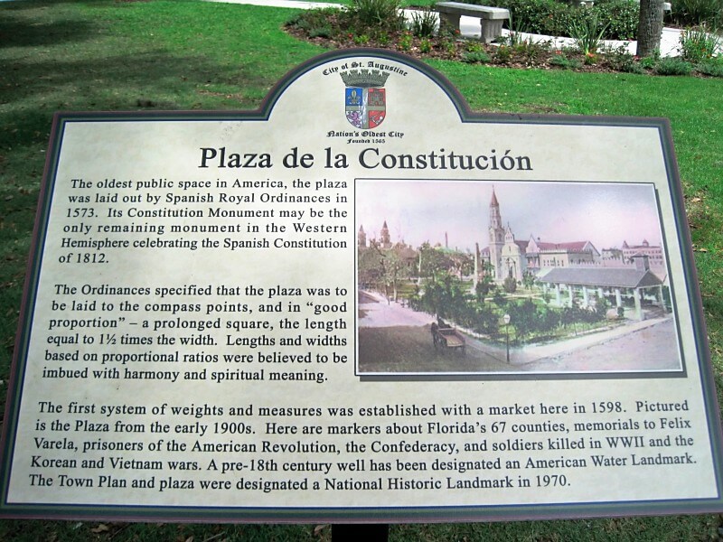
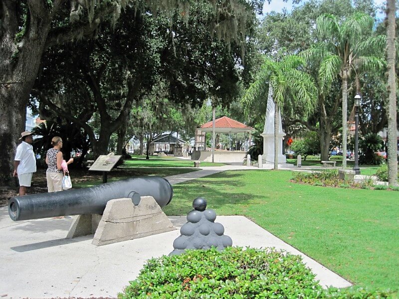
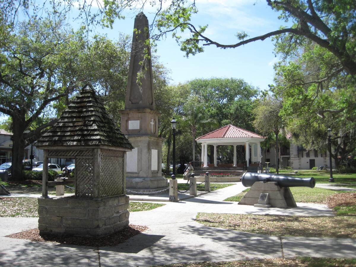
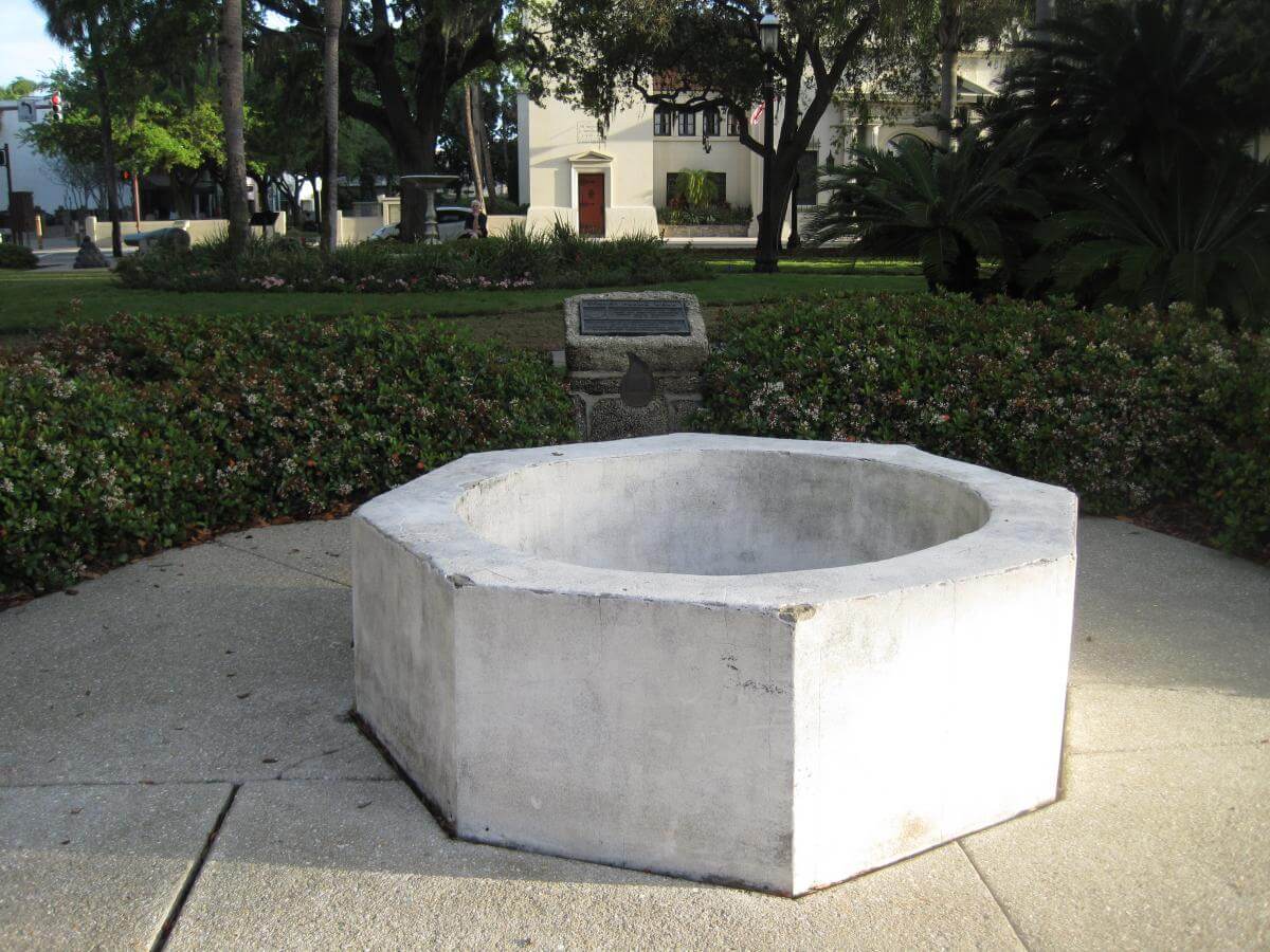
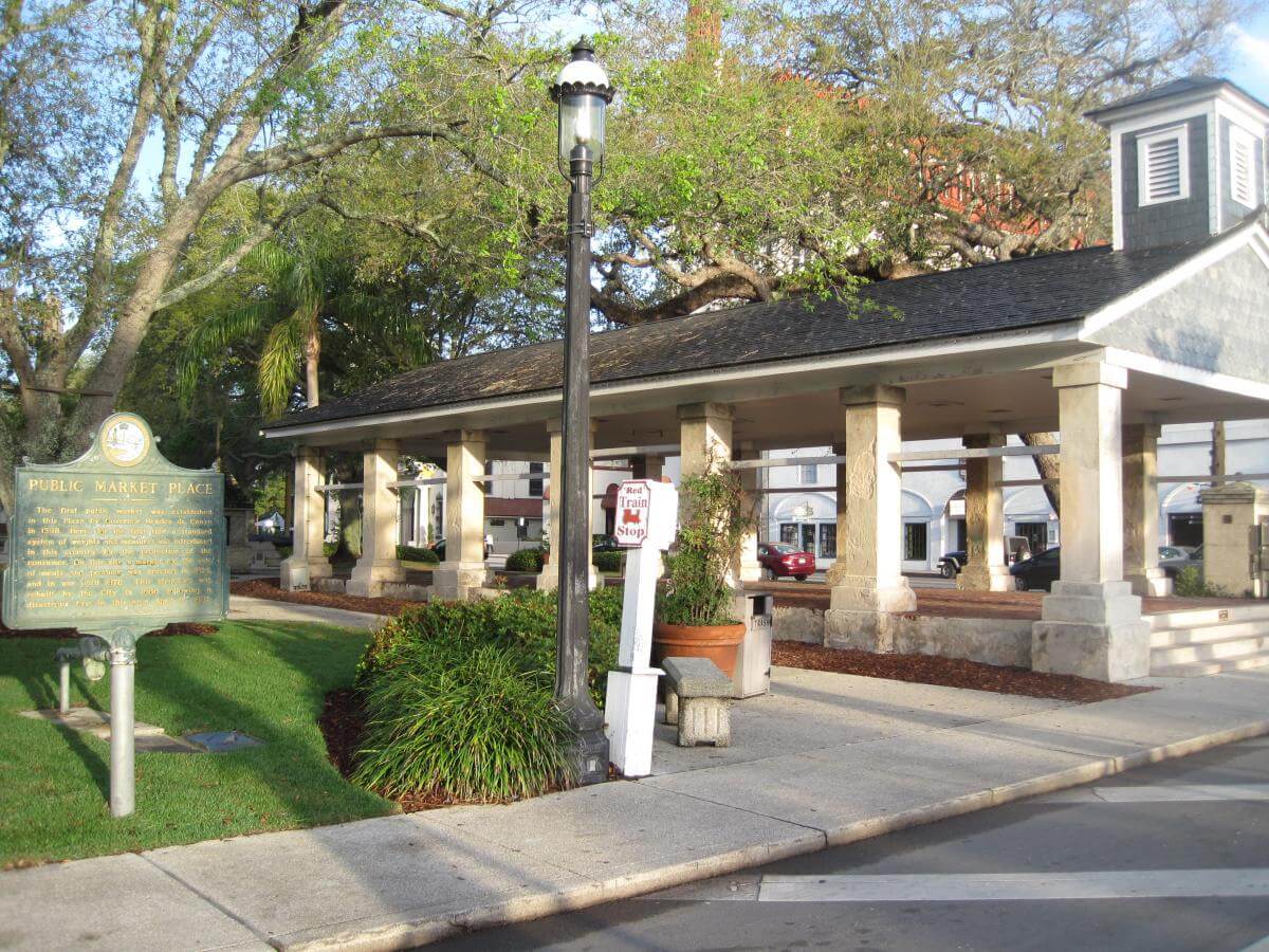
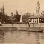
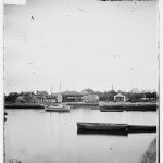

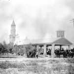
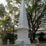
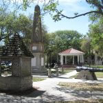
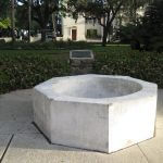

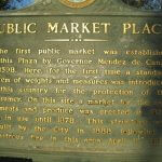
The public market anchors the east end of St. Augustine's Plaza de la Constitución (Figures 10–12). The term "slave market" did not enter popular use until the 1870s, and the market is just one among many monuments competing for visitors' attention. The plaza's oldest structure, an 1813 coquina monument, commemorates the 1812 Constitution of Spain (Figure 13).14St. Augustine's obelisk may be the only monument dedicated to the Spanish Constitution in the Western Hemisphere. "Art Images of Monument to the Spanish Constitution of 1812," The St. Augustine Record, September 8, 2011. Public works from St. Augustine's colonial history include a reconstructed seventeenth-century well in the plaza's center and remains of an eighteenth-century Spanish well on its western border (Figures 14–15). No monuments publicly commemorate the Native American past. The only Native presence in the plaza adorns the Florida state seal, atop historical markers erected in the 1970s (Figures 16–18).
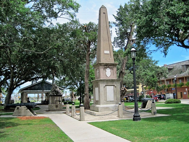
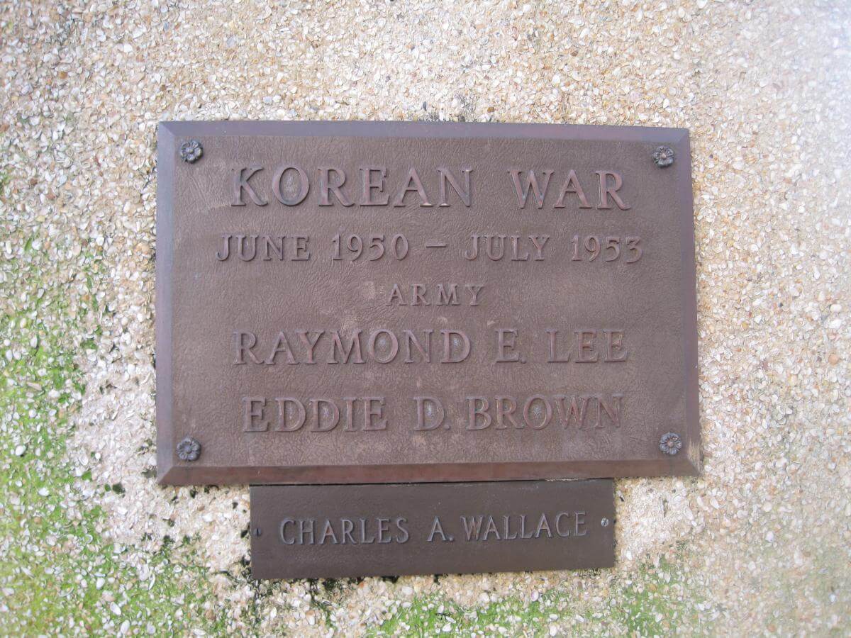
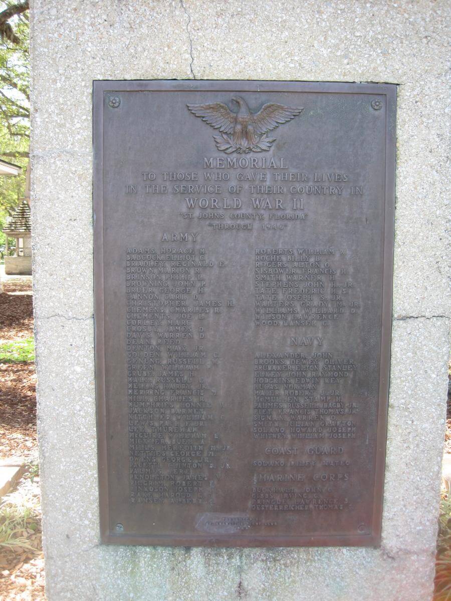
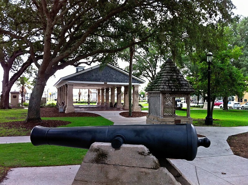
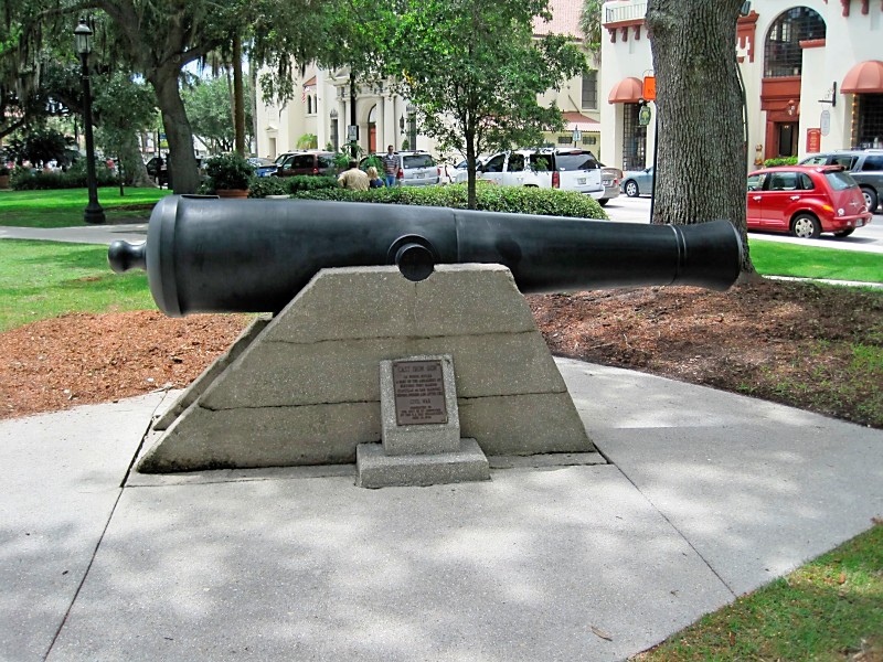
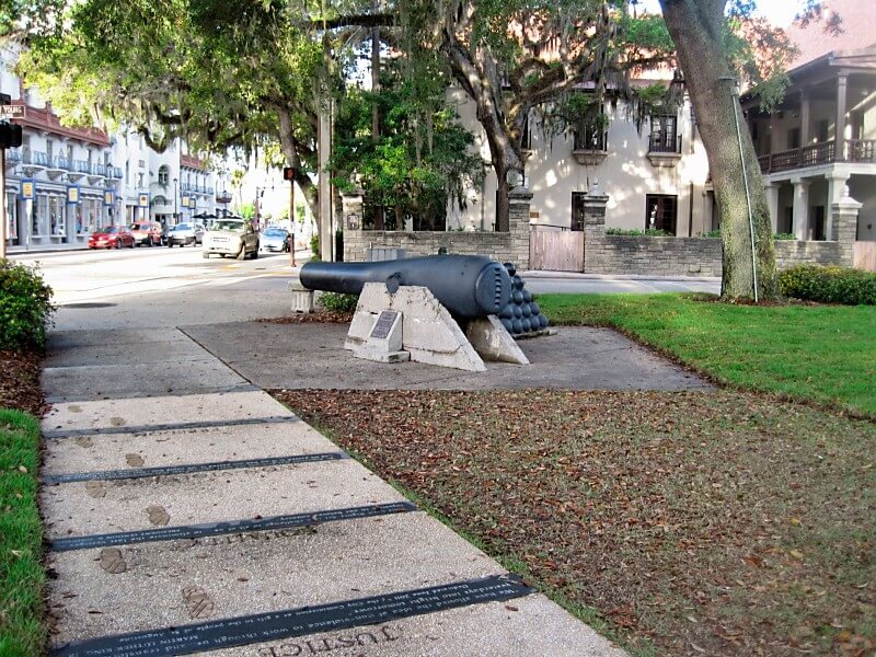
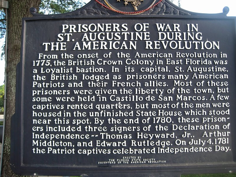
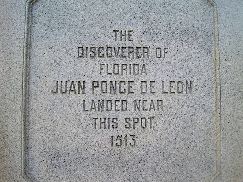
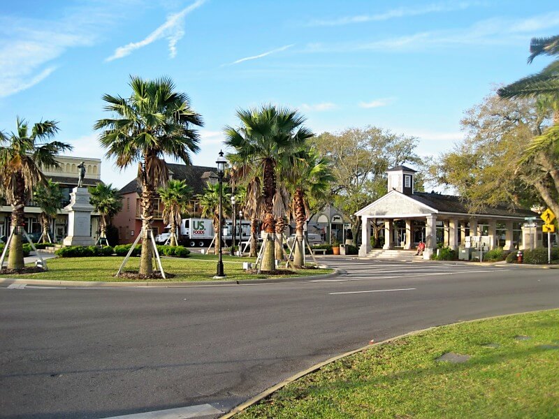
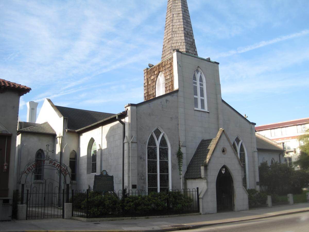
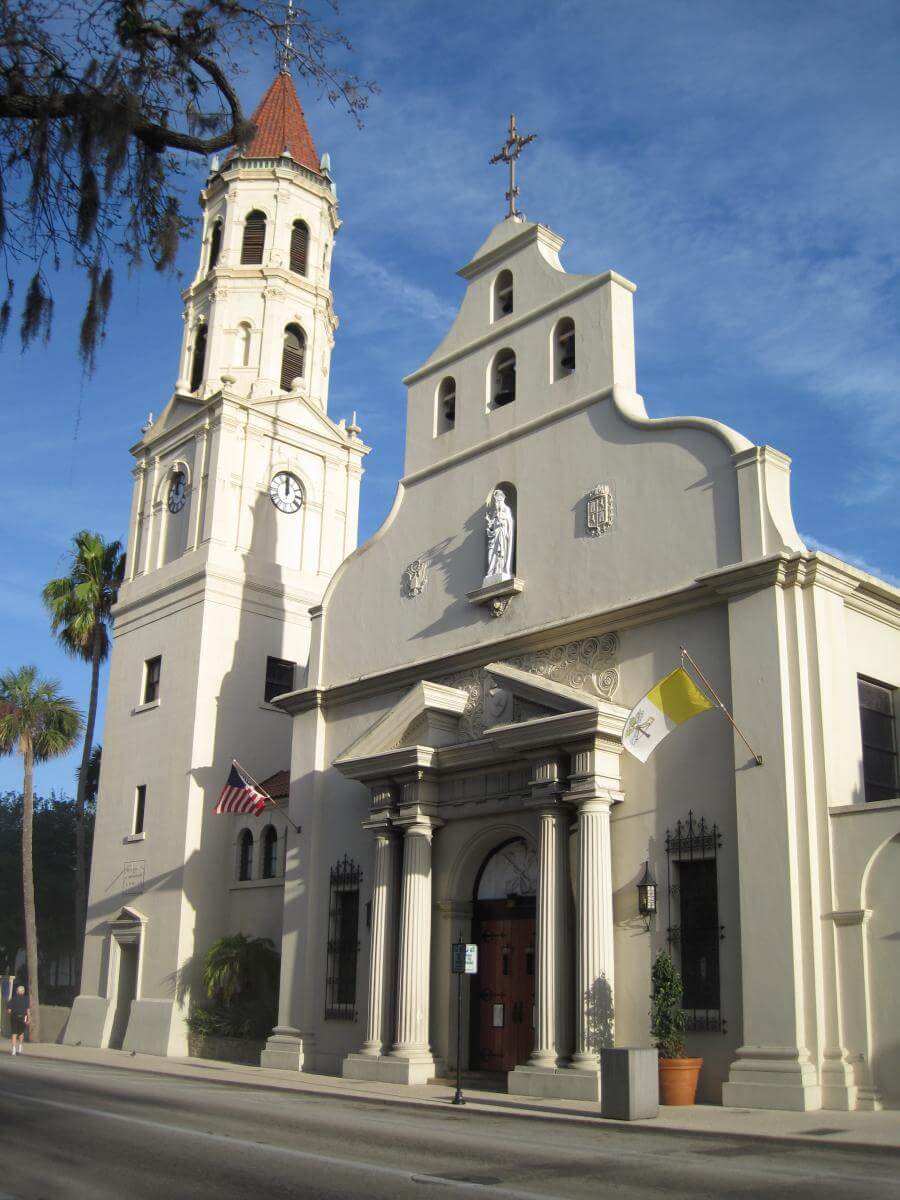
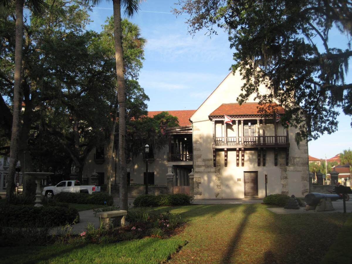

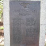

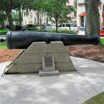
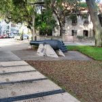
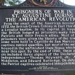
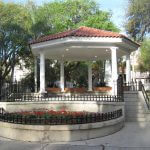
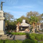
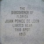
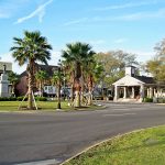


The plaza's tallest monument was erected in 1872 by the Ladies Memorial Society for the Confederate dead, and stands adjacent to the "slave market" (Figure 19).15Founded in September 1866, the Ladies Memorial Society consisted of socially prominent white St. Augustine women, mostly wives and relatives of Confederate soldiers. Monuments for soldiers killed in World War II, the Korean War, and the Vietnam War are accompanied by Civil War cast iron guns and stacks of cannonballs (Figures 20–26). A plaque erected by Florida's Daughters of the American Revolution memorializes American prisoners of war captured by British troops and held during the American Revolution at Fort Marion (Castillo de San Marcos) (Figure 27). A bandstand and gazebo renovated in 2011 recall Gilded Age tourists (Figure 28). At the plaza's eastern border overlooking the bay stands a statue of Juan Ponce de León, who "landed near this spot in 1513" (Figures 29–31). Bordering the plaza's perimeter, next to a wax museum, restaurants, and souvenir shops, are Trinity Church, the Cathedral Basilica of St. Augustine, and the historic Government House (Figures 32–34).
 |  |
| Figure 35. Holly Goldstein, St. Augustine Foot Soldiers Monument, Plaza de la Constitución, St. Augustine, Florida, 2012. The Foot Soldiers Monument overlooks a former Woolworth's where desegregation sit-ins occurred in the 1960s. | Figures 36–38. Holly Goldstein, Andrew Young Crossing Monument, Plaza de la Constitución, St. Augustine, Florida, 2012. Figure 36 shows the length of the path. Figure 37 highlights the footsteps. Figure 38 focuses on a quotation by Andrew Jackson. |
Located directly south of the "slave market," the plaza's first civil rights memorial, the 2011 St. Augustine Foot Soldiers Monument, overlooks a former Woolworth's where desegregation sit-ins occurred in the 1960s (Figure 35). Four sculpted heads, an unnamed African American man, woman, and teenage girl, and a white male college student, represent the protesters who fought for an end to segregation in St. Augustine. The plaque reads,
Dedicated to those who participated in the Civil Rights Movement of the 1960s in St. Augustine. They protested racial discrimination by marching, picketing, kneeling-in at churches, sitting-in at lunch counters, wading-in at beaches, attending rallies, raising money, preparing meals and providing safe haven. They persisted in the face of jailings, beatings, shootings, loss of employment, threats, and other dangers. They were Foot Soldiers for Freedom and Justice whose efforts and example helped to pass the landmark Civil Rights Act of 1964. Their courage and heroism changed America and inspired the world.
A bas-relief sculpture behind the four heads presents the plaza as a backdrop for the fight for racial equality. Commissioned by the St. Augustine Foot Soldiers Remembrance Project (directed by Foot Soldier Barbara Vickers) the $70,000 project came to fruition after seven years of planning and a 2009 amendment to a City Code that barred new monuments in the plaza celebrating historical events occurring after 1821.16David Nolan, interview with the author, March 22, 2012; City Commission Meeting notes: "City of St. Augustine, Regular City Commission Meeting, April 27, 2009," accessed April 1, 2012, http://www.staugustinegovernment.com/your_government/documents/CCMinutes04.27.09.pdf. The racial population of St. Augustine has changed since the 1960s, with an influx of white notherners in the 1970s–1990s. Whereas the black population hovered around twenty-five percent in the 1960s, today it is below ten percent. Zach Gray, "Racism in St. Augustine, Not Just a Thing of the Past," Flagler College Gargoyle, April 26, 2012. St. Augustine Mayor Joseph Boles, Jr. noted in his dedication speech that visitors would "see this monument next to the Old Slave Market where evil held forth in the diatribes and hate speech of the KKK during the marches and they will know that this blessed event is designed to exorcise that nightmare."17Joseph Boles, Jr. (speech, Foot Soldiers Monument dedication ceremony, St. Augustine, FL, May 14, 2011). Although the city council initially disallowed the May 14, 2011 dedication ceremony from taking place inside the "slave market," a rainstorm relocated the gathering under the market's roof.
Two months later the city dedicated designer Jeremy Marquis's "Andrew Young Crossing," a monument to the well-known activist who led protests at the "slave market" for its symbolism of racial oppression and who was beaten here by segregationists (Figures 36–38).18Young and other demonstrators referred to the public market as the "slave market." As he writes in his memoir, "The destination of the marches in St. Augustine was the old slave market, which was unfortunately drawing large crowds of unruly whites who gathered each night to harass, threaten, and sometimes strike out at marchers." Andrew Young, An Easy Burden: The Civil Rights Movement and the Transformation of America (New York: Harper Collins, 1998), 291. This memorial features bronze replicas of Young's footsteps alongside quotes by him, President Lyndon Johnson, and Martin Luther King, Jr.
What to Call It?
 |
| Figure 39. Holly Goldstein, Plaque on northeast pillar of Public Market, Plaza de la Constitución, St. Augustine, Florida, 2012. Figure 40. Detail. |
The St. Augustine pavilion has served as an "all-purpose protest site" from early twentieth-century socialists to suffragettes to Iraq war protesters.19David Nolan, interview with the author, March 22, 2012. "Slave market" is not found in written records until the 1870s.20For examples of the term "slave market" used prior to the 1880s, see Earnest A. Meyer, "Childhood Memories" reprinted in El Escribano: The St. Augustine Journal of History 44 (2007): 204, in which Meyer depicts the "slave market" dated 1875. An illustration in Frank Leslie's Illustrated Newspaper from May 1878 also depicts the "slave market." A portrait bust of female slave Nora August, inscribed in part, "purchased from the Market, St. Augustine, Florida April 17th 1860" is found in the sculpture collection at the Museum of the Confederacy, see Museum of the Confederacy, Before Freedom Came: African American Life in the Antebellum South (Richmond: Museum of the Confederacy and University of Virginia Press, 1991), cover, 8. As for what to call the site and how to present it publicly, plaza markers contradict each other (Figures 39–40). The predominantly white St. Augustine Historical Society now officially sanctions the structure as "a public market that had occasional slave sales." A historical marker, "Public Market Place," just south of the pavilion erected in 1970 by the St. Johns County Historical Commission details only the weights and measures first established there and omits any mention of slavery (Figures 17–18). Like much of St. Augustine's tourist infrastructure, the 1970 sign highlights Spanish colonial accounts, not African American history.
Slaves were sold in and around the public market. While most slave sales in pre-Civil War St. Augustine took place at plantations, in homes, or on boats, public transactions usually occurred on the steps of the Government House directly west of the plaza. Visiting St. Augustine in 1827, Ralph Waldo Emerson wrote of the slaves he saw auctioned in the Government House yard, including the sale of "four children without the mother who had been kidnapped therefrom."21Ralph Waldo Emerson, Journals of Ralph Waldo Emerson, ed. Edward Waldo Emerson and Waldo Emerson Forbes (Boston: Houghton Mifflin, 1909), 177, quoted in Len Gougeon, Virtue's Hero: Emerson, Antislavery, and Reform (Athens: University of Georgia Press, 1990), 33. Henry L. Richmond, "Ralph Waldo Emerson in Florida," Florida Historical Quarterly 18, no. 2 (October 1939): 75–93. Hoping that the balmy climate would cure his tuberculosis, the twenty-three-year-old Emerson saw his first slave sale while in the Government House for a Bible Society meeting. "One ear therefore heard the glad tidings of great joy," he wrote, "whilst the other was regaled with 'going gentlemen, going!'"22Gougeon, 33. Witnessing slavery firsthand confirmed his staunch abolitionism.
 |  |
| Figures 17–18. Holly Goldstein, Marker for "Public Market Place," Plaza de la Constitución, St. Augustine, Florida, 2012. Figure 17. Detail of the Marker. Figure 18. Marker for "Public Market Place" and the Market. | |
Deeds of sale and newspaper clippings document slave sales in the market. As examples, the St. John's County Deed book cites the sale of "two slaves [Malvina and Gabina, both about nineteen] . . . at public auction to the highest bidder at the market house in St. Augustine" in 1836; "the sale of a negro woman Sally at public auction in the market house" to settle the Mary Hanford estate; and the auction of twenty-eight-year-old Tamaha, for $180.23County Deed Book, 24, 126, 288. Public Market Clippings File, St. Augustine Historical Society Research Library. These slave sales and others are also documented in E. W. Lawson, "The Slave Market," Today in St. Augustine, May 21, 1939. Public Market Clippings File, St. Augustine Historical Society Research Library. The East Florida Herald advertises slave sales to be held "in the public market" from the 1820s through the 1840s.24Auction advertisement from the East Florida Herald, October 31, 1827. Also recorded in Deed Book F, 394. In addition to auctions, the market was often the site for public corporal punishment. In August 1849 "a negro man named Daniel, the property of M. Antonio Bouke, was to receive thirty-nine stripes on his back in the public market for escaping" and "a negro man named Joseph received the same punishment in the public market" one week later.25Public Market Clippings File, St. Augustine Historical Society Research Library. The market also hosted meetings of the slave patrol, white citizens who apprehended "all slaves or free persons of color, who may be found in the streets thirty minutes after the ringing of the Bell without having a proper pass from their masters or guardians."26David Nolan, "Slaves Were Sold in Plaza Market," St. Augustine Record, September 27, 2009.
Introducing these names—Malvina, Gabina, Sally, Tamaha, Daniel, Joseph, and others—attaches human lives to St. Augustine's market, although precious few names were recorded and almost nothing is known about them. One first-person narrative, The Odyssey of an African Slave, recounts the story of Sitiki, later called Jack Smith, an African who died free in St. Augustine.27Griffin, Patricia, ed., The Odyssey of an African Slave (Gainesville: University Press of Florida, 2009). While Sitiki was not sold at the market, his story of capture (as a five-year-old in Africa) and enslavement (traveling the eastern shore with various masters) offers a glimpse into this history.28Walter Johnson's Soul by Soul: Life Inside the Antebellum Slave Market (Cambridge, MA: Harvard University Press, 2001) examines the New Orleans slave market, North America's largest, where over 100,000 slaves were sold. While the rate of exchange in New Orleans vastly exceeds that of St. Augustine, Johnson's account of slave narratives, slave-owner letters, and court records offers insight into the commercial exchanges and human lives in St. Augustine.
Gilded Age Postcards and Civil Rights Photographs
 |  |  |
| Figures 41–43. Holly Goldstein, The former Hotels Ponce de Leon (now Flagler College) (Figure 41), Alcazar (now City Hall and Lightner Museum) (Figure 42), and Cordoba (now Casa Monica) (Figure 43), St. Augustine, Florida, 2012. | ||
From the 1870s through the 1890s, St. Augustine transformed from a colonial town into a tourist destination for wealthy white northerners. Standard Oil tycoon Henry Flagler developed a railroad (the Florida East Coast Railway) down the Florida coast transporting tourists to his grand hotels.29Patrons of Flagler's St. Augustine's hotels were wealthy white vacationers. Thomas Graham, Flagler's St. Augustine Hotels: The Ponce de Leon, the Alcazar, and the Casa Monica (Sarasota, FL: Pineapple Press, 2004). The Hotel Ponce de Leon, the Hotel Alcazar, and the Hotel Cordova line King Street, just steps from the Plaza de la Constitución (Figures 41–43).30The Ponce de Leon Hotel, which opened to great fanfare in 1888, is now the home of Flagler College. The Alcazar now houses City Hall and the Lightner Museum. The Cordoba still operates as a hotel, renamed the Casa Monica. These monumentally ostentatious resorts—the Alcazar housed the world's largest indoor swimming pool; the Ponce de Leon boasted Louis Comfort Tiffany windows and was one of the first American buildings to have electricity—attracted elite vacationers from northern winters. Local entrepreneurs capitalized on the wealth and curiosity of Flagler's patrons.
With its prominent location and its food-selling function central to daily life, the public market became a St. Augustine icon, appearing in paintings and photographs produced for and by tourists. An artist colony, the Ponce de Leon studios, operated adjacent to Flagler's flagship hotel. Numerous plein-air paintings depict the market as a peaceful leisure destination.31The first artist in residence at the Ponce de Leon studios was Flagler's friend Martin Johnson Heade. Artists who depicted the public market in their paintings include William Staples Drown, Robert S. German, Frank Shapleigh, and Felix de Crano. Sarah Barghini, A Society of Painters: Flagler's St. Augustine Art Colony (Palm Beach, FL: Henry Morrison Flagler Museum, 1998). To view the paintings depicting the market, see Gary Libby, ed., Reflections: Paintings of Florida 1865–1965. From the Collection of Cici and Hyatt Brown (Daytona Beach, FL: Museum of Arts and Sciences, 2009); Gary Libby, ed., Celebrating Florida: Works from the Vickers Collection (Daytona Beach, FL: Museum of Arts and Sciences, 1995); and Maybelle Mann, Art in Florida 1564–1945 (Sarasota FL: Pineapple Press, 1999).
 |
| Figure 44. The Market House of St. Augustine, Florida, Formerly Used as a Slave Market, c. 1886. Stereograph from the collection: Florida: The Land of Flowers and Tropical Scenery. Courtesy of the State Archives of Florida. |
Savvy photographers and postcard producers peddled images of the "slave market" to instill fascination into an ordinary-looking space. Technical advances in photomechanical reproduction and the sudden boom in tourism ushered in a golden age of picture-postcard manufacture.32Tom Phillips, The Postcard Century (London: Thames and Hudson, 2000); Marian Klamkin, Picture Postcards (New York: Dodd and Mead, 1974). Early postcard makers copied images from stereographs, such as an anonymous pre-1887 stereoview (labeled "the market house of St. Augustine, Florida, formerly used as a slave market") sold as part of the series "Florida, the Land of Flowers and Tropical Scenery" (Figure 44). More tourists and the newly available supply of postcards prompted an explosion of "slave market" cards by the 1890s and offered a picturesque attraction for sightseers.33Postcards promoting relics of slavery to tourists are not unique to St. Augustine; other slave market sites are discussed below. In addition, Jim Crow era postcards often depicted grotesque illustrations of racism and segregation such as lynching. For an extensive discussion of lynching postcards see Amy Louise Wood, Lynching and Spectacle: Witnessing Racial Violence in America, 1890–1940 (Chapel Hill: University of North Carolina Press, 2009). Wood notes that lynching postcards, like slave market postcards, "deemed these events both customary and spectacular." Inscribing and circulating lynching postcards "substantiate[d] white supremacist views," normalizing the inhuman practice and packaging it as entertainment. Wood, 108. The slave market postcards operate similarly, sanitizing the human slave trade into sentimental nostalgic keepsakes. George Fredrickson discusses the romantic image of blacks in The Black Image in the White Mind: The Debate on Afro-American Character and Destiny, 1817–1914 (New York: Harper & Row, 1971). The images sanitize and romanticize slavery into the sentimental bygone.
Why buy a souvenir of slavery? In the years following Reconstruction, many northerners, explains historian Maurie McInnis, conceived the South as "a land of leisure and romance, a simpler place than the rapidly industrializing North. Central to that southern imaginary was a benign view of slavery, one that fantasized a harmonious relationship between masters and slaves, a natural hierarchy."34Maurie McInnis, Slaves Waiting for Sale: Abolitionist Art and the American Slave Trade (Chicago: The University of Chicago Press, 2011), 220. The sanitized "slave market" postcards promoted picturesque architectural remains, not inhumanity. As the pre-1887 anonymous stereocard advertises, the empty "slave market" complemented other attractions found in Florida, the "land of flowers and tropical scenery." Viewers of antebellum relics were charmed by a "quaint antidote to the modernization and standardization" of northern cities and by the comparatively slower pace of selected southern sites.35Ibid. Architectural vestiges of slavery, such as grand plantation homes, ruins of slave quarters, and unused slave markets embodied this romanticized projection.
Historian Nina Silber argues that the northern view of the South as a "land of leisure, relaxation, and romance" stemmed from the desire for reconciliation after the Civil War.36Nina Silber, The Romance of Reunion: Northerners and the South: 1865–1900 (Chapel Hill: The University of North Carolina Press, 1993), 67. "Tourism and reconciliation went hand in hand" as affluent white vacationers soaked up hospitality, food, entertainment, and accommodations.37Ibid. Flagler's indulgent hotels helped to forge a "romantic and sentimental culture of conciliation."38Ibid., 2. Plantations, slave markets, and African Americans became must-see attractions on a tour that followed the St. Johns River through Florida and invariably included a stop in St. Augustine. Picture postcards catered to these desires.
 |  |
| Figure 45. W. J. Harris Co., Old Slave Market, St. Augustine, Florida, 1904, recto. Collection of the Author. | Figure 46. W. J. Harris, c. 1920. Courtesy of the Harris Family. |
One popular market postcard, dated 1904, depicts the empty pavilion as a haunting reminder of slavery (Figure 45). In the image by St. Augustine photographer William James Harris (Figure 46) (1868–1940), an elderly African American man stands before the market cradling a basket in his right hand and leaning on a cane with his left.39Prior to 1912 the postcard appeared in black and white and was printed in color after 1912. Robert R. Goller, "North and South With W.J. Harris, Photographer," El Escribano: The St. Augustine Journal of History 28 (1991): 38; Robert Bogdan and Todd Weseloh, Real Photo Postcard Guide (Syracuse, N.Y.: Syracuse University Press, 2006), 245. Harris labeled the man an "old slave" in the caption of some versions of this postcard.40Goller, 38. The text on the front of the postcard reads, "Old Slave Market, St. Augustine, Florida." The verso text reads, "The old slave market in the east end of the Plaza is an interesting landmark of antebellum days. Built in 1840." A later version was amended to include on the reverse, "It was used as a public market in which slaves were occasionally sold. Old Slave in foreground." His somber face, white beard, and rumpled clothing suggest a lifetime of hard work. He is dressed for a day in town and carries a basket perhaps for shopping; this appearance of romanticized dignity conforms to the paternalistic euphemism that old slaves were cared for or respected. As the only figure in this deserted scene, the man appears as spectral, barely suggesting the terrible history of this site. The tidy marketplace and row of shops behind it visually contrast the old man, who looks as if he hobbled into the scene. Harris's old slave is anonymous and unthreatening. He is not Malvina, Gabina, Sally, Tamaha, Daniel, or Joseph; he is defined by his approximate age, "old," and his status as property, "slave." Slavery has become a costumed actor in the St. Augustine that turn-of-the century tourists encountered. Just west, the barely visible Confederate monument peeks through trees. The storefronts at right house modern businesses.
 |
| Figure 47. W. J. Harris, Public Market and "Old Slave," Plaza de la Constitución, St. Augustine, Florida, c. 1904. Copyright St. Augustine Historical Society. |
Harris's photographic negative of this scene reveals more grime and weathering on the market than is visible in the postcard (Figure 47). A comparison of postcard and photograph reveals that Harris removed foliage and pushed the trees at left into the distance to increase the market's visibility; he diminished the height of cathedral's campanile to exaggerate the pavilion's importance, removed a bicycle in the foreground, and added some summer clouds.41Research at the St. Augustine Historical Society and conversations with Harris's daughter and granddaughter did not reveal any information on the identity of the man depicted in the postcard. The market in the postcard appears modern and iconic.
W. J. Harris produced and sold this postcard in his St. Augustine studio on St. George Street and leased the image to postcard publishing houses in the United States and internationally.42Leslie Goode, personal communication with the author, March 23, 2012. See also Leslie Goode, "Harris Pictures," accessed July 5, 2011, http://www.harrispictures.com/. Harris Pictures is authored and operated by Leslie Goode, great-granddaughter of W. J. Harris. Her business currently sells t-shirts, coffee mugs, calendars, posters, and key chains emblazoned with images from Harris's postcards of St. Augustine landmarks. Although this popular image offered a clean, romantic trace of slavery and a non-threatening African American, local historians and civic boosters in a post-Reconstruction culture of forgetting sought to distance their town altogether from its slave-trading past and "set the record straight" that the structure was built to sell food, not slaves.43Nina Silber discusses how "Black people . . . assumed especially picturesque qualities" for northern tourists. Silber, 80. Susan Parker, "Was it a Public Market or a Slave Market?" The St. Augustine Record, October 28, 2007. Silber states "forgetfulness, not memory, appears to be the dominant theme of reunion culture." Silber 4. For further reading on "forgetfulness" and the historical memory of the Civil War, see David Blight, Race and Reunion: The Civil War in American Memory (Cambridge, MA: Belknap Press of Harvard University Press, 2001), 250–99. Blight characterizes the culture of forgetting as "reconciliationist." Responding to criticism, and after much prodding by local historians, Harris modified the postcard text to read, "The old slave market in the east end of the Plaza is an interesting landmark of antebellum days. Built in 1840 for a public market. Called "slave market" by an enterprising photographer to make his pictures sell."44Goller, 38. Of course, the "enterprising photographer" was Harris himself.45Jackie Feagin, "Slave Market Tag Came from Huckster Trying to Promote Tourism" The St. Augustine Record, Saturday July 20, 1985, 10A. The interviews conducted on March 22, 2012 by the author with the following subjects were particularly helpful: Charles Tingley, Amy Howard, David Nolan, and Howard E. Lewis. See also Goller, 38–43.
Balancing history and tourism, photographer W. J. Harris served as the business manager for the St. Augustine Historical Society, supervising some of St. Augustine's more dubious attractions, including "Luella Day McConnell's Fountain of Youth," where visitors still sip today.46Amy Howard, "Public Market (Slave Market)," published February 5, 2009, accessed July 5, 2011, http://www.augustine.com/history/black_history/slave_market/tourism.php. This article authored by historian and teacher Amy Howard details the history of the "slave market" and the chronology of slavery in St. Augustine. See also Goller 31. Harris's most vocal detractor was Charles B. Reynolds, founder of one of the nation's oldest travel agencies and author of St. Augustine's 1892 Standard Guide.47Charles Tingley, interview with the author, March 22, 2012. According to Tingley, Reynolds was the first St. Augustine historian "to take the city's attractions to task"—including the "slave market" and "oldest house"—for historical claims. The Charles Bingham Reynolds papers are in the collection of the University of Florida Smathers Libraries, Special Area Studies Collections. Reynolds (1856–1940) was originally from New York and worked for a time as editor of Forest and Stream Magazine. He helped to form the Audubon Society and partnered with Ward G. Foster to publish commercial guidebooks. Reynolds describes the Plaza de la Constitución as "A pleasing bit of greensward in the center of the town. . . . It is a public park of shrubbery and shade trees, with monuments and fountains, an antiquated marketplace inviting one to loiter, and an outlook to the east over the bay."48Charles B. Reynolds, The Standard Guide to St. Augustine (St. Augustine, FL: E. H. Reynolds, 1892), 53-4. In addition to his "Standard Guide" Reynolds published the book Old Saint Augustine: A Story of Three Centuries (St. Augustine, FL: E. H. Reynolds, 1885). Of the market, Reynolds writes,
The open structure on the east end of the Plaza is commonly pointed out as the "old slave pen" or "slave market," and it is sometimes alleged to have been of Spanish origin. It was never used as a "slave pen," nor as a "slave market," nor had the Spaniards anything to do with it, for they had left the country twenty years before it was built. . . . The market was intended for a very prosaic and commonplace use, the sale of meat and other food supplies, and it was devoted to that use. . . . It was not only until the influx of curiosity seeking tourists, after the Civil War that any one thought of dubbing the Plaza market a "slave pen" or "slave market." The ingenious photographer who labeled his views of the old meat market "slave market" sold so many of them to sensation hungry strangers that he has since retired with competence . . . [yet] the "slave market" yarns . . . have been told so often to credulous visitors that there are now some residents of St. Augustine who actually believe the stories themselves.49Reynolds, Standard Guide, 54.
Reynolds blames Harris (the "ingenious photographer") with popularizing the "yarns" which caused tourists to "stand and gape in foolish wonder at the old market; just as in like manner, perhaps, if brought into the presence of a hero of a hundred fearful conflicts, they would ignore the record of his valor and stand lost in vulgar contemplation of a wart on his nose."50Ibid. But Reynolds did not go unchallenged. Responding to an early version of Reynolds's guide, local resident S. J. Whall writes,
Dear Sir, I have many times seen slaves sold from the steps of the old market on the plaza. I have seen a ship of slaves disembarked on the beach at St Augustine, and sold at this market. My mother was the first English settler at St Augustine after the change of flags and the body of my father who died of yellow fever lies buried in the old graveyard near the city gates.51S. J. Whall, letter to Charles Reynolds, October 7, 1889. Public Market Clippings File, St. Augustine Historical Society Research Library.
Numerous white St. Augustine residents sought to bury the "slave market" myth, including Anna M. Marcotte, editor and proprietor of The Tattler, the journal of "Society in the South." Published weekly in St. Augustine, The Tattler billed itself as "a spicy, bright paper of sixteen pages."52Reynolds, 105. Advertisement for The Tattler in Reynolds's guide. The publication was "sold on trains, in the hotels, and on news stands." Like Reynolds, Marcotte saw the "slave market" as an ugly detraction from her city's image, and her Tattler articles denounced Harris's claims.
Harris was not alone in profiting from the market's association with slavery. In a popular 1884 pamphlet, Bloomfield's Illustrated Historical Guide, Max Bloomfield writes, "East of the Confederate monument stands the old, old market. A queer-looking structure it is. . . . We have been told that before the war it had been used as a slave market. Whenever a sale was to take place the bell in the cupola would be rung to notify the public."53Max Bloomfield, Bloomfield's Illustrated Historical Guide (St. Augustine, FL: Bloomfield, 1884), 30. Bloomfield concedes later the doubtful accuracy of the slave-market-bell-ringing story, yet he delights in spreading it. Bloomfield sold his guidebook at the museum he operated near St. Augustine's city gate.
British Victorian Lady Duffus Hardy accelerated the debate over the "slave market" in her melodramatic 1883 novel Down South, written during a tour with her daughter Iza.54Born Mary Ann McDowell (1825–1891), Hardy married Sir Thomas Duffy Hardy, the Keeper of Her Majesty's Records. She published fourteen novels, some under the pseudnym Addlestone Hill. Hardy traveled to America between 1880 and 1881 with daughter Iza, also a novelist. See Helen C. Black, Notable Women Authors of the Day (London: McLaren, 1906), 198. "There is the 'Plaza de la Constitution,'" Lady Hardy writes, "where the good Christians burnt their brethren a century ago":
In the center stands the curious old market-place, roofed in at the top, but open on all sides; this was the ancient slave mart where, "God's image, carved in ebony" was bought and sold in most ungodly fashion; there is the place where they stood, like cattle in a pen, so that their purchasers might walk to and fro examining them from all points to see if they had their money's worth.55Lady Duffus Hardy, Down South (London: Chapman and Hill, 1883), 171–72.
A letter to the St. Augustine News from 1898 is typical of local complaint about the "slave market" name:
The old market house is something with an unknown history, when the lie was born . . . to call it the slave market. A breath will start slander, but the army cannot stop it. These men [postcard-makers] have acknowledged they never would have sold any pictures of the building if they had not printed slave market under their creations. Tourists now visit this spot, with their feelings in a sympathetic condition, for the cruelties that circle around these artistic columns, where only food was sold, under certain regulations, some of which we have copied from the original records.56Letter to the editor, St Augustine News, Saturday September 24, 1898. Public Market Clippings File, St. Augustine Historical Society Research Library.
 |  |
| Figure 48. William Henry Jackson, The Slave Market, St. Augustine, Fla., c. 1904. Collection of the Author. Created for the Detroit Publishing Company, the image, like Figure 45 above, depicts a lone figure idling beside the empty market. | Figure 49. William Henry Jackson, The Slave Market, St. Augustine, Fla., c. 1902. Library of Congress, Prints & Photographs Division, Detroit Publishing Company Collection, LC-D4-9102. |
With his postcard, W. J. Harris was not the only photographer to capitalize on the site's cruel past. An English immigrant raised in Pennsylvania, Harris did not arrive in St. Augustine until 1898. A contemporaneous image created by photographer William Henry Jackson for the Detroit Publishing Company also depicts a lone figure idling beside the empty market (Figure 48). With utility poles and nearby buildings removed, and clearly labeled "slave market," Jackson's glass negative (now in the Library of Congress) became a mass-produced color postcard (Figure 49). The figure—a Caucasian man wearing a suit and hat with his hand touching his chin in thought—is almost imperceptible at first glance, blending into the background foliage. In contrast Harris's "old slave" presents a sharp outline against the manicured lawn and white pillar. As Roland Barthes points out, photographs confirm both death (what you see in the photograph is a moment from the past, never to return) and life (the moment exists, in the image, for eternity).57Roland Barthes, Camera Lucida: Reflections on Photography, trans. Richard Howard (New York: Hill and Wang, 1981), 5, 77. Accordingly, Harris's old slave is relegated to the past, yet his presence haunts this location and image. The 3½ by 5½ inch colored cardboard testifies that human enslavement occurred in this place now visited for pleasure.
 |  |
| Figure 50. The Rotograph Co., Old Slave Market, St. Augustine, Fla., c. 1909, recto. Collection of the Author. | Figure 51. Duval News Company, Old Slave Market, St. Augustine, Fla., Oldest City in the United States, c. 1915, recto. Collection of the Author. |
Other versions of the "slave market" postcard, adopting Harris's general vantage point and caption, reveal the pavilion's different uses by Gilded Age tourists. A postcard stamped 1909 depicts the market in a grimier state (dirt visible on the masonry pillars) and an empty basket (abandoned by Harris's "old man"?) lying unused near the front steps (Figure 50). The utility pole in the foreground suggests growing modernity, while visitors with downcast faces occupy the dark interior of the market stall. They peer into a wishing well installed in an attempt to remove the "slave market" stigma. Benches and chairs offer shade. Local belief held that visitors who drank from the fountain were destined to return to St. Augustine.58David Nolan, e-mail message to author, March 20, 2012.
A slightly later postcard also re-imagines the site as a picturesque leisure plaza (Figure 51). Azaleas nestle the walls. Tables and chairs draw visitors. Throughout the first half of the twentieth century men playing checkers met at the market.59"Public Amusement for Visitors," The St. Augustine Evening Record, December 6, 1915, 4. Photographs from the 1880s and 1890s reveal inside tables. The air-conditioned restaurant (at right) and the public band shell and tile-roofed gazebo (at left) offer amenities. Live oaks and a wrought-iron lamppost complete the charm.
As portable objects, postcards acquire meanings as owners use, store, and manipulate them.60Glen Willumson and Alison Nordstrom discuss the importance of tracing the "trajectory" of an object through time in Elizabeth Edwards and Janice Hart, eds., Photographs Objects Histories: On the Materiality of Images (London: Routledge, 2004). Entrepreneurs sold postcards of St. Augustine's "slave market" to entice curious northerners and reassure anxious southerners. Postcards from other cities similarly promoted their slave markets as tourist attractions, often with as conflicting historical and imaginary meanings as those of Harris, presenting architectural relics of slavery as clean, picturesque, and inviting.
 |
| Figure 52. Louisville Drug Co., Old Slave Market, Built 1758, Louisville, Ga., c. 1930. Collection of the Author. |
Louisville, a former capitol of Georgia, houses a market pavilion, once used to sell slaves, in its town center. Built in the late 1700s, the wood-beamed and shingled structure has been reconstructed and repaired over the years. While the Louisville market was undisputedly used for slave sales and commonly called the "slave market," civic officials have de-emphasized this use and the building is now officially referred to as the "market house."
Replacing an earlier sign titled "slave market," a 1979 marker in Louisville lists "slaves" as one more commercial item in addition to goods and land tracts. As in St. Augustine, the history of enslavement at Louisville's market is underplayed both in contemporary conversation and in vintage postcards. An early twentieth century postcard illustrates the cheerful market adorned with flowers at a quiet intersection (Figure 52). The verso text begins, "Built in 1758, the only Slave Market in America is pictured on the reverse side." Both facts—the construction date and uniqueness of the building—are inaccurate.61The Louisville, St. Augustine, and Charleston slave markets are three of many US sites once used to hold slave sales. At each location, debate persists about what to call these structures and how to commemorate their history. This debate is not unique to the South; many northern sites hosted slave sales. As Robert Desrochers notes, "Boston, the hub of the slave trade and much else in colonial Massachusetts, never had a single slave marketplace. It had many." Robert Desrochers, Jr., "Slave-For-Sale Advertisements and Slavery in Massachusetts, 1704–1781" William and Mary Quarterly 59, no. 3 (2002): 626.
 |
| Figure 53. Paul E. Trouche, Publisher, Old Slave Market, Charleston, S.C., c. 1930. Collection of the Author. |
Charleston, South Carolina's "old slave market" appeared often in postcards, advertising "one of the many interesting relics from the days of slavery" (Figure 53).62Text on postcard's verso. The Charleston site hosted slave auctions, yet it remains at the center of a dispute over what to call it. Maurie McInnis explains that while "The Mart" on Chalmers Street in Charleston was specifically built for slave auctions, numerous articles nonetheless "tried to 'deny there existed sufficient buying and selling of slaves in the city to have warranted the establishment of any institution for that purpose.'"63McInnis, 220. Steven Deyle, Carry Me Back: The Domestic Slave Trade in American Life (Oxford: Oxford University Press, 2005). In this postcard, the slave market fills the frame, presenting an imposing façade, like an armory or jail.64World of a Slave, an encyclopedia of slavery's material culture, assesses Charleston's Slave Mart building and other slave markets as "slave jails." Martha B. Katz-Hyman and Kym S. Rice, eds., World of a Slave (Santa Barbara, CA: Greenwood Publishing Group, 2011), 463–468. Charles Carleton Coffin, war correspondent for the Boston Daily Journal, wrote an account of the Charleston Slave Mart on February 17, 1865, referring to it as a "prison." The clean storefront, with an arched doorway framed by octagonal piers, appears sturdy enough to have held slaves.
Postcards bearing "slave market" helped establish St. Augustine's old pavilion as a symbol of racism and helped galvanize civil rights activists to make it a site for demands for desegregation and racial equality. The "St Augustine Movement" of 1963–1964 directed national attention to the brutal effects of segregation in Florida and contributed directly to the signing of the Civil Rights Act in June 1964.65Warren, If it Takes All Summer; David R. Colburn, Racial Change and Community Crisis: St. Augustine Florida, 1877–1980 (Gainesville: University Press of Florida, 1991). Films chronicling the St. Augustine movement include C. B. Hackworth, dir., Crossing in St. Augustine (2011); Clennon King, dir., Slave Market Diary (2004); and St. Augustine Department of Police, prod., St. Augustine Race Riots (1964), Florida State Archives. In 1963, local dentist Dr. Robert Hayling organized the Youth Council of St. Augustine's NAACP chapter. As St. Augustine prepared for its 1965 four-hundredth birthday, the town's Quadricentennial Commission organized a dinner at the Ponce de Leon hotel hosting President Lyndon Johnson. The guest list of local luminaries failed to include any African Americans. Hayling and other NAACP activists including Clyde Jenkins, James Jackson, and James Hauser organized nonviolent demonstrations over the next year. Local youths were arrested during a 1963 sit-in at the Woolworth's lunch counter on King Street adjacent to the "slave market." In 1964 northern college students traveled to St. Augustine for a spring break protest. Martin Luther King, Jr. visited at Hayling's request and was arrested for trying to eat lunch at the Monson Motor Lodge restaurant, one block north of the "slave market." Police thwarted attempts to integrate St. Augustine's beaches on Anastasia Island, and a "swim-in" at the Monson ended when hotel owner James Brock poured acid into the demonstrator-filled pool. Images of confrontations between protestors and segregationists provoked national outrage. The US Senate passed the Civil Rights Act two weeks later (Figure 54).66Ninety Associated Press photographs of civil rights demonstrations in St. Augustine are available available at "AP Photos Of 1964 Civil Rights Protests," The St. Augustine Record, accessed March 30, 2012, http://spotted.staugustine.com/galleries/index.php?id=335043.
 |  |  |
| Figures 54–56. Figure 54. Segregationists trying to prevent blacks from swimming at a "white only" beach in St. Augustine, St. Augustine, Florida, 1964. Courtesy of the State Archives of Florida. Figure 55. Civil Rights demonstrations around the "slave market," St. Augustine, Florida, 1964. Copyright Associated Press. Figure 56. Reverend Charles Conley "Connie" Lynch in the "slave market," St. Augustine, Florida, 1964. Courtesy of the State Archives of Florida. | ||
Throughout the summer of 1964, demonstrators circled the "slave market" on daily marches down King Street.67King Street received its name much earlier. Segregationists also seized upon the site, verbally assaulting and brutally beating marchers (including Andrew Young).68Other organizers for the Southern Christian Leadership Conference (SCLC) present at the demonstrations included Ralph Abernathy, Willie Bolden, Dorothy Cotton, J. T. Johnson, Fred Shuttlesworth, and Hosea Williams. Photographs locate the plaza as a site of repression and resistance. In one (Figure 55), a young black man's sign reads, "Are you proud of your 400 yrs. history of slavery and segregation." A white woman behind him vows, "Until St. Augustine is desegregated tourists will demonstrate." White men in shirtsleeves play checkers. Just left of the central demonstrator is the 1930 "slave market" plaque. At night, segregationists occupied the market, physically and verbally attacking the marchers. St. Augustine became a hub of racist resistance. California Reverend Charles Conley "Connie" Lynch, along with Jesse Benjamin "J. B." Stoner, delivered nightly diatribes under the market's roof.69Wyn Craig Wade, The Fiery Cross: The Ku Klux Klan in America (Oxford: Oxford University Press, 1998), 325. Rev. Lynch stands on a table clapping and grinning (Figure 56). The low vantage point positions him as the pinnacle of a pyramid made up of two young boys and a megaphone at the base and a Confederate flag at right. Electric lights installed by police illuminate the scene; the frenzied look on Lynch's face contrasts with the quiet boys. After being continually arrested, insulted, and assaulted, the marchers gained public sympathy. While not as well known as those of other cities, the civil rights demonstrations in St. Augustine, situated at the "slave market," were crucial to the movement's success.
A Place to Memorialize Enslavement
The monuments commemorating the Foot Soldiers and Andrew Young construct new layers of meaning for the Plaza de la Constitución, yet the site is rarely labeled on tourist maps and goes largely unnoticed by sightseers, even as the nearby streets of the Colonial Spanish Quarter are constantly full.
The denial of slavery at the market has remained a common refrain. As recently as 1986 St. Augustine Mayor Kenneth Beeson stated, "as far as our manuscripts indicate, no slave was ever sold there."70Jackie Feagin, The St. Augustine Record, January 22, 1986. Market Clippings File, St. Augustine Historical Society Research Library. Beeson's comments provoked an outcry. St. Augustine historian David Nolan published articles detailing the historical slave transactions at the site.71Nolan, "Slaves Were Sold in Plaza Market." Margo Pope, "St. Augustine Once a Hub of Slave Trade" The Florida Times Union, December 2, 2001. Still, citizens disagree about what to call the market and how it should be used.72Historian Ralph Voss stated in 1984, "After digesting data from the library files, one question was answered. Slaves were DEFINITELY sold in the public market. But did that make it a slave market. That question is still open for debate." Ralph A. Voss, "Slave Market," North Florida Living, August 1984, 34–35.
In 2009, at the request of black history advocates, historian, teacher, and tour guide Amy Howard wrote a history of the public market for the tourism website augustine.com. Howard assesses three constituencies who disagree over the market's name and legacy. Most locals who use the term "slave market," writes Howard, "have little knowledge of the history, but have grown up with that name."73Amy Howard, e-mail message to author, March 23, 2012. Proponents of black history also use "slave market" because they protest "Black oppression getting swept under the rug. They bristle at people who say there was never a slave market in St. Augustine."74Ibid.; Karen Harvey, "Letter: 'Slave Market' is Part of City's Civil Rights History," The St. Augustine Record, November 1, 2007. The term "public market" tends to be favored by "heritage tourism advocates" who lament
racism threatening the city's image. Ever since Henry Flagler came along, the town has clung to tourism as its life blood. In the early tourism heydays, slavery was a marketable story. During and after the civil rights movement, racism became a scourge on the town. Now we have intellectuals trying to market the history, and doing their best to deny the . . . racism that still lingers today.75Howard, e-mail.
Howard E. Lewis, proprietor of St. Augustine's Black History Tours (a local walking tour company) agrees that while most locals use the terms "slave market" and "public market" interchangeably, black history advocates do not want the memory of slaves at the market to be forgotten, and "heritage tourism" promoters would rather not refer to slavery every time they mention the market.76Howard E. Lewis, nterview with the author, March 22, 2012. Information on Lewis' tours is found at "St. Augustine Black History Tours," accessed April 1, 2012, http://augustine.com/vacation/business/st_augustine_black_history_tours. Local historian Lewis writes St. Augustine history and tourism articles for Examiner.com.
As St. Augustine prepares for its 450th anniversary in 2015, government and civic organizations are planning projects, festivals, and events. The presidentially appointed "Federal Commission" of city organizers includes Andrew Young as well as St. Augustine's mayor Joseph Boles.77The official website for the St. Augustine 450th Commemoration is "St. Augustine 1565–2015," accessed March 30, 2012, https://sites.google.com/site/staugustine450/. A central goal is to integrate St. Augustine's histories of slavery and of civil rights into the larger narratives of colonial history and civic pride. Organizers responsible for installing the Foot Soldiers monument have chosen as their next goal the construction of a civil rights museum in this only major battleground city without one.78The non-profit organization Civil Rights Museum of St. Augustine, Inc. is planning the museum. "CRM of St. Augustine," accessed April 1, 2012, http://civilrightsmuseumstaug.webs.com/; David Nolan, interview; Kim Severson, "New Museums to Shine a Spotlight on Civil Rights Era" The New York Times, February 20, 2012, A8. A statement of the proposal is at "CRM of St. Augustine."
Throughout the past five decades, residents and government leaders have proposed ways to reinvigorate the old marketplace, including leasing the site to vendors.79Rosemary Heffernan, "Market Proposal Taken Under Advisement by City Commission" The St. Augustine Record, July 29, 1980. The city's 450th anniversary offers a renewed opportunity to resurrect these calls and, most importantly, to recognize and remember slavery. The debate over what to call the pavilion—"slave market" or "public market"—reflects a deep, unsettling disagreement.80Scholarship on racial memory that informed this essay includes: Kirk Savage, Standing Soldiers, Kneeling Slaves: Race, War, and Monument in Nineteenth-Century America (Princeton, NJ: Princeton University Press, 1997); Cynthia Mills and Pamela H. Simpson, eds., Monuments to the Lost Cause: Women, Art, and the Landscapes of Southern Memory (Knoxville: University of Tennessee Press, 2003); Bruce Baker, What Reconstruction Meant: Historical Mmory in the American South (Charlottesville: University of Virginia Press, 2007); and Blain Roberts and Ethan J. Kytle, "Looking the Thing in the Face: Slavery, Race, and the Commemorative Landscape in Charleston, South Carolina, 1865–2010," Journal of Southern History LXXVIII, no. 3 (August 2012): 639–684. The market is a reminder that America's "first coast," the picturesque "land of flowers and tropical scenery" was a haven for the slave trade.
One successful example of utilizing a former slave market as a site of education and remembrance is the Chalmers Street Market in Charleston. Currently operating as the "Old Slave Mart Museum," Charleston's former slave auction gallery offers visitors a forthright account.81"The Old Slave Mart Museum," City of Charleston, SC, accessed August 20, 2012, http://www.charleston-sc.gov/dept/content.aspx?nid=1469. St. Augustine's "slave market" remains an ambiguous structure, its historic and present meaning muddled by conflicting public markers and contrasting popular opinion. Rather than skirting the problem of slavery, St. Augustine residents have an opportunity to create a public acknowledgement and discussion of the city's history.
Review
 |
When I saw a note about Chuck Thompson's new book, Better Off Without 'Em: A Northern Manifesto for Southern Secession, I had to take a look. From the title alone I thought it might be the proverbial train wreck of colliding stereotypes, but like most passersby of an accident I had to stare at least a little. A writer of "travel memoirs," Thompson seems to have arrived in the South with much of his opinion fixed, many of his storylines nearly set in stone. I've been amused in recent years with the increasingly terse genre categories of writing: Chick Lit, Grunge Lit, or speaking of the American South, Grit Lit. I have to admit deep suspicion of easy taxonomy. But after reading Thompson, I'd like to offer a new genre: Flit Lit.
Flit Lit is the work of a growing tradition of writers who descend into a locale or region or perhaps even another person's life, and become, rather miraculously and quickly, experts. And then record their revelations and deep understandings in writing, for us, their wide audience.
"Flitting" is not the same as traveling. And it's certainly not the same as moving into new spaces and geographies with a keen eye and ear for reflection and understanding. The American South was chronicled early, and at times with profound resonance, by a range of travelers and visitors. William Bartram and William Byrd left indelible and artful accounts in the 1700s. What would we be without James Audubon's nineteenth-century visual and literary records of where he went, what he experienced, and what he saw. Or what about Frederick Law Olmsted's A Journey in the Seaboard Slave States? I wouldn't consider any of their work a result of flitting. But Thompson, with his bar tab calculations and his smug questions fired at southerners across an imagined territory, recounts his journey, twelve states wide and a quarter-mile deep. That, to be sure, deserves a special place on any bookstore's Flit Lit shelf.
In the book's Epilogue, Thompson writes about attending Professor James Cobb's "Understanding Southern Culture" class at the University of Georgia. After class he treats three professors and three students to adult libation in hopes of learning more about his set plot of secession. "Although the night hadn't produced the secession quorum I'd be angling for," he muses, "in an unexpected way it did provide a glimpse into how the future of the South might play out, with or without separation." He writes on, summarizing his lessons from the three Georgia students, his characteristic patronizing tone in high form: "Shots shooted, bar tabs settled, bro hugs administered, I said good-bye to my new college buds—three intelligent, thoughtful, ambitious guys on the campus of a major university that pulls 60 percent of its student population from metro Atlanta, the most important city in the South. Three likely leaders of tomorrow."
But I like the honesty of his approach. ("Mr. Thompson decided to use wishful thinking as his guide," wrote Janet Maslin in the New York Times.) Thompson refers to his task as that of a "fledgling ethnographer," and his cutesy, near-humorous conclusions remind me of a plethora of reality television shows. I just wish for much more reality and a lot less TV. "How can I miss you when you won't go away?" sings native Arkansan Dan Hicks in his tongue-in-cheek classic. As someone continually and deeply interested in individual stories, personal explorations of postage stamps of community soil, I ask Thompson, "How can you understand the South if you won't stop and stay?"
The real answer, perhaps, is just that I'm just not made for Thompson's approach or book—flit's not my lit.
About the Author
Tom Rankin is director of the Center for Documentary Studies and associate professor of the Practice of Art and Documentary Studies at Duke University. His books include Sacred Space: Photographs from the Mississippi Delta (University Press of Mississippi, 1993) and Local Heroes Changing America: Indivisible (Norton, 2000). Forthcoming books include A Place of Tender Images: Paul Kwilecki's Four Decades of Photography of Decatur County, GA (forthcoming 2012) and Truths of the Matter: Traditions in Documentary Studies (forthcoming 2012). His photographs have been published and exhibited widely. He is a frequent writer on photography and the documentary tradition.
]]>Essay
 |
| Map of Fish Trap Hollow and northeastern Mississippi, 2012. ©OpenStreetMap contributors, CC-BY-SA. |
The visitors are from Virginia, a state that simply sounds clean. There are two young children and a mom. We go for a boat ride.
As will happen when you have your visitors, fishing gear, swimming rings, blowup tiger, picnic lunch, and dog on the boat, it stalls. We are lucky to get back to the dock.
I chance to remember a Tennessee Valley Authority beach on this beautiful lake called Pickwick. You can get there by land. A Plan B is a wonderful thing at such a moment. We all pile back into the car.
The weather is like October. The lake water is warm. The sky blue. We march down to the public place where even those without lakeside homes and boats can go to get their toes wet. We struggle to the bottom of the bluff with all our paraphernalia. We stop short.
Even the children are horrified by the litter. I have never seen anything like it, not on Pickwick or anywhere else. And, yes, I've been to New Jersey.
 |
 |
| Rheta Grimsley Johnson, Trash on a beach on Pickwick Lake, Fish Trap Hollow, Mississippi, 2012. |
"Litter" sounds like a McDonald's coffee cup on the side of the road. This is worse. This is three years' worth of beer cans. This is empty propane tanks, broken fishing rods, dirty diapers, catfish heads, pickup truck bed liners, chairs, boards, nails, swimsuits, life jackets, glass, plastic containers of every size and description. This is a lakeside landfill.
I apologize to the visitors. I apologize for my county, my state, my people. I say I hope this won't be the permanent impression of Mississippi that they take away.
We try to let the children swim, but the joy has gone out of the outing. Nobody wants to wade through a pig pen to the lake.
I have spent much time on this lake for the last quarter-century. Yes, I've seen folks leave bags of garbage, as if TVA sends around a garbage truck or elves to pick up what picnickers leave behind.
I've seen old campfires full of ash-covered beer cans. I've seen trash thrown from boats washed up on the shoreline.
But, I repeat: I've never seen anything like this.
In the summer, there is always some litter. I take away all the trash I can carry in the bag I've brought for my own picnic waste. But to clean this site would require heavy equipment and days of work. You would need gloves, a mask and a backhoe.
This public beach seems emblematic of all that is wrong with American culture. On the one hand, you have government so broke at every level—federal, state, and county—it can't afford to keep its nice places clean. TVA doesn't enforce its no-littering policy. Probably doesn't have the manpower. The county doesn't take the initiative to help maintain its biggest asset: a beautiful lake.
On the other hand are citizens who have so little respect for themselves or one another that they desecrate the place where they recreate. Trashy behavior begets more trashy behavior.
Those with their own bit of private shoreline have no dog in the fight. They can speed by the littered public beaches and avoid the stench and sorry sight.
There are bigger problems in this country of ours than a trashed public beach in Mississippi, yes. But I wonder if any of them say more about us.
About the Author
A native of Georgia, Rheta Grimsley Johnson grew up in Alabama where she attended Auburn University. She now lives near Iuka, Mississippi. This essay is courtesy of Kings Features Syndicate. Johnson is the author of several books, including Enchanted Evening Barbie and the Second Coming (2010).
]]>
Review
Well-worn words and phrases come to mind when driving the Blue Ridge Parkway—stunning, dramatic, timeless, a miracle of engineering and landscape architecture—and all of them ring true. Cruising even a short section of the Parkway on a crisp fall afternoon does give a person pause and inspires superlatives we don't often get to use in today's world. But the word that comes to this driver's mind is slow. I feel it immediately as I enter the roadway—not only my car decelerating to the forty-five mph speed limit, but also my breathing slowing to match the surroundings. The Parkway encourages, insists, that motorists adopt slow time, change their pace, and step back; for me, this is the Parkway's real gift to the public.
Slow has served as the operative word since the Parkway's conception as one of Franklin Roosevelt's New Deal programs. Controversial decisions regarding land use, routing, right-of-way, and access to the roadway from local communities delayed the beginning of actual construction until 1935. After a break for World War II, all but 7.5 of the Parkway's 469-miles opened to the public in 1961. Those final few miles, around Grandfather Mountain in North Carolina, the "missing link," took another twenty-six years to complete because of environmental and public relations concerns and lawsuits filed by the mountain's owner and promoter, Hugh Morton.
 |
| Screen capture of the GeoBrowse tool, Driving Through Time, 2012. The GeoBrowse tool allows visitors to browse documents in the collection by geographical location. |
Beyond the political and legal challenges, the actual construction of the Parkway proved difficult at best and tortuous at worst. High mountain terrain, twenty-six tunnels, weather, and an existing landscape that often had to be made "scenic" presented challenging and ongoing obstacles to the engineers, architects, and workers tasked with building the road. But, after fifty-two years of work, and twenty-five years since its completion, the Blue Ridge Parkway continues to resonate in reality and imagination. According to Anne Mitchell Whisnant, author of Super-Scenic Motorway: A Blue Ridge Parkway History, and the scholarly advisor for the website Driving Through Time, "Since 1946, the Blue Ridge Parkway has been the most visited site in the entire national park system. In recent years, more than eighteen million visitors have traveled parts of the Parkway every year."1Anne Mitchell Whisnant, "About the Parkway," Driving Through Time: the Digital Blue Ridge Parkway in North Carolina, accessed March 20, 2012, http://docsouth.unc.edu/blueridgeparkway/about/about_parkway/parkway/.
Driving Through Time: the Digital Blue Ridge Parkway in North Carolina, a construction of materials from numerous sources, has recently been published by Documenting the American South (DocSouth), a program of the University of North Carolina Library System. A coming addition will include the Virginia section.
It's a huge collection. 363 newspaper articles, thirty-one oral histories, 121 letters, 104 maps, thirty-one drawings and plans, and 3,547 photographs will keep the most dogged visitor on site for days. Searchable by date, subject, and location, materials are meticulously cross-referenced and captioned. Driving Through Time also provides "overlooks," a series of essays and exhibits that will grow over time. These brief stopovers illustrate particular fragments of Park history; for example, an illustrated essay by Katy Vance and Amanda Foster adds welcomed texture and nuance to Asheville's relationship with the Parkway.
Driving Through Time organizes materials in space and time. Geo-referenced historic maps align past and present locations through Google Maps. The geo-browse function gives most materials a geographic coordinate. And the website offers suggestions for use in K-12 classrooms.
 |
| Robert E. Howe, #7, Yellowstone Falls and Headwaters of the East Fork of the Pigeon River, Section 2V of the Blue Ridge Parkway, 1955. National Park Service—Blue Ridge Parkway. This image is accessible through the "Explore" feature of Driving Through Time. |
Photographs make up the bulk of Driving Through Time. The Park Service employed numerous photographers over the years and their work provides evidence of the construction process, the existing landscape, and the times. These photographers created a clear and coherent record of the process. It's a utilitarian portrait, but as you slowly view the pictures, you're left with a discernible sense of place and time. The photographs feel familiar—families picnicking or stopped at overlooks, masons laying stone archways, landscapes. I found one image from 1955 of Yellowstone Falls and the headwaters of the Pigeon River eerily reminiscent of a graying photograph from a family vacation. I've often wondered where that picture was made; my parents couldn't remember. But seeing Robert Howe's image from section 2V of the Parkway told me we had probably stopped at that same overlook. Other visitors to this website will have similar revelations.
While the majority of the pictures in Driving Through Time come with captions which provide engaging ancillary information, the newspaper articles, letters, and oral histories immerse visitors in the Project's minutiae. We can read accounts of drawn-out battles between the state and individual landowners over eminent domain and right-of-way or about the political maneuvering and public relations wars orchestrated by Tennessee and North Carolina over the Parkway's route.
 |
| Screen capture of "We Drivers," an Overlooks exhibit, Driving Through Time, 2012. Modeled on the overlooks that punctuate the Blue Ridge Parkway, these short articles highlight documents in the Driving Through Time collection. |
There are gaps. The majority of the Driving Through Time collection comes from the five decades of the Parkway's construction—the 1930s through the 1970s (the 30s, with 1,499 items, has the most representation). In contrast, the decades from 1980 to 2009 have only sixty-eight entries. And, while there is significant documentation of the historical record and the people who shaped that history, we don't get the same detail regarding what I would call the personal past—how the Parkway impacted the 4,500 smaller landowners—the people who lost a couple of acres of high pasture or others who had to move their houses out of the sightline of the road. I also wanted to hear from the driving public—families, church groups, and individuals—to get a feeling of their relationship with the Parkway. But those stories, especially from the early years, likely don't exist except in people's living rooms. A problem? Probably not, although I did find myself thinking a re-photographing and interview project would provide an opportunity for comparison between then and now.
But I'm being picky. Driving Through Time offers an insightful journey—a slow, deliberate meander through our shared history and landscape that lets us see far below the Blue Ridge Parkway's surface. So, pack a lunch, sit down, start up your computer, and take the trip. It's a drive worth taking.
Neither Eden nor Wasteland
Ninety miles south of Florida lies the island that PBS's Nature calls the "Accidental Eden."1"Cuba: Accidental Eden," Nature, PBS (September 26, 2010), http://www.pbs.org/wnet/nature/episodes/cuba-the-accidental-eden/introduction/5728/. According to the show's website: "While many islands in the Caribbean have poisoned or paved over their ecological riches on land and in the sea in pursuit of a growing tourist industry, Cuba's wild landscapes have remained virtually untouched." Ironically, the photograph the PBS program chose to use on its opening page shows a site that is far from a "natural" area devoid of human intervention. Rather it is a valley called Viñales that is filled with small farms.
 |
| Charles D. Thompson, Jr., Viñales valley horse cart heading back to town, Viñales, Cuba, 2011. |
Just a three hour drive from Havana, Viñales is a popular tourist destination for foreigners who want to experience the Cuban countryside. Although it is a protected "natural" area, it is the valley's human landscape—thousands of small, working farms—that make the region uniquely picturesque. In 1976, Cuba deemed the Viñales Valley a national park while allowing the farmers to remain and tend the land as their ancestors had for centuries. In 1998, UNESCO named Viñales a World Heritage site.2"World Heritage List," UNESCO, accessed March 15, 2012, http://whc.unesco.org/en/list/840. Some residents in Viñales are benefiting from tourist dollars by offering casa particulares or by working in restaurants, hotels, as musicians, etc. Most of the area's small farmers are not benefiting from tourist dollars, but that does not mean they can't.
Viñales is known for its forested hills called mogotes, its caves, and its family-run farms, most of them growing tobacco, beans, rice, corn, and other crops, and many plowed by oxen. While this Cuban valley may be a paradise of sorts, humans here are much more than spectators. Viñales farms are no accidental Edens. They display the results of generations of sacrifice and invention, of work with machete and plow. Idyllic portrayals of the natural beauty of Cuba often ignore people and their agency, relegating farmers to insignificance and citizens to passivity. People help shape the scenery, and their innovations help them manage their environments.
 |
| Charles D. Thompson, Jr., Farmer cultivates young tobacco in a field, near Viñales, Pinar del Rio, Cuba, 2011. |
Even as some groups have praised the Cuban environment—accidental and otherwise—the US government has shunned the island nation. Many Americans know only a simplistic narrative of Cuba as a communist wasteland, a nation of people lacking agency and hope for any change in the absence of outside intervention. The most strident opponents of a renewed relationship with Cuba, such as Senator Robert Menendez (D-NJ), have sought to further limit the possibilities for engagement. Menendez strongly supported the 1992 Cuban Democracy (Torricelli) Act and the 1996 Helms-Burton Act, which codified divisions between the nations and tightened the grip of the US economic embargo in an effort to force political change. Menendez, like many Cuban-Americans of his generation, opposes lifting the US ban on travel to Cuba because he believes exchange would provide additional funding to the "Castro regime," doing nothing to promote political and economic change. In July 2010 Menendez took the Senate floor to oppose an easing of travel restrictions, remarking that more opportunities for US citizens to go to Cuba "will not make conditions for the Cuban people any better or change the history of brutality of the Castro regime—a brutality that continues to this day."3 "Menendez Remarks on the Senate Floor Against Lifting of Cuba Travel Restrictions," Robert Mendendez, July 16, 2010, http://www.menendez.senate.gov/newsroom/press/menendez-remarks-on-the-senate-floor-against-lifting-of-cuba-travel-restrictions.
Views like Menendez's reflect an inconsistency in US foreign policy when it comes to our closest Caribbean neighbor. The United States is willing to cultivate relationships with countries with human rights conditions that the State Department deems similarly flawed to Cuba's in the interest of exchanging ideas and advancing trade.4Bureau of Democracy, Human Rights, and Labor, "2010 Country Reports on Human Rights Practices," US Department of State, accessed December 16, 2011, http://www.state.gov/j/drl/rls/hrrpt/2010/index.htm. Rather than cutting off contact, the United States maintains relationships while attempting to promote progress toward civil and human rights. If the goal is to advance the rights of Cuban citizens, an open line of communication is essential. If US policy is founded on a notion that Cuba has nothing to teach, it is profoundly near-sighted. The United States, and particularly agricultural areas of the US South, shares with Cuba the challenge of sustainably growing food and fiber without despoiling water and soils, and harming the people doing the work. These challenges transcend national borders.
 |
| Charles D. Thompson, Jr., Russian Belarus tractor from the Soviet period, Trinidad, Cuba, 2010. |
Between the fanciful extremes of Eden and evil empire lies a third way: understanding Cuba as a potential interlocutor regarding sustainable agriculture. New voices call for dialogue between US and Cuban citizens engaged in a burgeoning organic farm and garden movement in both countries. Dialogue between Cuban agriculturalists and their counterparts in the United States can further collective knowledge and improve environmental conditions.
To understand sustainable agricultural initiatives in Cuba and to envision future exchanges, I organized a research team and obtained an academic visa for travel in December 2010 and January 2011. With help from US and Canadian organizations, we arranged visits to experimental sites and meetings with some of Cuba's foremost agricultural innovators. Most memorably, during our two week trip we got to know some farmers and gardeners. I came back to the United States convinced that those of us working on building a sustainable and just agricultural economy must be engaged with what is happening in Cuba.
Learning from the Past, Enduring the Present
Following the Cuban Revolution (1953–1959), the Soviet Union's (USSR) agricultural imperatives drove the island toward state-run farms, marginalizing many family run operations. The breakup of the USSR in 1990 spelled the end of Soviet agricultural influence but intensified Cuban food shortages. Cuba began to look within for solutions, finding indigenous knowledge and encouraging local innovation. Exaggerated praise for developments in the country's sustainable agriculture belies the reality that Cuba is no utopia. Popular descriptions often oversimplify the narrative of Cuba's sustainable agriculture. For example, the website of the Durham, North Carolina, non-profit NEEM (Natural Environment Ecological Management) features a narrative sketch that labels the rise of organic garden collectives in Cuban cities "the urban agriculture miracle."5"Neem in Cuba," NEEM, accessed December 11, 2011, http://neemtree.org/projects/organic-cuba/. Others have suggested that we can expect "an ecological agriculture" in Cuba's future.6Thompson, Jr., Charles D. "Epilogue: The Unique Pathway of Cuban Development," in Sustainable Agriculture and Resistance (Oakland, CA: Food First Books, 2002), 280.
 |
| Charles D. Thompson, Jr., Fallow, newly plowed, and re-growing sugarcane fields, east of Trinidad, Cuba, 2010. |
In much sustainable agriculture praise of Cuba, we do not hear that the country (like the United States) has confinement hog and chicken houses, that major US food conglomerates are already selling vast quantities of grain and other products there, or that the embargo on trade with Cuba does not apply to US agribusiness. We are not told that thousands work in small farming because they have no other option.
 |
| Charles D. Thompson, Jr., Early morning in Viñales, a sign depicting a common form of farm transport along with one of thousands of US vehicles from the 1950s still on the road, thanks to Cuban ingenuity, Viñales, Cuba, January 2011. |
Agricultural work is popular in Cuba, in part, because state-supported income is drying up for hundreds of thousands of wage earners and there is often nowhere else to turn but to small-scale farms and gardens. Yet much of Cuba's former sugarcane land, once a volatile but powerful economic life-force, is idle and in poor condition. Even with its admirable innovations in sustainable and organic farming, Cuba's domestic agricultural producers cannot meet the food needs of the island's population; there is a real sense of food insecurity. Looking for food (in dollar stores, on the black market, legally), is a major pre-occupation for much of the population. Cuba imports at least 80 percent of its food, with much of it coming from its largest trading partners—China and Venezuela. This is hardly a sustainable scenario, and while there does not appear to be starvation in Cuba, food shortages remain a problem, even as the government's meager food rationing is fading.7 For background, see: Anita Snow, Associated Press, "Living on Cuban Food Ration isn't Easy," Washington Post, July 2, 2007, http://www.washingtonpost.com/wp-dyn/content/article/2007/07/02/AR2007070201103.html. Also, see footnote 11. However, household food insecurity is also on the rise in the United States today. According to the US Department of Agriculture at least 14.5% of US households were food insecure at some time during the year in 2010, up from 11% in 2005.8USDA, "Household Food Security 2010," accessed March 12, 2012, http://www.ers.usda.gov/topics/food-nutrition-assistance/food-security-in-the-us/readings.aspx#.UZJLhaKce5I.
Most Cubans lack housing options and do not have money for home repairs. They crowd onto public transportation that, on a good day, can take them twenty miles. To supplement their incomes, many people rent rooms in their homes, sell black market cigars in Havana or offer services to tourists on the street—ranging from help finding the "best" nearby restaurant to sexual favors. Nearly all Cubans are underemployed, even though most are better educated and receive better healthcare than many of their Caribbean neighbors. Many Cubans receive help from relatives living abroad, including in the United States.
 |
| Charles D. Thompson, Jr., A lettuce grower in Trinidad looks at a milk rationing line where families must show ration cards to obtain their daily quota, Trinidad, Cuba, December 2010. |
With Cuba developing closer ties to the US agriculture industry, increasing its trade with China, and, with Venezuela's help, poised to explore oil fields off its northern coast, we cannot assume that the island nation will adopt a model of ecological sustainability.9Victoria Burnett, "U.S. is Urged to Plan to Aid Cuba in Case of an Oil Spill," New York Times, September 9, 2011, accessed December 11, 2011, http://www.nytimes.com/2011/09/09/world/americas/09cuba.html. Resistance to the onslaught of ecologically destructive development that looms on Cuba's horizon will come through cooperation and exchange, not isolation.
What we do know about Cuba's agricultural innovations is that domestic shortages brought on by the end of Soviet subsidies and the US embargo forced the Cuban government to seek alternative solutions. This entailed ceding some degree of power to its innovative citizen farmers and gardeners who have, in turn, helped create an alternative to industrial agriculture through the formation of organic garden cooperatives known as "organopónicos," local distribution channels, information exchanges, and the like.10Fernando Funes, "The Organic Farming Movement in Cuba," in Sustainable Agriculture and Resistance (Oakland, CA: Food First Books, 2002), 7. Urban dwellers, many of them university trained, some of them scientists, have joined cooperative gardens in the cities. Working toward sustainability, Cuba's rural farmers have received new freedoms to produce for more open markets. Such policy changes, along with newly revamped farms and numerous urban gardens, have contributed to a much-needed increase in the country's food supply since the early 1990s.11Lucy Martín, "Transforming the Cuban Countryside: Property, Markets, and Technological Change," in Sustainable Agriculture and Resistance (Oakland, CA: Food First Books, 2002), 65. While overall food production in Cuba in 2010 was lower than in 2005, the organic movement coupled with local sales and farmers' pocketing some of the profit, is one area of progress.12Marc Frank, "Cuban food output down despite agriculture reforms," Reuters, August 3, 2010, accessed December 20, 2011, http://www.reuters.com/article/2010/08/03/us-cuba-food-idUSTRE6724QW20100803.
Opportunities for a Sustainable Future
 |
| Charles D. Thompson, Jr., A small vegetable patch in Pinar del Rio, Cuba, January 2011. |
The first stop on our trip was Vívero Alamar, one of the best known organopónicos in Havana, founded by Miguel Salcines Lopez, who also serves as the elected president. He graciously spent a morning with us, beginning by talking about Cuba's history of agriculture. "Cuba's first farmers were slaves," Miguel said, and because of this past as well as Cuba's history of development, people did not want to enter agriculture. Cubans filled the cities, and the countryside soon depended on sugar exports alone. At its height, over 5 million acres were planted in sugarcane, and 160 different refineries dotted the landscape.13Miguel Salcines Lopez, interview by the author, December 2010. This system created a dependency on one export crop and established a precedent for importing everything else. "The whole diet was based on imported food," Miguel said.
When the USSR collapsed and ceased buying sugar at inflated prices—over five times the going international rate—and the United States continued its embargo (called a blockade by Cubans) on agricultural and other inputs, Cuba urgently explored ways to produce its own food. "The blockade was beneficial in one way for Cuba," added Miguel, "otherwise the talent would have left."
Because of a lack of chemical fertilizers, pesticides, and machinery, the island nation turned to organic fertilization and pest control, all run by trained scientists, such as Miguel. "If we hadn't gone organic, we'd have starved!" The goals were to avoid eating imports and to become self-sufficient in food. We met scores of people, young and old, engaged in harvest. We met a scientist named Marisol, who was conducting a lab experiment involving beneficial insects. We found her bent over a microscope in a small shed in the middle of the fields, her child playing nearby. We saw acres and acres of picture-perfect organic vegetables.
 |
| Charles D. Thompson, Jr., Farmers near Trinidad planting watercress for later sale in town, Trinidad, Cuba, December 2010. |
Miguel characterized the impressive system they have built as a "biological machine" with everything self-contained. One hundred and eighty-one workers are employed by the garden. We were impressed by the organipónico's sense of organization, its members' dedication to having a biologically cyclical operation with no outside inputs, and most of all by the cooperative's amazing production of healthy vegetables. Miguel claimed they are producing two hundred tons per acre off the plots, and we could see that production was at full-bore in December 2010. The diversity and the extent of crop production result from the number of hands that have carefully infused life into the plots. These gardens stand in sharp contrast to fields worked by machines on commercial farms, and unlike the land on monocultural, industrial farms, which declines in quality, the soil at the organopónico becomes richer with time and layers of vermiculture compost. Miguel and his colleagues are feeding over five thousand weekly, and lines of people form outside the gates daily to purchase the results of their work. "There is much to do," he said. "The market is waiting."


There is a long list of people waiting to join the garden project at Vívero Alamar, both for the nutritional benefits and the income. We learned that while the minimum monthly salary in Cuba is around 250 Cuban pesos (approximately 25 Cuban pesos to the American dollar), the minimum brought in by members of the organopónico is 350, with as much as 700 for a number of leaders. While markets function differently in the United States, similar models should be profitable here. Agriculture researchers are looking for ways to reverse the losses of family farms in the US South by locating organic, sustainable markets. The Center for Environmental Farming Systems (CEFS) in Raleigh, North Carolina, is one of the best examples of a US organization using sustainable agriculture to create jobs and further social justice in economically depressed areas.14Center for Environmental Farming Studies, accessed March 15, 2012, http://www.cefs.ncsu.edu/. There is a growing market emphasizing "locavorism," with restaurants, cookbooks, and blogs supporting and promoting local foodways. Considering the parallels in their work, it would seem mutually beneficial for groups such as CEFS and Vívero Alamar to cultivate a relationship of exchange.
 |
| Charles D. Thompson, Jr., Community plot with 10 members named "Organoponico Manaca Iznaga," Trinidad, Cuba, 2010. |
The day after leaving the organopónico we met with Dr. Fernando Funes, internationally recognized leader of the sustainable agriculture movement in Cuba. His son, also Fernando, who increasingly has stepped into his father's leadership role, told us, "My father was a farmer, and I thought he was backward." Young Fernando changed his mind as he witnessed commercial agriculture using tremendous amounts of fertilizers and other imports and began to realize that local farming knowledge was of critical importance. Following the collapse of the Soviet Union, during what came to be called the "Special Period," Cuba was unable to feed its people. This stark situation prompted frantic searches for innovative approaches and an eventual change to biological-intensive—as opposed to chemical-intensive—means of production. The government opened over three hundred agricultural research stations.15Fernando Funes, interview by the author, December 2010.
Where urban agriculture had been prohibited previously because of the danger of chemical exposure, Fernando explained, after the policy change the number of gardens immediately shot up to over two hundred. Some 375,000 people joined the ranks of rooftop and vacant lot gardeners. "They were producing something to eat," Fernando said. The government supplied the land and opened channels of distribution. In the first year any new group of gardeners could secure the right to cultivate approximately thirty-three acres and, with success, this could double the next year, and triple in three years to a hundred acres.
Dr. Funes published Sustainable Agriculture and Resistance: Transforming Food Production in Cuba with food activist Dr. Peter Rosset (formerly with the US organization Food First), and is widely known as an international ambassador for Cuba's sustainable agriculture. Funes' organization, the Asociación Cubana de Agricultura Orgánica (ACAO), received the Right Livelihood Award in 1999. His affability and intelligence drew us in, and we left believing that new leaders and groups would continue to learn from his example.16Funes, Fernando, Luis García, Martin Bourque, Nilda Pérez, Peter Rosset, eds. Sustainable Agriculture and Resistance (Oakland, CA: Food First Books, 2002).
 |
| Charles D. Thompson, Jr., Humberto Ríos Labrada looks over a farm research plot, Pinar del Rio, Cuba, December 2010. |
The following day we spent with Dr. Humberto Ríos Labrada, of the Cuban National Institute of Agricultural Sciences, and the recipient of the Goldman Prize in 2010 for his community-based research with Cuban farmers. We accompanied Humberto to talk with the "guajiros" (the nickname for people from the Cuban countryside) with whom he works daily. As we drove the four-lane road to Pinar del Rio, Humberto told us his organization works with a network of 55,000 farmers in seed sharing and farm-based research. Charged initially with increasing squash production in Cuba, Humberto began holding meetings with farmers who showed up to participate in an effort to find new seed varieties and improve their yields. Humberto recognized the need to turn the traditional extension model upside down. Instead of the scientists being the "experts", Humberto realized that the farmers themselves cultivated the necessary knowledge and crop diversity. The participation of farmers expanded exponentially, starting with a few hundred and increasing by the thousands. The opportunity to learn from the success of such grassroots organizing campaigns among farmers is another compelling reason for exchange across the Florida Straights.
 with their only son Royber and Maria's brother, a neighboring farmer, pictured on the patio at their farm. Pinar del Rio, Cuba, January 2011.") |
| Charles D. Thompson, Jr., Maria and Augostín (in hat) with their only son Royber and Maria's brother, a neighboring farmer, pictured on the patio at their farm, Pinar del Rio, Cuba, January 2011. |
At midday we arrived at the farm of Maria Valido, Agustín Pimental, and their son Royber in Pinar del Rio, near Viñales. Royber, completing his degree in agronomy at the local university, was conducting experiments on the family farm, including one plot with seventy three different varieties of beans. This family and thousands of others like them began alternative agriculture in 2002 with Humberto Ríos's encouragement. Suddenly farmers were sharing their knowledge and seed varieties together in meetings of campesinos. The family was eager to tell us about their operation, how they came to some of their innovations (Royber's father had built a methane digester), and how their seeds performed.
 |
| Charles D. Thompson, Jr., Farmhouse fitted with solar collector provided by a grant from the French government, Viñales Valley, Cuba, January 2011. |
"Farmers listen with their eyes," said Agustín. By seeing results on other farms, they could duplicate and improve their own work. On this little piece of land, our research team found hope and innovation, and some of the friendliest smiles and open, informed attitudes we had experienced in Latin America. We left glowing, having consumed farm-raised food and taken in a large helping of farm entrepreneurship that included not only experiments with plant breeding and food preservation, but also solar and methane energy production. We took away a feeling that true exchange had taken place, and that we were the primary beneficiaries.
 |
| Charles D. Thompson, Jr., Osiris Cueto weighs produce for her customer at the Mercado Agropecuario Beleu, Old Havana, Cuba, December 2010. |
If farmers could reach tourists and sell food directly as in the urban casas particulares where we stayed, people would pay handsomely to eat farm-raised food on a farm in place of the typical tourist fare. Humberto had explained that marketing ideas are as important as technical innovations. Miguel Salcines's ideas for distribution are why many are flocking to join. The Vívero Alamar group has reached thousands of consumers because of the cooperative's marketing, which includes an attractive farm stand with a cane press where people can buy fresh sugarcane juice as they buy their produce. Necessity is the driving force, but marketing keeps income rolling in for the members. Agritourism has already developed in parts of the US South. Autumn drivers along the Blue Ridge Parkway can see apple orchards filled with tourists picking fruit. Likewise, a chance to try one's hand at a plow powered by a pair of oxen, for example, might intrigue adventurous tourists in Cuba. Agritourism, of course, is no simple or straightforward solution, as historic experience with tourism and agritourism shows. If farmers and local communities are not in control, tourism could create greater inequalities and exacerbate food insecurity. Therefore any emphasis on tourism has to take into account who owns and controls the local food system.
 |
| Charles D. Thompson, Jr., Tomás Pérez Ricardo, a recent graduate in agronomy, sells produce he raises on his own plot in downtown Trinidad, Cuba, January, 2010. |
The next morning was Christmas day and we visited a small alley market named Agropecuario Beleu in Havana. We met Osiris Cueto, a buyer/seller who manages a small stall. She taught us how the Cuban agricultural authorities broker the sales of vegetables and fruits. Each seller registers with a market officer, charges a fixed price, and takes a percentage of the profit for the day, paying some of the return to the government. From Osiris we learned why growers would surely welcome the chance to sell directly to consumers. A policy change in December 2011 was supposed to permit just that.17Jeff Franks, "Cuba to let farmers sell directly to tourist sector," Reuters, November 21, 2011, accessed December 15, 2011, http://www.reuters.com/article/2011/11/21/uk-cuba-reform-agriculture-idUSLNE7AK03G20111121.

That afternoon we left on a bus for Trinidad, another UNESCO world heritage site on the south coast. Lacking prior introductions did not seem to matter. The first day, I met Tomás Pérez Ricardo and his uncle on the street corner, selling produce from their small semi-rural organopónico named "Framboyan." Tomás, like the farmers we had met in Pinar del Rio, was gracious, proud of his work, and eager to share both produce and ideas. After visiting his house and farm the next day, I was impressed by how promising this young man believed his garden work to be and how open he was to sharing its message. Riding a horse-drawn cart to town and living in a modest cinderblock house, Tomás had no designs on getting rich, but he saw the possibilities for raising a family on vegetable sales. This sense of hope from agriculture has been a rarity in the developing world. For years, hope for economic prosperity has also eluded many small farmers in the US South. With the growing market for local and sustainably-produced food, the rural United States is beginning to benefit from employment associated with sustainable agriculture. And in Cuba, with only 20% of the market supplied by local production, there is plenty of room for more newcomers like Tomás.
 |
| Charles D. Thompson, Jr., Pedro Rodriguez Pérez harvests cabbage as his grandson looks on, Trinidad, Cuba, 2010. |
The next day we drove past thousands of acres of fallow sugarcane fields on our way to yet another UNESCO world heritage site, the Valley of the Ingenios (sugarcane mills) and specifically to the Manaca Iznaga estate. A tower, constructed for overseeing slaves in the fields nearly two centuries earlier, still looms over the old plantation. In the nearby garden of Organopónico Primero de Mayo, I could see the tower, as the ancestors of former slaves worked at a site of cooperation and member ownership. I imagined how non-profits working with former sharecropping families in the Mississippi Delta and Appalachia could find this model relevant.
The garden at Primero de Mayo grows eight kinds of vegetables with seeds supplied by the state. Ten members share the proceeds of the produce sold in the streets. The vice-president of the cooperative garden, Pedro Rodriguez Pérez, explained that while the government supplied the land and seeds, the more the members sell, the more they make. The cooperative pays a percentage back to the government, but there is incentive in reaching more customers. The model is not yet generating enough income to allow farm families to have economic autonomy from state subsidies (the same is true of US farmers). Even so, I appreciated watching a grandfather and grandson working side-by-side on land over which they had some say. The tradition of acquiring agricultural knowledge via parent or grandparent remains alive in Cuba in a way that it does not in most parts of the United States. This is largely because of efforts by organizations of small farmers between the Revolution and the Special Period.18Funes, "The Organic Farming Movement in Cuba," 5.
 |
| Charles D. Thompson, Jr., Tobacco farmer with his chickens and turkeys, Viñales, Cuba, January 2011. |
After spending the next night in Havana, we set out for Viñales. We had seen the edge of the region before, but had not quite reached the valley and round hills that appear in so many photographs, the actual location designated as the world heritage site. Our most important goal there was to meet farmers and, based on our previous experiences, we trusted we would find people willing to talk.
We met an energetic young farmer named Noél Parrapito our first day there. For two days he took us through the Viñales Valley where we met ten other farmers, sampled their tobacco, ate their produce and home-raised chicken, and learned about their animal husbandry—from their close work with oxen to their horseback riding skills and horse carts. Those skills, juxtaposed with solar technology, water purification, and a generally high literacy rate, spoke of something more than harkening back to yesteryear. Time-after-time when we explained that we were from the United States, our acquaintances replied with both warmth and surprise: warmth because of an association with so many family members and former neighbors who now live there; and surprise because no one from the United States had ever visited them before.
I found myself thinking at those times how lucky we were to be there—to be the first Americans to go there—knowing how much damage tourism as mentioned on the PBS Nature program had done in other places. I felt sadness as well, knowing how much the indigenous knowledge that these farmers possess was all but inaccessible to thousands of young people in the United States. This feeling was particularly acute because the farmers we met struck me as keenly interested in exchanging knowledge and ideas.
 |
| Charles D. Thompson, Jr., Vívero Alamar, a cooperative farmer, feeds the oxen after a morning's work, Havana, Cuba, December 2010. |
With Noél, with whom we shared several meals and lots of conversation while on horseback, we talked about "agritourism." How many people would pay to live on his farm, learn to work with oxen, and cultivate rice, corn, and the huge variety of animals and vegetables he produces? He perked up at the idea and wanted me to repeat the word the next day. He was a patient teacher, showing us every insect, plant, cave, and soil type we passed in the Valley.
 |
| Charles D. Thompson, Jr., Casava grown and shown by farmer Noél Parrapito, Viñales, Cuba, January 2011. |
Could farmers begin to rent their homes to visitors, a program already allowed by the government in urban areas? Could visitors work on the cooperative garden projects with innovators like Miguel Salcines and learn biological farming techniques? Could agritourism fit with the Viñales Valley model? And if it works in Cuba, what are the opportunities for us in the US South to learn through exchange? Too often in the United States, the people who are trying to combine sustainable agriculture and tourism were not raised in these traditions. There are obvious differences between the aesthetics of their fields and those of experienced farmers with years of inherited wisdom. The Cuban farmers we met take great pride in the appearance of their plots, and for tourists appearance is a significant selling point. In both countries, the larger the profits generated by sustainable farms, the stronger the case for more alternatives to industrial agriculture.
 |
| Charles D. Thompson, Jr., The view Tomás Pérez Ricardo, age 25, and his wife wake to each morning, Trinidad, Cuba, December 2010. |
On the last day of our research trip, shortly after New Year's Day, we took the public bus to Humberto's farm and heard his band play songs about seed sharing and agriculture. He and his band use their music, as shown on the Goldman Prize website, for outreach and education.19Goldman Environmental Prize, "Humberto Ríos Labrada," Goldman Environmental Prize: Islands & Island Nations 2010, accessed March 15, 2012, http://www.goldmanprize.org/2010/islands
Conclusion: A Call for Exchange
 |
| Charles D. Thompson, Jr., Royber Pimental Valido shows here some home bottled mango concentrate grown and processed on the farm, Pinar del Rio, Cuba, January 2011. |
Individuals and small groups can begin to heal historic wounds between two countries—through common experiences, work, and dialogue. I came back to the United States enriched beyond measure, not by internalizing the policies of agriculture over the last century or even what might make an organopónico movement run better, but by human exchanges and in-person meetings.
We should invent ways to enable visitors who are prepared to listen and learn to go to Cuba, as well as ways to bring farmers and technicians from Cuba to work in the US South. The dialogue of resistance to imperialism in Cuba can help inform the politics of the US sustainable agriculture movement. And with political and economic changes imminent in Cuba, there are lessons to be learned from US organizations confronting corporate agriculture. It would be tragic if loosened commercial restrictions in Cuba resulted in planting an agribusiness model there that we are desperately trying to get away from in our own country. As Fernando Funes put it, the inclusion of small farmers through redistribution of resources "makes them critical actors in the new reconfigured economy."20Fernando Funes, interview by the author, December 2010. Cuban people, particularly rural people, are the true wealth of the island. Most are literate, savvy about change, and have developed opinions about workable solutions. The potential for exchange between Cuba and the US South offers a collective possibility for agricultural sustainability, an exchange that must overcome boundaries between nations.
Acknowledgments
The authors gratefully acknowledge the contribution of researcher Hope Shand to this essay.
About the Authors
A native son of Franklin County, Virginia, author and filmmaker Charles D. Thompson, Jr. is the curriculum and education director at the Center for Documentary Studies and a lecturer in cultural anthropology at Duke University. His latest book, Spirits of Just Men: Mountaineers, Liquor Bosses, and Lawmen in the Moonshine Capital of the World, was published on the University of Illinois Press in 2011.
Originally from Athens, Georgia, Alexander Stephens is an associate director at the Marian Cheek Jackson Center for Saving and Making History. He completed a semester of study in Havana, Cuba, before graduating with a degree in Latin American Studies from the University of North Carolina at Chapel Hill.
]]>