Video and Essay
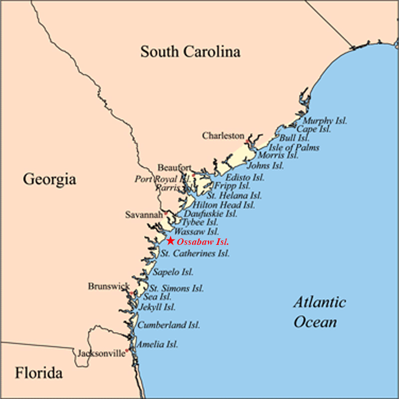
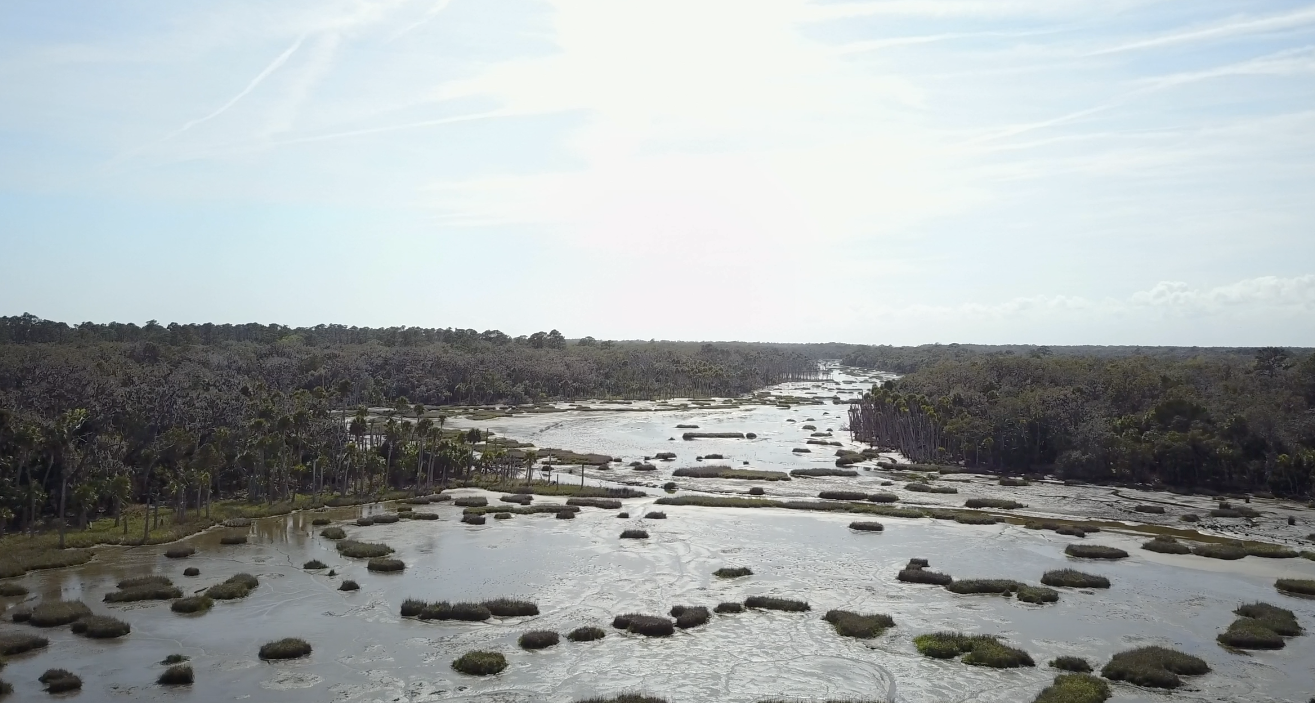
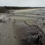
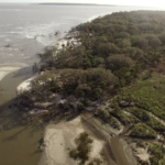
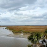
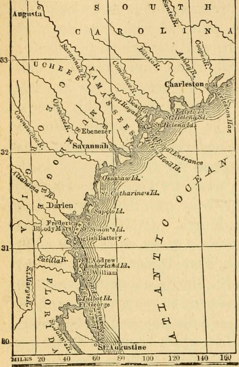
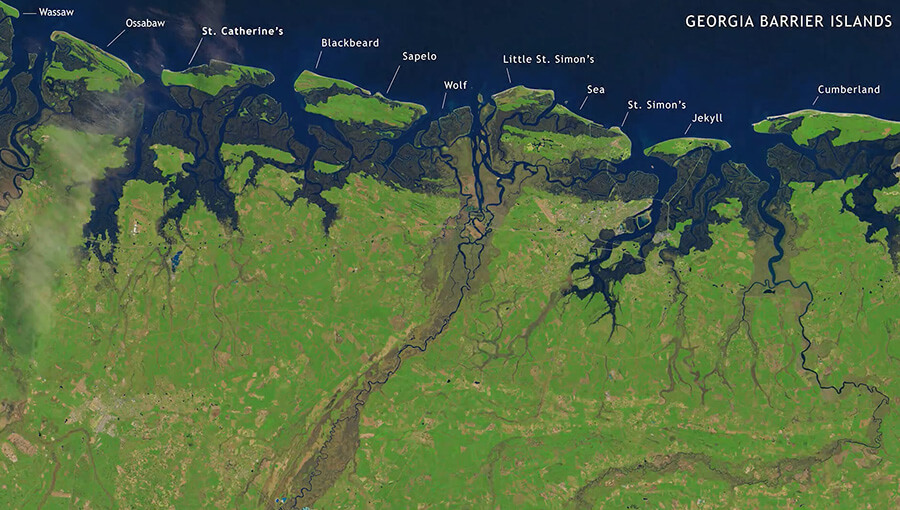
Ossabaw Island is a barrier island on the Georgia coast. The island, which trends northeast–southwest, is about 14.5 kilometers (9 miles) long and 10.5 kilometers (6.6 miles) wide. It is located between latitudes 31° 49.5' and 31° 43.2' N. Of the Georgia barrier islands, Ossabaw is the most geologically unusual. Like the major Georgia islands south of it—Cumberland, Jekyll, St. Simons, Sapelo, and St. Catherines—Ossabaw is a composite island, in which sediments from Pleistocene and Holocene shorelines are directly adjacent or superimposed. However, sediments of the Pleistocene (Silver Bluff) and Holocene shorelines on Ossabaw split near its southern portion, with the Pleistocene trending north–south and the Holocene trending northeast–southwest. The modern shoreline, which formed only in the past few thousand years, wraps around the southern and northeastern corners of the island.
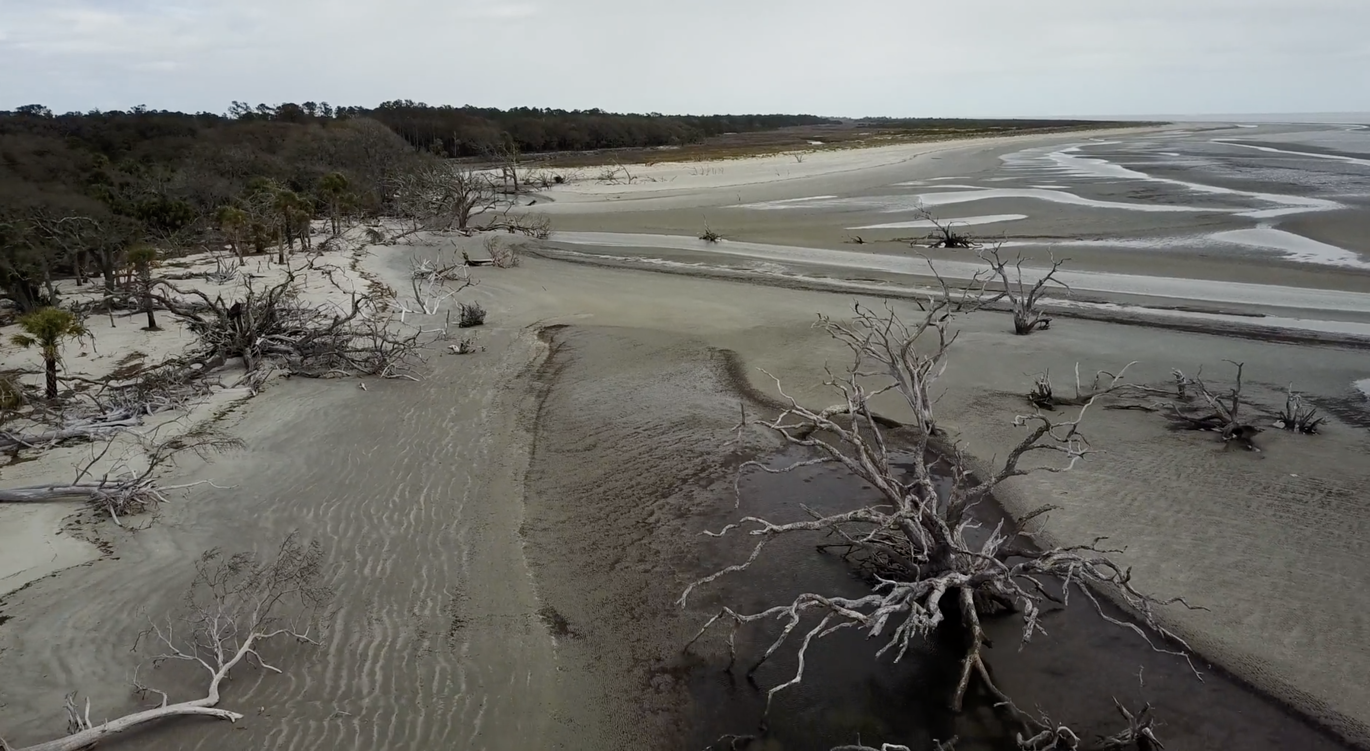
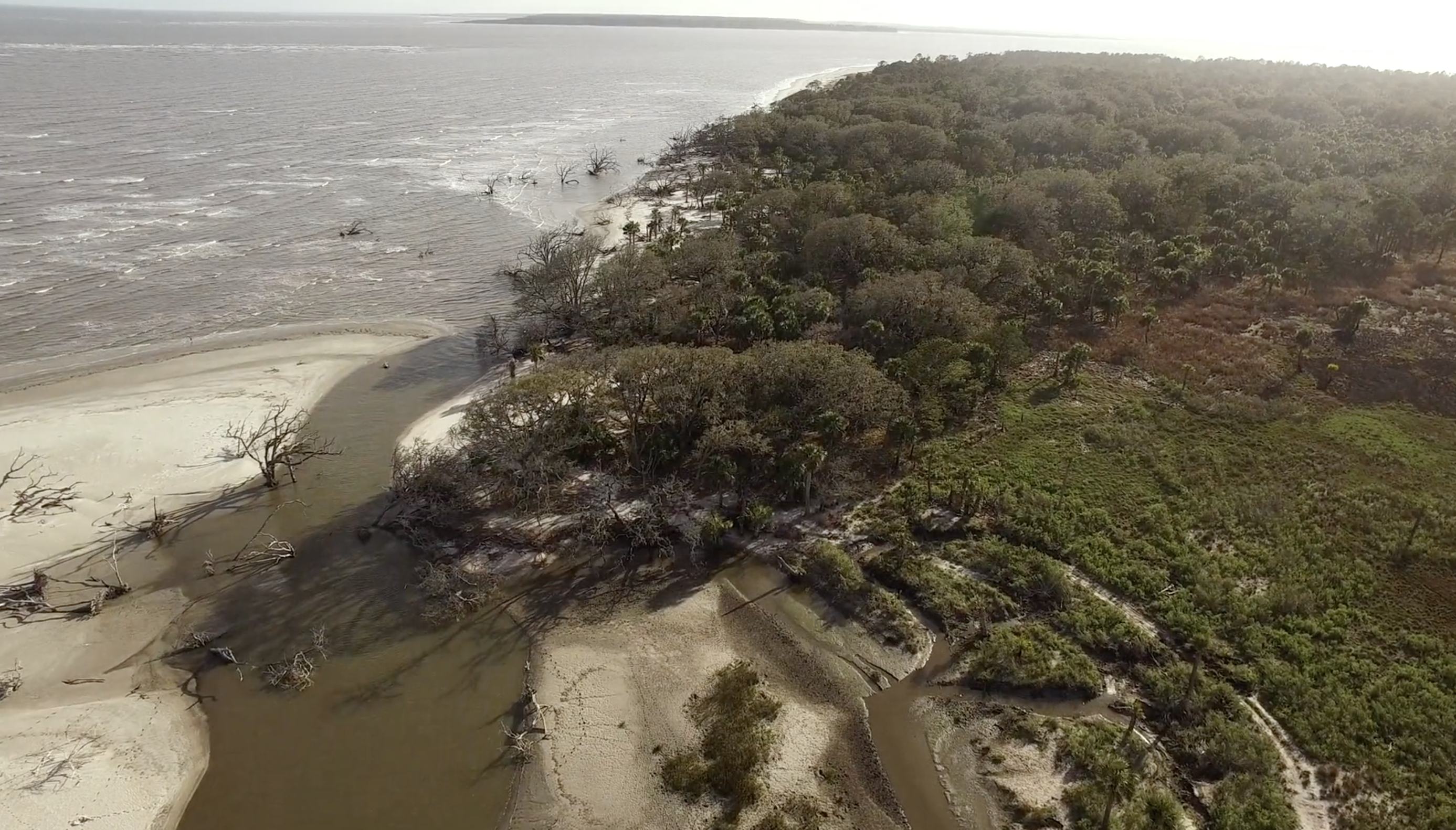
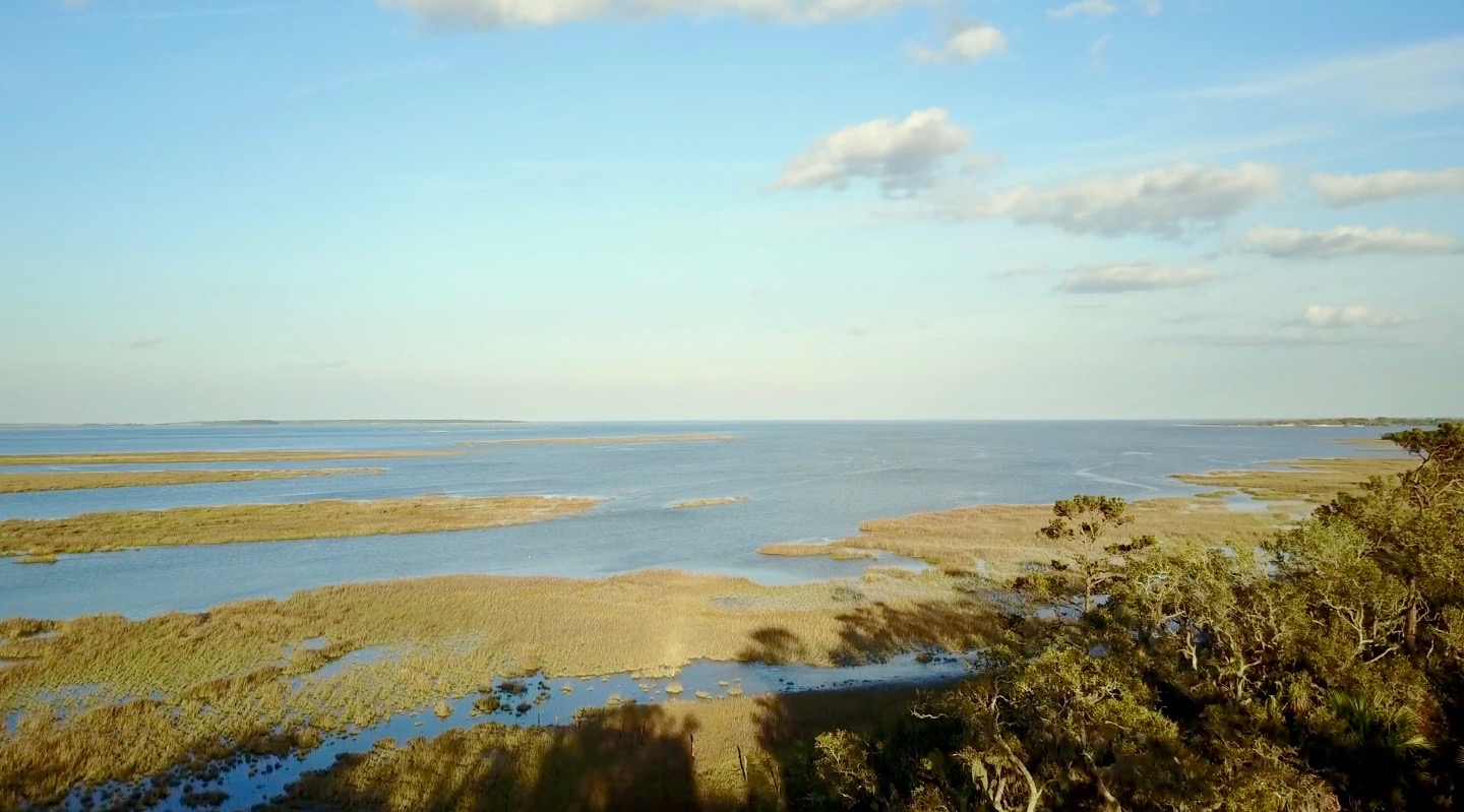
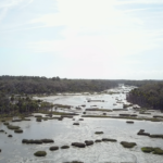
Ecosystems on Ossabaw include salt marshes, maritime forests, beaches, and a few freshwater ponds. Salt marshes are widespread west of Ossabaw, but also occupy much of the middle and eastern parts of the island between sediments of the Pleistocene and Holocene shorelines, dividing its maritime forests. The climate of Ossabaw is temperate to subtropical, with temperatures ranging from an average high of 32° C (90° F) in the summer to 10° C (50° F) in the winter. Average rainfall is about 50 centimeters (20 inches) per year, with most precipitation during the hurricane season (May–September). Hurricanes have rarely affected the Georgia barrier islands until recently, when Ossabaw was hit by Hurricane Matthew (2016), then later Hurricane Irma (2017). Hurricane Matthew, in particular, uprooted many of the older live oaks on the island and otherwise dramatically altered its landscape.
Although Ossabaw is often labeled as "pristine," humans have transformed its landscapes for at least 4,000 years. Its human history is similar to that of its island neighbor, St. Catherines, beginning with Native Americans (the Guale). The Guale had occupied Ossabaw since about 2000 BCE, but European colonization began when the Spanish arrived in the late sixteenth century. A lasting remnant of Spanish colonization on Ossabaw is the presence of feral hogs, some of which are linked to Spanish stock. This relatively large population of hogs has disrupted or otherwise altered ecosystems throughout the island.
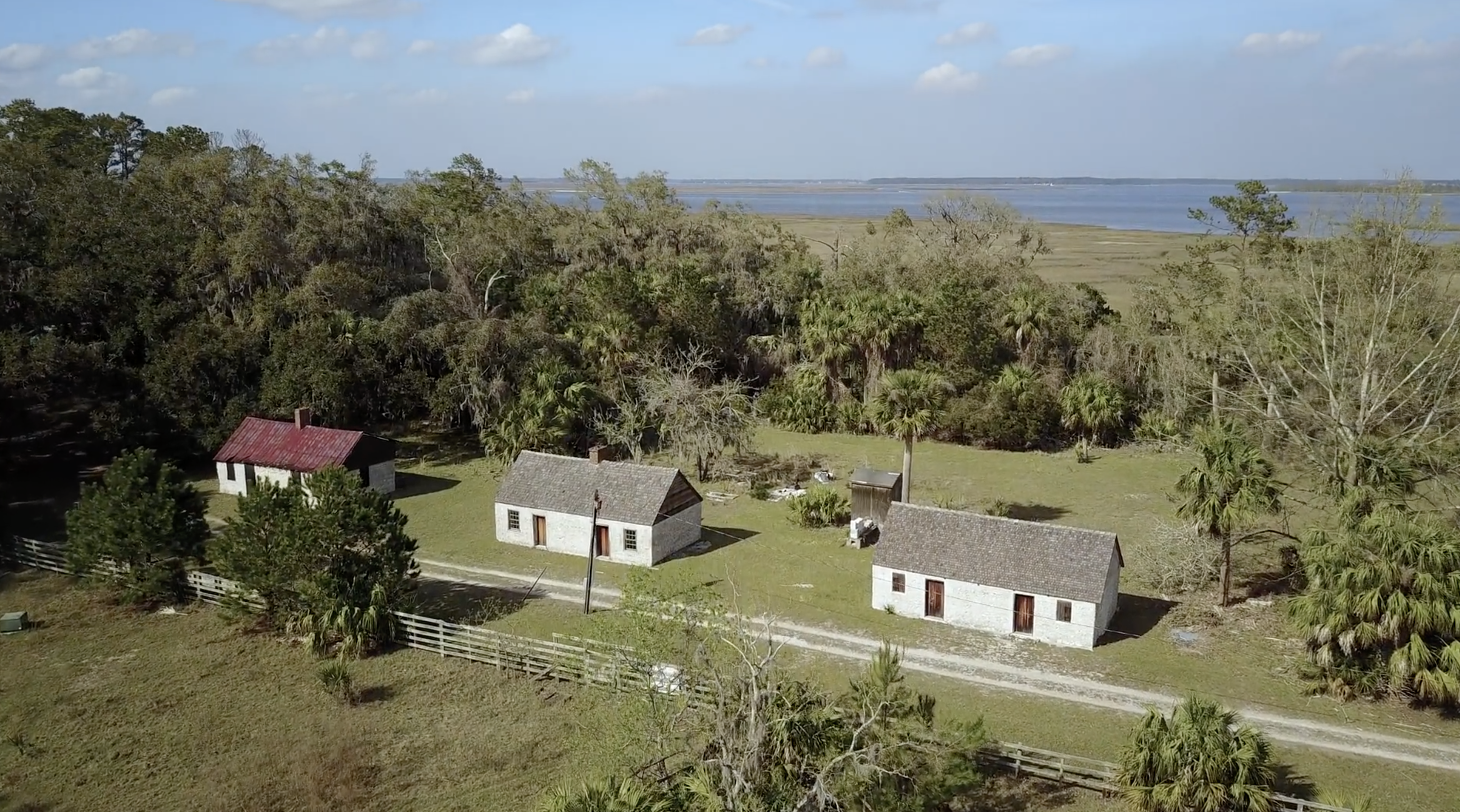
The British took control of Ossabaw in the 1730s, by which time the Guale had mostly moved inland or suffered near extinction under the pressure of colonization. Early treaties reserved Ossabaw as hunting and fishing ground for the Creek people until 1758. The British also began enslaving African people for their plantation economy, and in the late eighteenth century American settlers continued using enslaved people as laborers for growing cotton and indigo. Most inland ecosystems of Ossabaw, especially the maritime forests and salt marshes, were altered considerably by this agriculture. Following the American Civil War, a significant population of African Americans stayed on the island, but most moved to the mainland after the Sea Island Hurricane of 1893. Many of their descendants today comprise the Gullah-Geechee community in Pin Point, Georgia.
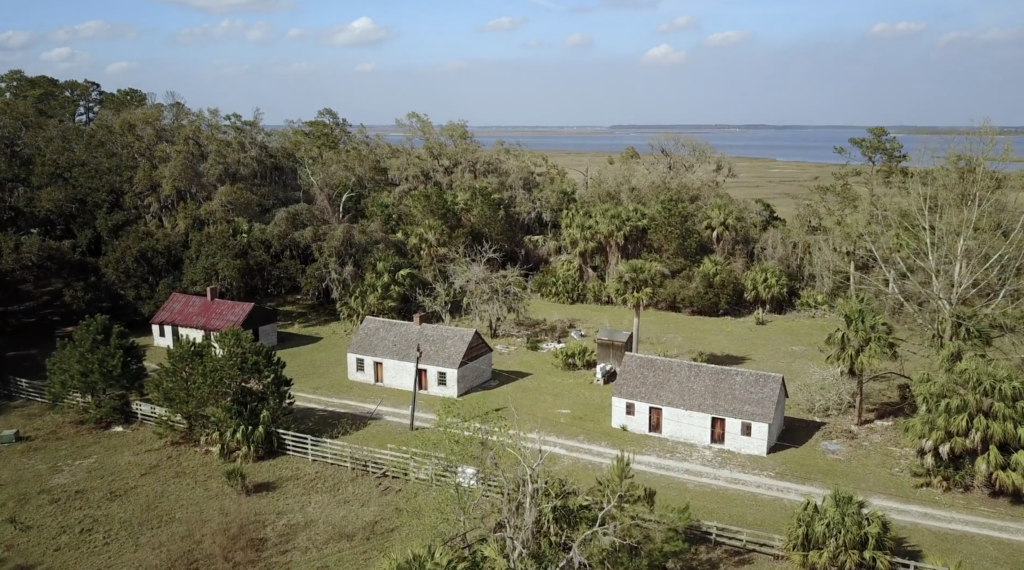
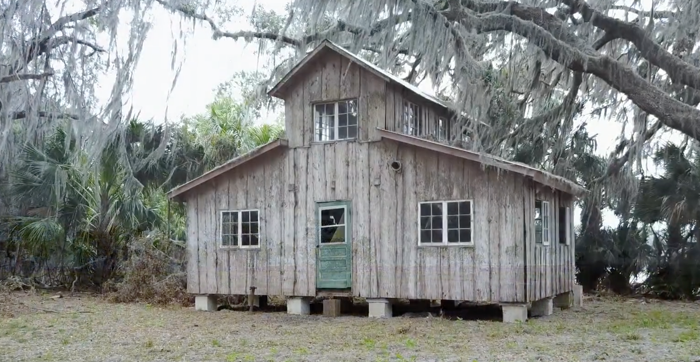
Through the early to late twentieth century, Ossabaw's ownership changed several times, but the island remained largely undeveloped and sparsely inhabited. The last private owners were members of the Torrey family, starting with Dr. Henry Norton Torrey and Nell Ford Torrey, and ending with their daughter, Eleanor Torrey ("Sandy") West. The Torreys oversaw the building of a large home for themselves, as well as hunting lodges, a beach house, and unpaved roads. In 1961, after Sandy West inherited the island, she and her husband Clifford West began the Ossabaw Island Project. This project brought luminaries of the arts and sciences to the island as a retreat center for study and discussion; notable participants included composer Aaron Copeland, writers Ralph Ellison, Margaret Atwood, and Annie Dillard, as well as ecologist Eugene Odum. This creative initiative also resulted in the Genesis Project, which focused more on the natural sciences and hosted scientists for on-site studies of and education about the archaeology, ecology, and geology of the island.
In 1978, Sandy West sold Ossabaw to the state of Georgia to establish it as the state's first heritage preserve, and it has been managed since by the Georgia Department of Natural Resources (DNR). The Ossabaw Island Foundation was established afterwards as a non-profit organization working with DNR to encourage educational, cultural, and scientific programs on the island. Sandy West continued living on the island until just recently; at the time of this writing (January 2020), she was living in nearby Savannah, Georgia, and had just celebrated her 107th birthday.
This Ossabaw flyover video provides a visual sample of the many interconnections between natural and human histories on Ossabaw. Featuring sweeping aerial views and audio annotations explaining the island's varied environmental features, this video is organized around four sequential but overlapping themes: fauna, flora, landscapes, and human structures. 
Acknowledgment
Thanks to the Ossabaw Island Foundation for their support on this piece.
About the Authors
Anthony "Tony" Martin is a professor of practice in the Department of Environmental Sciences at Emory University. His publications include Life Traces of the Georgia Coast (Bloomington: Indiana University Press, 2013).
Steve Bransford is the senior video producer at the Emory Center for Digital Scholarship. His documentary feature film The Well-Placed Weed is available on the PBS website and app.
Michael Page is lecturer in Geospatial Sciences and Technology at Emory University.
Leotie Hakkila is an MPH student at the Rollins School of Public Health, Emory University.
Anandi S. Knuppel is a visiting assistant professor in the Department of Religious Studies at Lawrence University.
]]>Video and Essay
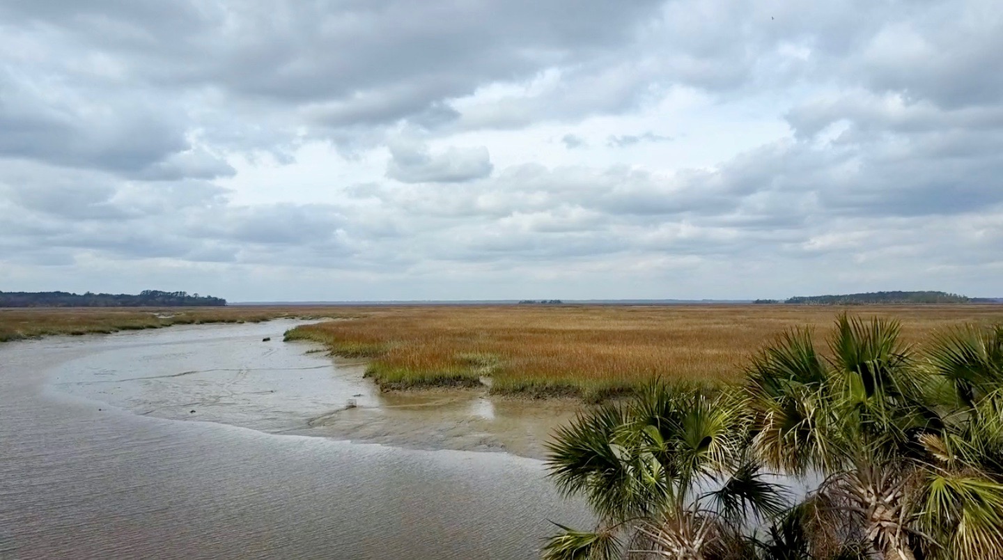
A barrier island on the Georgia coast, Sapelo has an unusually long and varied blend of natural and human history. The western half of the island is composed primarily of Pleistocene sediments deposited along a shoreline 40–50,000 years ago. Much of its eastern half is more recently formed and dynamically shifting. Modern ecosystems include extensive salt marshes with tidal creeks, beaches, maritime forests, back-dune meadows, grasslands, and a few human-made freshwater ponds. Erosion occasionally reveals sediments from older environments, such as hundreds-year-old relict marshes exposed along Cabretta Beach on Sapelo's northeastern edge.

Sapelo Island in the Sea Islands Watershed. Courtesy of Wikimedia Commons. Creative Commons license CC BY-SA 2.5.
The Sapelo climate is temperate to subtropical; temperatures range from an average high of 90°F (32° C) in summer to 50°F (10° C) in winter. Freezing is rare. Rainfall is about 50 inches (127 centimeters) a year, with the majority of precipitation during the May–September hurricane season. Despite the impact of Hurricane Matthew on October 8, 2016, hurricanes rarely affect the Georgia coast. The worst was in 1898, and directly impacted Sapelo and its companion, Blackbeard Island, to the northeast. Until the 1898 hurricane hit, Blackbeard hosted a US Marine Hospital yellow-fever quarantine station, which was damaged heavily by the storm; it reopened, only to close in 1909 with the development of yellow-fever vaccines.
A prominent and well-preserved Native American (Guale) shellring on the northwestern corner of the island gives evidence that humans have experienced Sapelo for at least 4,500 years. The arrival of the Spanish in the sixteenth century resulted in the naming of "Sapelo," an Anglicized corruption of "Zapala" from Spanish and likely a corruption of the original Guale name for the island. French and English colonization of Sapelo in the eighteenth and nineteenth centuries heavily modified the local ecosystems.
Following the American Revolution, alteration of the local environment continued throughout the early to mid-nineteenth century. Plantation agriculture depended on slave labor of people with varied languages and origins in west Africa, resulting in an enforced cultural mélange. Descendants of those enslaved people, and the only Gullah-Geechee population on any Georgia barrier island, reside today in the Hog Hammock community. Although shrinking in size, Hog Hammock retains a distinctive culture and features a revival of traditional knowledge, including handicrafts such as sweetgrass basket weaving, cultivation of unique agricultural species (e.g., Sapelo red peas), and Gullah-Geechee storytelling.


Top, the UGAMI complex on Sapelo Island, Georgia, 2015. Bottom, lighthouse on Sapelo Island, Georgia, 2015. Screenshots courtesy of Southern Spaces.
Perhaps the most scientifically significant legacy of Sapelo is its birthing of modern ecology, much of which was done at the University of Georgia (Athens) Marine Institute, or the UGAMI, founded in 1953. The UGAMI owes its existence to ecologist Eugene Odum (1913–2002) and tobacco heir/businessman R.J. Reynolds, Jr. (1906–1964). Reynolds bought most of the island in 1934, but Odum persuaded him to donate land and buildings to start the UGAMI in 1953. The Institute, located next to its study sites, has conducted world-renowned research on salt-marsh ecology and other aspects of natural communities on and around the island.
Reynolds' widow, Annemarie Reynolds, sold much of the island to the state, which the Georgia Department of Natural Resources now manages. The western edge of Sapelo is part of NOAA's National Estuarine Research Reserve system, termed the Sapelo Island National Estuarine Research Reserve. The UGAMI still serves as a thriving center for ecological research and hosts academic field trips in natural science education.
In September, November, and December 2015, we visited Sapelo Island to gather ground and aerial drone-video footage that would visually summarize its ecosystems. This footage also shows signs of human activity, such as the UGAMI complex, paved roads, a freshwater pond created by excavation, and the present-day lighthouse, still used for guiding maritime traffic in Doboy Sound.

Internal Waterway, Sapelo Island, Georgia, 2015. Screenshot courtesy of Southern Spaces.
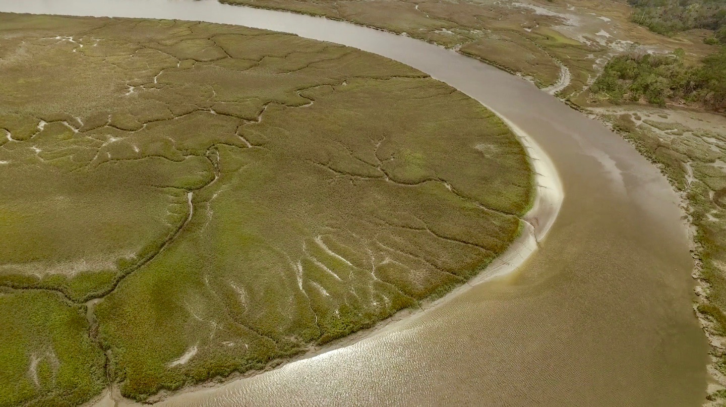
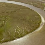
Our first trip in September 2015 also coincided with "king tides," spring tides accentuated by a relatively stronger gravitational pull associated with a "super moon." This situation caused unusually high tides to flood marshes, roads, and other low-lying places on Sapelo, a phenomenon repeated there and along the rest of the Georgia coast in late October 2015. Tidal ranges on the Georgia coast are already greater than those of most barrier island systems, typically varying from 2.5–3 meters (8.2–9.8 feet). Any addition to this already-voluminous water exchange imparts dramatic effects. Some of the drone footage showing the extent of the flooding serves as a harbinger of predicted sea-level rise on the east coast associated with climate change. We also included two snippets of time-lapse sequences of intertidal areas—Cabretta Beach, on the northeastern corner of the island, and a salt marsh in the south end—to further convey the effects of tides on island margins and interiors.
This Sapelo video encapsulates a history that forecasts the future under climate change. Among its subjects are: abrupt transitions in coastal ecosystem, from beach to back-dune meadows to maritime forests; beaches where sand is being actively eroded or deposited by longshore drift; a tree "boneyard" with dead trees on a beach signaling the former presence of a maritime forest; an artificial freshwater pond adjacent to maritime forest but with salt marshes in the background; dendritic drainage patterns of marshes at low tide, and much more. Despite its short 3:45-minute length, this video's content, combined with its brief narrated descriptions, can inspire an hour or more of classroom discussion of natural and human systems on this remarkable Georgia barrier island.
About the Authors
Anthony (Tony) Martin is a professor of practice in the Department of Environmental Sciences at Emory University. His publications include Life Traces of the Georgia Coast (Bloomington: Indiana University Press, 2013). Steve Bransford is an educational analyst for video with University Technology Services at Emory. He launched his own production company, Terminus Films, in 2001. Anandi Salinas is a PhD candidate in religion at Emory and a training specialist with the Emory Center for Digital Scholarship. Michael Page is lecturer in geospatial sciences and technology at Emory. Shannon O'Daniel is an educational analyst with Emory's Library and Information Technology Services.
]]>Video and Essay
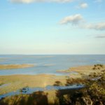
One of the barrier islands along the Georgia coast of the Atlantic Ocean, St. Catherines has an extraordinary ecological and settlement history. First inhabited more than four thousand years ago, the undeveloped island is privately owned but protected for the public good. A small network of unpaved roads connect the interior of the ten-mile long, three-mile wide island. In addition to ongoing environmental study, extensive archaeological research has occurred at St. Catherines with regard to Native American settlements, the Spanish mission of Santa Catalina de Guale, and pre-Civil War plantation sites.
 |  |
During a week-long visit to St. Catherines in March 2015, Emory University geographer Michael Page, environmental scientist Anthony (Tony) Martin, and graduate student Alison Hight flew a camera-bearing drone over nearly every type of ecosystem on the island: maritime forests, extensive beaches, back-beach meadows, salt marshes, mud flats, fresh-water ponds, and more. Along with colleagues from Georgia Southern University, Page and Martin have worked together at St. Catherines since 2011, locating, describing, mapping, and writing about alligator dens and gopher-tortoise burrows. The use of a drone enables a new way of studying the island's dynamic ecosystems and scouting locations difficult to reach on foot. During their spring 2015 trip, Page and Martin found places where alligators walk from their dens through nearby salt marshes, then return. Rather than trying to track the alligators in the marshes—a challenging, time-consuming, and risky endeavor—they sent the drone to take overhead photos at higher resolutions than currently available imagery from the US Department of Agriculture and other agencies. Page and Martin georeferenced and mosaicked the captured images for their research geodatabase. In addition to demonstrating the potential of a drone in difficult-to-access areas, Page and Martin plan to use the St. Catherines video footage to teach students how to identify and interpret the environments of a Georgia barrier island, and to conduct local-scale mapping.
From the many hours of March 2015 drone footage, documentary videographer Steve Bransford edited the short video presented here. It begins by orienting viewers to the location of St. Catherines, and then travels smoothly across the various ecosystems. The former site of the Spanish mission is visible (its footprint outlined by cabbage palms) as are alligator tracks, and alligators swimming near the video's end.
About the Authors
Steve Bransford is an educational analyst for video with University Technology Services at Emory University. He launched his own production company, Terminus Films, in 2001. Anthony (Tony) Martin is a professor of practice in the department of Environmental Sciences at Emory University. His publications include Life Traces of the Georgia Coast (Bloomington: Indiana University Press, 2013). Michael Page is lecturer in geospatial sciences and technology in the department of Environmental Sciences at Emory University.
]]>