Thursday, September 26, 2024
In Marshall talking with Joel and Josh. Very real concerns about the river, which is at ten feet, fierce, and rapidly rising. The island is already under water. At fourteen feet the river would be in town. At nineteen feet there would be extensive flooding and costly repairs.
Our niece Jody arrives at the house. She’s going to do a soap-making tutorial with Leslie for the weekend. We lose power later this evening and with it our water. Cell and internet are also out.
My concern is the wind. The ground is saturated from three days of rain. A windstorm could bring down thousands of trees lining our driveway, the road into town, and the forests that make up 73% of the land in Madison County.
Friday, September 27
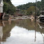
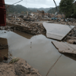
The river crested early this morning at twenty-seven feet, four feet higher than the previous record set in 1916. Yesterday’s concerns are facing today’s reality — the town’s total destruction. The wind never materialized at the house. It’s still raining. Our friend Maia has joined us after being evacuated out of Marshall.
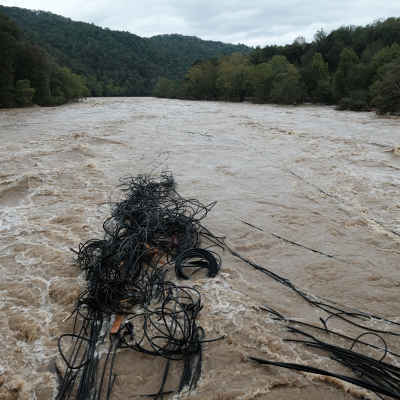
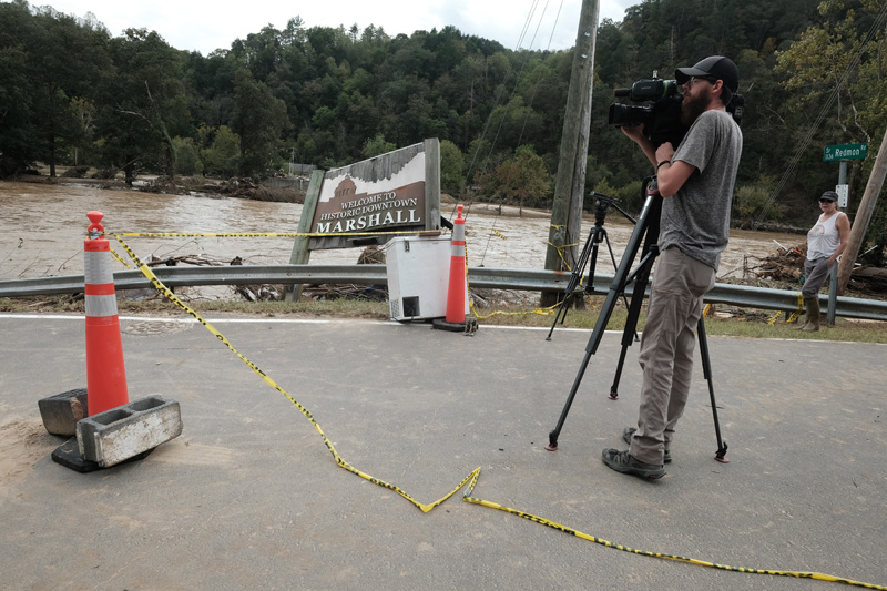
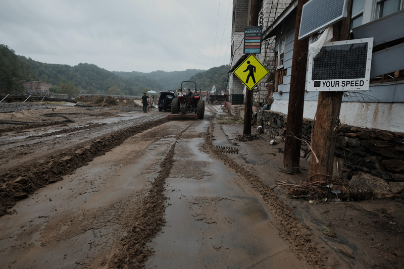
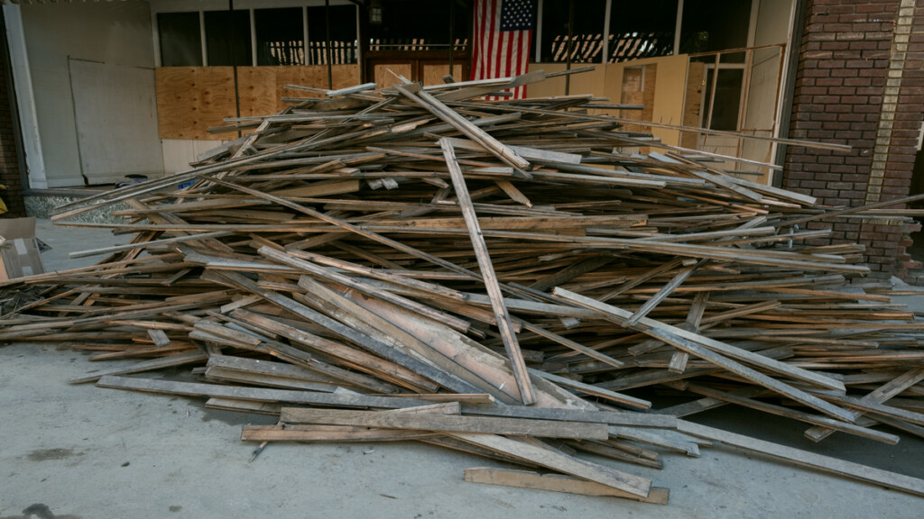
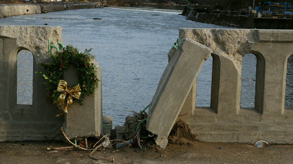
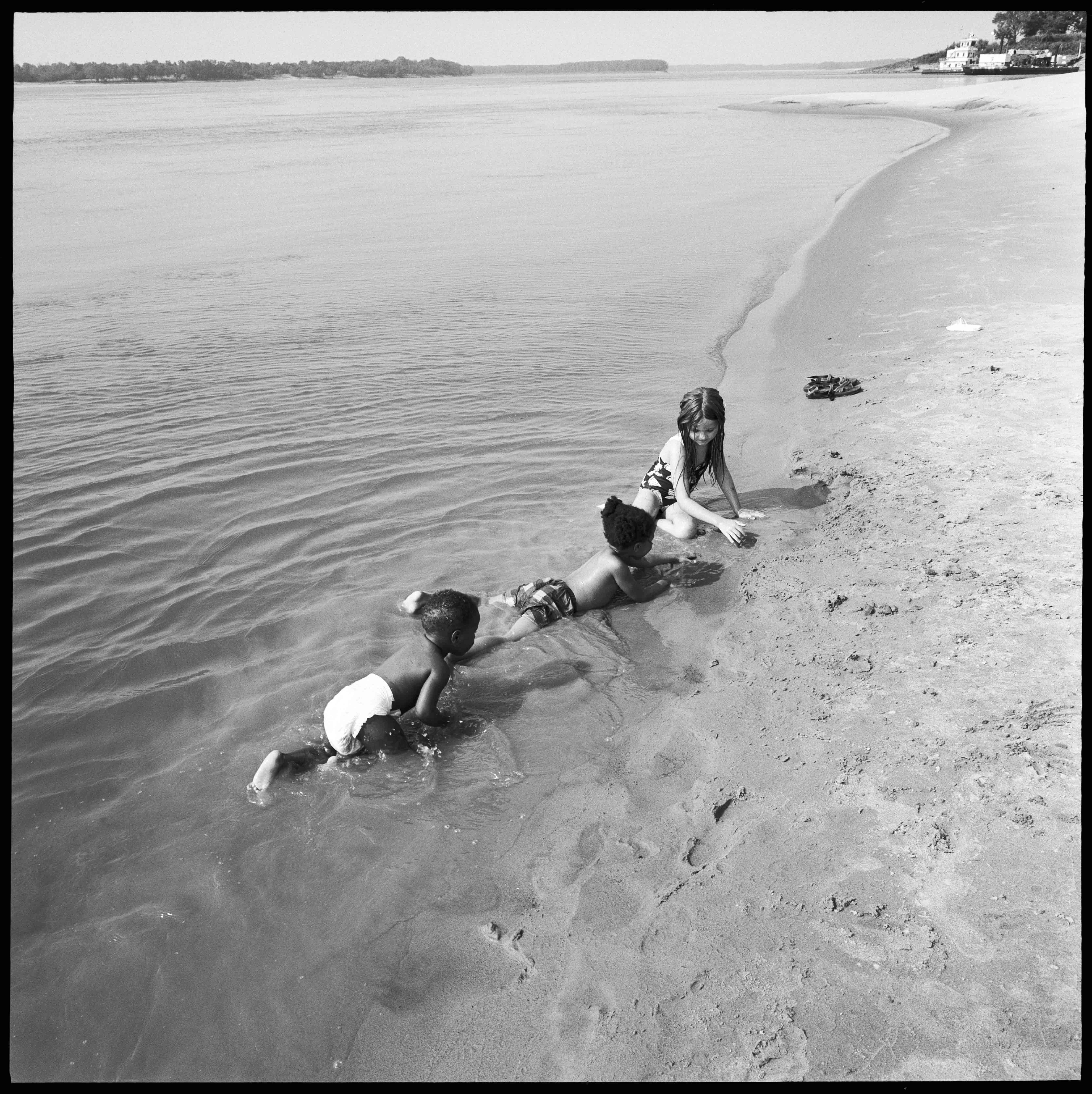
We pile into our car and drive down Little Pine, thinking we’ll go into Marshall. We’re stopped before we get to the Redmon bridge. Neighbors are lining the road looking at the river, which has become one with the road. Fuel tanks, giant tangles of PVC piping, shipping containers — swept away.
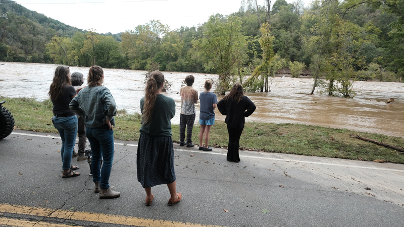
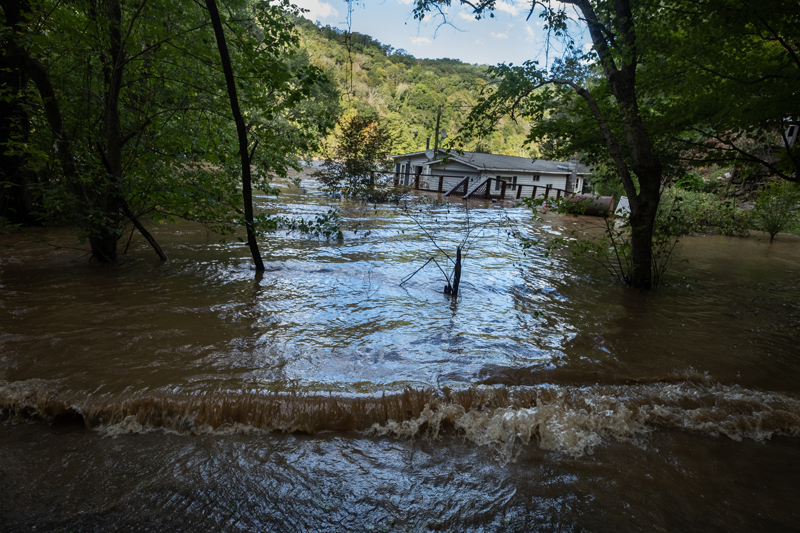
We turn around and drive down Anderson Branch to Barnard. There, worse. Over five feet of water covers the road. Ronnie Meadow’s house inundated. Neighbors wading waist-high water to get his prescriptions and photographs.
Stop at Paul and Laurie’s and get water from their spring. Go home and start cooking and the power comes on. Internet and cell service spotty.
Saturday, September 28
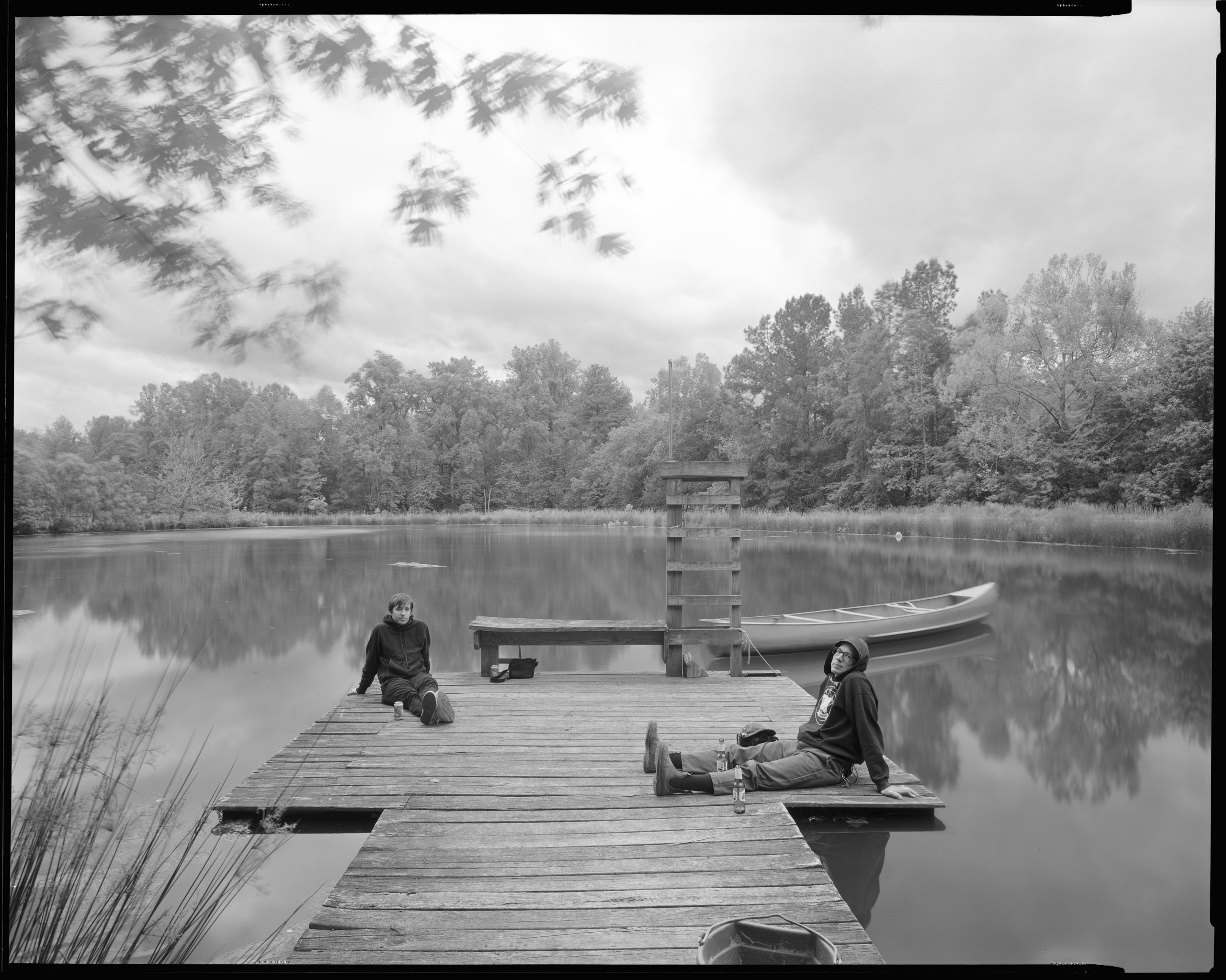
Drive down to Barnard to see if we can get out, and do. Stop at the bridge. Meet some neighbors, make some pictures, come home. Chris, Maia’s boyfriend, got in from Atlanta. We make supper.
Sunday, September 29
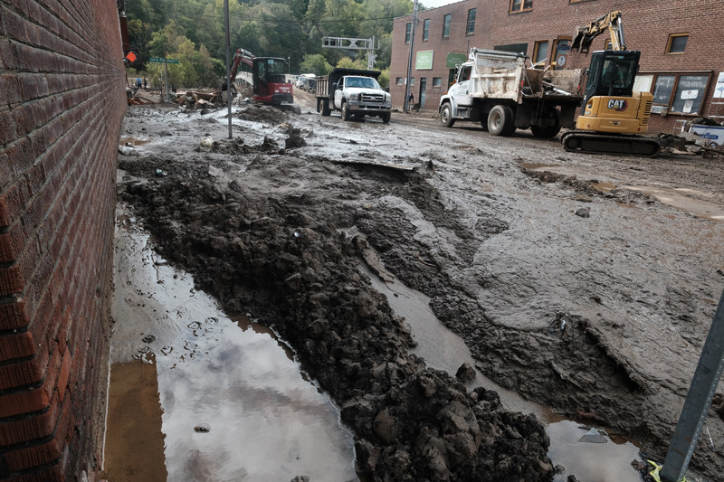
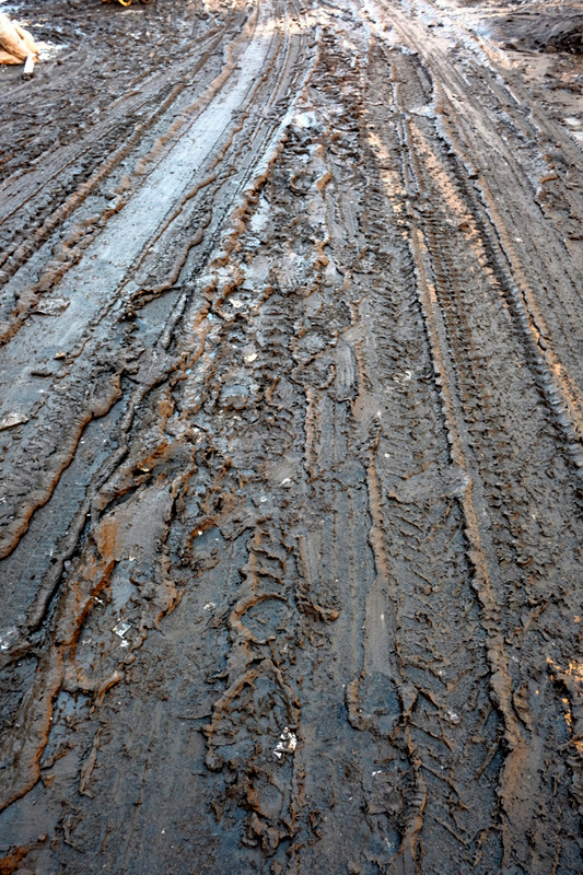
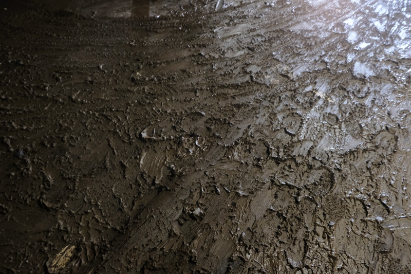
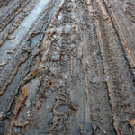
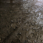
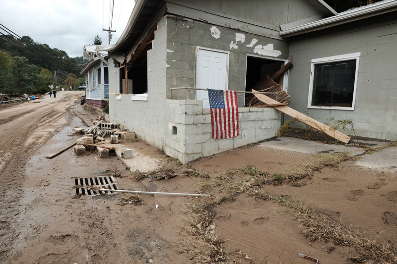
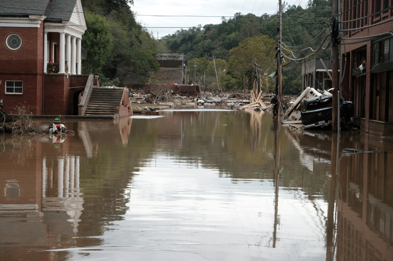
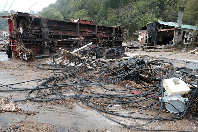
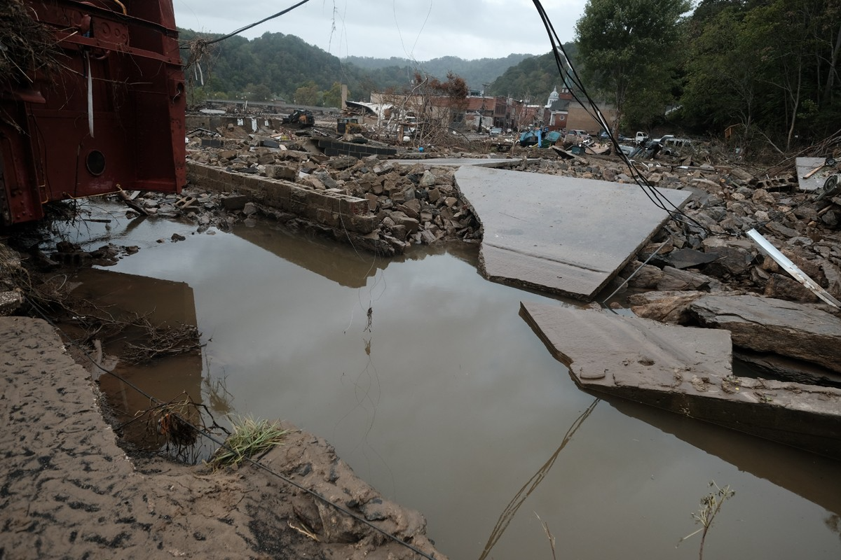
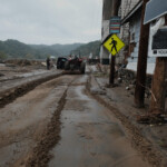
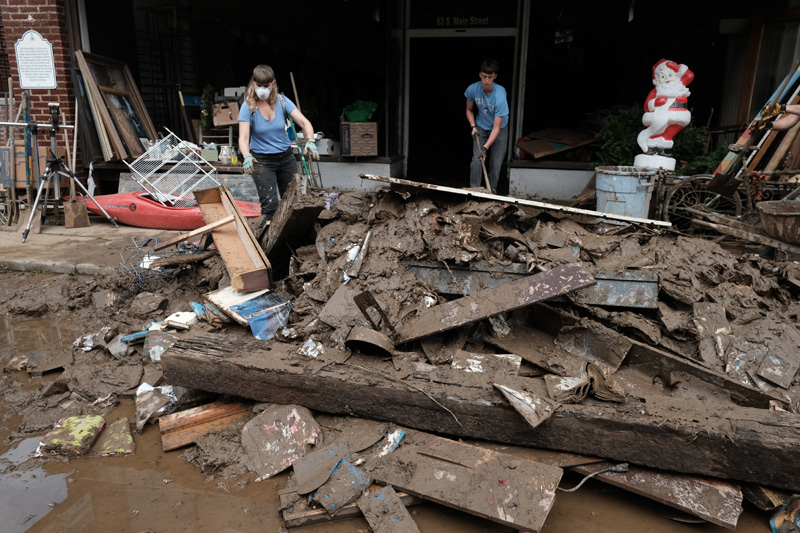
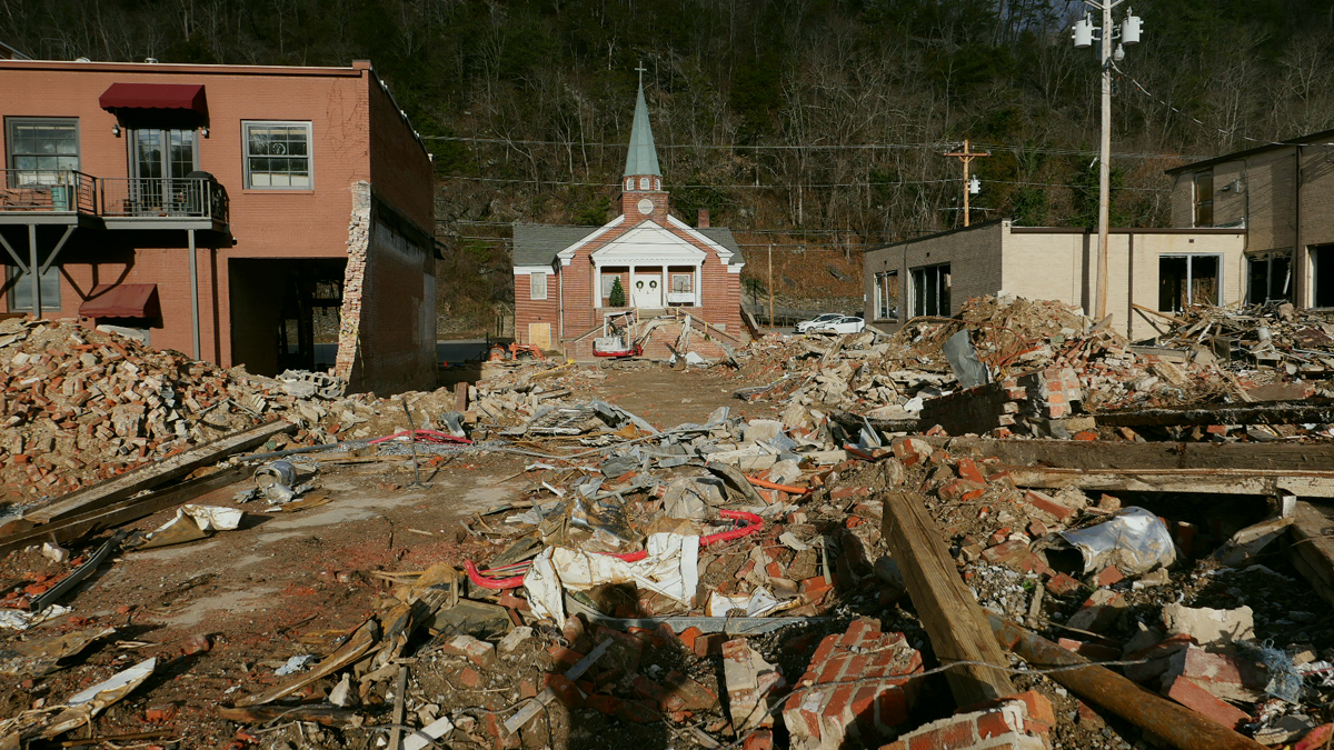
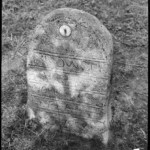
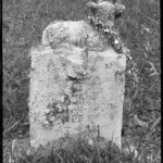
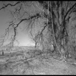
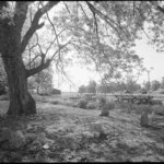
A first look at Marshall. The mud. Everywhere, impossible to avoid. Heavy, sticky. The kind of mud that sucks you in and holds you close. The beginnings of debris piles. Submerged cars and trucks. Rubble where buildings once stood. Stores and restaurants where we’d visited just days before, windows broken, spewing mud from their orifices. And the smell, a mix of water and mud, and propane, a general sense of toxicity.
This is the fourth hurricane related flood I’ve photographed in the last twenty years — Katrina in New Orleans, Hugo in South Carolina, Floyd in Eastern North Carolina, and now, Helene in my backyard.
There are similarities between the four. The mud. The displaced buildings and houses and subsequent debris fields. People’s faces and eyes, at once unbelieving and resilient.
But this is different. It is home, it is friends, neighbors, it is music and dancing, it is church if you want, art most everywhere, eccentricity abounding. It is gone.
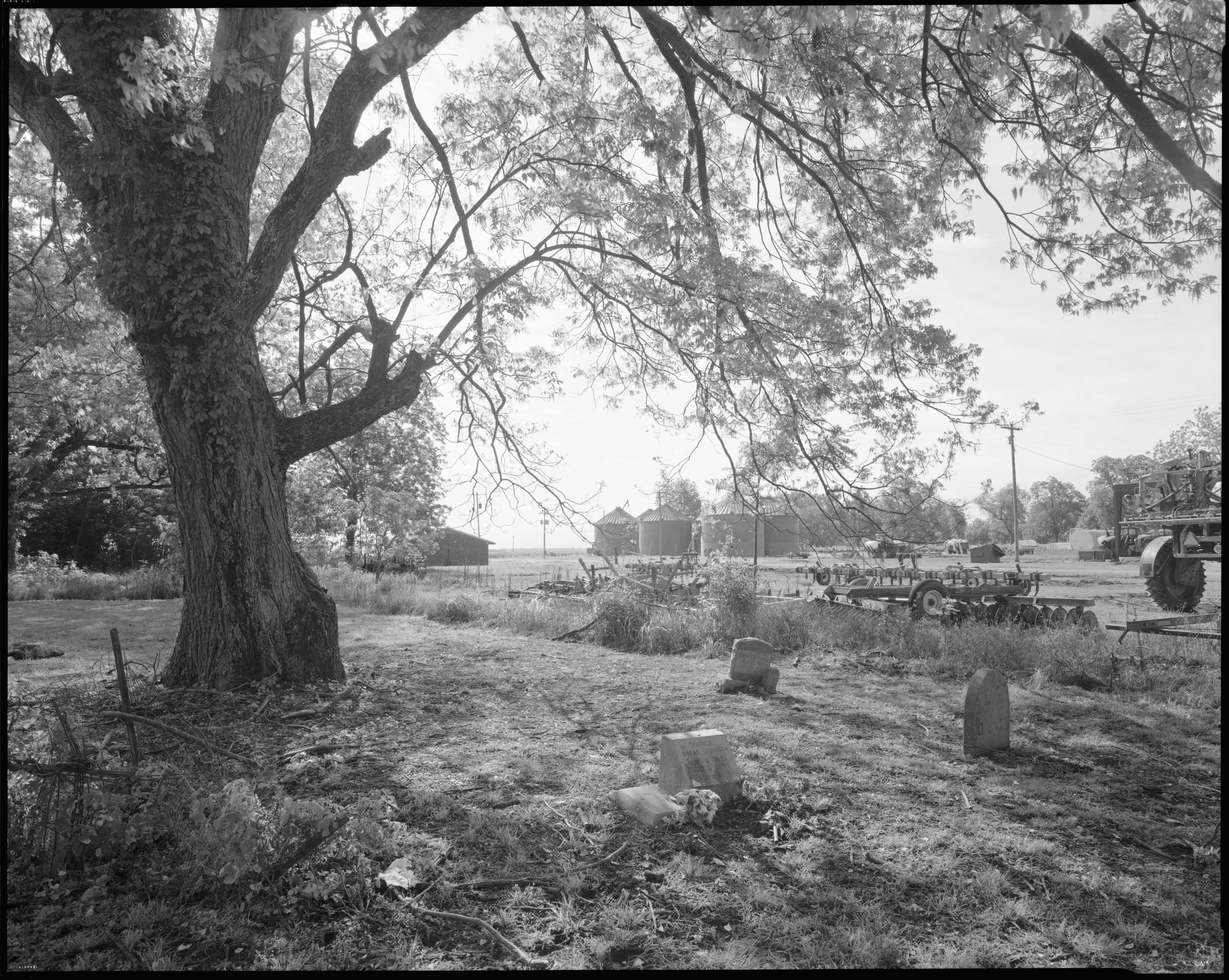
I see Morgan, in the midst of mud and debris. Forlorn. No doubt realizing she’s lost her job to the flood. We hug. I move on.
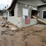
The uniqueness of each building has taken on a sameness of look. Broken windows, water lines above the doorways, stuff beginning to line the street — books, chairs, a sewing machine, an elk head, furniture, boxes of dripping files in front of a lawyers’ office — and mud.
Monday, September 30
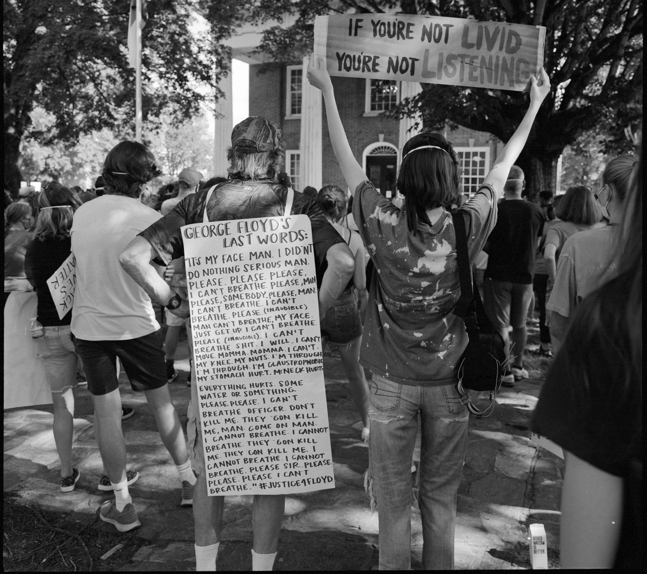
For many people, town residents and storeowners, this is a first look at the town, their places of business, their homes. The shock is palpable. The enormity of the destruction incomprehensible and impossible to accept. There’s tears, many, and embraces. What else to do? It’s a reckoning of what once was and what it has become in the blink of an eye. And what lies ahead.
Western North Carolina has long been considered a climate haven. The Southern Appalachian mountains are among the oldest on earth and they offer protection from tornados and hurricanes and other natural disasters. We’ve had floods and landslides in the past, and memorable snowstorms, droughts, and fires. But Helene was unique and has been termed a “geological event” because the accompanying flooding, landslides, and tree damage will have a lasting impact on the landscape. It certainly has had a lasting impact on Marshall and the twenty western counties of North Carolina.
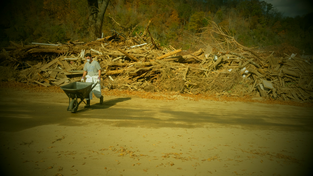
I walk through town for three or four hours, making photographs, talking to friends and neighbors. I think about shoveling mud, but feeling how dense and heavy it is, I realize that it’s a heart attack waiting to happen. I’m clearly the oldest person out there and the work is for the young.
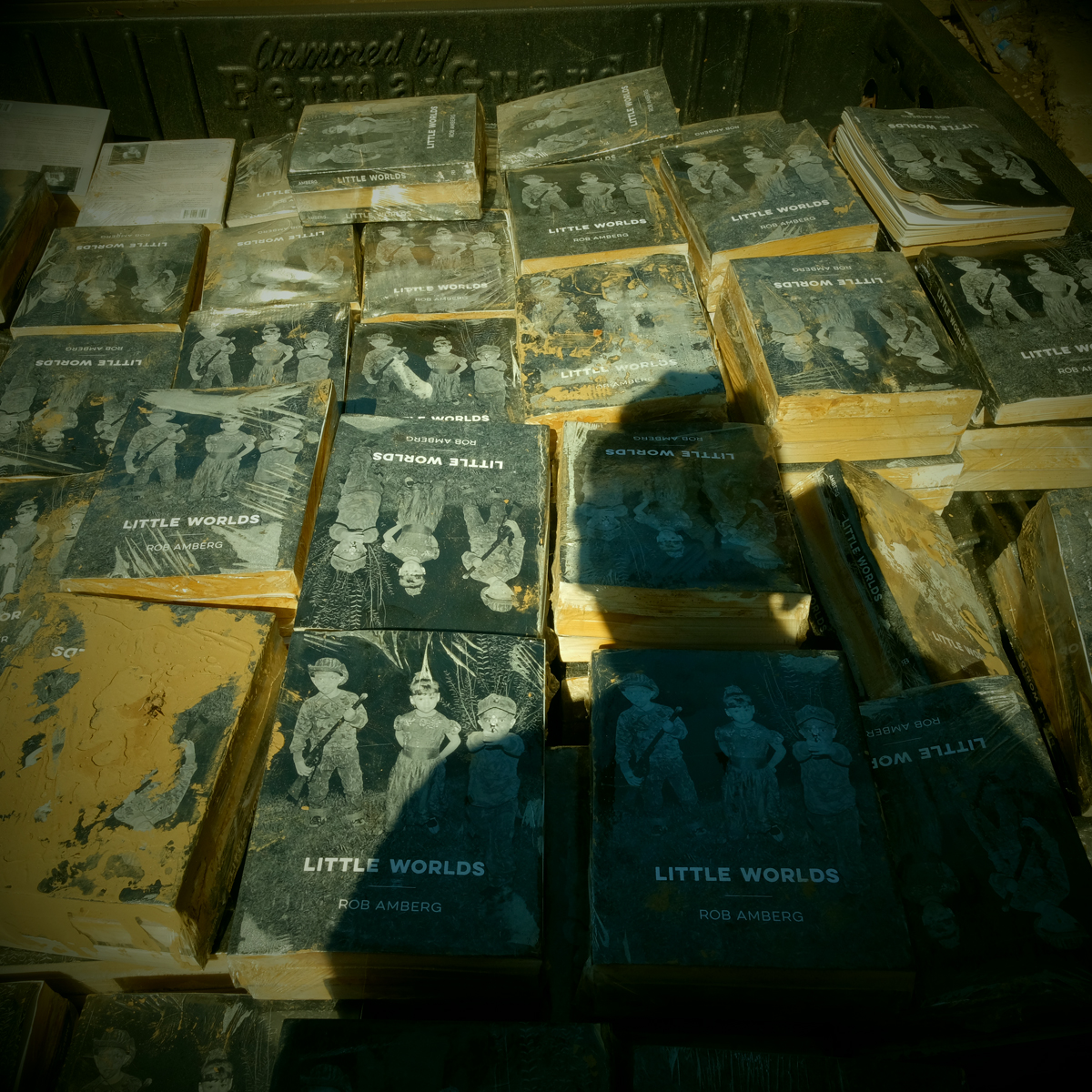
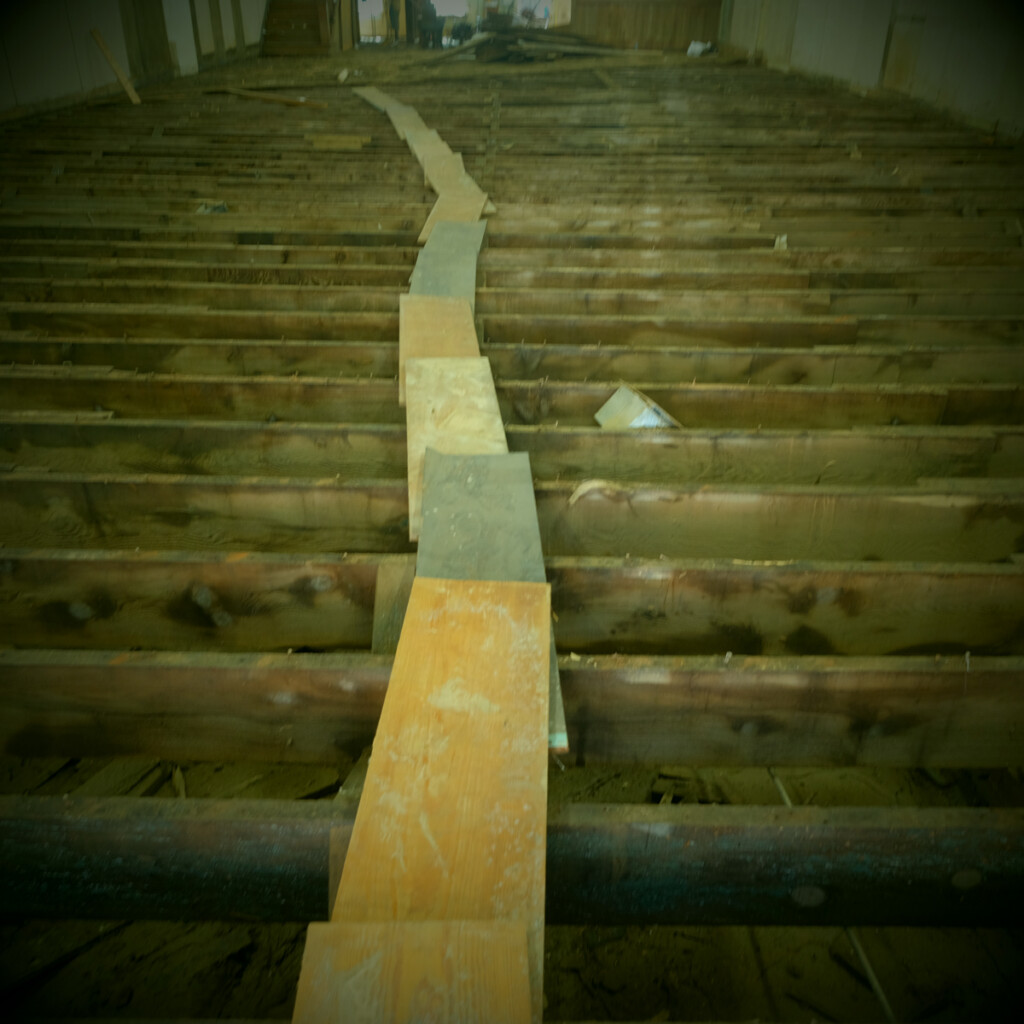
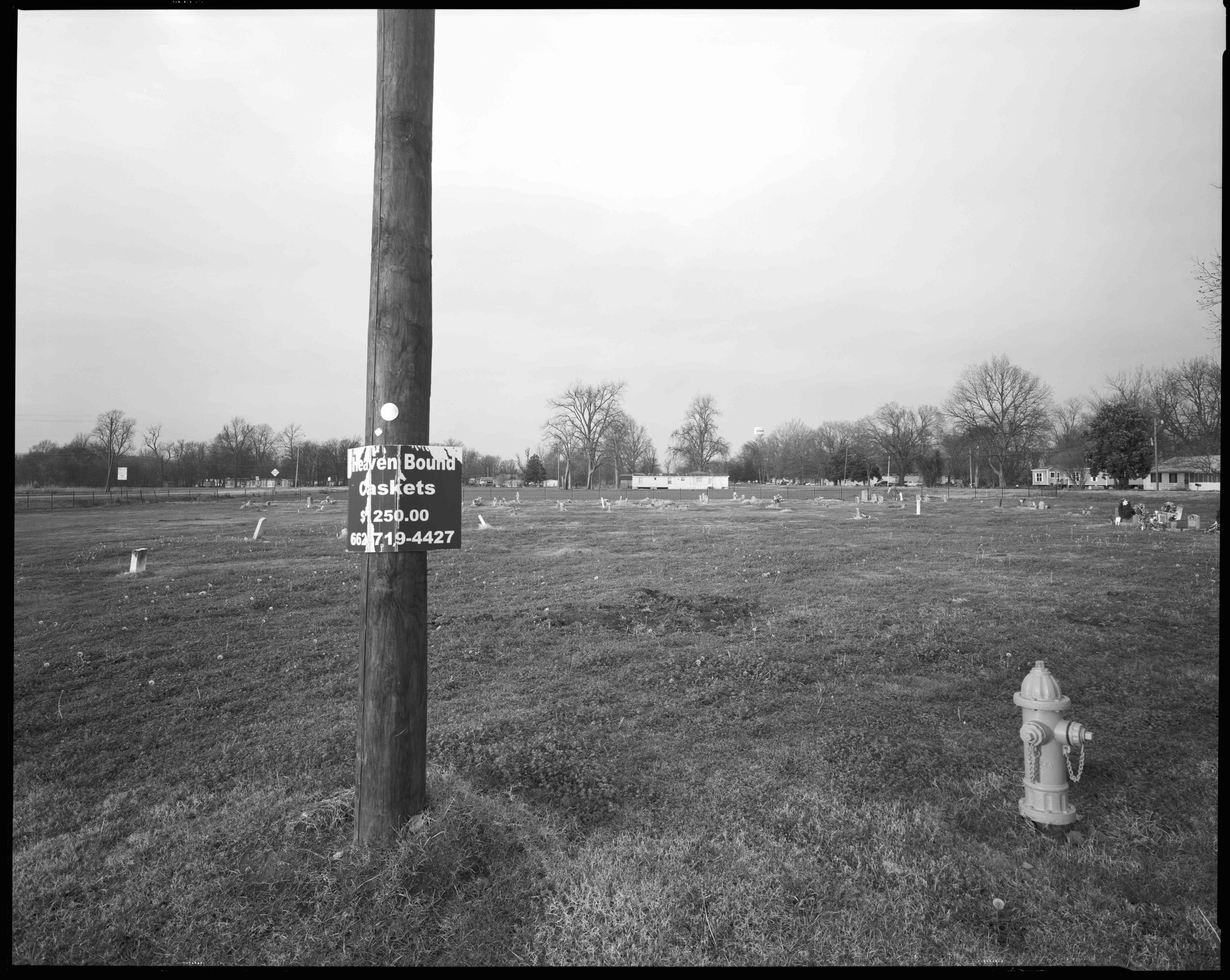
I went to check on my books — 450 copies of my new book, Little Worlds —that were stored in a friend’s warehouse in town. The road in front of the building is foot deep in mud but seems firm at first step. With the second I am shin deep and locked in place, unable to lift my feet. John and Kirsten pull me out, sans shoes, which Kirsten pulls out by laying flat on the ground.
Tuesday, October 1
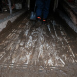
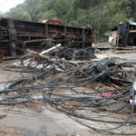
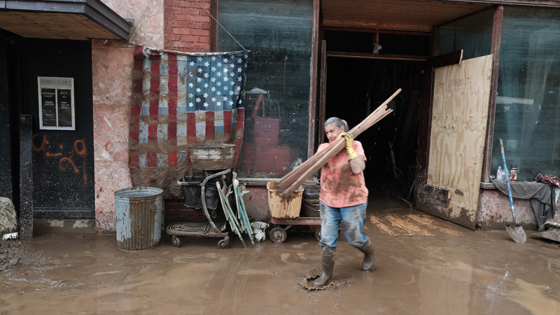
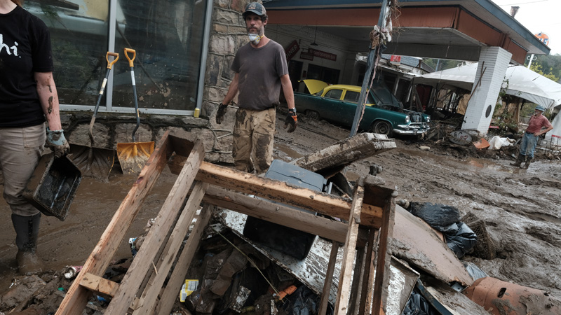
There’s more people in town today, beginning the task. Some are clearing buildings, adding to debris piles. Others are shoveling and scraping mud. Some are salvaging what little there is to salvage. There’s heavy machinery and a steady line of dump trucks heading to the landfill. The mud remains slick, never-ending, clinging to whatever it touches.
I talk with Jamie Smith and his wife who own the French Broad Exchange, our local used bookseller. They’ve lost over 15,000 volumes to the flood, almost their entire inventory. They’re older, of retirement age, and questioning a return. They don’t own the building and the owner is reluctant to commit to doing any repairs.
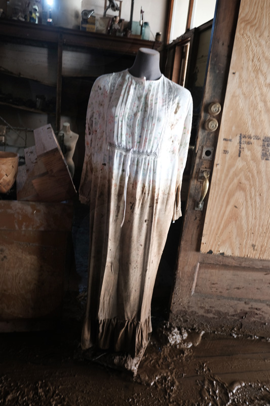
At Penland & Sons Store, the interior looks like a giant has gone in with huge salad forks and stirred the contents — clothing, books, jams and jellies, fresh vegetables. Georgette takes me to a moveable counter with two baskets of my wife’s soap resting on top. The flood lifted the counter to the ceiling and rested it in a new location in the store, never disturbing the soap.
With help from Todd I make it into the building to check on my books. It’s dark inside the warehouse, the floor carpeted with mud and water, tools, lumber. Two-by-ten boards have been placed throughout the building and we walk gingerly to the back. The pallet of books has been moved and is resting on its side in a puddle of water and mud. The covers appear untouched, protected by the cellophane covering. But when I cut into the pallet and pull out a small bundle of books, I see they are all sealed shut, only opened by tearing pages. Disheartening.
Wednesday, October 2
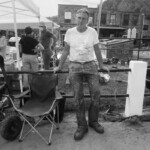
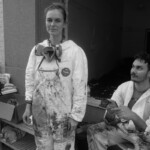
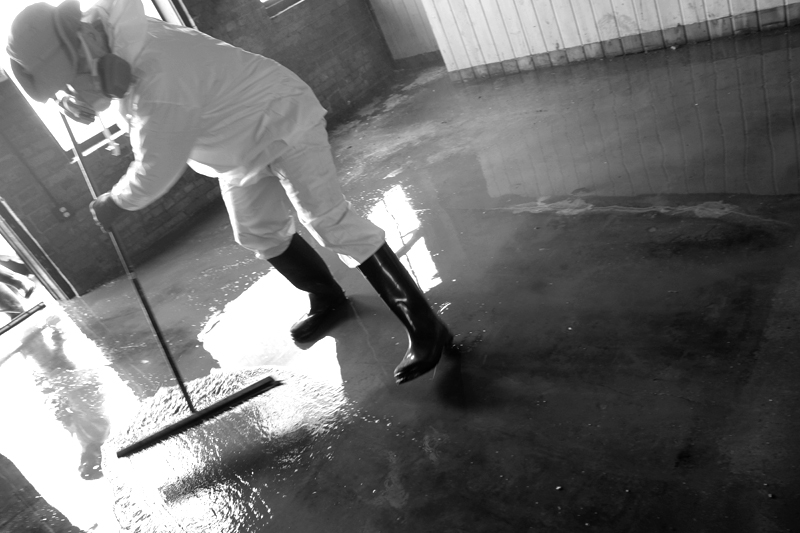
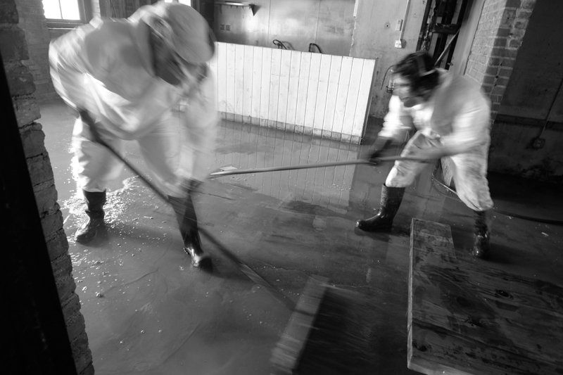
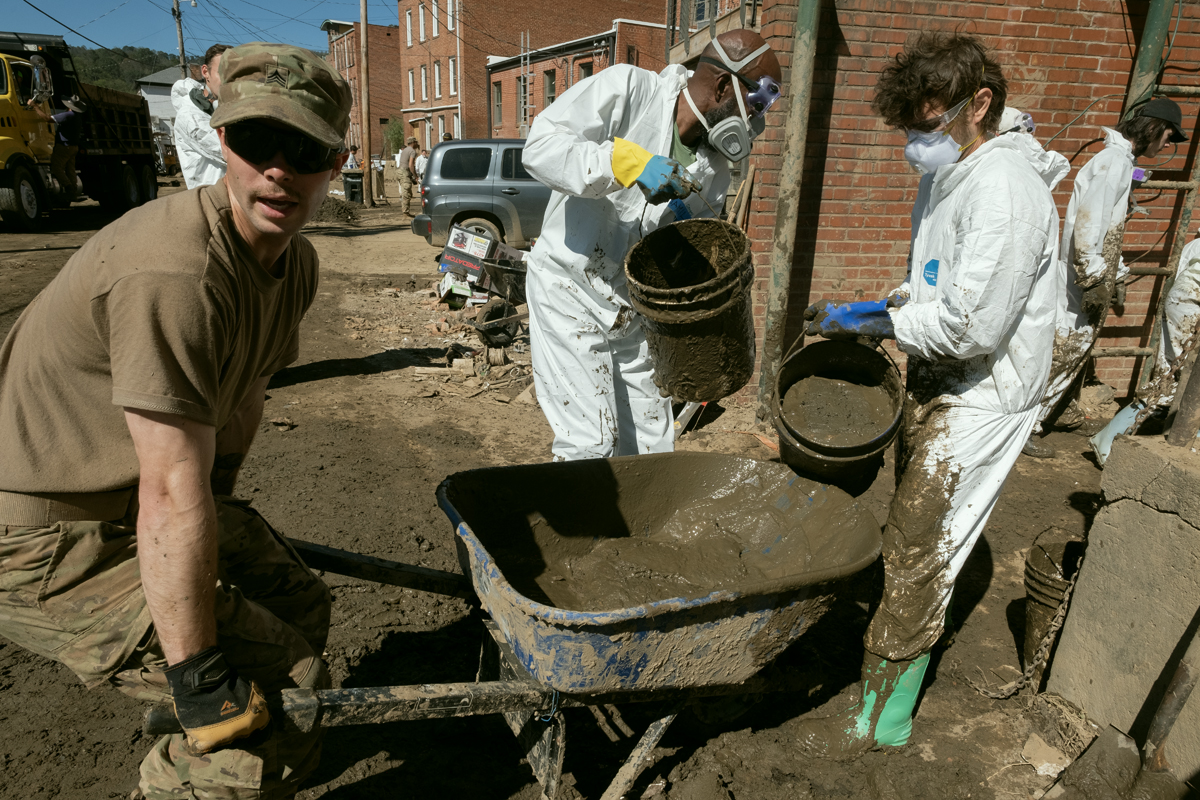
Staging ground has been set up at Nanostead on the Marshall bypass and it is immediately flooded with supplies, equipment, food, and volunteers. The volunteers are coming from all over and they are a diverse group — church groups, college students, elderly retirees, and county residents not impacted by Helene. They don Tyvek suits with boots, gloves and respirators as there are concerns about the toxicity of the mud. They’re shuttled into Marshall in the back of trucks, their gleaming white outfits blinding in the sunlight.
The town is a hub of activity. I’m reminded of stories about Marshall before the coming of I-40 and the bypass. Then, it was on the most direct route between Knoxville and Asheville. This small mountain town had three car dealerships, three grocery stores, two hardware stores, two florists (Sunnyside and Shadyside}, a library, the courthouse, countless attorneys, the jail, and restaurants and general stores.
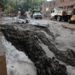
Now, the streets are crowded and dangerous with an abundance of heavy machinery — track hoes, front end loaders, bulldozers — all piling and loading a steady stream of dump trucks, some with mud, others with debris, and still others with remains of trees. Smaller tractors with scrape blades try to keep the mud at bay.
Inside the buildings the owners, along with friends and volunteers, push and bucket mud into the street. The concern now is mold. A series of warm sunny days heightens the fear. Piles of soggy, stinky, just plain nasty, insulation and sheetrock begin lining the street.
The mood is different today. The townspeople remain depressed and angry. But I also sense an adrenaline rush, a feeling of resilience and determination to rebuild. Perhaps it’s the volunteers, the added hands and young energy. Or the visible evidence of the recovery moving forward. Or how the town is working together.
Food stands are set up to feed the workers. Water. Washing stations.
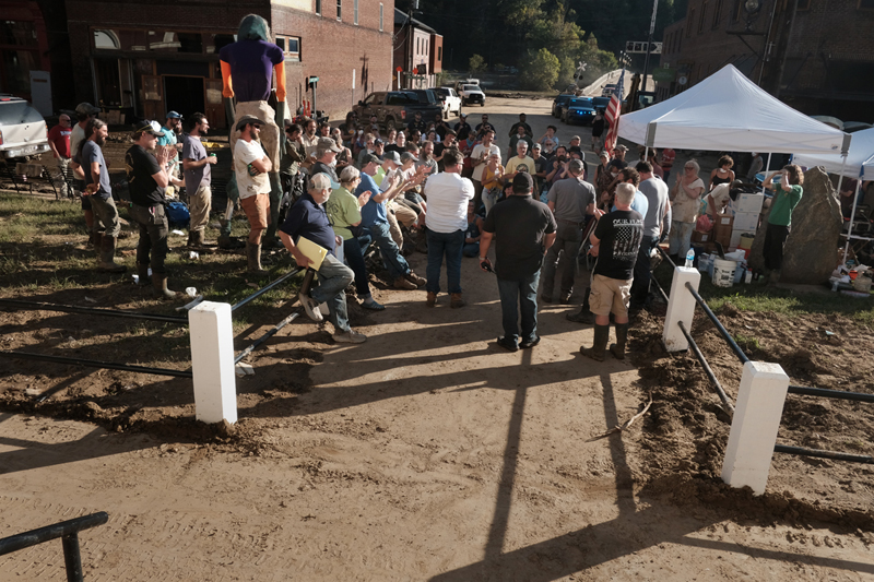
There is a town meeting every evening. An accounting of what was accomplished that day. How many truckloads of debris. The number of buildings mucked out. And also plans for the next day. Who needed what? What could be improved?
The town is shut down after the meeting. No power, no water, standing water throughout, massive and growing debris piles. Ghostly. Police patrol the streets at night. There has been looting.
Thursday, October 3
After the storm hit and the level of destruction to our region became evident my ex-Catholic guilt kicked in. I thought my book, Little Worlds, which speaks of a worldwide collapse, had somehow caused the flood. I could hear myself in confession — “Bless me father for I have sinned. I wrote a book that predicted an apocalypse and it came true. I’ve ruined a town and the lives of many people.” But, soon, I realized that, unlike the federal government of Marjorie Taylor Greene’s imagination, I could not control the weather.
But at the same time, both Leslie and I are experiencing survivors’ guilt; the knowledge that we faired well in the storm compared with friends who’ve lost everything. Yes, I lost a lot of books, income. seven years of sweat equity. But the books can be replaced. And a look around Marshall, helps me understand I’ve lost very little.
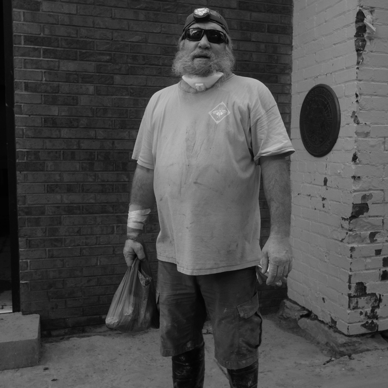
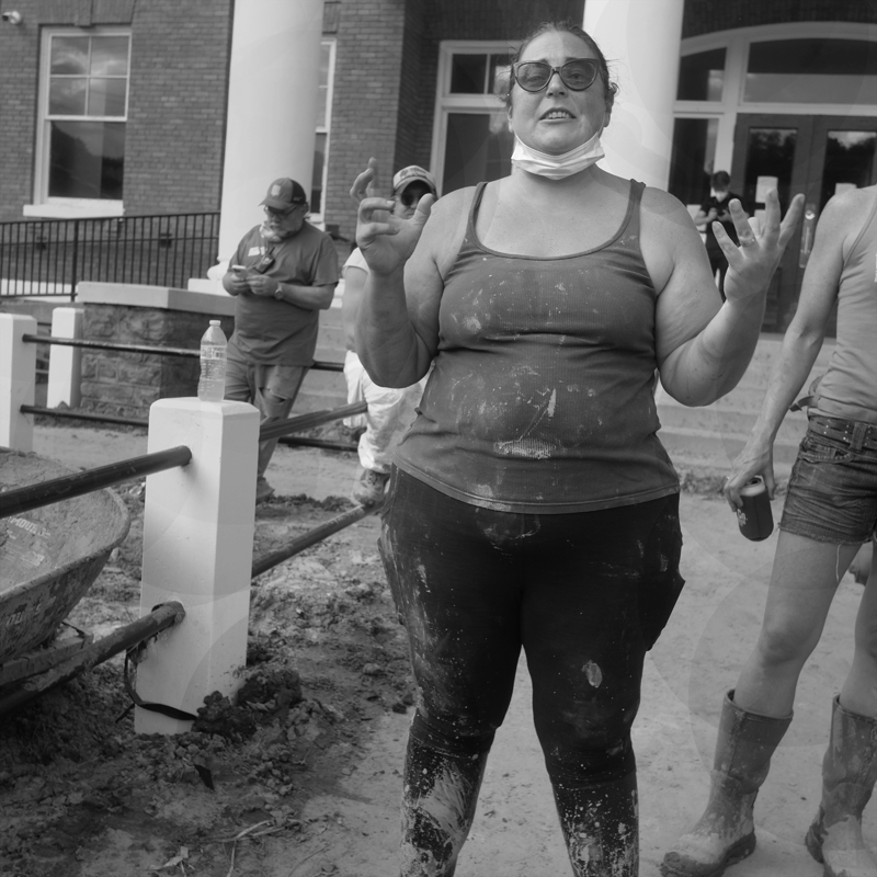
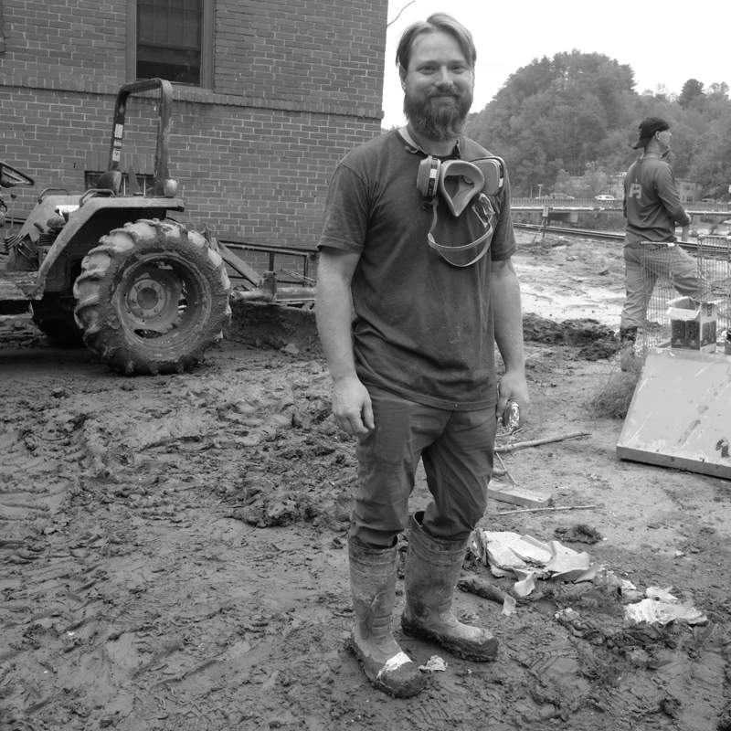
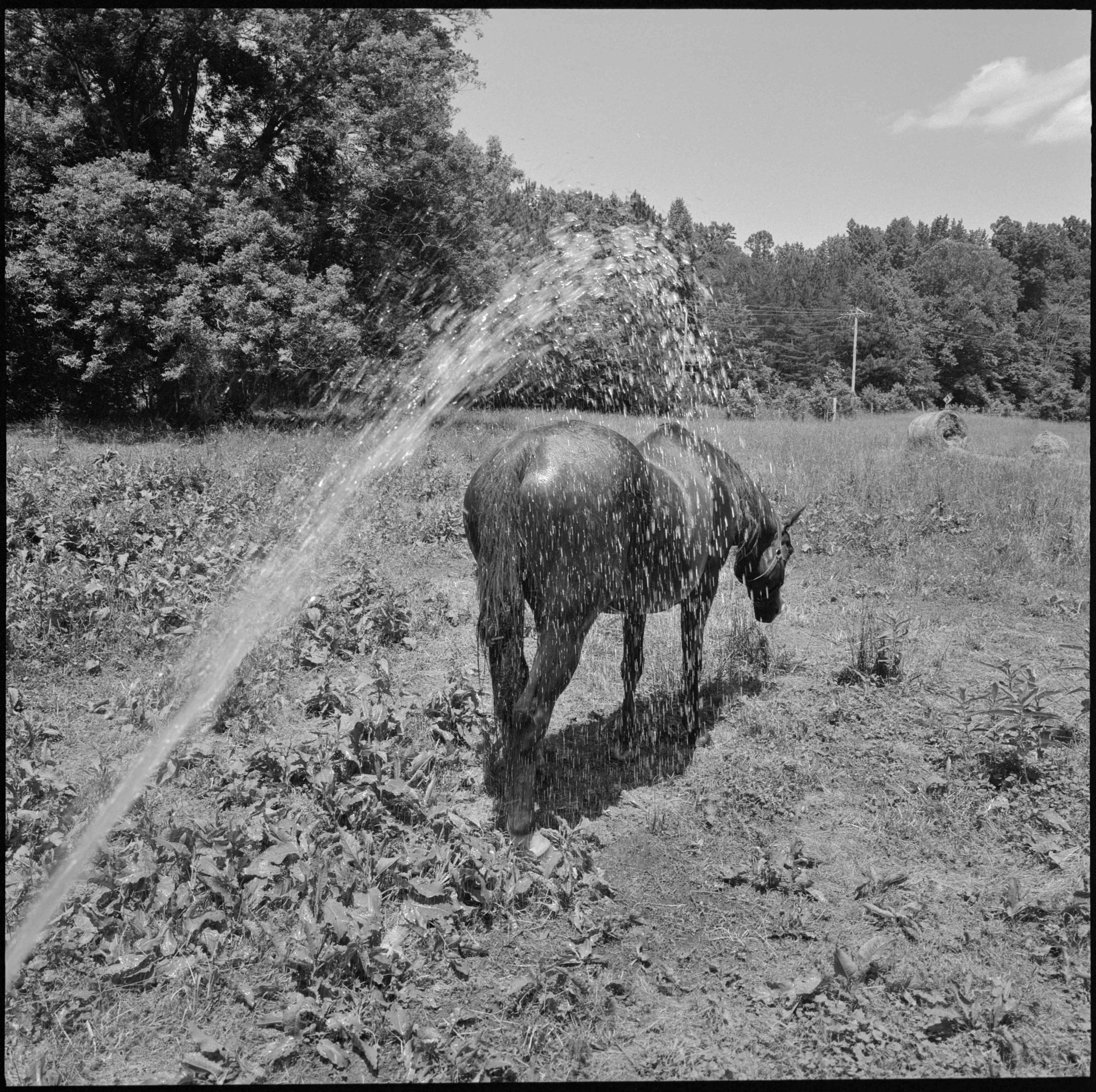
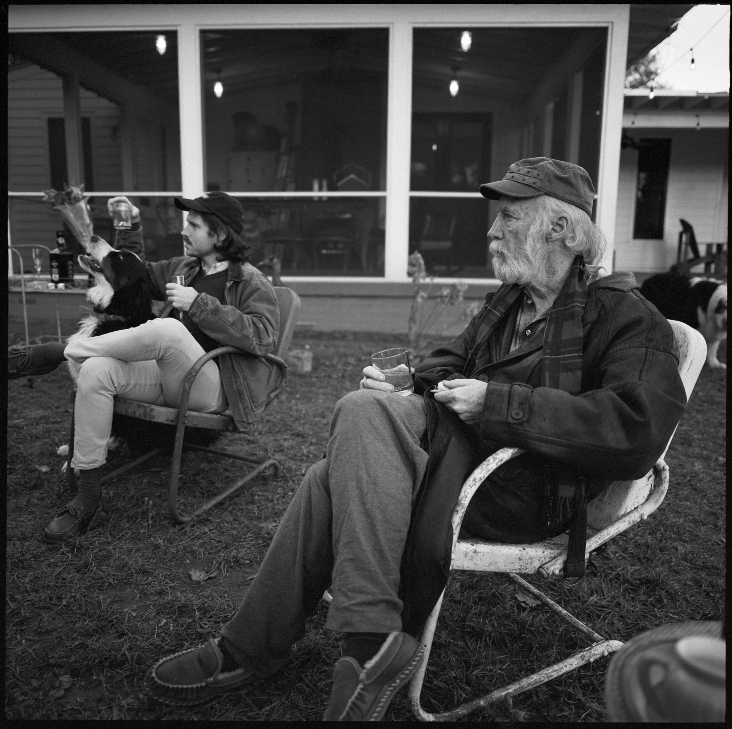
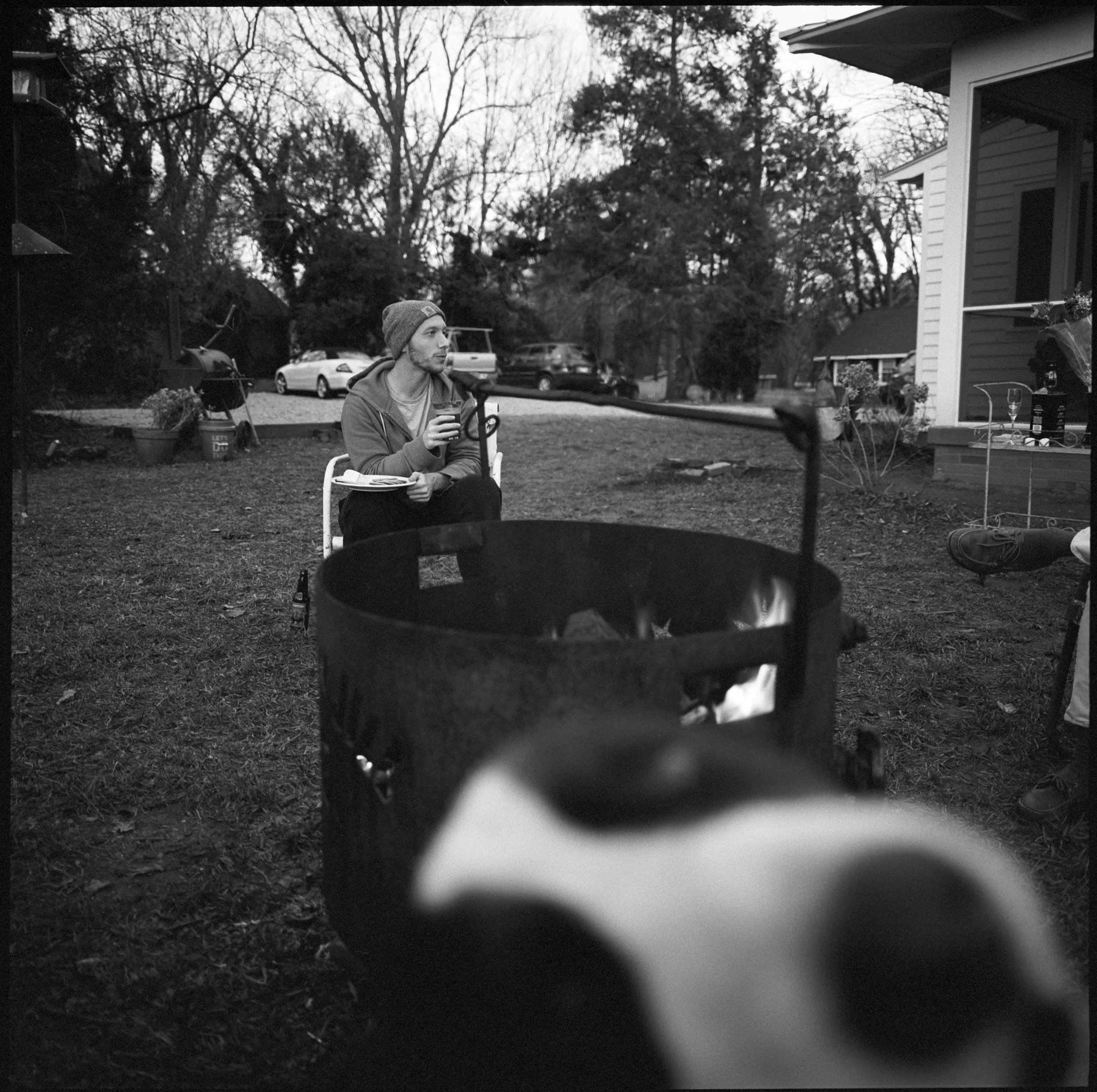
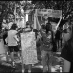
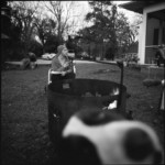
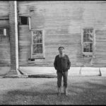
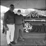
Shooting portraits today. Square format, b/w. Tight. Faces. Some objects. The black and white takes me back to my beginnings in photography and my belief that color can be so distracting. The monochrome heightens the emotions.
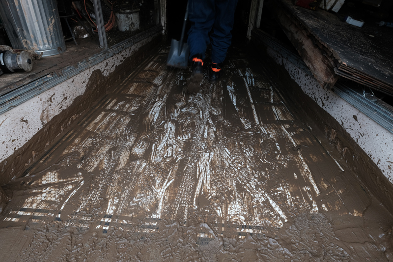
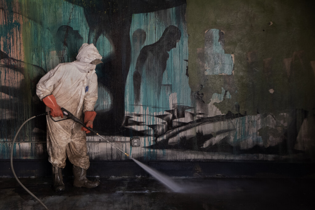
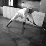
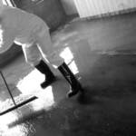
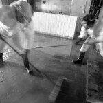
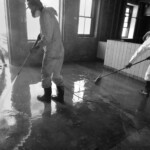
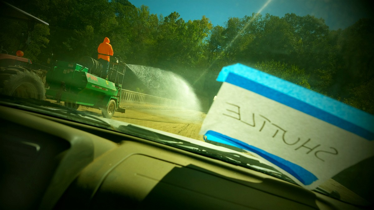
One of the real ironies of this catastrophe is water. The tremendous amount of water that flowed through town to cause this level of destruction. And now the tremendous amount of water being used to rid the town of what the flood left. Pressure washing — walls, floors, machinery, salvageable items.
As I walk through town, doorways seem to vomit debris. The piles of rubble, cinderblocks, and brick remind me of a walk with my son through the Valley of the Temples in Agrigento, Sicily. Some of the twenty-five hundred year old Greek temples had been meticulously restored to mimic their one-time magnificence. Others were mounds of crumbling limestone columns, left where nature had placed them. Both here and there, in Marshall and Sicily, I see fractured memories of what once was.
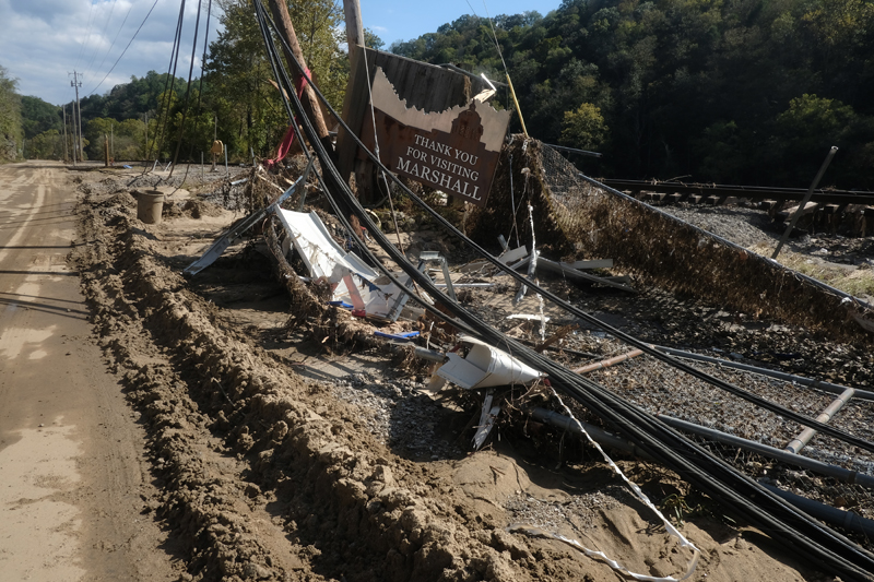
Cars looking like relics dug from a different era. A telephone pole perches over Main Street, hanging by the wires that it once supported.
At Penlands Store, Georgette and Susan and their families sort through mounds of water and mud-soaked pants, shirts, dresses, scarves, hats, belts, boots. Trying to lighten the mood of despair, I jokingly ask Georgette if she has a 42-long sport coat. She gives me the finger.
My books have been moved to the upper floor of the warehouse, in the dry and out of the way. I can see them for what they are, and are not. What they are is artifacts, remnants of the great flood of 2024. The covers are readable, clean. What they are not is useable. The pages are glued shut, only opened by tearing. There looks to be 350 of them.


Friday, October 4
The town is crawling with journalists, photographers, videographers, all looking for the defining image or story. Some are working with major publications or media outlets, others are rubber-necking, disaster tourists. All are afraid to get close, to engage, choosing to keep their distance with their long lenses and removed personalities.
Volunteers are here in earnest today, hundreds of them. Arriving to Nanostead, the staging area, and donning brilliant white Tyvek and boots, heavy gloves, masks and respirators. They’re driven by shuttle into town and turned loose. Students from all over, elderly people here with church groups from Oklahoma, California, and Louisiana with memories of Katrina. A soul food truck operated by a family from Florida who stay a week and then have to beat it back to Florida to help with Hurricane Milton. The best fried catfish I’ve ever eaten. Other trucks arrive in regular fashion, bringing food, water, chain saws, generators, more Tyvek.
Throughout the day I see people — hugging, holding hands, crying together, hugging some more. The look remains one of disbelief, confusion, anger, emotional exhaustion. Yet, people are here — together — mucking, hauling debris, ripping out sheetrock and insulation, helping each other. I see my friend Matt, a local building contractor, who sends a crew down to the Natural Foods store where they demo the sheetrock and insulation throughout the store in ninety minutes — a job that would’ve taken the owners days to finish.
Sunday, October 6
There are fewer people in town today and I don’t stay long.
Deb and Jerry Burns at Engine House Design are mucking and removing debris but already thinking about how to redesign the building.
Jamie at French Broad Exchange isn’t sure what he’s doing. The buildings’ owner is not helping with the clean-up and restocking will be a long, slow and expensive process. But he loves the town and being part of it.
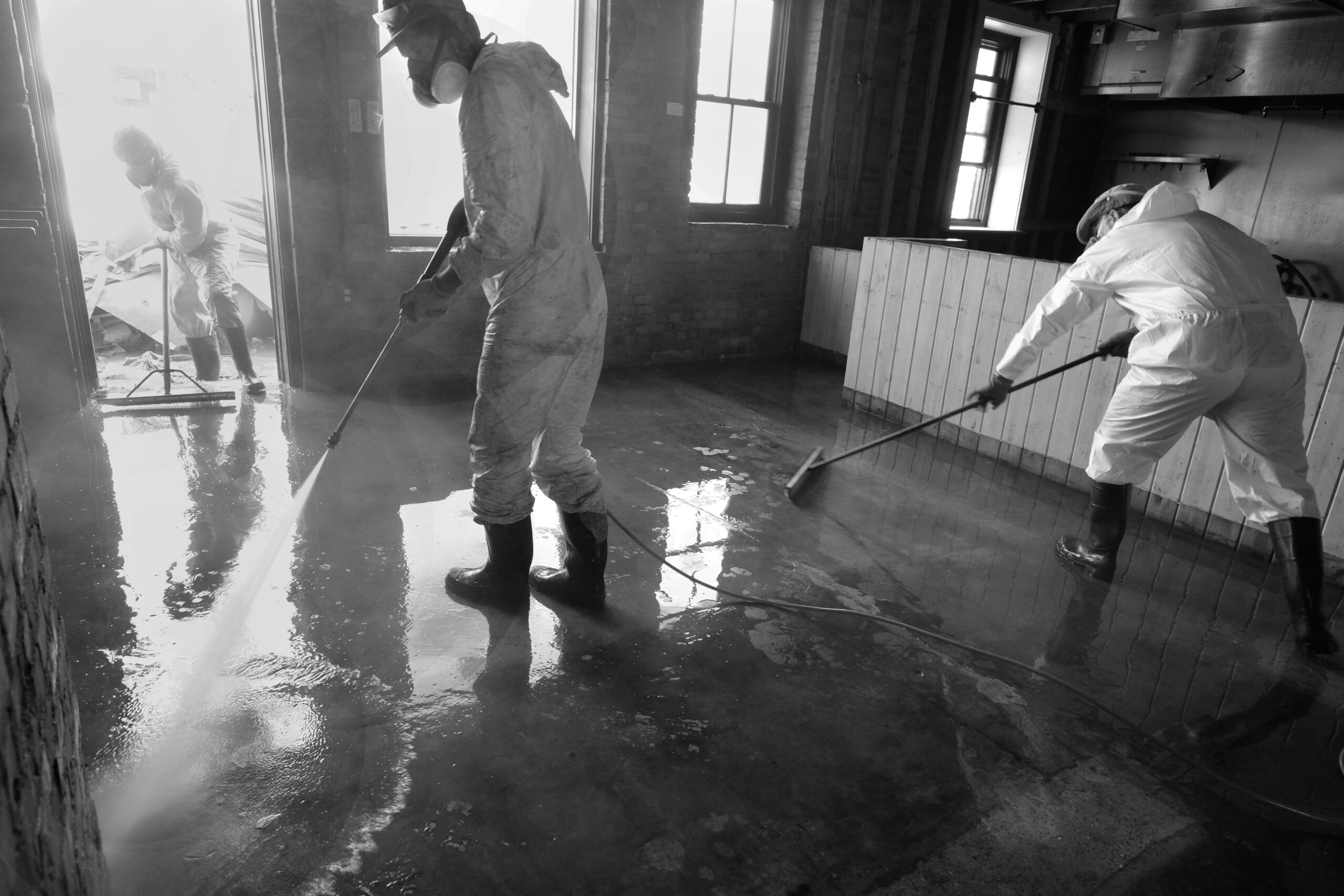
Josh has a small crew pressure washing the kitchen at the Old Marshall Jail. I’m mesmerized by their movement with hose and brush, like an elegant dance of light and space. And for a time I dance with them, moving, seeking the right spot, stopping time.


Tuesday, October 8
The town is humming with activity today. Food stations at Nanostead preparing for the noon rush. Downtown, mud remains the ever-present problem. Inside the buildings, pressure washing and sweeping the liquid muck into the street, where it will be piled, picked up, and hauled off. There is a sense about the mud that it will never go away, as if it’s been imprinted and will forever be a part of the town.
There are some buildings, farther along in their rebuild, that have fans set up in their open doorways, drying the building and clearing the air.
There are more volunteers, their gleaming white Tyvek soon to turn brown. They’re mostly young, many students, some from close by, others from far away. It’s heartening.
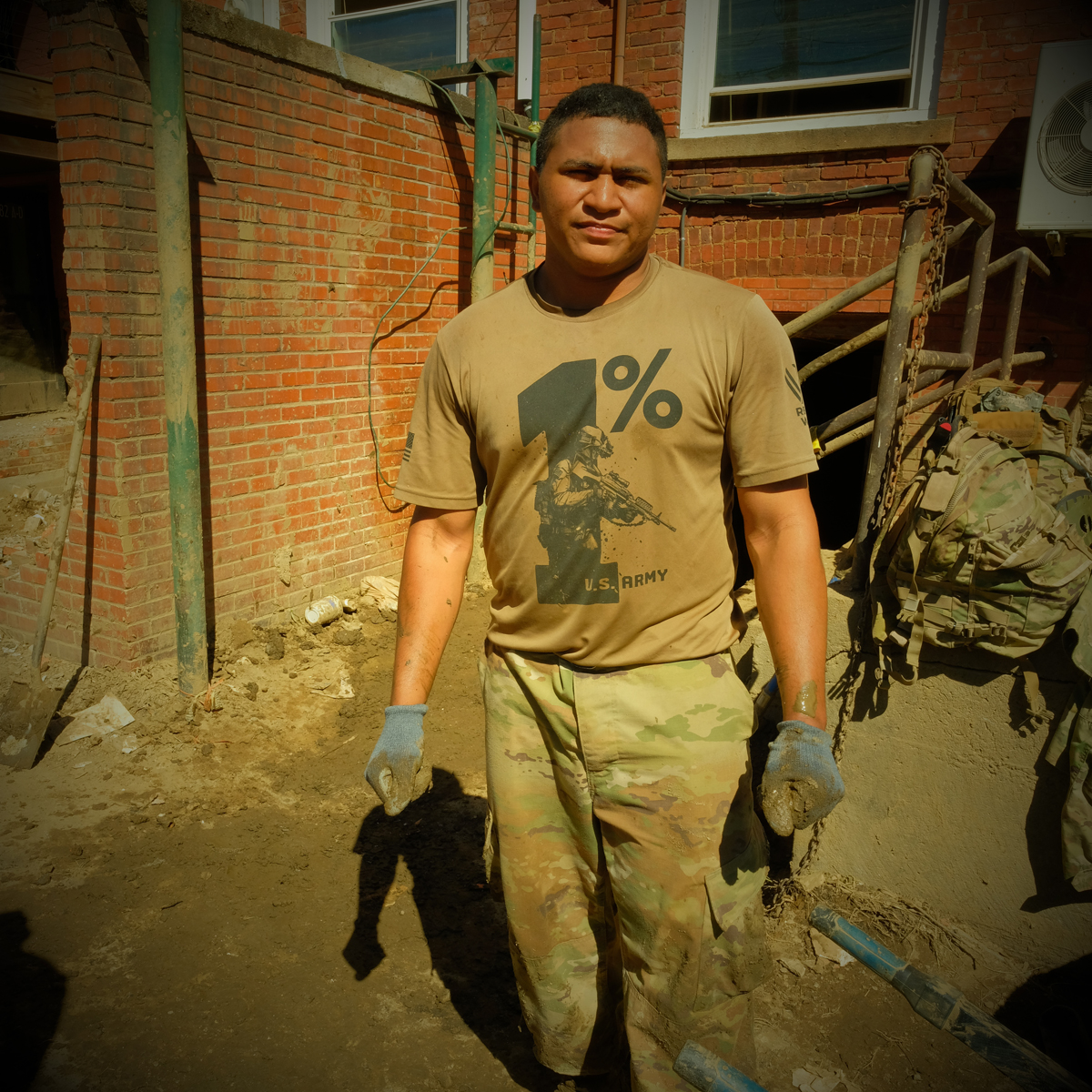
And the Army has arrived. Probably a couple of platoons of men and women from the 101st Airborne Division from Fort Campbell, Kentucky. They, too, are very young, some not long out of high school. Fit, with shoulders and arms meant for work.
I walk through town hunting artifacts. They’re everywhere. Still-life expressions of what once was.
Wednesday, October 9
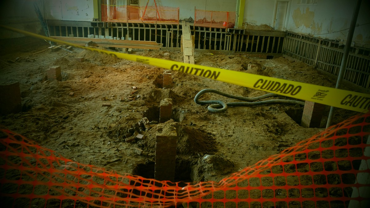
The Army seems to have found its purpose in the basements of downtown Marshall. In those tight, low-ceiling, airless dungeons, up to three feet of river mud has settled. In most cases the only access to the basements is through suspect steps and narrow doorways with no room for machinery.
I have a long history with the Army. My father was a veteran of World War II and both of my parents worked for the Department of the Army throughout their careers. I was an Army enthusiast and went to an all-boys, Catholic, military high school. I considered a career in the military as a potential life goal. I enrolled in advanced ROTC in college and was preparing to enter the Army as a second lieutenant upon graduation.
But change happens if you are open to it. I began reading a broader body of history and literature and hanging out with a more diverse group of people (teachers and students) who introduced me to new ideas and ways of seeing the world. A trip to Italy with my grandmother sealed my distaste for Catholicism and opened me to European opinions of America.
So, when the 101st Airborne marched into Marshall, I was prepared to be resistant at worst, mistrustful at best. But change happens.
At the Madison County Arts Council building, a crew of fifteen soldiers are gathered around the stairs and doorway to the basement. A group of six or eight of them, two mud buckets each, go into the dark, dank room and begin shoveling. The mud is thick, heavy with water, and stinks; a half a bucketful is almost too heavy to lift. At the doorway stands Lopez. He handles all the buckets, hauling them to the stairs, and handing them to two men above him who empty them into wheelbarrows. It is grueling, nasty work. They work in thirty-minute shifts, a fifteen-minute break, then back at it. It takes two days to clear the building.
There is a side of me that is in awe of these young men and women — their focus, work ethic, stamina, and their ability to find the best solution to a problem and then just doing the work. At the same time I know that when they signed up for the Army they didn’t really have a choice as to what work they did. And I much prefer they are in Marshall, rather than in some far away place shooting up the local population and countryside. The whole town is thankful they are here.
Friday, October 11
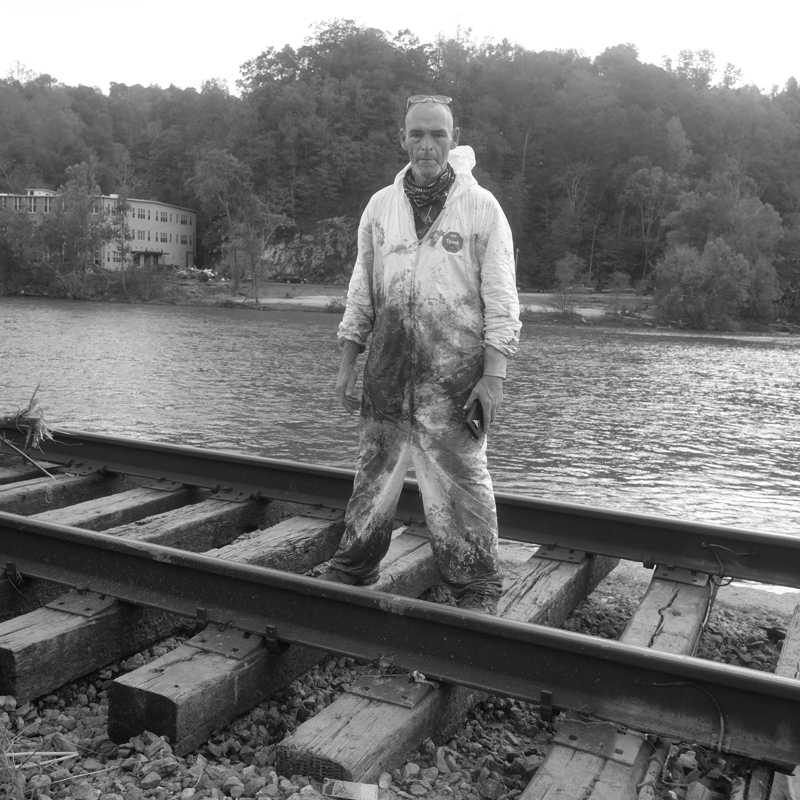
The river’s flow looks almost normal today. Nothing else about it is the same. New channels and sandbars. The river banks are stripped clean or a tangle of downed trees, miscellaneous debris, and a gelatinous mix of sand and mud. There’s a shipping container wrapped around one of the bridge pilings. Those trees that survived the flood are festooned with plastic sheeting and bundles of PVC pipe.
The Army and the volunteers are back at it, but roles have changed. The soldiers have been ordered out of the basements by their superiors for fear of mold and toxicity. They’ve been replaced by the young volunteers.
I wade into the warehouse to check on my books. They’ve been moved upstairs, safe and dry, and out of the way. Sealed shut and unreadable.
Saturday, October 12
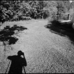
Al and I go back to the warehouse and gather the books into the back of my truck. We’re going to park them in our barn for some undetermined future use.
I make a photograph of the books in the truck that speaks to me of the totality of my loss. The image filled with mud-splattered books — black and white and brown. In the corner, looming, is my head and torso’s shadow, the books’ covers living in my body’s trace.
Tuesday, October 15
A late afternoon walk through town. Streets mostly empty of people, not the mud, which maintains a lessened but constant presence.
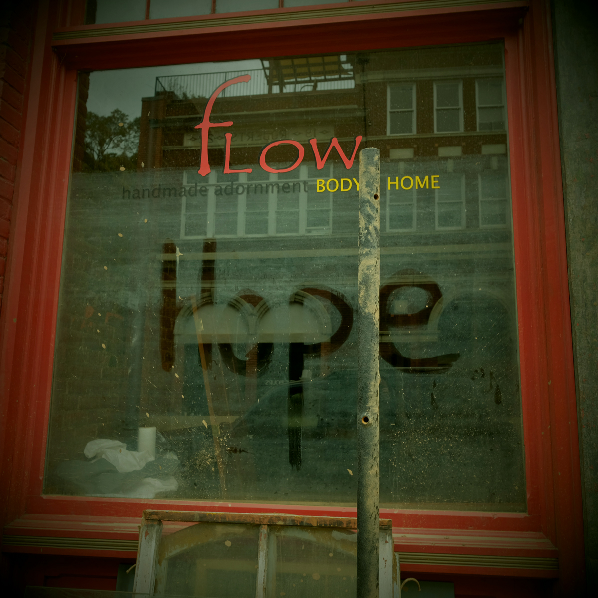
Years ago, when I lived in downtown Marshall, in converted warehouse space on the third floor of what is now the Flow building, the town emptied at 5 o’clock. Dave, the town custodian who doubled as Santa Claus in the Christmas parade, would begin his walk through town with pushcart, shovel and broom. And Marshall would shut down for the night.
This town closure, of course, is different. Involuntary. Streets passable but slick with mud, buildings open to the air, no power, the town not just shuttered for the night, but essentially dead.
But I do faintly hear music and follow it to the courtyard behind the old Rock Cafe. It’s a small gathering celebrating Deb Burn’s birthday. There’s a chocolate cake, and music, and people dancing around a portable heater.
Saturday and Sunday, October 19 & 20
It’s mostly quiet as I walk through town. There’s people, but not many. Thomas and Mark are washing and sweeping, getting ready to mitigate for mold. The Shadyside florist guy is stunned, everything that was inside his store is now piled high outside.
The relative lack of sound, the quiet of the place, offers the opportunity to see quietly, without the urgency of the cleanup dominating most images. There’s time to feel the light and taste the wind, hear the now muffled sound of the river. There’s beauty in the stillness of the destruction, life as the river has left it.
The roads are dusty now, the recurring mud dry from lack of rain. It’s been three weeks since the storm.

Monday, October 21
A quick visit with Georgette and Susan at Penlands Store. They’ve torn the flooring out of the building and I bring some home with me to maybe use in an art project.
Sunday, October 27
Town has become emotionally exhausting for me and I’ve been staying away more and more. The constant reminder of the loss of my books and the utter destruction of the town. Plus, the upcoming election has me and my friends on edge. We’re hopeful Harris will win but not without fear of a bad ending. We know Madison County will vote Republican.
Wednesday, October 30
I’m not quite sure how he’s done it but Josh is having ballad swap at the Jail tonight. Balladry has a long and storied tradition in Madison County and the county, especially the community of Sodom, is considered a rich source for acapella ballad singing. Since Josh Copus opened the Old Marshall Jail as a boutique hotel, restaurant and bar, he has been hosting a monthly ballad swap. Six to ten singers, some with multi-generational roots in the tradition, gather at the Jail to swap songs and stories.
It’s pretty much the first event in town since the flood a month ago and the symbolism is hard to miss — the community’s ancient tradition responding to the wrath of our most ancient river, the French Broad.
It's primitive at the Jail, no food, a portable tap serving free beer, limited seating, highly emotional. Everyone is glad to be among other people. Hopeful. Closes with “I’ll Fly Away.”
Saturday, November 2
Meet up with Jack Cecil from the Biltmore Estate and his wife and sister and do a walk around town. He is on the board of trustees for the Duke Endowment, which has donated millions to the rebuilding effort in the region and wants to do more. They’ve asked me to come to their monthly meeting and do a presentation about Marshall.
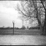
We walk over to the island for a look at the Marshall High Studios. The grounds — the walking trail, basketball court, swing sets, picnic tables, maybe a hundred trees — denuded and gone. Replaced with debris piles, mountains of trees, and a heavy layer of sand. Inside the building — like every other place in town — but bigger, more complicated, very expensive.
The dust. It’s dry. People beginning to worry about fires with all the downed trees, fuel.
Saturday, November 16
The mud is mostly gone, not entirely, but out of the majority of the buildings and off the streets. Debris and dead trees remain a work-in-progress with any one day better than the day before. Many places have been pressure washed and mitigated for mold, swept, and open to the dry air outside.
The town has been feeding on a shared energy to get to this visible progress and today is the expression of that bursting energy. Party is in the air. Not quite two months since the flood and Marshall is ready to cut loose, take a break from the doom and gloom, catch our collective breath and ready ourselves for the next, hardest push.
My friend Lois, a fellow artist and thirty-year resident of the county has decided to have her annual found art fashion show. Lois lost everything to the storm—her home and studio, and every trace of her seventy years of life and fifty years of art. Her response to the grief of losing the physical memory of her life—make more art.
I photographed Lois’s first fashion show at the Madison County Arts Council and many more since then. Funny, outrageous, creative, the shows take full advantage of the overwhelming number of artists in the community. This year is no different in that respect—a celebration of the power of art, and resilience. This year's theme — Tyvek.

Spring, 2025
I think about Helene a lot. Was this our “Get Right With God” moment? Retribution for past sins? Noah? Or was it a random, freak-of-nature storm that devastated the western third of our state. Was nature humbling us? Letting us know that while we consider ourselves safe from most of nature’s fury, it isn’t a sure thing. When I think about the frequency and intensity of these natural and manmade disasters in places like Paradise, California, Maui, Hawaii, Gaza, Ukraine, Los Angeles, it may simply have been our turn.
The adrenaline wore off months ago, about the time winter set in. It carried the town through the intensity of the cleanup — the mucking and striping and pressure washing and mitigating. There is still evidence of the recent destruction — lingering piles of debris, or trees, or mud — but Main Street is clean, drivable, and gives the appearance of nothing being amiss.
But peoples’ moods have darkened with the season; money to rebuild being the main concern. Insurance monies are slow to arrive and federal dollars that flowed quickly during the previous administration are being delayed or rejected by the current crowd in office.
People sit and wait and get frustrated.
Also there’s a shortage of sub-contractors with the entire region devastated. Plumbers, electricians, carpenters, laborers, heavy equipment operators, all hard to find.
Major questions about the rebuild of the town, which lost over a quarter of its buildings, and still lies in the floodplain, something that won’t change. And there is the very idea of the town itself — what is it, who is it for, how is it paid for?
Marshall has been reborn in recent years. What had been the economic, political, and cultural hub of the county for many decades had mostly died during the 1980s and 1990s with better access to the outside world and changing demographics. The 2000s brought new money, ideas, and energy to town and Marshall and the county emerged as a destination for art, cultural tourism, and outdoor adventure. The flood changed all of that.
Some people/businesses will leave. Some will stay. Of the original businesses in town, Penlands Store, Shadyside Florist, maybe Bowman’s Hardware, the VFW building, will stay. Every other business is new within the last twenty-five years and most of them are coming back.
I continue walking. Often through town looking for traces of improvement, or not. There are places in town where it looks like the flood happened yesterday, and others that are open for business. I went with Jim along a stretch of the railroad track near Redmon searching for debris and was not disappointed. Same in the woods and field next to Ronnie Meadow’s house.
There are gatherings in town. Mal’s bar has opened for music a few different times and there was a big Punk concert at the Arts Council. The venues are unfinished, almost primitive, without plumbing, but offering a place to come together. Everyone is hungry for it.
Summer, 2025
Was speaking with Pete the other day and we agreed that town felt different. And we couldn’t really say what that difference is. The physical changes are obvious, but beyond that, the emotional and attitudinal shifts areharder to identify. It seems the overall, never-ending need for money is dwarfing the strong sense of community that existed before the flood. And the uncertainty of what is coming next, knowing Marshall will be altered, possibly shattered beyond repair.
As I’m finishing this essay, I must acknowledge several of the catastrophes that have hit the nation since Helene devastated our region. Fires in Los Angeles and Maui, tornados in the Midwest and Plains, another flood in eastern North Carolina, and the unprecedented high-water disaster in Texas.
Storms are growing in frequency and intensity, with devastating effects on people, the natural world, and property. How to reverse course? How to rebuild? How will governments and insurance companies pay for ever-more-costly reconstructions? Our current national government seems intent on removing itself from the responsibilities of emergency management, leaving it up to the states who can’t afford the costs to clean up and rebuild.
Marshall and our neighboring town of Hot Springs are rebuilding, slowly. People are supportive. Music is regularly happening and a couple of restaurants are open. During the day the streets are busy with construction workers —carpenters, plumbers, electricians —putting the towns back together. There is no safe place. All of us are vulnerable; some people much more than others, but there is no hiding from the fact that we live in a deteriorating global environment. And as the scientists have predicted, it will only get worse. 
About the Author/Photographer
Rob Amberg has photographed and written about western North Carolina since moving there in 1973. Internationally published and exhibited, his photographs are represented in numerous public and private collections. Rob has received fellowships and awards from the National Endowment for the Humanities, the John Simon Guggenheim Foundation, The Center for Documentary Studies, and others. His books include Quartet: Four North Carolina Photographers (2007); The Living Tradition: North Carolina Potters Speak (2009); and his Madison County trilogy: Sodom Laurel Album (2002), The New Road: I-26 and the Footprints of Progress in Appalachia (2009), and Little Worlds (2024). Books and prints are available on his website: robamberg.com. Amberg lives in Madison County, North Carolina.
Donations for Marshall’s recovery can be made to:
The Madison County Arts Council
The Downtown Marshall Association
]]>
There are no truly universal feelings about the shared experience of Covid, but there is, I believe, a collective impression that we’ve all experienced a tangle of time, a displacement from the normal markers and seasons, a confronting of the inequities that accompany a pandemic, a fuller view of vulnerability and mortality. Amidst the diversity of ways we’ve managed the many interruptions and anxieties, the unknowing and the seeming to know, there’s shared understanding of a narrowing and shortening of our movements, maps, and itineraries. Through it all I’ve photographed. Sometimes in direct response to covid—with a sense that there’s something rare and exceptional about the moment—and at other times just doing what I always do.
I’ve come to understand that any photograph made during Covid is a ‘Covid photograph.’ To be sure, I recognize that some images made over the last couple of years are directly observing a response to Covid. Images of health care workers, vaccine researchers, shuttered businesses and empty offices, empty stands at athletic events, all of those and more are deeply identified with the pandemic. But so are all the other images, photographs made with full recognition of our altered routines and attitudes, the lightness and darkness that we observe having shifted. There is no way to separate the act of making pictures from a recognition of the injuries caused by the weather that surrounds. The Covid weather tightened our geography, led to a perspective that sees closer and perhaps with more intimacy, intended or not. Anytime we find ourselves looking at a singular sameness, we hope for deeper clarity and precision of sight. If there is hopefulness here, it is in the realization that there’s forever more to see in the most ordinary; another way to compose, to transform the world into an image, to confront the temporal luminance before us in an otherwise dimming day.
There is a recognizable evil tyranny in assuming that our worlds never fall apart, in taking the day-to-day for granted. We like to think we know better (“Here today, gone tomorrow,” and all that). Whatever we know doesn’t prevent us from the familiar condition that when at home the protagonist so often wishes to be away, and when away the deepest wish is often to be at home. Making pictures throughout Covid has been energized by an acceptance of a shrinking physical daily terrain, of being isolated in smaller places. My reply was to busy myself by affirming through images the fullness of wonders and contradictions close to home.
Photographers—and photographs—get all they have from embracing the darkness and light equally, shadows adjacent to highlights, contrast next to flatness, what is present alongside what has gone, low fertile valleys juxtaposed with the dry peaks. The opposites are coequal and mutually dependent, elemental to how we see. The last line from Psalms 139:12 is “the darkness and the light are both alike to you.” Alike, I argue, in that both arrive daily, and perpetually offer us a frontier to explore, render, and move to reveal, a time and place to take full visual advantage of the mystery and the uknown.


About the Author
Tom Rankin is Professor of the Practice of Art and Documentary Studies at Duke University where he directs the MFA in Experimental and Documentary Arts. For fifteen years he was director of the Center for Documentary Studies at Duke. His books include Sacred Space: Photographs from the Mississippi Delta (Jackson: University Press of Mississippi, 1993); Deaf Maggie Lee Sayre: Photographs of a River Life (Jackson: University Press of Mississippi, 1995); Local Heroes Changing America: Indivisible (New York: W.W. Norton & Co., 2000); One Place: Paul Kwilecki and Four Decades of Photographs from Decatur County, Georgia (Chapel Hill: University of North Carolina Press, 2013); and Goat Light (Durham, NC: Horse and Buggy Press, 2021) coauthored with Jill McCorkle. His photographs have been collected and published widely and included in numerous exhibitions. A frequent writer and lecturer on photography, culture, and the documentary tradition, he is the general editor of the Series on Documentary Arts and Culture with the University of North Carolina Press.
Public Health in the US and Global South is a collection of interdisciplinary, multimedia publications examining the relationship between public health and specific geographies—both real and imagined—in and across the US and Global South. These essays raise questions about the origin, replication, and entrenchment of health disparities; the ways that race and gender shape and are shaped by health policy; and the inseparable connection between health justice and health advocacy.
Beginning in 2022, the series expands to include 1000-word blog posts, as well as longer commentaries, essays, articles and media productions that address the public health and political implications of the COVID-19 pandemic from multiple viewpoints. The series editor for Public Health in the US and Global South is Mary E. Frederickson.
Introduction

In August 2015, the Collier Heights home of Herman J. Russell (1930–2014), African American construction and real estate executive, came on the Atlanta market for $675,000. The listing video characterizes Russell's home as a hub for both real estate transactions, political strategy sessions, and community barbecues.1After two price reductions, as of January 2016, the house was listed at $497,000. See Phil W. Hudson, "Herman J. Russell's home hits the market," Atlanta Business Chronicle, January 8, 2016, http://www.bizjournals.com/atlanta/news/2016/01/08/herman-j-russell-s-old-home-hits-the-market.html; Kimberly Turner,"House Envy: Andrew Young reminisces on Herman J. Russell's 1963 Home," Atlanta Magazine, January 20, 2016, http://www.atlantamagazine.com/homeandgarden/house-envy-andrew-young-reminisces-on-herman-j-russell-1963-home/. The founder of H.J. Russell & Co. was a key player in the city's racially-shifting midcentury real estate business and power structure. Collier Heights, originally a predominately white neighborhood in Atlanta’s southwest corner, would not have welcomed Russell when he founded his company at the height of Jim Crow restrictions in 1952. The 8,761-square-foot residence on 714 Shorter Terrace signals the hard work and commitment of businessmen and women, like Russell, who established residential and retail districts for Atlanta’s growing black middle class. In 2009, the National Register of Historic Places recognized Collier Heights as the first neighborhood developed, financed, designed, and constructed by African Americans for African American residents.2See Betsy Riley, "Collier Heights awarded Local Historic district status," Atlanta Magazine, May 16, 2013, http://www.atlantamagazine.com/civilrights/collier-heights-awarded-local-historic-district-status/; U.S. Department of the Interior, National Park Service, National Register of Historic Places Registration Form: Collier Heights Historic District Application, NPS Form 10-900,OMB No. 1024-0018, received by NPS May 15, 2009, http://www.nps.gov/nr/publications/sample_nominations/CollierHeightsHD.pdf.

As of 2016, Collier Heights is a neighborhood of approximately 1,700 single-family homes in 54 separate but interrelated subdivisions on over one thousand acres. Fleeing urban displacement, impoverished schools, and rampant segregation, African American residents moved to Collier Heights en masse between 1952 and the late 1960’s, redefining the area’s color line and populating a neighborhood important in the civil rights movement. Former residents include Martin Luther King Sr., Christine King Farris, and Ralph David and Juanita Abernathy.
Lydia Harris: Photographer's Statement

In 2010, I began taking portraits of homeowners in front of their Collier Heights houses using my 4x5 large format camera. After spending two years meeting with residents and making images of facades, I began conducting oral history interviews and taking photos inside neighborhood homes. These sessions became the 2015 book and photo exhibition, "The View of Collier Heights," staged in the Auburn Avenue Research Library Auxillary Gallery at Atlanta’s Hammonds House Museum.
For this Southern Spaces photo essay, I include "Facades," photos of the homeowners ("Faces"), along with several interiors ("Recreation Rooms" and "A Seat at the Counter") of Collier Heights homes. During Jim Crow, when owning a home was a civil rights victory unto itself, neighborhood residents made full use of their hard-won residences. These photographs suggest how facades and recreation rooms (with furniture, home design, objects, and décor) expressed one style of African American domestic life in midcentury Atlanta.
Facades

The home of Mr. Alfred and Dorothy Knox in the Royal Oaks Manor subdivision of Collier Heights, October 14, 2012. "This was a kind of remote area of the city when we first moved here," Knox, a businessman explains. "We were displaced by urban renewal. And although I kind of objected to being displaced, because I had a business there, and I had great plans for improvement in the community, south of the city here, but we lost all and moved here. And we are very glad that we moved here. Very pleasantly surprised to have such good neighbors." Knox, interview by author, May 13, 2013.

The home of Mr. Roger Mathews located in the Valhacha subdivision of Collier Heights, November 9, 2011.

The home of Mr. Charles and Dr. Lois Moreland in the Royal Oaks Manor subdivision of Collier Heights, October 12, 2013. The Morelands moved into their home in December of 1961.

The home of Dr. William B. Shropshire III and Dr. Marian Shropshire on Waterford Road in the Woodlawn Heights area of Collier Heights, November 14, 2011.

The home of native Atlantan Dr. Harvey B. Smith, who lives next door to the Shropshires, January 9, 2013. Smith was one of the original land buyers in the Woodlawn Heights Development Company, which built and developed significant portions of Collier Heights. He came to this neighborhood because there was a "great need for housing for people within my group, and there were few places you could find to go." Smith, interview by author, January 11, 2013.


The home of Alma and Albert Hayward in the Woodlawn Heights subdivision of Collier Heights. Top, under construction in 1962, and bottom, May 17, 2015. Historic image courtesy of the Haywards.
Recreation Rooms
Of the thirty-nine homes that existed in Royal Oaks Manor (a Collier Heights subdivision) in 1969, twenty-two included recreation rooms intended for "seated luncheons, dances, parties, receptions, fashion shows, games, relaxation, and television."3A considerable percentage of space was dedicated to leisure time, unlike the small houses in the original Collier Heights subdivisions that were built for middle class Americans. See Annie S. Barnes, The Black Middle Class Family: A Study of Black Subsociety, Neighborhood, and Home in Interaction (Lima, Ohio: Wyndham Hall Press, 1985), 74. Henry Herbert Bankston, a government worker and resident of Collier Heights, remembers, "I think about our getting together like we once did and it was basically because we did entertain in our basement. Or in our recreation area, that's what we called it. And that's where we had our parties, that’s where we had dances, and all, and meetings, in our basements. See, we can come in here and entertain in this living room, but that recreation room downstairs is where we came and had our little dances, where we had our club meetings, and so forth and so on. Most of these homes around here are equipped that way."4Henry Herbert Bankston, interview by author, April 12, 2012.


A Seat at the Counter


Faces

Alfred and Dorothy Knox, October 14, 2012.

Charles and Dr. Lois Moreland, October 12, 2013.

Dr. William B. Shropshire III and Dr. Marian Shropshire, November 14, 2011.

Dr. Harvey B. Smith, January 9, 2013.

Alma and Albert Hayward, May 17, 2015.

Constance Pruitt and her son John, April 6, 2012.

E. Gayle Barnett, January 10, 2013.
Brick by Brick
As Lorainne Hansberry writes in 1959’s A Raisin in the Sun, "we have decided to move into our house because my father—my father—he earned it for us brick by brick."5Lorraine Hansberry, A Raisin in the Sun (New York: Vintage Books, 1994), 148. For residents whose homes were built—brick-by-brick—by fellow African Americans, from conception to financing to development and construction, Collier Heights represents more than a hallmark of change. The neighborhood became a sanctuary where black Atlantans claimed a space of their own. As I return to the image of the Herman J. Russell home that begins this essay, my eye follows a stone path to the front door. As neighborhoods like Collier Heights experience new demographic shifts and historic homes go on the market, may we remember those who opened doors and paved the way.
About the Artist
Working in photography, video, and installation, Lydia A. Harris's art tackles situations of inequality and power dynamics. Her solo shows have included exhibitions at the Photographic Resource Center in Boston, the Hammonds House Museum/Auburn Avenue Research Library Auxiliary Gallery in Atlanta, and the Firehouse Center for the Arts in Newburyport, Massachusetts. Group shows have included exhibitions at the Fort Point Art Center, the Essex Art Center, the Griffin Center for Photography, the Museum of Fine Art Boston, The Light Factory’s 4th Juried Annuale in Charlotte, North Carolina, and the University of Maine Museum of Art Photo National 2011 where she received the director’s purchase award for "Hendrie." For more information, please visit the artist's website.
]]>Neither Eden nor Wasteland
Ninety miles south of Florida lies the island that PBS's Nature calls the "Accidental Eden."1"Cuba: Accidental Eden," Nature, PBS (September 26, 2010), http://www.pbs.org/wnet/nature/episodes/cuba-the-accidental-eden/introduction/5728/. According to the show's website: "While many islands in the Caribbean have poisoned or paved over their ecological riches on land and in the sea in pursuit of a growing tourist industry, Cuba's wild landscapes have remained virtually untouched." Ironically, the photograph the PBS program chose to use on its opening page shows a site that is far from a "natural" area devoid of human intervention. Rather it is a valley called Viñales that is filled with small farms.
 |
| Charles D. Thompson, Jr., Viñales valley horse cart heading back to town, Viñales, Cuba, 2011. |
Just a three hour drive from Havana, Viñales is a popular tourist destination for foreigners who want to experience the Cuban countryside. Although it is a protected "natural" area, it is the valley's human landscape—thousands of small, working farms—that make the region uniquely picturesque. In 1976, Cuba deemed the Viñales Valley a national park while allowing the farmers to remain and tend the land as their ancestors had for centuries. In 1998, UNESCO named Viñales a World Heritage site.2"World Heritage List," UNESCO, accessed March 15, 2012, http://whc.unesco.org/en/list/840. Some residents in Viñales are benefiting from tourist dollars by offering casa particulares or by working in restaurants, hotels, as musicians, etc. Most of the area's small farmers are not benefiting from tourist dollars, but that does not mean they can't.
Viñales is known for its forested hills called mogotes, its caves, and its family-run farms, most of them growing tobacco, beans, rice, corn, and other crops, and many plowed by oxen. While this Cuban valley may be a paradise of sorts, humans here are much more than spectators. Viñales farms are no accidental Edens. They display the results of generations of sacrifice and invention, of work with machete and plow. Idyllic portrayals of the natural beauty of Cuba often ignore people and their agency, relegating farmers to insignificance and citizens to passivity. People help shape the scenery, and their innovations help them manage their environments.
 |
| Charles D. Thompson, Jr., Farmer cultivates young tobacco in a field, near Viñales, Pinar del Rio, Cuba, 2011. |
Even as some groups have praised the Cuban environment—accidental and otherwise—the US government has shunned the island nation. Many Americans know only a simplistic narrative of Cuba as a communist wasteland, a nation of people lacking agency and hope for any change in the absence of outside intervention. The most strident opponents of a renewed relationship with Cuba, such as Senator Robert Menendez (D-NJ), have sought to further limit the possibilities for engagement. Menendez strongly supported the 1992 Cuban Democracy (Torricelli) Act and the 1996 Helms-Burton Act, which codified divisions between the nations and tightened the grip of the US economic embargo in an effort to force political change. Menendez, like many Cuban-Americans of his generation, opposes lifting the US ban on travel to Cuba because he believes exchange would provide additional funding to the "Castro regime," doing nothing to promote political and economic change. In July 2010 Menendez took the Senate floor to oppose an easing of travel restrictions, remarking that more opportunities for US citizens to go to Cuba "will not make conditions for the Cuban people any better or change the history of brutality of the Castro regime—a brutality that continues to this day."3 "Menendez Remarks on the Senate Floor Against Lifting of Cuba Travel Restrictions," Robert Mendendez, July 16, 2010, http://www.menendez.senate.gov/newsroom/press/menendez-remarks-on-the-senate-floor-against-lifting-of-cuba-travel-restrictions.
Views like Menendez's reflect an inconsistency in US foreign policy when it comes to our closest Caribbean neighbor. The United States is willing to cultivate relationships with countries with human rights conditions that the State Department deems similarly flawed to Cuba's in the interest of exchanging ideas and advancing trade.4Bureau of Democracy, Human Rights, and Labor, "2010 Country Reports on Human Rights Practices," US Department of State, accessed December 16, 2011, http://www.state.gov/j/drl/rls/hrrpt/2010/index.htm. Rather than cutting off contact, the United States maintains relationships while attempting to promote progress toward civil and human rights. If the goal is to advance the rights of Cuban citizens, an open line of communication is essential. If US policy is founded on a notion that Cuba has nothing to teach, it is profoundly near-sighted. The United States, and particularly agricultural areas of the US South, shares with Cuba the challenge of sustainably growing food and fiber without despoiling water and soils, and harming the people doing the work. These challenges transcend national borders.
 |
| Charles D. Thompson, Jr., Russian Belarus tractor from the Soviet period, Trinidad, Cuba, 2010. |
Between the fanciful extremes of Eden and evil empire lies a third way: understanding Cuba as a potential interlocutor regarding sustainable agriculture. New voices call for dialogue between US and Cuban citizens engaged in a burgeoning organic farm and garden movement in both countries. Dialogue between Cuban agriculturalists and their counterparts in the United States can further collective knowledge and improve environmental conditions.
To understand sustainable agricultural initiatives in Cuba and to envision future exchanges, I organized a research team and obtained an academic visa for travel in December 2010 and January 2011. With help from US and Canadian organizations, we arranged visits to experimental sites and meetings with some of Cuba's foremost agricultural innovators. Most memorably, during our two week trip we got to know some farmers and gardeners. I came back to the United States convinced that those of us working on building a sustainable and just agricultural economy must be engaged with what is happening in Cuba.
Learning from the Past, Enduring the Present
Following the Cuban Revolution (1953–1959), the Soviet Union's (USSR) agricultural imperatives drove the island toward state-run farms, marginalizing many family run operations. The breakup of the USSR in 1990 spelled the end of Soviet agricultural influence but intensified Cuban food shortages. Cuba began to look within for solutions, finding indigenous knowledge and encouraging local innovation. Exaggerated praise for developments in the country's sustainable agriculture belies the reality that Cuba is no utopia. Popular descriptions often oversimplify the narrative of Cuba's sustainable agriculture. For example, the website of the Durham, North Carolina, non-profit NEEM (Natural Environment Ecological Management) features a narrative sketch that labels the rise of organic garden collectives in Cuban cities "the urban agriculture miracle."5"Neem in Cuba," NEEM, accessed December 11, 2011, http://neemtree.org/projects/organic-cuba/. Others have suggested that we can expect "an ecological agriculture" in Cuba's future.6Thompson, Jr., Charles D. "Epilogue: The Unique Pathway of Cuban Development," in Sustainable Agriculture and Resistance (Oakland, CA: Food First Books, 2002), 280.
 |
| Charles D. Thompson, Jr., Fallow, newly plowed, and re-growing sugarcane fields, east of Trinidad, Cuba, 2010. |
In much sustainable agriculture praise of Cuba, we do not hear that the country (like the United States) has confinement hog and chicken houses, that major US food conglomerates are already selling vast quantities of grain and other products there, or that the embargo on trade with Cuba does not apply to US agribusiness. We are not told that thousands work in small farming because they have no other option.
 |
| Charles D. Thompson, Jr., Early morning in Viñales, a sign depicting a common form of farm transport along with one of thousands of US vehicles from the 1950s still on the road, thanks to Cuban ingenuity, Viñales, Cuba, January 2011. |
Agricultural work is popular in Cuba, in part, because state-supported income is drying up for hundreds of thousands of wage earners and there is often nowhere else to turn but to small-scale farms and gardens. Yet much of Cuba's former sugarcane land, once a volatile but powerful economic life-force, is idle and in poor condition. Even with its admirable innovations in sustainable and organic farming, Cuba's domestic agricultural producers cannot meet the food needs of the island's population; there is a real sense of food insecurity. Looking for food (in dollar stores, on the black market, legally), is a major pre-occupation for much of the population. Cuba imports at least 80 percent of its food, with much of it coming from its largest trading partners—China and Venezuela. This is hardly a sustainable scenario, and while there does not appear to be starvation in Cuba, food shortages remain a problem, even as the government's meager food rationing is fading.7 For background, see: Anita Snow, Associated Press, "Living on Cuban Food Ration isn't Easy," Washington Post, July 2, 2007, http://www.washingtonpost.com/wp-dyn/content/article/2007/07/02/AR2007070201103.html. Also, see footnote 11. However, household food insecurity is also on the rise in the United States today. According to the US Department of Agriculture at least 14.5% of US households were food insecure at some time during the year in 2010, up from 11% in 2005.8USDA, "Household Food Security 2010," accessed March 12, 2012, http://www.ers.usda.gov/topics/food-nutrition-assistance/food-security-in-the-us/readings.aspx#.UZJLhaKce5I.
Most Cubans lack housing options and do not have money for home repairs. They crowd onto public transportation that, on a good day, can take them twenty miles. To supplement their incomes, many people rent rooms in their homes, sell black market cigars in Havana or offer services to tourists on the street—ranging from help finding the "best" nearby restaurant to sexual favors. Nearly all Cubans are underemployed, even though most are better educated and receive better healthcare than many of their Caribbean neighbors. Many Cubans receive help from relatives living abroad, including in the United States.
 |
| Charles D. Thompson, Jr., A lettuce grower in Trinidad looks at a milk rationing line where families must show ration cards to obtain their daily quota, Trinidad, Cuba, December 2010. |
With Cuba developing closer ties to the US agriculture industry, increasing its trade with China, and, with Venezuela's help, poised to explore oil fields off its northern coast, we cannot assume that the island nation will adopt a model of ecological sustainability.9Victoria Burnett, "U.S. is Urged to Plan to Aid Cuba in Case of an Oil Spill," New York Times, September 9, 2011, accessed December 11, 2011, http://www.nytimes.com/2011/09/09/world/americas/09cuba.html. Resistance to the onslaught of ecologically destructive development that looms on Cuba's horizon will come through cooperation and exchange, not isolation.
What we do know about Cuba's agricultural innovations is that domestic shortages brought on by the end of Soviet subsidies and the US embargo forced the Cuban government to seek alternative solutions. This entailed ceding some degree of power to its innovative citizen farmers and gardeners who have, in turn, helped create an alternative to industrial agriculture through the formation of organic garden cooperatives known as "organopónicos," local distribution channels, information exchanges, and the like.10Fernando Funes, "The Organic Farming Movement in Cuba," in Sustainable Agriculture and Resistance (Oakland, CA: Food First Books, 2002), 7. Urban dwellers, many of them university trained, some of them scientists, have joined cooperative gardens in the cities. Working toward sustainability, Cuba's rural farmers have received new freedoms to produce for more open markets. Such policy changes, along with newly revamped farms and numerous urban gardens, have contributed to a much-needed increase in the country's food supply since the early 1990s.11Lucy Martín, "Transforming the Cuban Countryside: Property, Markets, and Technological Change," in Sustainable Agriculture and Resistance (Oakland, CA: Food First Books, 2002), 65. While overall food production in Cuba in 2010 was lower than in 2005, the organic movement coupled with local sales and farmers' pocketing some of the profit, is one area of progress.12Marc Frank, "Cuban food output down despite agriculture reforms," Reuters, August 3, 2010, accessed December 20, 2011, http://www.reuters.com/article/2010/08/03/us-cuba-food-idUSTRE6724QW20100803.
Opportunities for a Sustainable Future
 |
| Charles D. Thompson, Jr., A small vegetable patch in Pinar del Rio, Cuba, January 2011. |
The first stop on our trip was Vívero Alamar, one of the best known organopónicos in Havana, founded by Miguel Salcines Lopez, who also serves as the elected president. He graciously spent a morning with us, beginning by talking about Cuba's history of agriculture. "Cuba's first farmers were slaves," Miguel said, and because of this past as well as Cuba's history of development, people did not want to enter agriculture. Cubans filled the cities, and the countryside soon depended on sugar exports alone. At its height, over 5 million acres were planted in sugarcane, and 160 different refineries dotted the landscape.13Miguel Salcines Lopez, interview by the author, December 2010. This system created a dependency on one export crop and established a precedent for importing everything else. "The whole diet was based on imported food," Miguel said.
When the USSR collapsed and ceased buying sugar at inflated prices—over five times the going international rate—and the United States continued its embargo (called a blockade by Cubans) on agricultural and other inputs, Cuba urgently explored ways to produce its own food. "The blockade was beneficial in one way for Cuba," added Miguel, "otherwise the talent would have left."
Because of a lack of chemical fertilizers, pesticides, and machinery, the island nation turned to organic fertilization and pest control, all run by trained scientists, such as Miguel. "If we hadn't gone organic, we'd have starved!" The goals were to avoid eating imports and to become self-sufficient in food. We met scores of people, young and old, engaged in harvest. We met a scientist named Marisol, who was conducting a lab experiment involving beneficial insects. We found her bent over a microscope in a small shed in the middle of the fields, her child playing nearby. We saw acres and acres of picture-perfect organic vegetables.
 |
| Charles D. Thompson, Jr., Farmers near Trinidad planting watercress for later sale in town, Trinidad, Cuba, December 2010. |
Miguel characterized the impressive system they have built as a "biological machine" with everything self-contained. One hundred and eighty-one workers are employed by the garden. We were impressed by the organipónico's sense of organization, its members' dedication to having a biologically cyclical operation with no outside inputs, and most of all by the cooperative's amazing production of healthy vegetables. Miguel claimed they are producing two hundred tons per acre off the plots, and we could see that production was at full-bore in December 2010. The diversity and the extent of crop production result from the number of hands that have carefully infused life into the plots. These gardens stand in sharp contrast to fields worked by machines on commercial farms, and unlike the land on monocultural, industrial farms, which declines in quality, the soil at the organopónico becomes richer with time and layers of vermiculture compost. Miguel and his colleagues are feeding over five thousand weekly, and lines of people form outside the gates daily to purchase the results of their work. "There is much to do," he said. "The market is waiting."


There is a long list of people waiting to join the garden project at Vívero Alamar, both for the nutritional benefits and the income. We learned that while the minimum monthly salary in Cuba is around 250 Cuban pesos (approximately 25 Cuban pesos to the American dollar), the minimum brought in by members of the organopónico is 350, with as much as 700 for a number of leaders. While markets function differently in the United States, similar models should be profitable here. Agriculture researchers are looking for ways to reverse the losses of family farms in the US South by locating organic, sustainable markets. The Center for Environmental Farming Systems (CEFS) in Raleigh, North Carolina, is one of the best examples of a US organization using sustainable agriculture to create jobs and further social justice in economically depressed areas.14Center for Environmental Farming Studies, accessed March 15, 2012, http://www.cefs.ncsu.edu/. There is a growing market emphasizing "locavorism," with restaurants, cookbooks, and blogs supporting and promoting local foodways. Considering the parallels in their work, it would seem mutually beneficial for groups such as CEFS and Vívero Alamar to cultivate a relationship of exchange.
 |
| Charles D. Thompson, Jr., Community plot with 10 members named "Organoponico Manaca Iznaga," Trinidad, Cuba, 2010. |
The day after leaving the organopónico we met with Dr. Fernando Funes, internationally recognized leader of the sustainable agriculture movement in Cuba. His son, also Fernando, who increasingly has stepped into his father's leadership role, told us, "My father was a farmer, and I thought he was backward." Young Fernando changed his mind as he witnessed commercial agriculture using tremendous amounts of fertilizers and other imports and began to realize that local farming knowledge was of critical importance. Following the collapse of the Soviet Union, during what came to be called the "Special Period," Cuba was unable to feed its people. This stark situation prompted frantic searches for innovative approaches and an eventual change to biological-intensive—as opposed to chemical-intensive—means of production. The government opened over three hundred agricultural research stations.15Fernando Funes, interview by the author, December 2010.
Where urban agriculture had been prohibited previously because of the danger of chemical exposure, Fernando explained, after the policy change the number of gardens immediately shot up to over two hundred. Some 375,000 people joined the ranks of rooftop and vacant lot gardeners. "They were producing something to eat," Fernando said. The government supplied the land and opened channels of distribution. In the first year any new group of gardeners could secure the right to cultivate approximately thirty-three acres and, with success, this could double the next year, and triple in three years to a hundred acres.
Dr. Funes published Sustainable Agriculture and Resistance: Transforming Food Production in Cuba with food activist Dr. Peter Rosset (formerly with the US organization Food First), and is widely known as an international ambassador for Cuba's sustainable agriculture. Funes' organization, the Asociación Cubana de Agricultura Orgánica (ACAO), received the Right Livelihood Award in 1999. His affability and intelligence drew us in, and we left believing that new leaders and groups would continue to learn from his example.16Funes, Fernando, Luis García, Martin Bourque, Nilda Pérez, Peter Rosset, eds. Sustainable Agriculture and Resistance (Oakland, CA: Food First Books, 2002).
 |
| Charles D. Thompson, Jr., Humberto Ríos Labrada looks over a farm research plot, Pinar del Rio, Cuba, December 2010. |
The following day we spent with Dr. Humberto Ríos Labrada, of the Cuban National Institute of Agricultural Sciences, and the recipient of the Goldman Prize in 2010 for his community-based research with Cuban farmers. We accompanied Humberto to talk with the "guajiros" (the nickname for people from the Cuban countryside) with whom he works daily. As we drove the four-lane road to Pinar del Rio, Humberto told us his organization works with a network of 55,000 farmers in seed sharing and farm-based research. Charged initially with increasing squash production in Cuba, Humberto began holding meetings with farmers who showed up to participate in an effort to find new seed varieties and improve their yields. Humberto recognized the need to turn the traditional extension model upside down. Instead of the scientists being the "experts", Humberto realized that the farmers themselves cultivated the necessary knowledge and crop diversity. The participation of farmers expanded exponentially, starting with a few hundred and increasing by the thousands. The opportunity to learn from the success of such grassroots organizing campaigns among farmers is another compelling reason for exchange across the Florida Straights.
 with their only son Royber and Maria's brother, a neighboring farmer, pictured on the patio at their farm. Pinar del Rio, Cuba, January 2011.") |
| Charles D. Thompson, Jr., Maria and Augostín (in hat) with their only son Royber and Maria's brother, a neighboring farmer, pictured on the patio at their farm, Pinar del Rio, Cuba, January 2011. |
At midday we arrived at the farm of Maria Valido, Agustín Pimental, and their son Royber in Pinar del Rio, near Viñales. Royber, completing his degree in agronomy at the local university, was conducting experiments on the family farm, including one plot with seventy three different varieties of beans. This family and thousands of others like them began alternative agriculture in 2002 with Humberto Ríos's encouragement. Suddenly farmers were sharing their knowledge and seed varieties together in meetings of campesinos. The family was eager to tell us about their operation, how they came to some of their innovations (Royber's father had built a methane digester), and how their seeds performed.
 |
| Charles D. Thompson, Jr., Farmhouse fitted with solar collector provided by a grant from the French government, Viñales Valley, Cuba, January 2011. |
"Farmers listen with their eyes," said Agustín. By seeing results on other farms, they could duplicate and improve their own work. On this little piece of land, our research team found hope and innovation, and some of the friendliest smiles and open, informed attitudes we had experienced in Latin America. We left glowing, having consumed farm-raised food and taken in a large helping of farm entrepreneurship that included not only experiments with plant breeding and food preservation, but also solar and methane energy production. We took away a feeling that true exchange had taken place, and that we were the primary beneficiaries.
 |
| Charles D. Thompson, Jr., Osiris Cueto weighs produce for her customer at the Mercado Agropecuario Beleu, Old Havana, Cuba, December 2010. |
If farmers could reach tourists and sell food directly as in the urban casas particulares where we stayed, people would pay handsomely to eat farm-raised food on a farm in place of the typical tourist fare. Humberto had explained that marketing ideas are as important as technical innovations. Miguel Salcines's ideas for distribution are why many are flocking to join. The Vívero Alamar group has reached thousands of consumers because of the cooperative's marketing, which includes an attractive farm stand with a cane press where people can buy fresh sugarcane juice as they buy their produce. Necessity is the driving force, but marketing keeps income rolling in for the members. Agritourism has already developed in parts of the US South. Autumn drivers along the Blue Ridge Parkway can see apple orchards filled with tourists picking fruit. Likewise, a chance to try one's hand at a plow powered by a pair of oxen, for example, might intrigue adventurous tourists in Cuba. Agritourism, of course, is no simple or straightforward solution, as historic experience with tourism and agritourism shows. If farmers and local communities are not in control, tourism could create greater inequalities and exacerbate food insecurity. Therefore any emphasis on tourism has to take into account who owns and controls the local food system.
 |
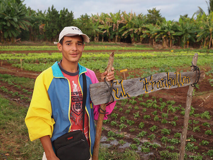
| Charles D. Thompson, Jr., Tomás Pérez Ricardo, a recent graduate in agronomy, sells produce he raises on his own plot in downtown Trinidad, Cuba, January, 2010. |
The next morning was Christmas day and we visited a small alley market named Agropecuario Beleu in Havana. We met Osiris Cueto, a buyer/seller who manages a small stall. She taught us how the Cuban agricultural authorities broker the sales of vegetables and fruits. Each seller registers with a market officer, charges a fixed price, and takes a percentage of the profit for the day, paying some of the return to the government. From Osiris we learned why growers would surely welcome the chance to sell directly to consumers. A policy change in December 2011 was supposed to permit just that.17Jeff Franks, "Cuba to let farmers sell directly to tourist sector," Reuters, November 21, 2011, accessed December 15, 2011, http://www.reuters.com/article/2011/11/21/uk-cuba-reform-agriculture-idUSLNE7AK03G20111121.

That afternoon we left on a bus for Trinidad, another UNESCO world heritage site on the south coast. Lacking prior introductions did not seem to matter. The first day, I met Tomás Pérez Ricardo and his uncle on the street corner, selling produce from their small semi-rural organopónico named "Framboyan." Tomás, like the farmers we had met in Pinar del Rio, was gracious, proud of his work, and eager to share both produce and ideas. After visiting his house and farm the next day, I was impressed by how promising this young man believed his garden work to be and how open he was to sharing its message. Riding a horse-drawn cart to town and living in a modest cinderblock house, Tomás had no designs on getting rich, but he saw the possibilities for raising a family on vegetable sales. This sense of hope from agriculture has been a rarity in the developing world. For years, hope for economic prosperity has also eluded many small farmers in the US South. With the growing market for local and sustainably-produced food, the rural United States is beginning to benefit from employment associated with sustainable agriculture. And in Cuba, with only 20% of the market supplied by local production, there is plenty of room for more newcomers like Tomás.
 |
| Charles D. Thompson, Jr., Pedro Rodriguez Pérez harvests cabbage as his grandson looks on, Trinidad, Cuba, 2010. |
The next day we drove past thousands of acres of fallow sugarcane fields on our way to yet another UNESCO world heritage site, the Valley of the Ingenios (sugarcane mills) and specifically to the Manaca Iznaga estate. A tower, constructed for overseeing slaves in the fields nearly two centuries earlier, still looms over the old plantation. In the nearby garden of Organopónico Primero de Mayo, I could see the tower, as the ancestors of former slaves worked at a site of cooperation and member ownership. I imagined how non-profits working with former sharecropping families in the Mississippi Delta and Appalachia could find this model relevant.
The garden at Primero de Mayo grows eight kinds of vegetables with seeds supplied by the state. Ten members share the proceeds of the produce sold in the streets. The vice-president of the cooperative garden, Pedro Rodriguez Pérez, explained that while the government supplied the land and seeds, the more the members sell, the more they make. The cooperative pays a percentage back to the government, but there is incentive in reaching more customers. The model is not yet generating enough income to allow farm families to have economic autonomy from state subsidies (the same is true of US farmers). Even so, I appreciated watching a grandfather and grandson working side-by-side on land over which they had some say. The tradition of acquiring agricultural knowledge via parent or grandparent remains alive in Cuba in a way that it does not in most parts of the United States. This is largely because of efforts by organizations of small farmers between the Revolution and the Special Period.18Funes, "The Organic Farming Movement in Cuba," 5.
 |
| Charles D. Thompson, Jr., Tobacco farmer with his chickens and turkeys, Viñales, Cuba, January 2011. |
After spending the next night in Havana, we set out for Viñales. We had seen the edge of the region before, but had not quite reached the valley and round hills that appear in so many photographs, the actual location designated as the world heritage site. Our most important goal there was to meet farmers and, based on our previous experiences, we trusted we would find people willing to talk.
We met an energetic young farmer named Noél Parrapito our first day there. For two days he took us through the Viñales Valley where we met ten other farmers, sampled their tobacco, ate their produce and home-raised chicken, and learned about their animal husbandry—from their close work with oxen to their horseback riding skills and horse carts. Those skills, juxtaposed with solar technology, water purification, and a generally high literacy rate, spoke of something more than harkening back to yesteryear. Time-after-time when we explained that we were from the United States, our acquaintances replied with both warmth and surprise: warmth because of an association with so many family members and former neighbors who now live there; and surprise because no one from the United States had ever visited them before.
I found myself thinking at those times how lucky we were to be there—to be the first Americans to go there—knowing how much damage tourism as mentioned on the PBS Nature program had done in other places. I felt sadness as well, knowing how much the indigenous knowledge that these farmers possess was all but inaccessible to thousands of young people in the United States. This feeling was particularly acute because the farmers we met struck me as keenly interested in exchanging knowledge and ideas.
 |
| Charles D. Thompson, Jr., Vívero Alamar, a cooperative farmer, feeds the oxen after a morning's work, Havana, Cuba, December 2010. |
With Noél, with whom we shared several meals and lots of conversation while on horseback, we talked about "agritourism." How many people would pay to live on his farm, learn to work with oxen, and cultivate rice, corn, and the huge variety of animals and vegetables he produces? He perked up at the idea and wanted me to repeat the word the next day. He was a patient teacher, showing us every insect, plant, cave, and soil type we passed in the Valley.
 |
| Charles D. Thompson, Jr., Casava grown and shown by farmer Noél Parrapito, Viñales, Cuba, January 2011. |
Could farmers begin to rent their homes to visitors, a program already allowed by the government in urban areas? Could visitors work on the cooperative garden projects with innovators like Miguel Salcines and learn biological farming techniques? Could agritourism fit with the Viñales Valley model? And if it works in Cuba, what are the opportunities for us in the US South to learn through exchange? Too often in the United States, the people who are trying to combine sustainable agriculture and tourism were not raised in these traditions. There are obvious differences between the aesthetics of their fields and those of experienced farmers with years of inherited wisdom. The Cuban farmers we met take great pride in the appearance of their plots, and for tourists appearance is a significant selling point. In both countries, the larger the profits generated by sustainable farms, the stronger the case for more alternatives to industrial agriculture.
 |
| Charles D. Thompson, Jr., The view Tomás Pérez Ricardo, age 25, and his wife wake to each morning, Trinidad, Cuba, December 2010. |
On the last day of our research trip, shortly after New Year's Day, we took the public bus to Humberto's farm and heard his band play songs about seed sharing and agriculture. He and his band use their music, as shown on the Goldman Prize website, for outreach and education.19Goldman Environmental Prize, "Humberto Ríos Labrada," Goldman Environmental Prize: Islands & Island Nations 2010, accessed March 15, 2012, http://www.goldmanprize.org/2010/islands
Conclusion: A Call for Exchange
 |
| Charles D. Thompson, Jr., Royber Pimental Valido shows here some home bottled mango concentrate grown and processed on the farm, Pinar del Rio, Cuba, January 2011. |
Individuals and small groups can begin to heal historic wounds between two countries—through common experiences, work, and dialogue. I came back to the United States enriched beyond measure, not by internalizing the policies of agriculture over the last century or even what might make an organopónico movement run better, but by human exchanges and in-person meetings.
We should invent ways to enable visitors who are prepared to listen and learn to go to Cuba, as well as ways to bring farmers and technicians from Cuba to work in the US South. The dialogue of resistance to imperialism in Cuba can help inform the politics of the US sustainable agriculture movement. And with political and economic changes imminent in Cuba, there are lessons to be learned from US organizations confronting corporate agriculture. It would be tragic if loosened commercial restrictions in Cuba resulted in planting an agribusiness model there that we are desperately trying to get away from in our own country. As Fernando Funes put it, the inclusion of small farmers through redistribution of resources "makes them critical actors in the new reconfigured economy."20Fernando Funes, interview by the author, December 2010. Cuban people, particularly rural people, are the true wealth of the island. Most are literate, savvy about change, and have developed opinions about workable solutions. The potential for exchange between Cuba and the US South offers a collective possibility for agricultural sustainability, an exchange that must overcome boundaries between nations.
Acknowledgments
The authors gratefully acknowledge the contribution of researcher Hope Shand to this essay.
About the Authors
A native son of Franklin County, Virginia, author and filmmaker Charles D. Thompson, Jr. is the curriculum and education director at the Center for Documentary Studies and a lecturer in cultural anthropology at Duke University. His latest book, Spirits of Just Men: Mountaineers, Liquor Bosses, and Lawmen in the Moonshine Capital of the World, was published on the University of Illinois Press in 2011.
Originally from Athens, Georgia, Alexander Stephens is an associate director at the Marian Cheek Jackson Center for Saving and Making History. He completed a semester of study in Havana, Cuba, before graduating with a degree in Latin American Studies from the University of North Carolina at Chapel Hill.
]]>Palomares Bajo: Photo Essay
 |  |  |
| John Howard, Field (left), Home (center), Strata (right), Palomares, Spain, April 2011. | ||
Twenty years after the American annihilation of Hiroshima and Nagasaki, Japan, the United States Air Force dropped nuclear bombs on Spain. By accident. In early 1966, at the height of the Cold War, a B-52—en route from the Goldsboro, North Carolina, base to the edge of the Iron Curtain and back—collided with its refuelling plane, high above the Andalucían coastline, killing seven. As the aircraft disintegrated, four hydrogen bombs fell from the sky, with conventional explosives in two detonating near the town of Palomares (population: 2000).1Of multiple secondary sources in English and Spanish, my account relies foremost upon John Megara, "Dropping Nuclear Bombs on Spain: The Palomares Accident of 1966 and the U.S. Airborne Alert," M.A. thesis (Tallahassee: Florida State University, 2006), at http://digitool.fcla.edu/R/P4A11844II6LDYG2HM72I5MXHNULX1C1YDE3D6RJ5DVFCNB5LR-00243?func=dbin-jump-full&object_id=124140&local_base=GEN01&pds_handle=GUEST (accessed 16 January 2011) and Rafael Méndez, "Palomares contamination detected outside the expropriated and fenced areas," El País, 1 July 2007 (my translation), at http://elpais.com/diario/2007/07/01/sociedad/1183240801_850215.html (accessed 16 January 2011). Since 2010, the El País website has offered daily English translations of selected articles, which are retained for a week or more, but are not archived online.
Attempting to allay concerns, American Ambassador Angier Duke, the North Carolina tobacco heir, took a dip in the Mediterranean with Generalissimo Franco's Tourism Minister, cameras rolling. Meanwhile, officials dickered over the extent of the catastrophe. As feared, plutonium had been scattered in the mishap, and a wide arc of farms, homes, hills, and waterways was severely contaminated. Accepting limited liability, the US military led a limited cleanup. Soon, tons of radioactive Almerían topsoil would be comingled with South Carolina subsoil, as barrels of earth were shipped away and buried at the Savannah River Plant.2Palomares Scrapbook, Angier Biddle Duke Papers, Rare Book, Manuscript, and Special Collections Library, Duke University, Durham, NC.
This photo essay interrogates the devious discourses and reluctant rhetorics of what Time magazine belatedly called one of the world's twelve "worst nuclear disasters"—what others have called the worst nuclear weapons disaster in history. It is sparked by new reports showing continuing elevated levels of radioactivity in and around Palomares and with Wiki-leaked cables suggesting the US government may renege on future obligations. Combining contemporary images from Spain with a critique of key English-language primary and secondary sources, "Palomares Bajo" examines the southern European/American connections and traumas resulting from the incident. Acknowledging a vibrant Spanish tradition of protest and debate, rekindled through the years around anniversary observances, this essay solicits links to various stakeholders, cultural producers, and local residents, in anticipation of the fiftieth anniversary in 2016.3Recently updated to incorporate Fukushima, Japan, the online Time photo essay originated on 25 March 2009. See "The Worst Nuclear Disasters," at http://content.time.com/time/photogallery/0,29307,1887705_1862260,00.html (accessed 13 May 2011). Reprinted by El País, 11 December 2010, the two Wiki-leaked diplomatic cables are "Spain and U.S. Cooperating to Remediate Radiation Contamination from 1966 Nuclear Accident," 7 November 2006, at http://elpais.com/elpais/2010/12/11/actualidad/1292059036_850215.html (accessed 12 February 2011) and "Interagency Decision Needed on Palomares Response to GOS [Government of Spain]," 30 April 2009, at http://elpais.com/m/elpais/2010/12/11/actualidad/1292059036_850215.html (accessed 12 February 2011). Activist and historian Luisa Isabel Álvarez de Toledo, 21st Duchess of Medina Sidonia, helped lead early demonstrations, including a first anniversary protest. The erroneously dubbed "Red Duchess"—she identified as socialist, not communist—was jailed by the Franco regime for her efforts. Her memoir and the edited volume in which much of it is published should be considered an indispensable source, though as yet available only in Spanish. Eduardo Subirats, ed., La Era de Palomares (Barcelona: El Viejo Topo, 2010).
 |  |  |
| John Howard, Sheep and goats, Palomares (left), Unsold, Lower Palomares (center), Tractored and cultivated, Palomares (right), Spain, March and May 2011. | ||
As with Richard Misrach photographs of secret Navy bombing ranges in Nevada, my project is more than an exercise in outrage at military duplicity. It is, as Eric Sandeen describes Misrach's work, an attempt "to situate American vision, to anchor American memory, in the ruins of modernity." Such "ruins" extend well beyond US borders to homelands and imperial outposts where communities must continue to live with the mistakes, misjudgements, and moral failings of nuclear belligerents—differently perceived depending upon the angle of vision, the varied nationalist agendas and histories.4Eric J. Sandeen, "Souvenirs from the Landscapes of Modernity: Richard Misrach, Camilo Vergara, and the Visual Politics of Ruin," in Pictorial Cultures and Political Iconographies: Approaches, Perspectives, Case Studies from Europe and America, edited by Udo J. Hebel and Christoph Wagner (Berlin: DeGruyter, 2011), 316.
Through my own camera lens, with its particular framings and emphases, I view a region offering new resonances to age-old adages. Accidents do happen. (A crooked crosswalk caution sign, its own guard rails bent and broken, suggests worse fates still, the failures of precaution.) People push at limits. (A hole in a fence marks a trespass or a liberation, a shortcut or a grave danger.) Of course, some fenced borders are more ominous than others, some accidents virtually irreparable.
My photographic challenge is to counteract an American cultural amnesia around an event with which nearly all Spaniards are familiar, to contribute to a movement for redress that is perhaps best mobilized through multilateral engagement. Barring electron microscopy, cameras may have limited utility in the search for the elusive truth of nuclear contamination and its "acceptable levels." Indeed, as this essay argues, photography was cynically deployed in 1966 to redirect the public gaze, from land to sea, to avert eyes from the atrocity. Thus, my present-day focus on human, animal, and plant life in Palomares seeks to occasion reflection on physiological and psychological traumas that have waxed and waned over time in a persistent climate of uncertainty. It further seeks to goad. For as Walter Benjamin warns, mere reflection and rumination can turn misery, even the struggle against it, into an object of consumption and comfortable contemplation; they can turn writers and readers, artists and spectators, into collaborators. The challenge for us all, therefore, is to determine the "revolutionary use value" in owning up to historical wrongs and in allying with the people of Palomares to right them.5Walter Benjamin, "The Author as Producer," in Thinking Photographically, edited by Victor Burgin (Basingstoke: Palgrave Macmillan, 1982), 24-27. Captured in several images here, so-called plásticos—translucent synthetic coverings of tilled rows or entire fields—are commonplace throughout Almería province and are unrelated to contamination.
 |  |  |
| John Howard, After school (left), Andrés (center), Cat (right), 17 January 1966 Street, Palomares, Spain, April 2011. | ||
Many in Palomares saw the jets blow up, many more watched the falling debris, on 17 January 1966. They hurried to help. Bartolomé Roldán, a fishing captain from Águilas, lifted the B-52 commander, a Duke University grad, out of the sea and onto his boat, along with the co-pilot, a UNC alumnus. Fellow fisherman Francisco Simó pulled another Goldsboro-based pilot out of the water. The fourth and final survivor, a navigator from Virginia, was found ashore, after parachuting to safety. Rushed away for treatment, the airmen had scant opportunity to thank their rescuers. Hushed by official secrecy on all matters atomic, they would be given no occasion to apologize to local residents for contaminating their town and fields.6The survivors were Ivens Buchanan, Larry Messinger, Michael Rooney, and Charles Wendorf. Megara, 32-33.
Diplomatically isolated from Western Europe and NATO, long denied membership in the United Nations and World Bank, Spain and its ruthless right-wing dictator Francisco Franco had found friends among successive US administrations, who from 1953 built and managed "joint" military installations across the country. The Morón base, near Seville, sent air tankers to refuel these planes returning to Goldsboro along the southernmost of four US Air Force routes, designed to keep hydrogen bombers perpetually in the air, to and from the periphery of the Soviet Union. The dangers of such a "defence" strategy already had been well-demonstrated, with crashes disproportionately visited upon the American South, home to senior Congressional hawks and, consequently, home to huge boondoggle bases, an undeniable boon to struggling economies. Accidents in Georgia, Kentucky, Louisiana, North Carolina, South Carolina, and Texas had been mercifully free of thermonuclear explosions—and, it seems, of significant radioactive contamination. In this latter respect, the citizens of Palomares were not so lucky.7Nuclear bombs dropped off the coast of Georgia in 1958 and into a swamp near Goldsboro in 1961 were never recovered. H. L. Reese, AFRRI Special Report: DoD Nuclear Mishaps (Bethesda, MD: Defense Nuclear Agency, 1986), at http://www.dod.mil/pubs/foi/operation_and_plans/NuclearChemicalBiologicalMatters/634.pdf (accessed 12 May 2011). See also, Stephen I. Schwartz, ed., Atomic Audit: The Costs and Consequences of U.S. Nuclear Weapons Since 1940 (Washington, DC: Brookings Institution Press, 1998). On further rationales for base locations, see Frederick J. Shaw, ed., Locating Air Force Base Sites: History's Legacy (Washington, DC: United States Air Force, 2004), at http://www.afhso.af.mil/shared/media/document/AFD-100928-010.pdf (accessed 13 May 2011).
Austin, Texas-based airmen, temporarily stationed at Morón, were among the first of eight hundred US military personnel to arrive on the scene. Townspeople already had found four of their fellow aviators and three more from the B-52, all dead, west of town, not far from the cemetery. Spanish Civil Guard troopers located the first bomb, apparently undamaged. But the second, landing on the other side of the cemetery, was blown apart upon impact, when non-nuclear high-explosive components detonated. Startled, sisters-in-law Esperanza Ponce and María Serrano, working on their farm, now were worrying about their children at school. Through classroom windows, terrified students saw skies filled with smoke and burning wreckage, plummeting to earth.8The deceased were Emil Chapla, George Glessner, Paul Lane, Stephen Montanus, Lloyd Potolicchio, Leo Simmons, and Ronald Snyder. Megara, 27-8.
 |  |  |
| John Howard, Plásticos (left), Fencing (center), Cemetery (right), Near Bomb Site #2, Palomares, Spain, April 2011. | ||
There was another blast, east of town, as Pedro de la Torre was acutely aware. It knocked him to the ground, along with his two grand-nephews. What they and all the townspeople would not be officially told for six weeks was that the two explosions had scattered highly-hazardous amounts of radioactive plutonium powder, a carcinogen, across their homes and crops. Three kilograms or more were dispersed, and "inhaling a milligram"—as seems likely for someone as close as de la Torre—"would certainly lead to lung cancer," according to one expert. Though several families were temporarily evicted from their homes without explanation, no one was evacuated from the area. Meanwhile, as news leaked out, hundreds of protesting students, workers, and middle-class professionals took to the streets of towns as near as Cuevas and cities as far as Madrid, chanting "Yankees, no, Yankees, go!"9Megara, 31. Jeremy Bernstein, Plutonium: A History of the World's Most Dangerous Element (Ithaca, NY: Cornell University Press, 2007), 158. Szulc, 102, 124. David Stiles, "A Fusion Bomb over Andalucía: U.S. Information Policy and the 1966 Palomares Incident," Journal of Cold War Studies 8 (Winter 2006): 56. Christopher Morris, The Big Catch (Maidstone, Kent: Angley, 1966), 99.
The New York Times Madrid correspondent, Tad Szulc, eventually motored down to Palomares, retreading some tired city clichés along the way. Can't get there from here. Cut off. "Best reached," like the bombs and generals who followed by helicopter, "from the sky." As if to diminish the damage, Szulc declared the disaster "profitable" for the town of Vera, host to invading journalists. But as US enlisted men encamped on the beach and closed fields, leaving tomatoes and beans to rot, the local economy to wither, Szulc gazed on Almería province as if looking away down South in Dixie, with all the usual condescending tropes: the "pathetic," "leprous sight" of mining's collapse, "dusty villages," "barely accessible," "by-passed," "remote and forgotten"—where "nothing meaningful ha[d] happened" for decades.10Tad Szulc, The Bombs of Palomares (London: Victor Gollancz, 1967), 11-13.
The high command's top secrecy and press censorship was matched on the ground by a no-contact policy with townsfolk, a formula for global speculation and local resentment. "Little heed to the outside world"? Little knowledge of Cold War geopolitics? "The whole subject ... an unfathomable mystery"? Palomares schoolteacher Conchita Fernandez and others insisted that "Hiroshima and Nagasaki" were foremost in their thoughts. The "idl[e]" "octogenarian" de la Torre's account of the third bomb was disregarded, the elder himself disrespected, called by his first name. If "tough peasants" Ponce and Serrano "heard" the other explosion "without comprehension"—the familiar urbanist attribution of rural ignorance—the women learned soon enough, via Radio Independent Spain, broadcasting from Prague: what the Air Force dismissed as "propaganda." Hardly "isolated," the people of Palomares watched TV and "circulate[d] all the time." They found out the hard way.11Szulc, 14, 19, 21, 43, 101, 116-7, 119-23, 145. About press censorship, Szulc notes that beyond the constant US no-comment, "on certain days newspapermen were kept out of the village of Palomares altogether. On other days Spanish plain-clothes men prevented them from talking with the villagers," 202.
 |  |  |
| John Howard, Dog (left), Gate (center), Farm (right), Bomb Site #3, Palomares, Spain, April 2011. | ||
Two thousand eventually were tested, then those with positive urine samples were retested, under revised procedures: All negative! (Plutonium particles, US scientists claimed, had fallen off clothing directly into samples, skewing results—and inadvertently demonstrating a likelihood of inhalation.) To monitor the life-long enhanced susceptibility to cancer, a subset of 150 citizens was not provided with a local lab and clinic, an unprecedented opportunity for scientific inquiry and healthcare around large-scale plutonium contamination of human populations. Instead their medical records remained sealed to them, even as they were made to travel 250 miles to Madrid every year for examinations. Proving again, as city slicker Szulc surveyed it, that "all roads seem to lead away from [Palomares] rather than to it."12Méndez, "Palomares contamination." Szulc, 14, 153. Secrecy around Palomares medical records is confirmed in Arjun Makhijani and Stephen I. Schwartz, "Victims of the Bomb," in Schwartz, Atomic Audit, 409.
Szulc got one thing right: "Although the long spectacular search" for the fourth bomb, at the bottom of the Med for eighty days, "was to overshadow the village's radioactivity problem in [US] public opinion, the contamination was in reality the most significant" calamity. Truly, top brass lies ("There is no danger to public health") and dubious military heroics ("The Air Force alone distributed seventy medals and commendations") were now superseded by Navy exploits, a callous diversionary tactic continuing even into the twenty-first century. At the time, Newsweek, Readers' Digest, and Washington Post headlines focused on "The Missing H-Bomb," singular. The latest book, from 2009, probes The Day We Lost the H-Bomb. Explicit in its manipulation of press coverage and visual imagery, the Air Force enlisted the aid of Navy photographers: "In the absence of official comment..., decontamination of crops continues to be an area of [journalists'] concern.... We believe that Navy-furnished photography on their operations could reduce considerable pressure."13Szulc, 88, 115, 196, 252. "An H-Bomb is Missing and the Hunt Goes On," Newsweek, 7 March 1966; John G. Hubbell, "The Case of the Missing H-Bomb," Readers' Digest, September 1966; Howard Simmons, "The Missing H-Bomb" (series of articles), Washington Post, September 1966, all cited in Szulc, 255-6. Barbara Moran, The Day We Lost the H-Bomb: Cold War, Hot Nukes, and the Worst Nuclear Weapons Accident in History (New York: Presidio, 2009). W. M. Place, F.C. Cobb, and C.G. Defferding, "Palomares Summary Report," Field Command, Technology and Analysis Directorate (Kirtland Air Force Base, NM: Defense Nuclear Agency, 1975), 189, at http://www.dod.gov/pubs/foi/International_security_affairs/spain/844.pdf (accessed 2 August 2011). Szulc clearly gleaned the fourth bomb's problematic diversionary appeal from the Atomic Energy Commission's world-leading plutonium specialist, Dr. Wright Langham, overseeing decontamination efforts at Palomares. "Set against the efficient but cold professionalism of most ... experts on the scene," the orphan from east Texas, trained in Oklahoma, brought a needed "humaneness and understanding of farm land and its people," 145. Ill-focused American accounts from the period, the cold disregard for the plight of the people of Palomares, resulted in part from the limitations of interviewing. Official voices predominated. For example, in a book with chapters devoted largely to "The Sea," "The Search," "The Find," and "The Recovery" of the fourth bomb, the second chapter on "The Village" tracks the experiences of seven individuals, in a recurrent trope, "at 10:22 a.m. on the Monday of the accident." They are all male (priest, military officers, large landowner, etc.), except one, a nine-year-old girl, whose brief account is clearly relayed by her father. Flora Lewis, One of Our H-Bombs is Missing... (New York: McGraw-Hill, 1967). The skewed visual iconography of the Palomares disaster is perhaps best evidenced by the 33-illustration inset in Moran. Only two images depict local residents, whereas over half focus on aspects of the sea search, the majority of which are "US Naval Historical Center photograph[s]."
Sympathetic Spanish-speaking Southerners—an ag agent from south Texas, a claims adjuster from New Orleans, a reporter from L.A.—brought a measure of humanity. But they were the exceptions who proved the rule. Commanding thirty-four ships and 2,200 sailors, "snapp[ing] at his aides and curs[ing] the foul weather," Rear Admiral William Guest discounted Francisco Simó's crucial role in recovering the fourth bomb—and thereby discounted his salvage entitlement. "Exactly one month after the loss of the bomb," Georgia-native Guest had "finally succeeded [sic] in narrowing his high-probability search area from the initial 120 square miles to 27.33 square miles." Still, once the wayward bomb was surfaced intact, another two months later, the "Little Bulldog" derided the soul-saving skipper from Águilas. After all, the bomb was "a good mile" from Simó's sighting. No surprise, given "powerful bottom currents." More concerned with activities topside, desperate fishermen and women protested against the three-month closure of the shoreline and their loss of livelihood.14Szulc, 137, 170, 184-5, 220. Megara, 63.
 |  |  |
| John Howard, Mother and daughter (left), Looking (center), A walk (right), Life in Palomares, Spain, March and April 2011. | ||
In addition to class antagonisms and rural denigrations, race figured prominently. "Dark-faced Andalusian peasants" were seldom valued for their local knowledge. Farmers and fishers from neighboring Villaricos were thoroughly othered, marked as "racially different." Their "miserable and abandoned hamlet" was contradictorily said to be "inhabited by dark-skinned gypsies and by descendants of the Moor[s]," a coded reference to contested Judeo-Christian-Islamic histories. Among film stills from US military footage, displayed in a groundbreaking 2003 exhibition in Spain, non-naval images capture Civil Guards and locals mostly without protective clothing. African American airmen with gloves are shown measuring a house's radioactivity, laundering contaminated uniforms, and shifting barrels full of "hot soil."15Szulc, 17, 169, 246. Emphasis added. Antonio Sánchez Picón, ed., Operation "Broken Arrow": The Nuclear Accident at Palomares (Almería: Andalucían Center of Photography, 2003), 83, 115, 117 (my translation). The National Archives online database lists twenty-nine entries for "Palomares (Castilla-León [sic], Spain, Europe) inhabited place," all unedited film footage of salvage operations and related activities. In every case, use restrictions are "undetermined." Record Group 428, General Records of the Department of the Navy, 1941-2004, NWDNM(m)-428-NPC-36224 - 9, 36231 - 3, 36253, 36259, 36554 - 7, 36563 - 6, 36570 - 3, 36679, 36746 - 7, 36760 - 1. Shot lists from these twenty-nine entries evidence the great attention paid to the underwater search, reflected in subsequent news coverage. The best of the limited sources on ground operations seem to be 36554 - 5. Large amounts of Air Force footage were destroyed in 1991 and 1993, as is demonstrated in Sánchez Picón, 15. On the exhibition, see Daniel Wools, "1966 Hydrogen-Bomb Mishap in Spain Detailed," Los Angeles Times, 24 August 2003, at http://articles.latimes.com/2003/aug/24/news/adfg-nightmare24 (accessed 2 March 2011). Perhaps the only American review, it recycles the clichés about this "sleepy" "corner of the world where nothing much ever happened," inhabitants "oblivious" to radioactive dangers, a notion parroted even in latter-day Palomares: "This is a rural area. What did people know about bombs?"
Whether through inhalation or ingestion, direct contact or introduction into ecosystems, the myriad deleterious effects of plutonium exposure were subject to hot debate. Spanish nuclear experts—"first-rate scientists, many of whom were trained in US universities"—disagreed with US military-contracted scientists over the amount of earth to scrape away and subsurface to plow afresh, with Spanish levels initially fourteen and ten times higher, respectively. In the end, negotiated figures were much closer to US dictates, establishing a dangerous bilateral precedent with international ramifications. Made in the US, plutonium-239 was scarcely twenty-five years old in 1966, the decontamination guidelines underdeveloped and the available detection equipment inadequate to the task. With transparency and full disclosure cast along the wayside of totalitarianism and flawed democracy, there was no independent scrutiny of the cleanup. UN inspectors were not called in.16Szulc, 118, 150. Megara, 41-43. Randall C. Maydew, America's Lost H-Bomb! Palomares, Spain, 1966 (Manhattan, KS: Sunflower University Press, 1997), 70-80. The 1975 US military summary report on the incident is unusually frank about radiation detection equipment failures and the resulting windborne proliferation of plutonium contamination: "The total extent of the spread will never be known." Moreover, "the politics of the situation negated ... the placing of 'contaminated area' signs," confirming the official secrecy, the deliberate withholding of vital information from townspeople. In negotiations with Spanish scientists, a seemingly "natural concern of US authorities" was to establish acceptable contamination thresholds that would not prove too onerous or costly as a precedent for "future incidents." Plutonium was spread far beyond the 100-yard debris scattering at bomb site #2 and the 500-yard dispersal range at bomb site #3, even beyond sites downwind. Some US military "personnel arrived in Germany with some contamination on various articles." Place, 20, 38-42, 49-56, 64.
What a noxious homecoming. In the early 1950s, South Carolina farms and towns with significant black populations had been taken under eminent domain, residents forced out, as the US government contracted with DuPont for the production of weapons-grade plutonium and tritium. In 1966, an "atomic monument" in Spain—in the form of a new nuclear waste site—was deemed too politically explosive. So nearly 5,000 drums with 1,750 tons of tainted soil and vegetation were sent for burial back at the Savannah River Plant. But not before eight more airmen, normally attached to a Georgia base, were killed in a Palomares supply plane crash in the Sierra Nevada. It would take yet another USAF nuclear crash in Greenland in 1968—another accident waiting to happen—before authorities finally ended these ill-advised, round-the-clock, H-bomb flights, so costly to the American and European South. And North. For the contaminated Danish ice and water were also shipped across the Atlantic to Charleston, then sent up the tracks to their ultimate destination.17Szulc, 169, 197-8. The deceased were John Arceheaux, James Cisco, William Cornwell, Donald Gallitzin, Charles Henderson, Ronald Hickman, James Thompson, and Kenneth Young. The towns and communities demolished in the DuPont deal were Dunbarton, Ellenton, Hawthorne, Leigh, Meyers Mill, and Robbins, South Carolina. An acclaimed 1991 documentary elaborates: "To make way for the world's first hydrogen bomb manufacturing complex, the Atomic Energy Commission swallowed up 300 square miles of land in three counties, an area four times the size of Washington, DC. Whole towns were wiped off the map forever. Six thousand people from 1500 different families had to move." The film further exposes federal and corporate cover-ups of the radioactive contamination of employees, the area environment, and downriver: "A number of accidents [and leaks] due to faulty design and human error ... allowed high level radiation to escape." As with the collusion between US and Franco authorities in Spain, top secrecy insured that, to that time, "no outside studies of contamination [had] been undertaken" at the Savannah River Plant. Mark Mori and Susan J. Robinson, dirs., Building Bombs (Santa Monica, CA: Single Spark Pictures, 1991). For a review of this film, see Helen Shortal, "The Inner Life of the Deadly Machine," Southern Changes 12.5 (1990): 7-10, at http://southernchanges.digitalscholarship.emory.edu/sc12-5_1204/sc12-5_004/ (accessed 2 August 2011). See also, Louise Cassels, The Unexpected Exodus: How the Cold War Displaced One Southern Town (Columbia: University of South Carolina Press, 2007 [1971]), with an insightful new introduction by Kari Frederickson, including a critique of notions of "rural isolation" and "empty" space, xx-xxi. Frederickson calculates the displaced South Carolinians as "approximately eight thousand living persons [and] nearly six thousand departed souls from the region's many graveyards and cemeteries," xxviii. See also, Andre Carrothers, "Plutonium Politics: The Poisoning of South Carolina," Southern Changes 10.4 (1988), 4-5, 8-10, at http://southernchanges.digitalscholarship.emory.edu/sc10-4_1204/sc10-4_018/ (accessed 2 August 2011).
 |  |  |
| John Howard, Development, Mojácar Playa (left), Overgrown, Vera Playa (center), Precaution, Mojácar Playa (right), Spain, September 2010. | ||
There was a parade! In March 1966, an Air Force band marched through the streets of Palomares, heralding the conclusion of the cleanup. (Forty-five years later, Spain's socialist government, through Foreign Minister Trinidad Jiménez, would remind Secretary of State Hillary Clinton there was much left to be done.) There was speechifying in the Palomares square. After the morning's two seaside photo ops, at Mojácar Playa then closer to the town proper, Franco's Information and Tourism Minister Manuel Fraga offered conciliatory words to locals. (Fraga's career would extend far beyond the fascist heyday to the founding of the far-right Popular Alliance, progenitor of today's Popular Party, akin to the white South's beloved Republican Party.)18Szulc, 199. "US 'very committed' to find a way to clean Palomares," El Mundo,26 January 2011 (my translation) at http://www.elmundo.es/elmundo/2011/01/25/espana/1295987850.html (accessed 23 May 2011).
Fraga's promise "to turn this part of Almería into a major tourist center" was met with "a very tangible scepticism." And a sophisticated rural sarcasm. One of many such placards held aloft read: "We have blind faith in the justice of your decisions." Palomares proved an enduring source of satire. A recent YouTube clip splices footage of the Duke-Fraga swim—infamous across Spain, unknown in America—with a kitschy black-and-white horror film, in which an irradiated-humanoid, an atomic-age amphibian, emerges from the sea, menacing sailors and overturning cars.19Szulc, 209. The 47-second clip, uploaded by pichuneke, 21 October 2008, is "Palomares: Nuevos documentos inéditos, New never seen before documents," at https://www.youtube.com/watch?v=k5km6wJs7L4 (accessed 22 May 2011).
Never-ending—the half-life of plutonium-239 is 24,000 years—the story grows more farcical. Palomares today is not awash with tourists, of course. Fortunately, despite six consecutive crop failures in the late sixties, the agricultural sector has survived. But as no-go zones have expanded in Palomares and in the Almagrera foothills downwind, less is known about the site where, in 2008, two trenches of contaminants were discovered, left behind and buried by the Air Force—a literal cover-up. Still less is known (or said) about the beach where servicemen loaded the toxic barrels for transport. "Lower Palomares" remains a sparsely-populated stretch of an otherwise overdeveloped seashore, between Villaricos, now a popular scuba-diving destination, and Vera Playa, rechristened as Europe's longest nudist beach. In between, dog walkers cross paths with motocross enthusiasts, long-pole fishermen brush up against determined gay cruisers—with yards of plastic warning tape ripped down and balled up. What many fail to see or prefer to forget is what lies beneath the eerie surface beauty of Palomares Bajo.20Breezy Time articles from 1966 were eclipsed by John Blashill's somber piece, "Spain: After the Fall," Time, 24 January 1969, at http://content.time.com/time/magazine/article/0,9171,900563-1,00.html (accessed 13 May 2011). Insensitive to ironies of causality, Blashill wrote that the six tomato crop failures "may well be due to other causes [since] the plowing three years ago" – that is, the cleanup's scraping of topsoil and turning of subsoil – "apparently brought old salt deposits to the surface." Rafael Méndez, "Spain finds US radioactive ditches hidden in Palomares," El País, 10 April 2008 (my translation), at http://elpais.com/diario/2008/04/10/sociedad/1207778402_850215.html (accessed 12 May 2011).
 |  |  |
| John Howard, Mountains and fields (left), Warning (center), Pallets (right), Palomares Bajo, Spain, May 2011. | ||
In conclusion, from some vantage points, American Ambassador Angier Duke's "whimsical idea" to stage a swim in the Mediterranean, before the fourth bomb was salvaged, represented "a great success." It suggested a more "open and relaxed information policy," as opposed to the news bans and outright deception that characterized the days immediately following the crash and during the cleanup—indeed, that characterized top-secret nuclear arms policies generally. Duke's diplomacy, his "talent and experience," thus were credited with overturning the military's state-of-emergency authoritarianism.21Stiles, 62, 65, 66.
Actually, it's unclear when if ever American authorities would have publicly revealed the extent of the catastrophe, had it not been for Dr. José María Otero Navascués, president of the Spanish Nuclear Energy Board, who "took matters into his own hands" at the end of February 1966. Apparently acting unilaterally, without the approval of superiors, he gave an extended interview to Spanish news agency Cifra, conceding a serious "radioactivity problem" in and around Palomares. All subsequent US activities, therefore, appeared reactive. An early March press release finally confessed "the scattering of some plutonium," six weeks after the fact. The Duke-Fraga swim took place several days later, followed by a hasty termination of the decontamination exercise, and the last shipment of barrels on 24 March. "Opening" press access to the sophisticated naval operation, with its mesmerizing high-tech submersibles, effectively meant confining reporters to the sea, distracting them from the sullied landscapes. When the fourth bomb ultimately surfaced in April, officials orchestrated a splashy news conference far from Águilas, Villaricos, and Palomares, at the port of Garrucha. Locals were uninvited. Duke arrived by yacht.22Szulc, 202-3, 246-7. Maydew, 63. The Spanish press suggested a causal relationship between the Otero Navascués interview and subsequent US actions. See, for example, "State and Defense Departments officially admit fallen debris in Almería is nuclear," ABC, 3 March 1966 (my translation).
Across the global south, in the poorest regions of Europe and the United States, American Cold War aggression exacted its tolls upon those least able to pay them. Two decades would pass before documentarians were allowed inside the Savannah River Plant, exposing the deadly hazards for generations of South Carolinians. Photos of the Duke-Fraga swim circulated in some American newspapers, but swiftly faded from memory, supplanted by images of submarines and the solitary "missing H-bomb," in turn replaced at the turn of the millennium by the warped Hollywood heroism of Men of Honor, in which Cuba (Gooding, Jr.) finds the bomb. The United States paid little more than $700,000 on 500-plus compensation claims by farmers and residents, scarcely $1,000 per person. But at least one functionary declared it "overgenerous," "considering how these people live"—a good indication of the official indifference to "these people." Whereas Ambassador Duke had impossibly pledged to leave the region as it was before, the secret dump and countless shortcuts guaranteed an everlasting predicament. As Spanish reporter Rafael Méndez acerbically put it in 2008, "They took all the contaminated soil. Or so they said."23Place, 181. Blashill. Méndez, "Spain finds."
About the Photographer
John Howard is Professor of American Studies at King's College London. He is the author of Concentration Camps on the Home Front: Japanese Americans in the House of Jim Crow (2008) and Men Like That: A Southern Queer History (1999), both from the University of Chicago Press. An exhibition of his documentary photographs will be mounted in November 2011 at the University of Reading, UK, co-curated by Olena Slyesarenko and Mark W. Turner.
Acknowledgments
In 2010, Fundación Valparaiso generously granted a one-month artist's residency in Mojácar, where this project was conceived. I'm also grateful to editors Franky Abbott, Sarah Melton, Ellen Spears, and, as always, Allen Tullos for invaluable assistance in refining it.
]]>Residual Objects at the Border and Immigrant Trajectories
Material leftovers and abject residue are signs of the peculiar transformations . . . perversely, they show us that meaning has been made.
–Sophie Gee, Making Waste: Leftovers and the Eighteenth Century Imagination, p. 17
The photographs are a means of making “real” (or “more real”) matters that the privileged or the merely safe might prefer to ignore.
–Susan Sontag, Regarding the Pain of Others, p. 7
Susan Harbage Page photographs objects found at the international border (objects trouvés), in the Rio Grande Valley, near Brownsville (USA) and Matamoros (Mexico). The photographs, part of her Border Project, depict no immigrants, only the dried out clothes that they left behind after making it across the river. The photographs do not depict guards either, but they show bullet casings and detention gloves that remain.

Harbage Page’s photographs concentrate on the beginning that the border represents and are suggestive of the trajectories that immigrants followed afterwards. The residues depicted in these photographs speak tentatively of a successful journey into the United States but also reflect the fate of those for whom the crossing meant imprisonment and deportation. Photographs taken at the border hint at the lives that migrants started in the United States, or suggest journeys truncated by border enforcement violence.1All photographs: Susan Harbage Page, Chapel Hill, North Carolina. Copyright © 2009 and 2010. All rights reserved.

Susan Harbage Page, Path into the United States from the Rio Grande, 2008.
This essay offers an interpretation of the Border Project’s intervention on the immigration public debate. By photographing the border area and the physical remnants of crossings that are not sanctioned by the law, the photographer highlights the institutions of coercion that characterize border control. The photographs offer a critical account of the danger and potential violence involved in the border crossing and, through that critique, suggest the need to come up with new imagined geographies of the border. By concentrating on the border, the photographer illuminates dimensions of this space that are hardly ever considered in a conversation that revolves around fortification, fencing, and security. The objects depicted can be identified as residues of border coercion—evidence that even tightly fenced borders offer, on closer inspection, unrounded edges, gaps, and traces. I suggest that the highlighting of these residues acts as a powerful sign of the unfinished status of even the most secured border, and by extension the possibility of changing the existing terms of the debate and ultimately the shape of the border and the options offered to migrants upon arrival.

Susan Harbage Page, Path into the United States from the Rio Grande, 2008.
Engaging with the space of the border through its openings and the residues of crossing and policing it disrupts the narrative of security that justifies an unending fencing. The fortification of the border is predicated on the dangers of the outside, justifying the extension of immigration policing within border spaces and into domestic areas.
The photographs do not portray the migrants; instead, they show objects such as single shoes that stayed behind, self-fashioned flotation devices, and identity cards. They do not impose identities on the migrants, but suggest their journeys and arrivals into the United States. They do not show encounters between Border Patrol officers and migrants, but they depict the rubber gloves and bullet casings. They do not follow immigrants into detention, but register the residue—detention bracelets and boxes with Department of Homeland Security tags. The objects are suggestive of the men and women who passed through the border; those who were detained, on the run, or abused in the United States; and those who sometimes returned across the border. Some of the items speak of the violence their owners went through, and their sight tells of pain and suffering produced by fortified borders.

Susan Harbage Page, Looking across the Rio Grande to Mexico, near Brownsville, Texas, 2010.
The clothing and personal belongings are muddy, and sometimes need to be unearthed from layers of mud and dirt. This layering and the different stages of shredding and decomposition of the clothing suggest chronologies.

Susan Harbage Page, Clothing left behind on the US bank of the Rio Grande, Brownsville, Texas, 2008.

Susan Harbage Page, Buried comb, Brownsville, Texas, 2010.

Susan Harbage Page, Argyle sock, Brownsville, Texas, 2007.
The photographs portray wet clothing left behind only a few hours before, as well as worn out pieces of clothing. The ground of the border is partly constituted through the accumulation of leftover clothes and personal objects and the repeated transit through the “safest” pathways. Immigrants who cross the river must change into dry clothes once they arrive on the northern side, to conceal the marks of their crossing. They carry a dry set of clothes in a sealed plastic bag, sometimes found empty and tied to the tires used as flotation devices. The actions of thousands of immigrants crossing the border are not inimical to the border but, through their passage, leave behind worn out paths and newly layered border geographies. Just as a fenced border constructs immigrants as dangerous trespassers, Harbage Page’s depiction of a layered and complex border space humanizes them.

Susan Harbage Page, Clothes and bottle, Brownsville, Texas, 2010.
Objects found and photographed are often private and reveal the identity of border crossers. Some have actual identifying potential, as they contain the border crossers’ DNA.
The portrayal of everyday objects makes migrants present. In contrast to prevalent images of immigrants as outlaws, the recognition of their journeys through the border and the difficulties involved are suggestive of their pain and open the possibility of a different kind of welcoming. The photographs change the framing of the border away from a security-maximizing stance and towards a depiction of immigrants as subjects. The conventional focus on the material strength of the fence and the inviolability of the border excludes immigrants as subjects of concern and of violence, preventing sympathy from those on the inside towards border crossers’ journeys. The security obsession of the immigration debate makes immigrants’ lives not grievable, not valuable. The photographed objects and the image of the border as a populated space and port of entry evoke humanity.2Judith Butler, Frames of War. When Is Life Grievable (London: Verso, 2009), 25.

Susan Harbage Page, Yellow toothbrush, Brownsville, Texas, 2007.
The populated border conveyed by the photographs contrasts with images and acts of humiliation.The law SB1070 in Arizona and, before that, the procession of immigrants dressed in prisoner outfits paraded by Sheriff Arpaio on the streets of Phoenix, offer photo opportunities for the news media.3Arizona Senate Bill 1070, signed into law on April 23, 2010, controversially makes it a misdemeanor to be an alien in Arizona without carrying registration documents and requires law enforcement officials to determine a person's immigration status if there is "reasonable suspicion" that the person is an "illegal alien." It also establishes penalties for harboring or transporting an undocumented immigrant and allows law enforcement to arrest any individual without warrant if they believe this person is “removable from the United States." The quantification of the “success” of enforcement in number of immigrants deported and the imposition of detention quotas on immigration police also dehumanizes immigrants.4Spencer S. Hsu and Andrew Becker, "ICE Officials Set Quotas to Deport More Illegal Immigrants," The Washington Post, March 27, 2010. The tires dragged by Border Patrol vehicles shown in the next photograph are used to erase tracks and identify fresh footprints. The erasure of the traces of border crossing maintains the image of fortification while marking immigrants as trespassers.

Susan Harbage Page, Tires dragged along roads by the Border Patrol to see fresh footprints left by immigrants, Brownsville, Texas, 2010.
The photographs of tagged Department of Homeland Security boxes represent the end of the immigrant journey. They single out the detritus of detention and deportation—traces of immigrants who have been denied spaces to live in the United States.

Susan Harbage Page, Department of Homeland Security boxes, Matamoros, Mexico, 2010.

Susan Harbage Page, Department of Homeland Security box with label, Matamoros, Mexico, 2010.
Personal belongings boxes labeled by the Department of Homeland Security still contain the information and pictures of the detainees and appear piled as trash in the street near the southern side of the Matamoros-Brownsville international bridge.5The practice of formally detaining border crossers (as opposed to simply returning them across the border) has become more prevalent since the implementation of Operation Streamline in 2005. See ACLU and National Immigration Forum, "Operation Streamline Fact Sheet," (Washington, DC: National Immigration Forum, 2009).

Susan Harbage Page, Department of Homeland Security box with contents, Matamoros, Mexico, 2010.

Susan Harbage Page, Garbage can with evidence bags, Matamoros, Mexico, 2010.
Instead of focusing on immigrants detained, policed, fenced, and deported, Harbage Page shows the border as a populated space, whose shape is indebted to the people who pass through. The photographs suggest welcoming, represented in the small Guía del Migrante (Migrant Guide) prepared by Grupos de Protección al Migrante (Migrant’s Protection Groups) and distributed in border towns, whose back cover can be seen below. The leaflet, found on the Mexican side, tells a story of hope for safe passage.

Susan Harbage Page, Migrant Guide, Brownsville, Texas, 2010.
Clothes and objects left behind are as much traces of the identities of migrants as ID cards that non-Mexicans are keen to drop at the border to avoid being returned to more distant countries. This is the transition to a life of invisibility that the existing immigration regulations impose upon migrants without documents. Clothes left behind remind what the inauguration of immigrants’ presence in this country involves. Wet clothes are discarded as immigrants mix with the overwhelmingly Mexican-American population of border towns. The items in the photographs represent first actions taken by border crossers to hide their identity, practices that will continue to characterize their lives as undocumented immigrants in the United States.
The violence involved in border control is narrated through its residues, bullet casings, and detention gloves. Department of Homeland security boxes grant new identities to migrants who were detained—preventing their legal entry for years to come, expediting their deportation if they were to enter again.

Susan Harbage Page, Bullet casings, Brownsville, Texas, 2010.
The photographic evidence of official coercion—bullet casings, gloves, and detention bracelets—disrupt the impressions of fortitude, inviolability, and certainty that the border fence presents.

Susan Harbage Page, Medical glove, Brownsville, Texas, 2008.
The photographs question the assertion of territorial borders. Picturing these objects, tying them to narratives of the travelers who left them behind, and opposing them to the certainty of sovereign borders challenges the rules that seek to hide hesitancy, space for contestation, or room for debate.

Susan Harbage Page, Department of Homeland Security Baggage Check tag, Brownsville, Texas, 2010.
The addition of a map produced by an immigrant that traces her family’s trajectory adds to the welcoming stance of this project by incorporating immigrants as narrating subjects and by recognizing their journeys.6The map traces the journeys into the United States of members of an adult ESL course Harbage Page taught with Lauren McGrail and Dani Moore called Project Focus. It was a collaboration between Voices and Casa Multicultural and was funded by the North Carolina Community College System and the Durham Arts Council, 2000. The image is a page from an alphabet book produced in class. The maps are Polaroid images of a large map in the classroom where each student marked their journey from their home country to Durham, North Carolina with string. The writing was done by Guillermina Flores Godinez. According to the latest census data, among the top ten states in terms of growth in immigrant population between 2000 and 2009, eight were southern states.7Migration Policy Institute, “States Ranked by Percentage Change in the Foreign Born Population” Migration Policy Institute Data Hub (Migration Policy Institute, 2011). These figures explain why the South has been identified as one of the “new” immigration destinations, areas that, unlike California, Florida, New York, and Texas, were not traditional “immigrant states” until the last two decades. Jamie Winders refers to the US South as one of the “nontraditional” destinations for the Latino immigrant population, whose rates of growth have reached up to 500% in certain cities between 1990 and 2005. Jamie Winders, "Changing Politics of Race and Region: Latino Migration to the U.S. South," Progress in Human Geography 29, no. 6 (2005): 683-4. The 2010 census reflects this phenomenon, showing that those “areas that had been home to the most immigrants” show a flat growth in “foreign born population” while some rural and suburban areas with less than 5% of immigrant population in 2000 show increases of more than 60%. Sabrina Tavernise and Robert Gebeloff, "Immigrants Make Paths to Suburbia, Not Cities," in The New York Times (New York: 2010). Even in terms of the absolute increase in foreign-born population, three out of the top ten states, excluding traditional destinations Texas and Florida, are southern: Georgia, Virginia, and North Carolina.8Migration Policy Institute, “States Ranked by Numeric Difference in the Foreign Born Population” Migration Policy Institute Data Hub (Migration Policy Institute, 2011). The Pew Hispanic Center 2010 census tabulations of growth in Hispanic population (i.e., not necessarily foreign born) show that South Carolina, Alabama, Tennessee, Kentucky, Arkansas, North Carolina, and Mississippi figure among the top ten states. Immigrants from Mexico, the Caribbean, Central America and South America constitute approximately 53% of the total foreign born population. In Georgia, Virginia, and North Carolina they make up 54.5%, 36.1%, and 57.3%, respectively. See Tables 3 and 13 in Pew Hispanic Center “Statistical Portrait of the Foreign Born Population in the United States, 2009” in Pew Hispanic Center February 17 (Pew Research Center, 2011). The increase in the immigrant and—in particular—Latino population adds a new dimension to the troubled racial history of the South. These individuals fill the ranks of agricultural and construction workers and face discrimination, vulnerability in the workplace, and racially-targeted immigration enforcement.9Nicholas De Genova, "The Legal Production of Mexican/Migrant "Illegality"," Latino Studies 2, no. 2 (2004), Guillermina Gina Núñez and Josiah McC. Heyman, "Entrapment Processes and Immigrant Communities in a Time of Heightened Border Vigilance," Human Organization 66, no. 4 (2007); Inés Valdez, "Sovereignty and the City: Raiding, Detaining, and Domestic Immigration Policing" (paper presented at the Annual Meeting of the Western Political Science Association, San Francisco, April 3-5 2010); Mathew Coleman, "The "Local" Migration State: The Site Specific Devolution of Immigration Enforcement in the US South," Law & Policy forthcoming (2011).

Susan Harbage Page, Map and page from Alphabet Book tracking the journeys of adult ESL students into the United States, Durham, North Carolina, 2001.
Museums and the Upsetting of the Narrative of the "Nation of Immigrants"
If we were to rely on museum collections, we might get an impression of a much richer level of material wealth than truly was the case. This is because most museums save the unusual and the valuable object, and individuals now and in the past consign commonplace objects to the dump.
–James Deetz, Small Things Forgotten: An Archeology of Early American Life
When the objects found at the border are re-photographed in the artist’s studio their narratives are complicated by a new frame suggesting that the items now form parts of an exhibition. The stories they tell are neither confined to the past nor officially sanctioned. The objects contest the invisibility on which border coercion relies and challenge the discourse of fortification. In these images, Harbage Page chose background colors for their similarity to the palette that she encountered in her excursions in the Rio Grande Valley.
At the start of a decade that became characterized by anti-immigrant legislation, the Ellis Island Immigration Museum opened in 1990. Even as the museum celebrated the twelve million immigrants who went through its doors between 1892 and 1954, the US Congress passed restrictive immigration legislation and attached anti-immigrant provisions to crime, welfare, and anti-narcotics legislation.10Desmond King and Inés Valdez, "From Workers to Enemies. National Security, State Building and America’s War on Illegal Immigrants," in Narrating Peoplehood in Plural Societies: The United States, Canada and Denmark in Historical Experience and Theoretical Perspective, ed. Michael Bøss (Aarhus: Aarhus Academic Press, 2011). Ellis Island, as a space of memory, resulted from a complex interaction of actors and perspectives, including the Immigration History Society, the National Park Service, the Statue of Liberty-Ellis Island Foundation, as well as corporate actors in charge of the architecture, oral history recollection, and the catering and gift shop concession.11President Reagan launched the project of the museum on occasion of the centennial of the Statue of Liberty in 1986. He moved Ellis Island to the purview of the National Park Service, merged it with the Statue of Liberty and created a public-private partnership that was led by Lee Iacocca, himself the son of an immigrant and the American dream come true. Luke Desforges, "Front Doors to Freedom, Portal to the Past: History at the Ellis Island Immigration Museum, New York," Social & Cultural Geography 5, no. 3 (2004). In spite of the diverse interpretations of the narratives that the Ellis Island Immigration Museum puts forward, the immigration experience of Western Hemisphere migrants and, in particular, of Mexicans is only marginally acknowledged. Moreover, the identification of 1965 as the definitive end of unjust immigration regulation (through the abandonment of the national origin quotas) obscures the fact that the Hart-Celler Act is the same law that for the first time has limited immigration from Mexico and Latin America.12De Genova, "The Legal Production of Mexican/Migrant 'Illegality.'", Judith Smith, "Celebrating Immigration History at Ellis Island," American Quarterly 44, no. 1 (1992): 85.
Museums, and their inclusions and exclusions of artifacts, play a central role in the “production and legitimation of historical knowledges and social identities” and in the United States’ narrative as a “nation of immigrants."13Desforges, "Front Doors to Freedom, Portal to the Past: History at the Ellis Island Immigration Museum, New York," 437.
Setting aside the question of whether the Ellis Island Immigration Museum is able to critically tackle issues of politically-motivated detention and deportation, or even the racism of popular culture in the early twentieth century, it fails to make explicit connections to the role of race, detention, and deportation in contemporary America. Its narrative carves in stone a “good immigrant” story, while evading critical awareness about the management of current immigration flows.14A wall with over 700,000 names (at the time of writing) exists in Ellis Island. Individuals or families can add their names for a fee of $150. Entries are received for all ports of entry and years of arrival, with the common element being the “celebration of American migration” (see the museum’s site for the wall of honor). The opening of the “wall” to all immigrants is significant and worthy of praise, yet the story that is portrayed by the museum is still devoted to the earlier migratory wave, one restricted in time and not predominantly originating in the Western Hemisphere.

Susan Harbage Page, Archive photo, Tire, 2010.
Invoking the Ellis Island Immigration Museum vis-à-vis Harbage Page’s photographs of the “residues of border control” highlights the connections between nostalgic narratives of a nation of immigrants and the disavowal of contemporary stories of immigration taking shape at the US–Mexico border. The re-staging of the objects picked up in the border interpelates museums and exhibitions that omit these stories. The bullet casings and detention bracelets tagged and photographed in the studio defy (and make retrospective) the inclusionary bent of the “nation of immigrants” narrative. The staging of these objects as if they belonged to an archive or a museum collection plays with the fact that these items would not be granted entry to these realms.15The photographs in fact represent the physical archive that is being created and kept by Harbage Page.
In putting together the archive, the photographer asserts the importance of a marginal area and of seemingly marginal objects. The Border Project’s mundane objects do not passively back up a rehearsed story but convey the continuous flow of individuals, the encounter between border crossers and Border Patrol officers, and the deployment of state power over this liminal space. The photographs and the physical archive prompt conversation that is about the present and imagined futures.

The Border Project insists that immigrant identity is continuously transformed through successful and truncated journeys, newcomers, and settlement. Resisted by the mechanisms of border coercion and fortification, immigrant identity is remade by the individuals who leave their traces along the border.

Susan Harbage Page, Archive photo, Detention Center bracelet, 2010.
Susan Harbage Page’s photographs are welcoming not only of the individuals who are evoked through personal objects, but also of new narratives of migration and newly acquired identities. Because these photographs are too closely intertwined with the present and convey urgency, they refuse to memorialize a tightly packaged story of immigration and nationalism. By showing the residues of border crossing and the traces of coercion, these photographs invite a rethinking of the ways immigration is discussed.
About the Authors
Susan Harbage Page is an instructor in the Department of Art and an affiliated faculty member in Women's Studies at the University of North Carolina at Chapel Hill. In 2004, she received her M.F.A. in Photography from the San Francisco Art Institute. Her work has been displayed in over one hundred exhibitions, at venues including the Corcoran Museum of Art in Washington DC and the Boulder Museum of Contemporary Art in Colorado. Susan's research has been supported in part by a faculty research grant from the Center for the Study of the American South at the University of North Carolina (2007) and a North Carolina Arts Council Fellowship Grant (2010).
Inés Valdez will receive her PhD in Political Science at the University of North Carolina at Chapel Hill in the summer of 2011. She has been awarded a Max Weber Postdoctoral Fellowship at the European University Institute in Italy. Her research, forthcoming in the journal Political Studies, examines questions of sovereignty, immigration and democratic theory.
Acknowledgements
The authors thank the editorial staff at Southern Spaces and anonymous reviewers for helpful criticism and guidance.
]]> |
| John McWilliams, Hampton Plantation, McClellanville, South Carolina, 1973. |
In the early 1970s, John was teaching photography at Georgia State University when we discovered McClellanville through Robert Frank’s photograph “Barber shop through screen door - McClellanville, South Carolina” in The Americans. During the discussion of this iconic image, one of John’s students from nearby St. Stephens offered to introduce us to his friends. We began travelling to McClellanville often, built a marsh cabin there in 1981, and eventually moved there. The barber shop Frank photographed has been torn down but was located directly across the street from our studio on Pinckney Street.
McClellanville was settled by plantation owners after the Civil War as a summer refuge and remained remote until the construction of bridges across the Santee River to the north and the Cooper River to Charleston in the 1920s. Today, the town’s largely white population numbers around 450. Conversely, the surrounding communities of Germantown, Tibwin, Pinelands, Buck Hall, and South Santee have a predominantly African American population of about three thousand. Most of the the families have lived in the area for at least 250 years.
 |
| Nancy Marshall and John McWilliams, Homecoming parade preparation, McClellanville, South Carolina, 2010. |
A few years ago, Gussie Humes, the only African American member of the McClellanville town council, and Selden B. Hill, the white director of the Village Museum, proposed a parade to foster interaction between racial communities. We first encountered the Low Country Travelers Car Club as the parade passed our studio. We were struck by the vibrancy of the club and the parade's manifestation of the parallel black and white worlds within McClellanville.
We wanted to photograph the members of the car club alongside their cars. They agreed. In exchange, each member would receive copies of the photographs. We worked in a straight-forward manner to best present the car and its owner. Car club members suggested locations for their significance in the local African American communities: Old Bethel A.M.E. Church, Buck Hall Landing, and Jeremy Creek in McClellanville, the Deer Head Oak, River Road near M&M Garage, Lincoln High School, and Thompson Hill Playground in Awendaw.


A fraternal organization of approximately forty men who reside in McClellanville, Awendaw, Mt. Pleasant and Charleston, the Low Country Travelers began in March 2005 when Frank Ancrum had the idea of getting together men who were interested in owning and restoring “old school” cars. At a small gathering of old school car enthusiasts at James Island County Park, Ancrum had noticed his fourteen year-old son's growing interest and decided to buy a car to restore. His original impulse was “to promote unity of the brothers.” Ancrum asked two men from each area of the county to identify others. More than thirty attended that first meeting. Since its inception, the purpose of the club has been to promote interest in street-rodding activities, to create fellowship, and to encourage youth to develop an interest in mechanics and restoration as an alternative to less constructive activities. Ancrum stresses that the club is not a “social club,” but has a historical mission through preservation of the cars.
 |
| Nancy Marshall and John McWilliams, Award truck at Low Country Travelers car show, Mount Pleasant, South Carolina, 2010. |
By-laws state that members must have good character. Behavior “should not consist of sagging pants [associated with prisonwear], loud music and profane languages.” Displaying club colors of red, black, and silver and wearing red monogrammed sport shirts and hats, members like to look “sharp and pressed.” The Low Country Travelers consists entirely of African American men, although the bylaws do not prohibit members of other races or women. Members' ages range from twenty-somethings to the retired. Dues are $36 per year. Women and children wearing club colors are included in activities such as the annual car show, but do not attend the monthly meetings.
Club members must own American-made classic cars ranging in model year from 1900 to 1972. Restoration need not be completely authentic, as owners frequently paint their cars in colors used on a later models of completely different makes, such as “Mustang Yellow” on a much earlier Chevrolet. Younger members are influenced by muscle car styles which can involve pneumatic operations such as “air rides.” Not driven daily, the club cars are kept garaged or covered.


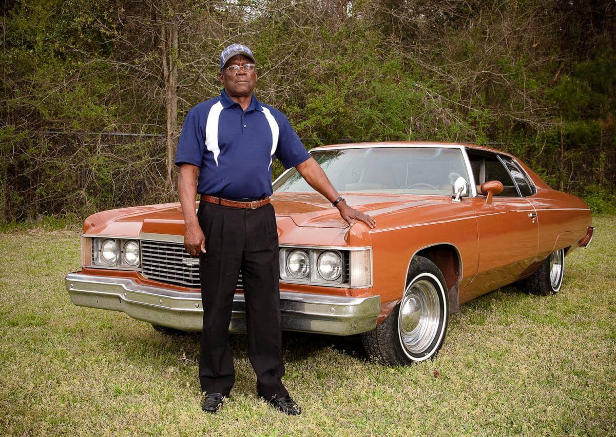

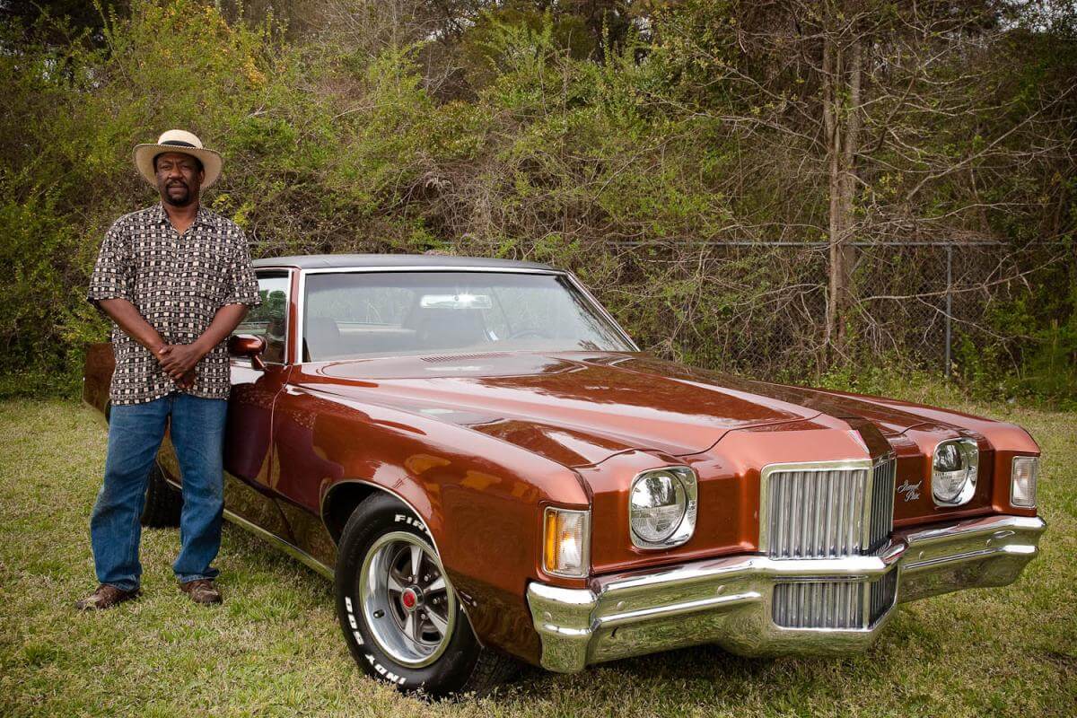

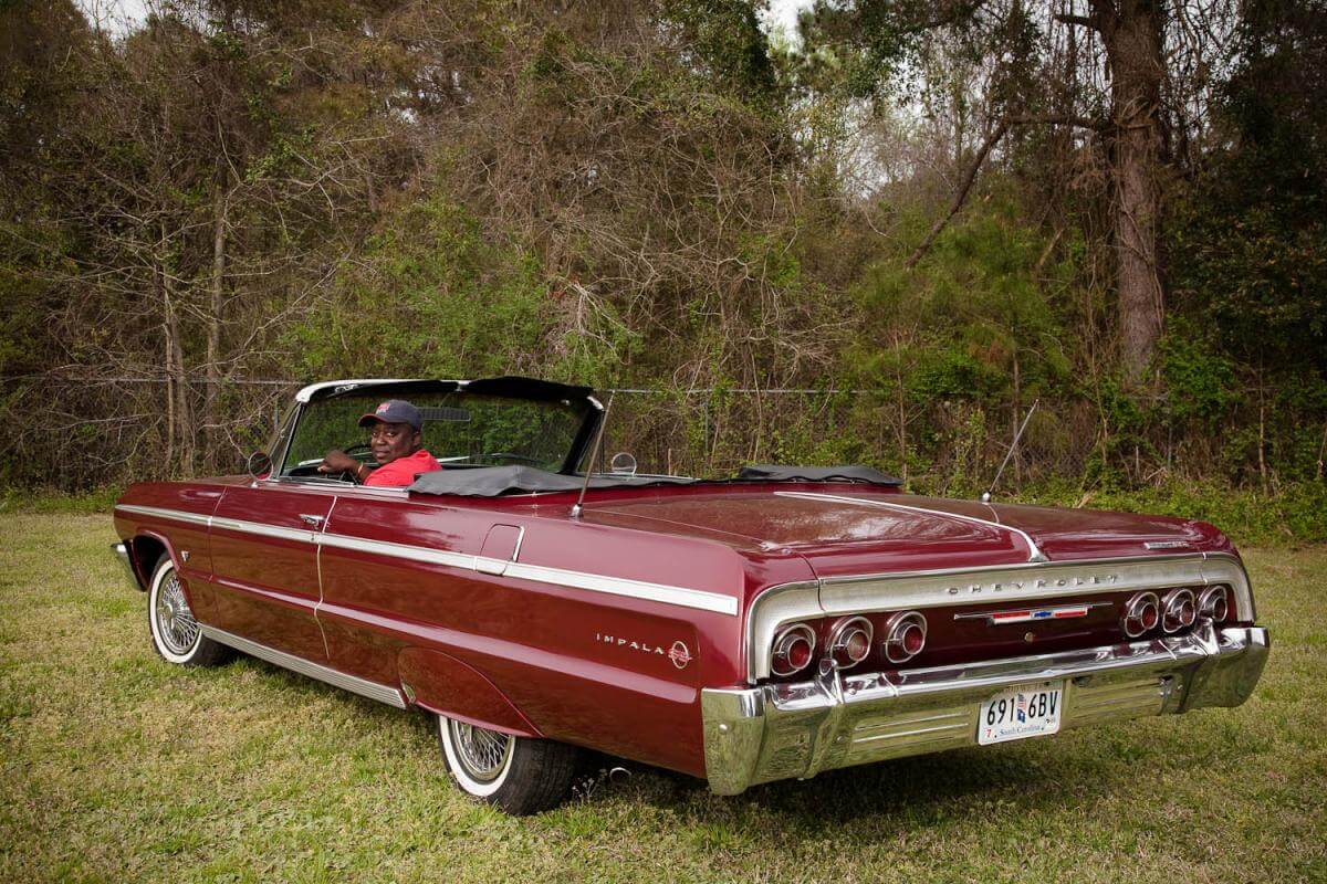
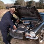


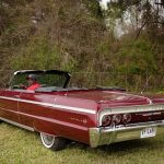
 |
| Nancy Marshall and John McWilliams, Homecoming parade, McClellanville, South Carolina, 2010. |
Low Country African American social life remains centered around churches and there is a strong spiritual camaraderie between car club members. As prescribed in the bylaws, Travelers members take turns every fourth Sunday visiting each other’s churches. These rules also extend to associates of the group: if a club member attends a different church than his wife or girlfriend, then that wife or girlfriend can also invite club members to visit her church. Club members drive their “old school” cars to church and afterwards go as a group to a restaurant for lunch or to a park where the members gather to talk and look over the cars.
In addition to the town parades, club members regularly bring their cars to the annual Lincoln High School Homecoming and have driven in Fourth of July and Christmas events, as well as Charleston’s Martin Luther King Day Parade and the Emancipation Proclamation Day Parade. The club hosts events for Black History Month, as well as a car show and judging every year with raffle prizes and trophies given for various categories such as “furthest distance traveled” and “best in show.” Money raised by the car show goes to charities such as a children’s hospital, and helps purchase school supplies. The club joined with other area clubs such as the Corvette Club to support a benefit for Haiti. Aside from events and charitable activities, the club has a strong sense of pride in its work. Frank Ancrum talks about the joy of driving his beautiful car down the highway and living for “the moment when he passes a little kid who gives him the thumbs up” when he sees the cool car go past.
]]>

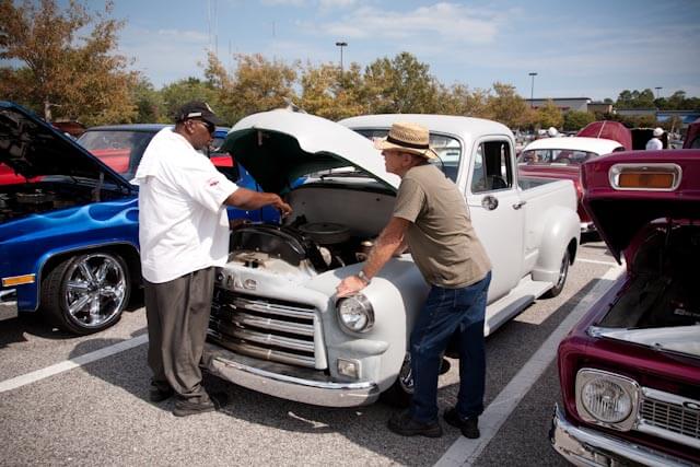
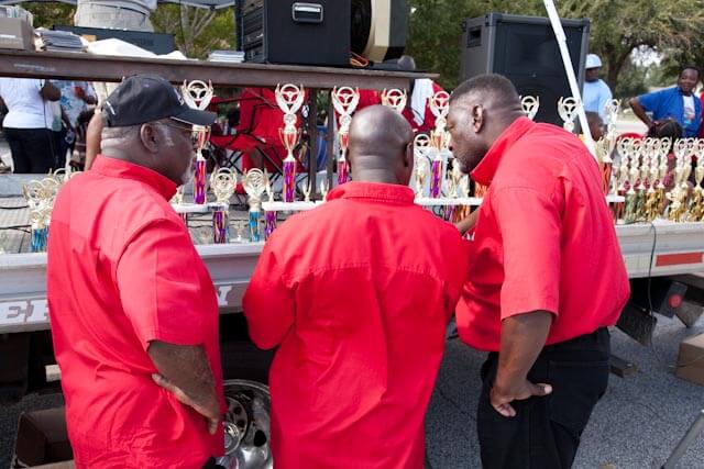

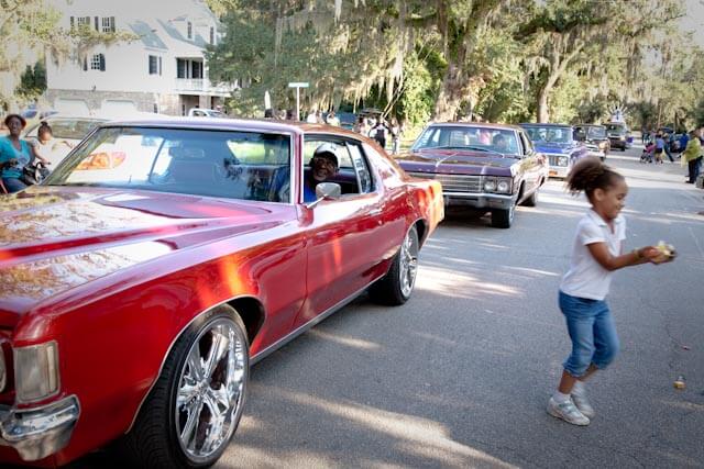
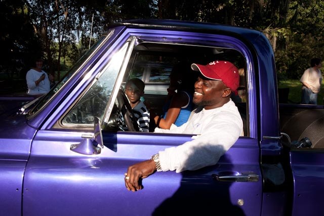


Introduction
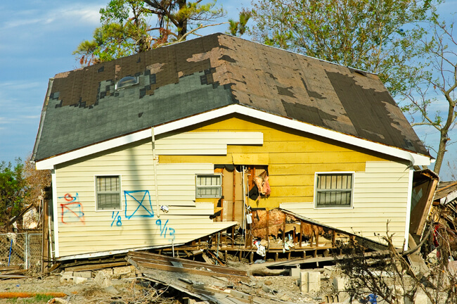
In the five years since August 29, 2005, when Hurricane Katrina wreaked havoc along the entire Gulf Coast and the subsequent failure of New Orleans’ levee system altered the history and the face of the city, thousands of professional and amateur photographers have sought to corral their memories and impressions of Katrina and its aftermath. Torrents of still and moving images speak to the immensity of the event that poet and New Orleans resident Andrei Codrescu refers to as “the most photogenic disaster in American history since the Civil War.”1Codrescu, Andrei, cover blurb for Jane Fulton Alt, Look and Leave: Photographs and Stories from New Orleans’s Lower Ninth Ward. Center for American Places at Columbia College Chicago, 2009.

The virtual exhibition presented here revolves around one iconic form in the visual landscape of Katrina in New Orleans—variants of the X-code left by searchers as they systematically covered the city, critically pertinent markings applied to visited houses and buildings. “Paint fades, archives endure,” reads a promotional poster from the Hurricane Digital Memory Bank.2http://hurricanearchive.org/. The Hurricane Digital Memory Bank uses electronic media to collect, preserve, and present the stories and digital record of Hurricanes Katrina and Rita. George Mason University’s Center for History and New Media and the University of New Orleans, in partnership with the Smithsonian Institution’s National Museum of American History and other partners, organized this project. Displaying three progressively fainter versions of the ubiquitous spray-painted signs that greeted residents returning to the city, the poster solicits electronic recollections for the Memory Bank as it features the X-code graphic that became an indelible symbol on the streets of New Orleans after Katrina. Although outdoors the codes are fading and disappearing, the X-code photographs, recorded by anyone in the vicinity during the last five years with a camera, constitute a documentary archive with tales to tell.
. Two sets of codes indicating that a second search took place at this location. The second occurred after the flooding had receded since the code is applied below the water line remaining on the building. © Jane Fulton Alt.")
The enigmatic X-code messages could appear threatening in their mystery, especially upon structures of personal significance to the viewer, while the cumulative power of thousands of these markings communicated the enormous scale of what had occurred. In addition to wind and water damage, infrastructure destruction, uncertainty about the fate of family, neighbors, and friends, and a complete disruption of familiar life, the appearance of the codes added another unknown—a mysterious graphic with alphanumeric markings spray-painted on homes, schools, businesses, and places of worship. Some residents immediately deciphered their meanings. There were also interpretations available such as a New Orleans Times-Picayune's September 17, 2005, front-page article.3Perlstein, Michael, “For Tales of Life and Death, the Writing’s on the Walls,” New Orleans Times-Picayune, September 17, 2005, p.1. Too often, though, the message sent was not the message received. Finding an X-code on his home, University of New Orleans professor Frederick Barton spoke for many when he commented, "That first day and for many thereafter, we did not understand what the mark meant. In fact, I am not sure that I do yet."4Barton, Frederick. E-mail correspondence, November 24–25, 2008.
Artist Elyse Defoor described her first visit back to the city in early 2006: “Instead of being macabre symbols X-ing out all presence, the Xs were in fact a coding system used by the search and rescue teams. . . . The discovery that what I had perceived to be marks of annihilation were in fact useful tools did not diminish the visceral experience of seeing those Xs scrawled across my beloved city. For me, they will always be stigmata of immense loss and unexpected death." 5Defoor, Elyse. E-mail correspondence, May 8, 2008.

How did others interpret the X-code?
". . . there was something almost biblical about those markings on all the front doors around here. . ."6Rose, Chris. "Badges of honor: Part historic preservation, part act of defiance, the spray-painted markings of Katrina rescue workers remain prominently displayed on many reoccupied New Orleans homes." New Orleans Times-Picayune, July 24, 2007.
“. . . conjuring a cross between the Vévé signs of voudun and a kind of military coroner's occupation.”7Spitzer, Nick. E-mail correspondence, June 16, 2009.
“Now each house bore runic signs in orange spray paint. . .”8Piazza, Tom. Why New Orleans Matters, New York: Regan Books, 2005, 125.
“Ah, the X—truly the most powerful symbol, for better or worse, that we have, I think.”9Smith, Barbara Lee. E-mail correspondence, September 15, 2009.
“For Tales of Life and Death, the Writing’s on the Walls”10Perlstein, loc.cit.
“. . . end-of-the-world eerie.”11Baker, Ellen. E-mail correspondence, August 27, 2009.
“. . .alarming . . . invasive . . .a violation . . .lawless graffiti . . . disrespectful . . .”12These are words and phrases that cropped up repeatedly in varied conversations.

The images gathered in this virtual exhibition entertain all these interpretations and more. Those recorded in 2005 and 2006 were most often found on grievously damaged properties. Some stakeholders returning were disturbed by the memories and symbolism, and quickly painted over, scrubbed and scraped off the codes, or discarded the offending graphics as they replaced doors, windows, or siding. Others were later removed as a concession to appearances for insurance purposes. Some residents made a conscious decision to retain the codes as part of the provenance of that structure or a memorial to the event. Shrine-like tableaux incorporate some X-code markings. Still others remain as unwitting testimonials on neglected, deteriorating structures barely touched since 2005, default memorials and commentaries.
The repetition of the X-code on house after house after house on mile after mile after mile of streets composed a powerful architectural narrative during the weeks following the storm as they appeared on structures spanning the socioeconomic mix of the city. “This [official graffiti] was the now-famous ‘X’ in a fluorescent orange or yellow that on the Caribbean-style color schemes of the homes in New Orleans made for some startling graphics,” recalls New Orleans artist Thomas Mann. “I began documenting these signs immediately and continue to do so. I found these markings to be visually interesting and full of import."13Mann, Thomas. Storm Cycle: An Artist Responds to Hurricane Katrina. Bellevue, Washington: Bellevue Art Museum, 2006, 7.


 New Orleans, Louisiana, 2005. Photographs by Thomas Mann. © Thomas Mann.
Codes Decoded

Mann was on vacation when the storm struck on August 29, 2005, so, like viewers all over the world, he watched television coverage of the unfolding tragedy in his city. He captured a screen image of a reporter sketching the official code in a notebook while explaining the search process.
Cynthia Scott's photo provides a clear illustration of the code in Faubourg Marigny in 2005. In addition to its adherence to the manual’s instructions, it stands out because, as the artist observes, “It appears the search team made an effort to coordinate their markings with the color scheme already in place.”
Although there is an official code system outlined in the Urban Search & Rescue team manuals used since the early 1990s, the code was not familiar to most citizens. With some 80% of New Orleans’ structures marked, the code commanded unprecedented attention.14http://www.fema.gov/, Urban Search and Rescue (US&R) Response System Field Operations Guide, FEMA, September 2003 (US&R-2-FG), p. 56.

Single slash drawn upon entry to a structure or area indicates search operations are currently in progress. The time and TF identifier are posted as indicated.

Crossing slash drawn upon personnel exit from the structure or area.
Distinct markings will be made inside the four quadrants of the X to clearly denote the search status and findings at the time of this assessment.
The marks will be made with carpenter chalk, lumber crayon, or duct tape and black magic marker.

LEFT QUADRANT — US&R TF identifier

TOP QUADRANT — Time and date that the TF personnel left the structure.

RIGHT QUADRANT — Personal hazards.

BOTTOM QUADRANT — Number of live and dead victims still inside the structure.
["0" = no victims]
The most striking portion of the code is the lower quadrant of the X, denoting the number of survivors or bodies.
Urban Search & Rescue (US&R) task forces, certified by FEMA, are highly trained first responders, who specialize in response to structural collapse, and who may be deployed in disasters either by FEMA or by sponsoring states. There are twenty-eight US&R task forces throughout the United States. While the codes are specified as their communication tool, in the chaos following the storm, first responders from other agencies often used a variant of the code, improvised their own, or may not have marked at all.
Another frequently encountered graphic is the X (or slash) in a square. This code is also an official US&R marking warning of structural instability and is diagrammed in the FEMA manual.15Ibid., p. 54

National Urban Search and Rescue Response System

Structure is accessible and safe for search and rescue operations. Damage is minor with little danger of further collapse.

Structure is significantly damaged. Some areas are relatively safe, but other areas may need shoring, bracing, or removal of falling and collapse hazards. The structure may be completely pancaked.

Structure is not safe for search and rescue operations and may be subject to sudden additional collapse. Remote search operations may proceed at significant risk. If rescue operations are undertaken, safe haven areas and rapid evacuation routes should be created.

Arrow located next to a marking box indicates the direction to the safe entrance to the structure, should the marking box need to be made remote from the indicated entrance.

Indicates that a HAZMAT condition exists in or adjacent to the structure. Personnel may be in jeopardy. Consideration for operations should be made in conjunction with the Hazardous Materials Specialist. Type of hazard may also be noted.
National Urban Search and Rescue (US&R) Response System, Washington, DC, September 25, 2003. Field Operations Guide by the Federal Emergency Management Agency.
The mysterious TFW Code
.")
A different form of code seen frequently in the Upper Ninth Ward, is the mysterious TFW code. There continues to be much speculation about the identity of the search team who left these markings. There are two forms of this code—one is a simple spray-painted lettering of TFW with the date, as seen in Andrea Booher's image above of guardsmen, taken on September 20.


Thomas Mann's photographs shows another more elaborate TFW iteration, a circular format with a date and information, plus a version of the TFW expanded into TFWldcts.
Jane Fulton Alt’s photograph shows a similar circular configuration, but without the expansion to Wldct.
How is this code interpreted? The exact meaning is a source of great speculation among residents and visitors, and after five years this speculation is taking on the dimensions of an urban legend. Here are a few guesses:
Toxic Flood Water
Totally Full of Water
Texas Fish & Wildlife
Tennessee Fish & Wildlife
Totally (x-rated)
Team Forth Worth
Task Force Wyoming
Task Force Wildcat
Fire department personnel told Bob Thomas, director of the Center for Environmental Communication at Loyola University, that this code stands for Task Force Wildcat.16Thomas, Robert A. E-mail correspondence, June 22, 2010. But not everyone agrees with this interpretation. “Amazing how hard it is to find info,” said Thomas four-and-a-half years later. “But—while they were doing the S&R, no one was even thinking of keeping records.” Jackson Barracks historian Thomas M. Ryan, LTC (ret) of the Louisiana National Guard (LNG), reports, “My source indicates that TFW was the mark used by Task Force Wyoming which coincides with my post-K memory bank. Hope that this helps.”17Ryan, Thomas M. LTC (ret). E-mail correspondence, June 27, 2010. Another LNG source confirms this interpretation. However, an online publication dated September 19, 2005, identifies the elusive group as a combination of the West Virginia and Oregon National Guards, signing themselves as TFW (Task Force Wildcat).18Sydenstricker, Capt. L. Paula, 153rd Mobile Public Affairs Detachment, "West Virginia National Guard Plays Vital Role in the Infantry Mission," Defense Video & Imagery Distribution System (dvids), http://www.dvidshub.net/news/3054/west-virginia-national-guard-plays-vital-role-infantry-mission, September 19, 2005
KEN
.")
Structures marked with KEN were specifically searched for bodies by Kenyon International Emergency Services, a Texas company that provided mobile morgue services. The codes indicate that two bodies were removed from this structure on October 2, 2005. The date confirms that the morgue service was still operating thirty-four days after the storm.
Other markings
“Cans of DayGlo spray paint were handed out by FEMA to second and third responders,” reports historian Douglas Brinkley. "The primary goal was to mark in bright red or orange which buildings had been searched and whether bodies were found."19Brinkley, Douglas, The Great Deluge: Hurricane Katrina, New Orleans, and the Mississippi Gulf Coast. New York: Harper Perennial, 2007. (First published 2006, William Morrow.) When these self-deployed teams and individuals marked, the meaning of the resulting spontaneous codes usually left town with the painters.

Frederick Barton describes encountering a unique interpretation of the code: “At the time of our first return to the city, we assumed the mark on our exterior wall was planned—the tail indicated hurricane damage and distinguished itself from other marks that FEMA used to indicate earthquakes or fire or other kinds of disasters. Now, however, I suspect the tail had no meaning whatsoever and was just the product of a guardsman standing on uneven ground and trying to make a circle that he didn't do correctly.”20Barton, loc. cit.
Probable interpretations of other commonly seen markings:
NE – the structure was Not Entered
SELA – Southeast Louisiana (a search unit)
F/W – seen most often with animal rescue markings and is believed to indicate that Food and Water were left for pets.
0 A, 0 D – no one was found, alive or dead
3 LV, or 3 L – 3 live persons found
HSUS—Humane Society of the United States
SPCA—Society for the Prevention of Cruelty to Animals
Codes Elsewhere
X-codes have been used in responding to disasters across the country through the years. Informal speculation is that they were developed after the California earthquakes in the early 1990s. My first awareness of these markings was in 1999 in Greenville, North Carolina, after devastating floods from Hurricane Floyd’s torrential rains had inundated the eastern half of that state destroying many properties near creeks and rivers. More documentation of the codes used elsewhere followed a March 15, 2008 tornado in Atlanta, Georgia, when a variant of the spray-painted code was used sparingly in the affected Cabbagetown neighborhood,and in 2008 when Hurricane Ike hit the Texas Gulf coast.
.")
First Responders
Photographers contracted by FEMA in August, September, and October of 2005 took the images in the following slide show. They accompanied the Urban Search & Rescue teams searching the city, often in boats.21All images marked "FEMA News Photo" are works of a Federal Emergency Management Agency employee, taken or made during the course of an employee's official duties. As works of the US federal government, all FEMA images are in the public domain.
The earliest dated codes and photographs are August 30, 2005, by Marvin Nauman and Jocelyn Augustino, documentation that the Urban Search and Rescue teams were at work in some parts of the city the day after the storm had passed.

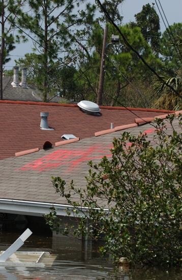
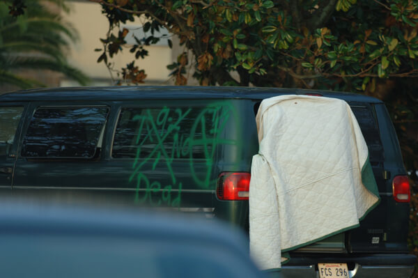
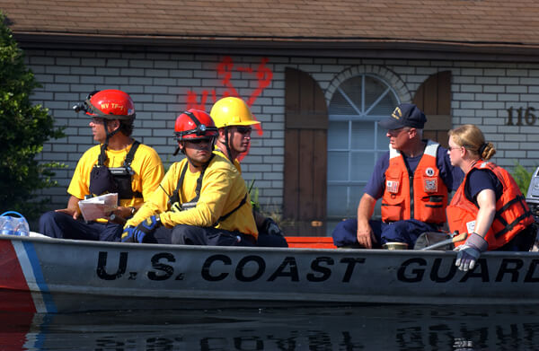
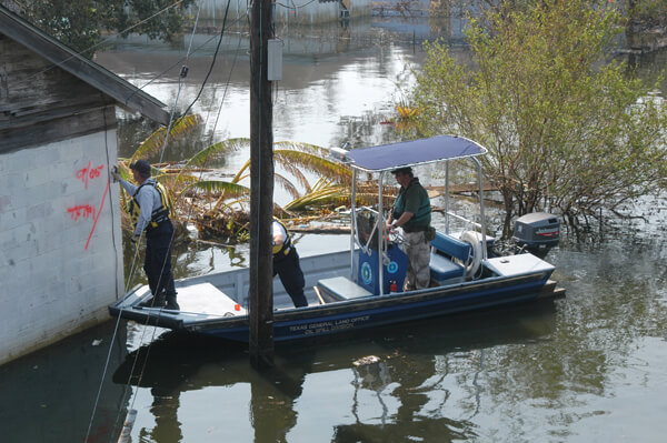
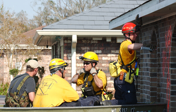
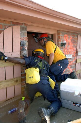
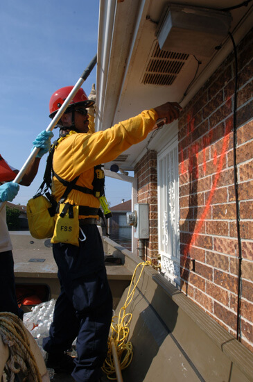
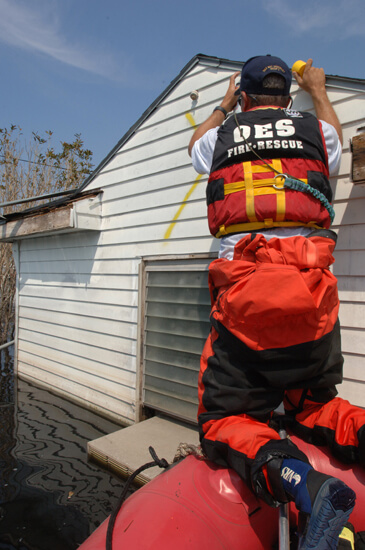
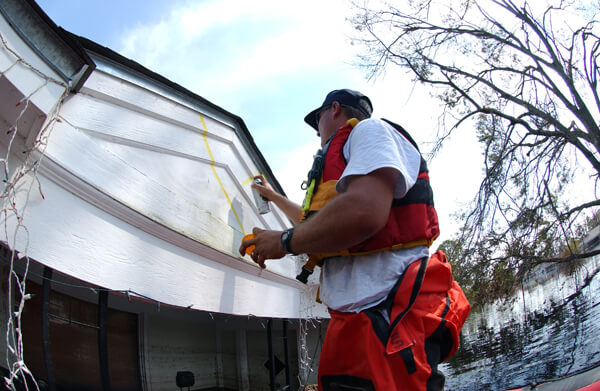


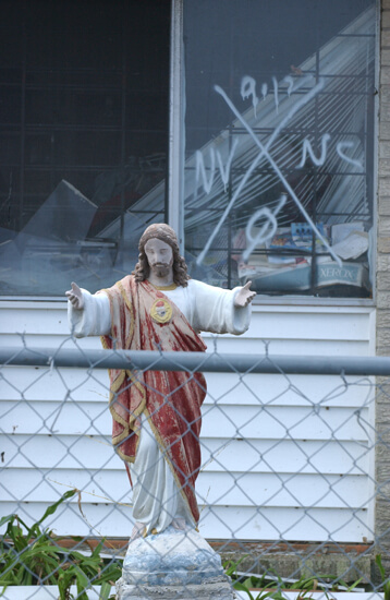
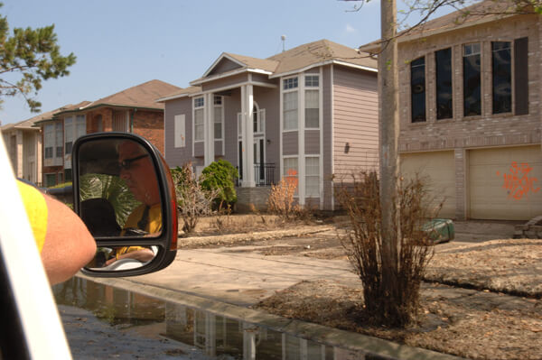
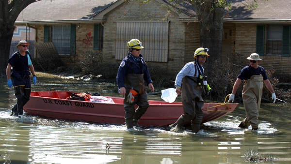
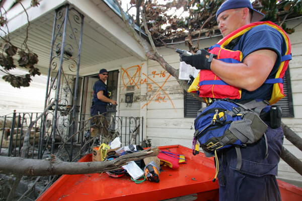
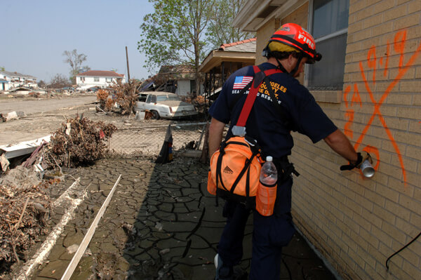
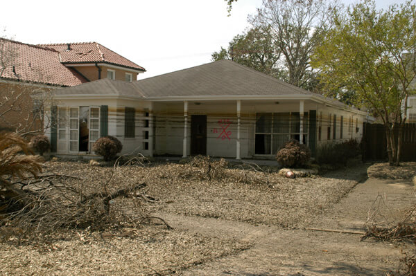
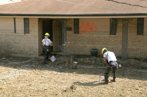
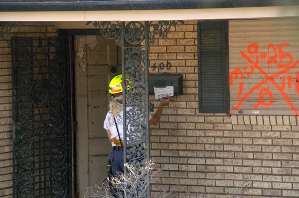
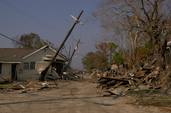
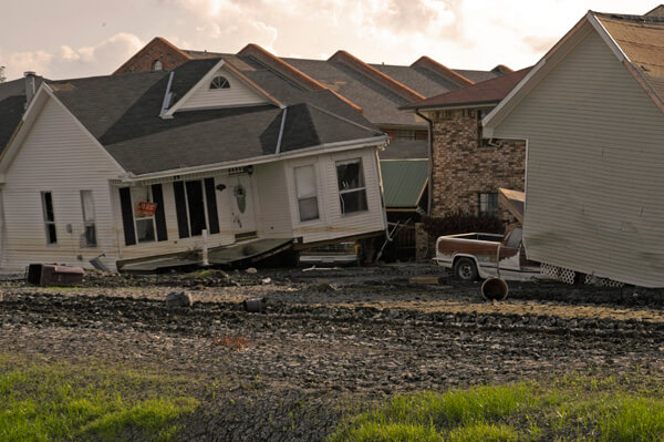
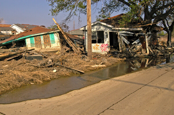
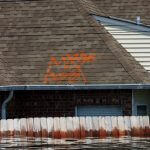

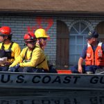

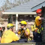
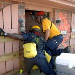
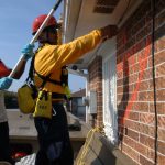


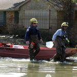
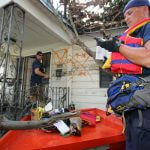
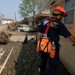
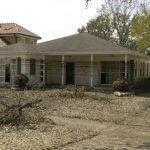
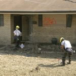
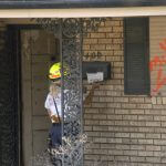
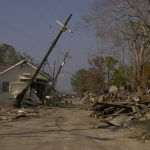
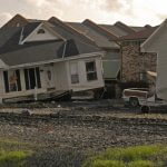
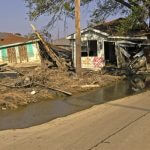
FEMA-contracted photographers with their authorized access captured images of codes applied to rooftops when these would have been the only visible portions of a home. They captured images of personnel painting the codes, leaving notices explaining the search in mailboxes, entering to search, of codes on structures that had floated to the middle of streets or landed atop vehicles, of boats on roofs and pieces of houses jumbled together, of successive lines marking where the water had settled, and the wreckage left behind when the water had receded. Their archives are remarkable for their on-the-scene immediacy. This slide show proceeds in chronological order, according to FEMA dating.
Maps of New Orleans
Two maps from the Community Data Center illustrate how New Orleanians think spatially about their city. The New Orleans Planning Districts map roughly corresponds to popular designations of city geography. The titles for these planning districts are used for the organization of the images that follow.

The second map, Neighborhoods in Orleans Parish, indicates the familiar neighborhood names included within each planning district. For example, the Bywater Planning District includes the Bywater, St. Claude, Florida Avenue, Desire, St. Roch, and Marigny neighborhoods.

In considering New Orleans map directions, the local cardinal points, rather than North-South-East-West, are usually described as Riverside-Lakeside-Upriver-Downriver, although sometimes Uptown-Downtown are substituted. It is a local convention that simplifies directions that defy logic—for example, Algiers on the West Bank, is actually southeast of the French Quarter.
.")
Campanella’s map of flood depths uses approximately the same neighborhood designations as those above and helps to interpret the variations in the flood’s effects between neighborhoods.
Lower Ninth Ward, 2005–2006
The hurricane's and flood's catastrophic effects on the Lower Ninth Ward were chronicled extensively by the media. This neighborhood of generational families and homeowners is bordered by both the Industrial Canal and the Mississippi River. A breach in the Industrial Canal levee near the Claiborne Avenue bridge was responsible for a tidal wave of rushing water destroying all in its path. The word "Lower" in Lower Ninth Ward does not refer to elevation, but designates that the area is below, or downriver from the Industrial Canal (the Upper Ninth is above, or upriver from the Canal).
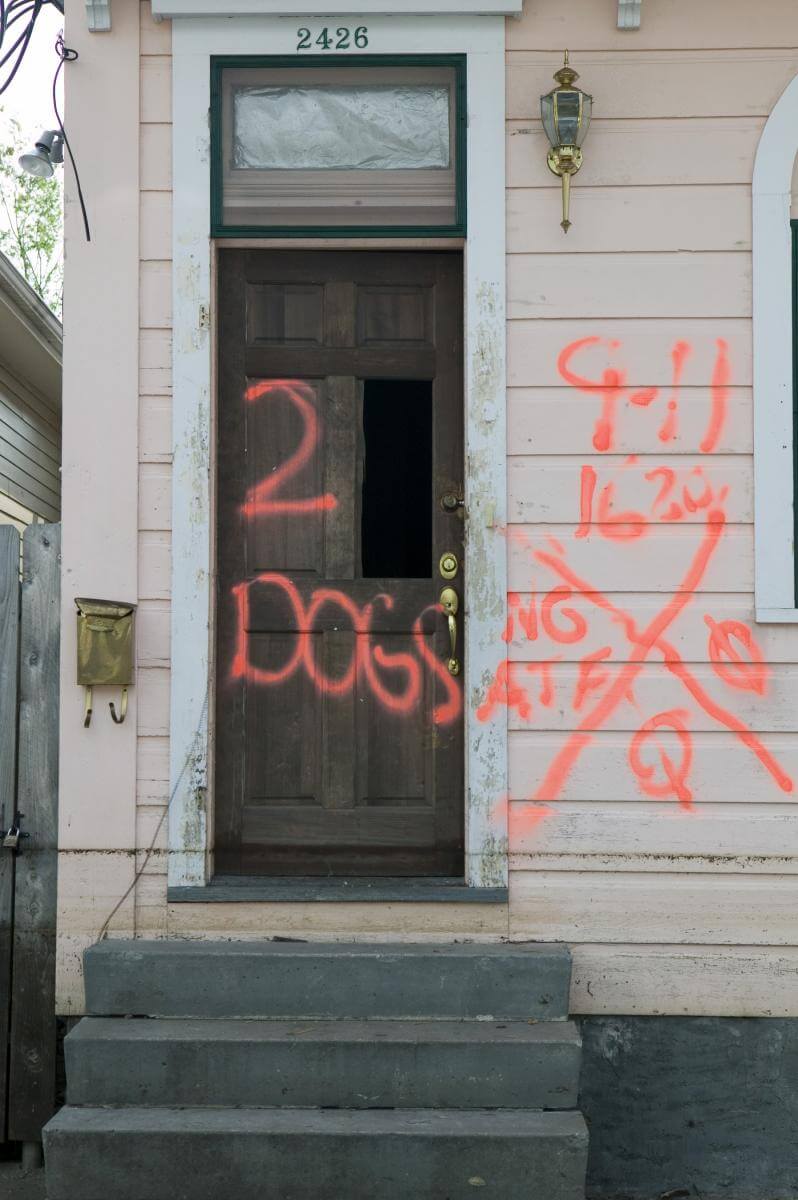
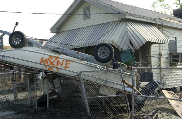
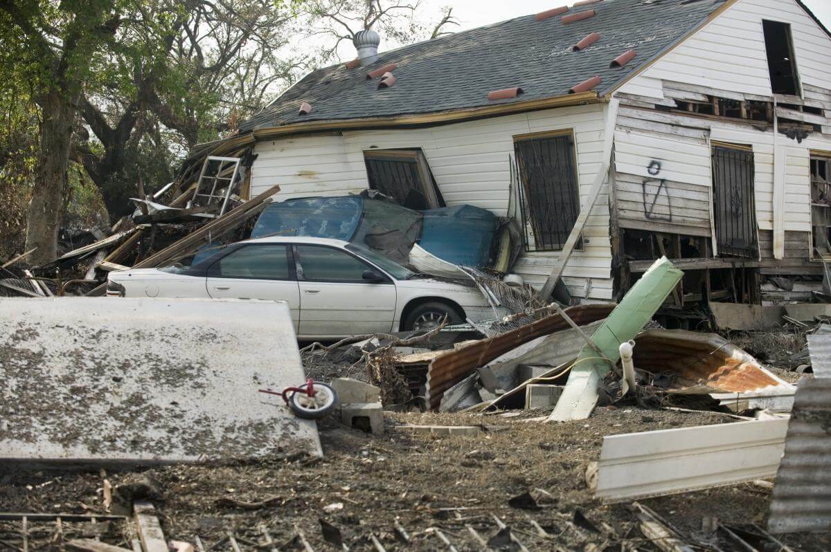
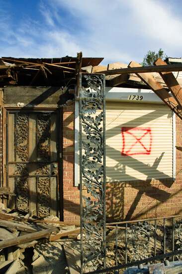
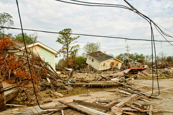

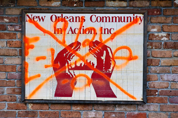
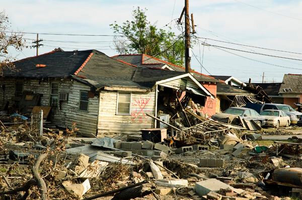
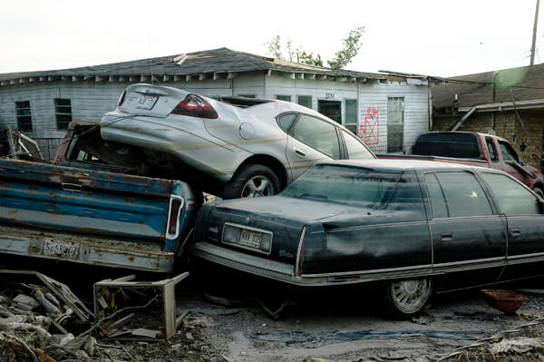
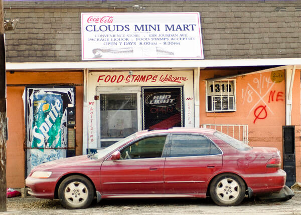
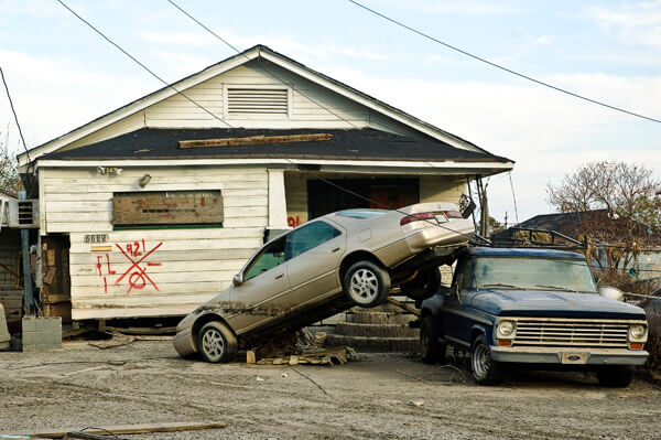
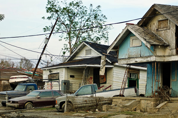
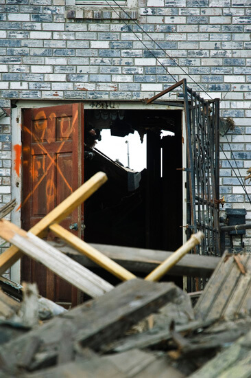

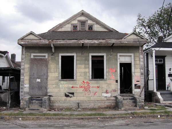
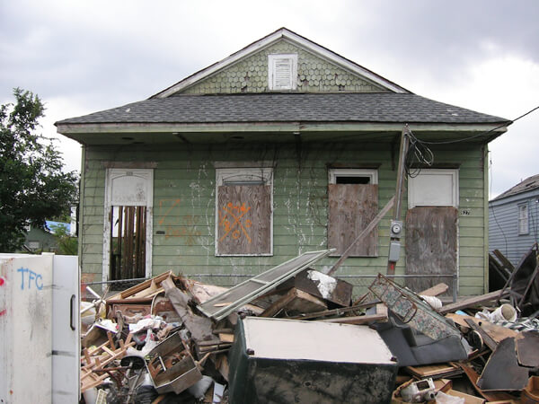
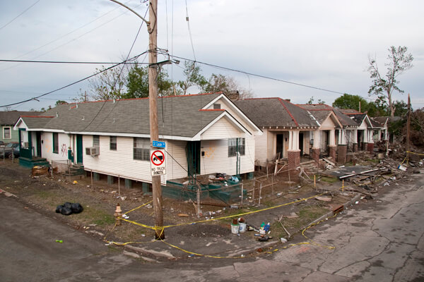


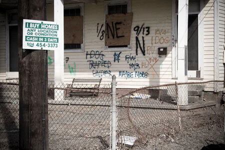

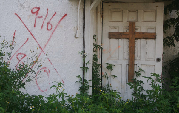
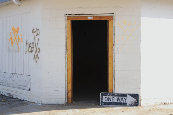
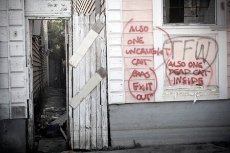
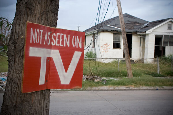
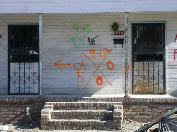
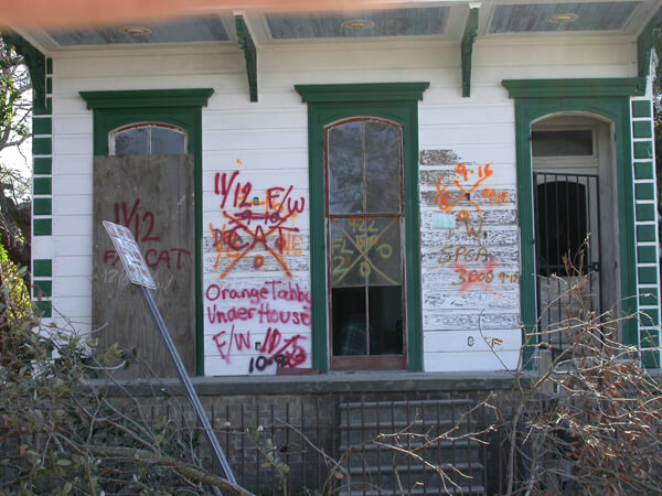
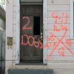
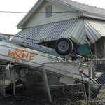
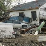
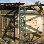
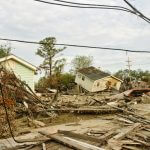

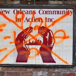
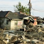
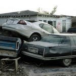

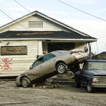
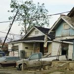
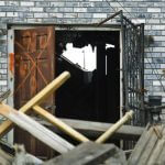

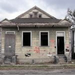
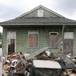
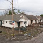
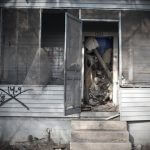

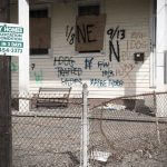
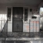
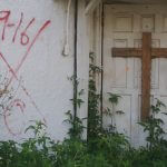
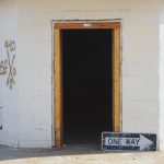
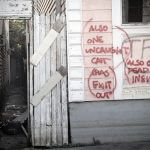
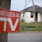
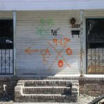
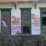
FEMA-contracted photographers and a few others with special access worked in the area in the early post-storm days. Photographer Jane Fulton Alt recorded her impressions in November during time off while she served as a counselor in the Look and Leave program. She accompanied homeowners on their first—and sometimes only—emotional trips back into the neighborhood to inspect their properties. Her off-time pilgrimages through the same territory documented what she had seen.
Hurricane Rita followed close on the heels of Katrina and the city felt the effects of the edge of that storm on September 22, 2005. Portions of the Lower Ninth reflooded and there followed a second round of searching and marking. Some buildings bear several sets of markings, layers of dates and data. In these photographs, as well as those from Lakeview and St. Bernard, the positions of houses, cars, boats, trees, and other objects testify to the furor of the water's force.
One house, three photographers
Before it was demolished and removed, at least three photographers documented this home swept from its foundations by the Industrial Canal levee breach: FEMA's Andrea Booher in October, Jane Fulton Alt in November, and Lauren Tilton in January.
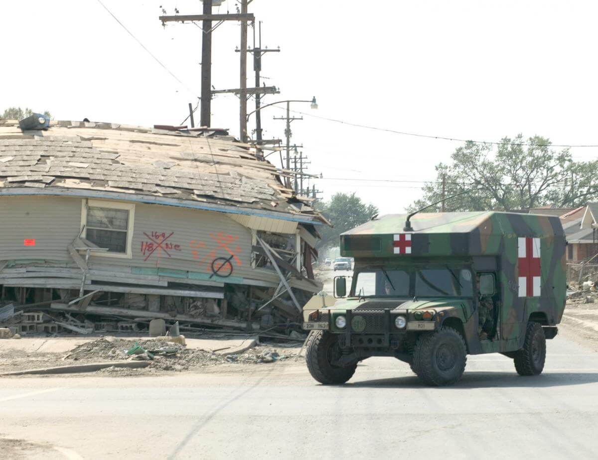
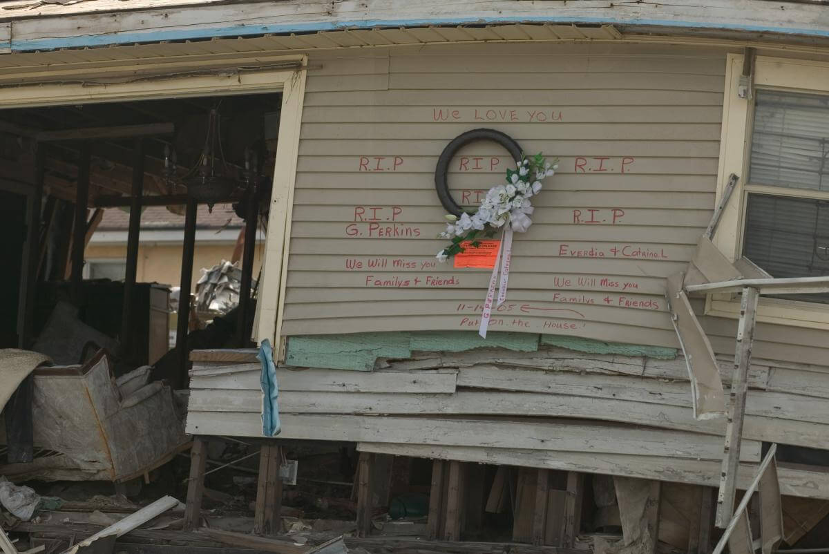

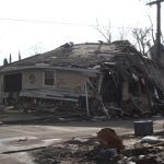
Each photographed the house from a different angle, but with the prominent coding of several searches recorded. Booher's close-up of a memorial message and a mourning wreath illustrates a spontaneous breaking of the code with a personal message from friends and relatives, clarifying the layered information to emphasize that some of the occupants did not survive.
Street Scene: Lizardi and Dauphine Streets, Holy Cross
Ian J. Cohn photgraphed three residences clustered around the intersection of Lizardi and Dauphine Streets in the Holy Cross neighborhood, a microcosm of the Lower Ninth Ward.


Street Scene: North Rampart Street and Jourdan Avenue, Holy Cross
Also in Holy Cross, Cohn recorded these houses near the North Rampart Street and Jourdan Avenue intersection.


Top left, Tree in house near N. Rampart Street. Top center, 4812 N. Rampart Street near Jourdan Avenue. Top right, 1005–1007 Jourdan Avenue. Bottom left, 1009 Jourdan Avenue near N. Rampart Street. Bottom right, 715 Jourdan Avenue near Royal. Holy Cross, New Orleans, Louisiana, November 4, 2005. Photographs by Ian J. Cohn. © Ian J. Cohn.
Street Scene: Forstall Street, Holy Cross to Lower Ninth Ward
Following Forstall Street from near the Mississippi River in Holy Cross into the northern end of the Lower Ninth Ward, Ian Cohn provides a view of moving down a street paralleling the Industrial Canal.


By early 2006 access to the Lower Ninth was less restrictive and photographers recorded structures that appeared untouched since the code painters had left their marks. Cohn photographed the same home in September of 2006 that Brian Gauvin had captured the preceding October, still canted against the trees and utility poles. Still untouched buildings that had floated from their foundations were scattered across the landscape. Vehicles lay atop and beneath wandering houses. Refrigerators hung suspended on power lines. Random items were strewn and abandoned before ruined houses. There were grim and hopeful animal rescue markings, defiant messages of identity, and always the code.
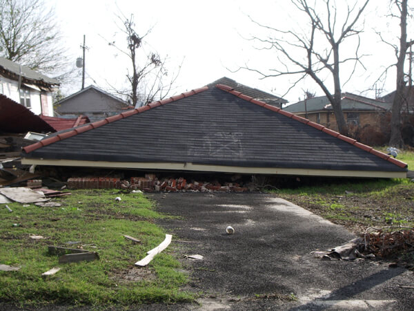
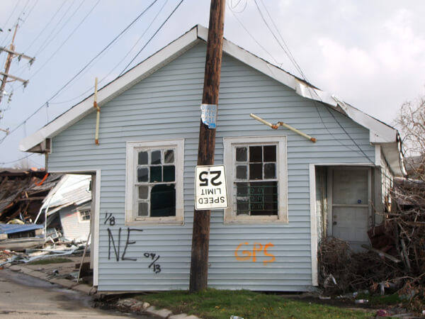
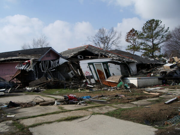
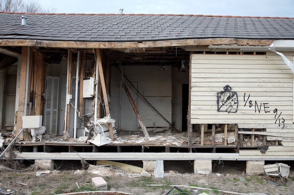
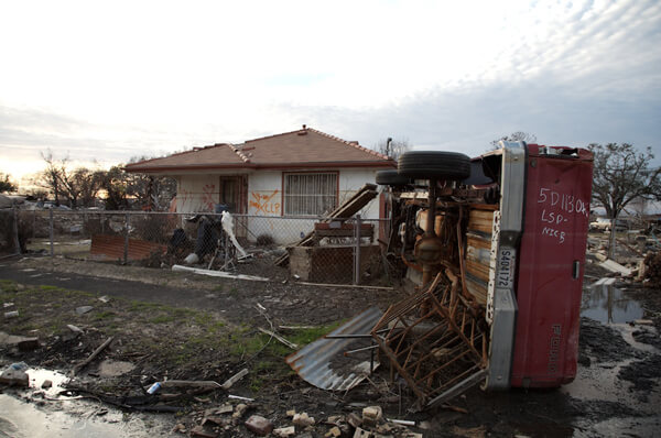
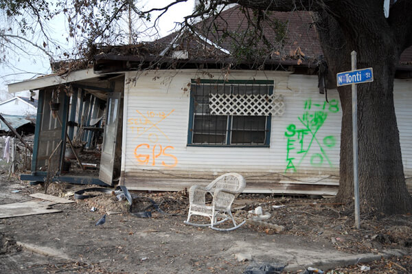
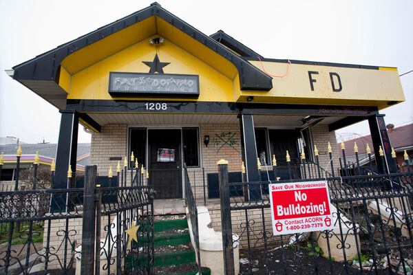

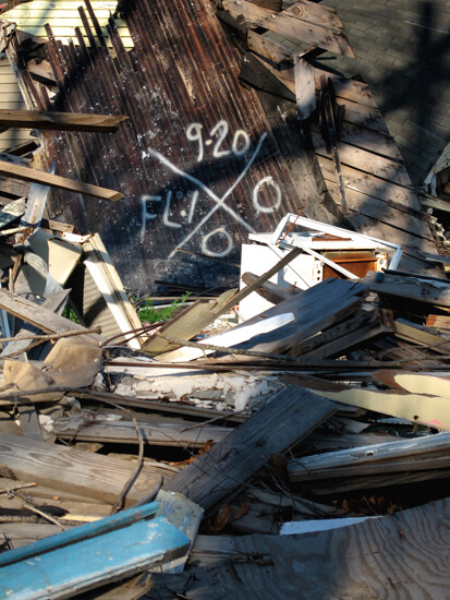
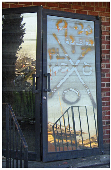
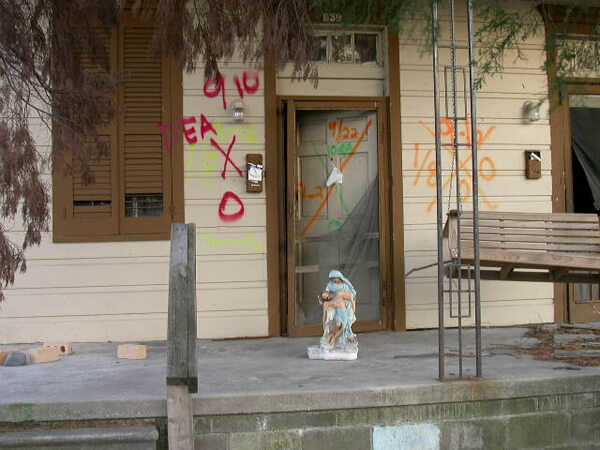
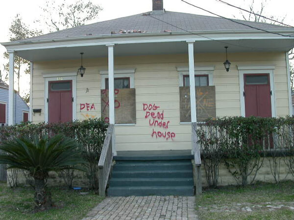
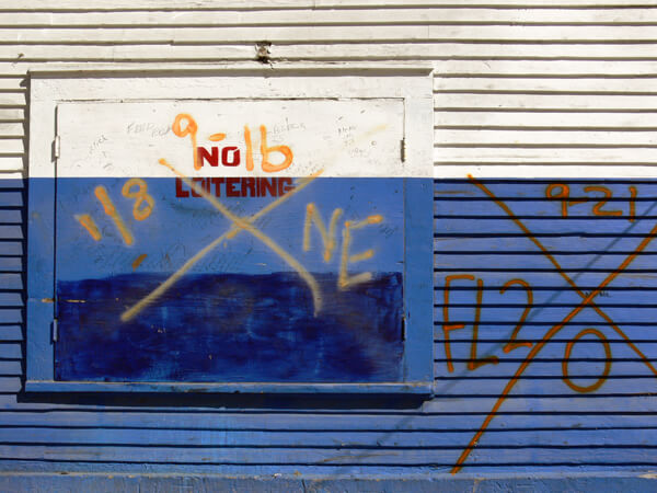
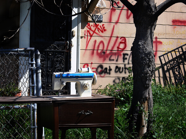
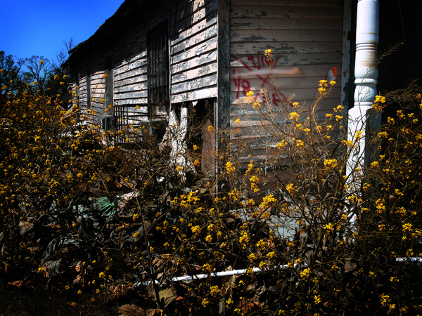
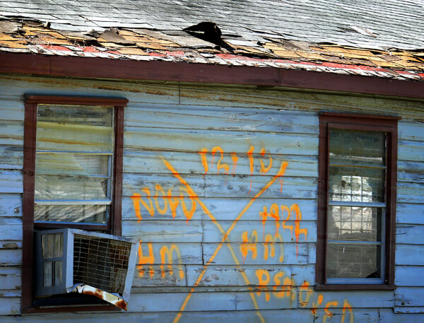
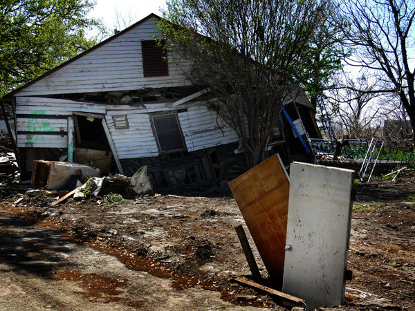
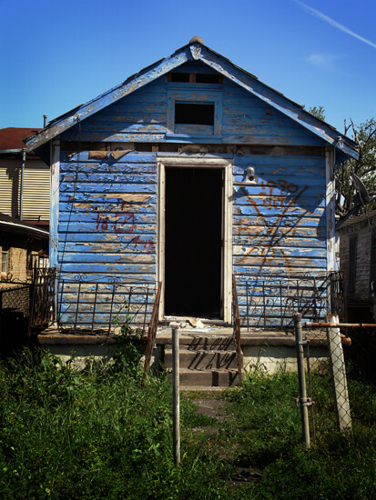
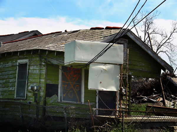
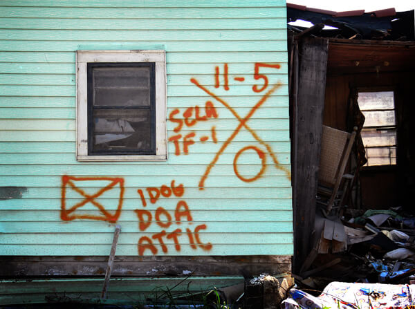
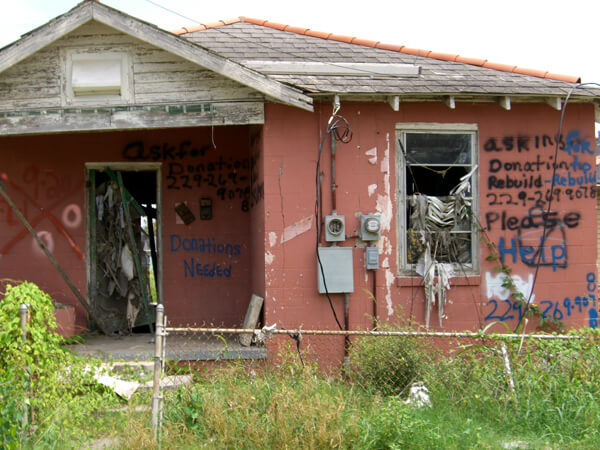
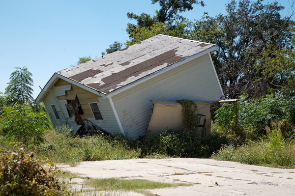
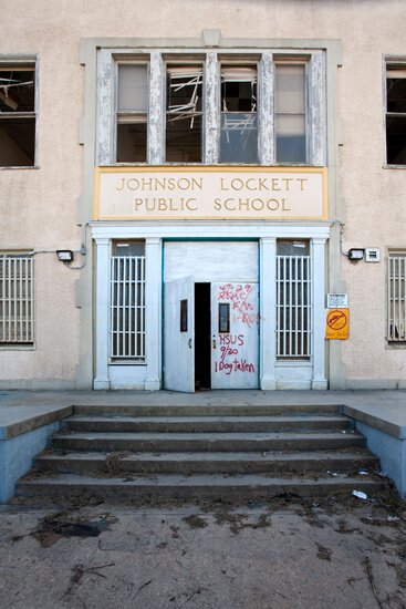
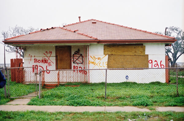
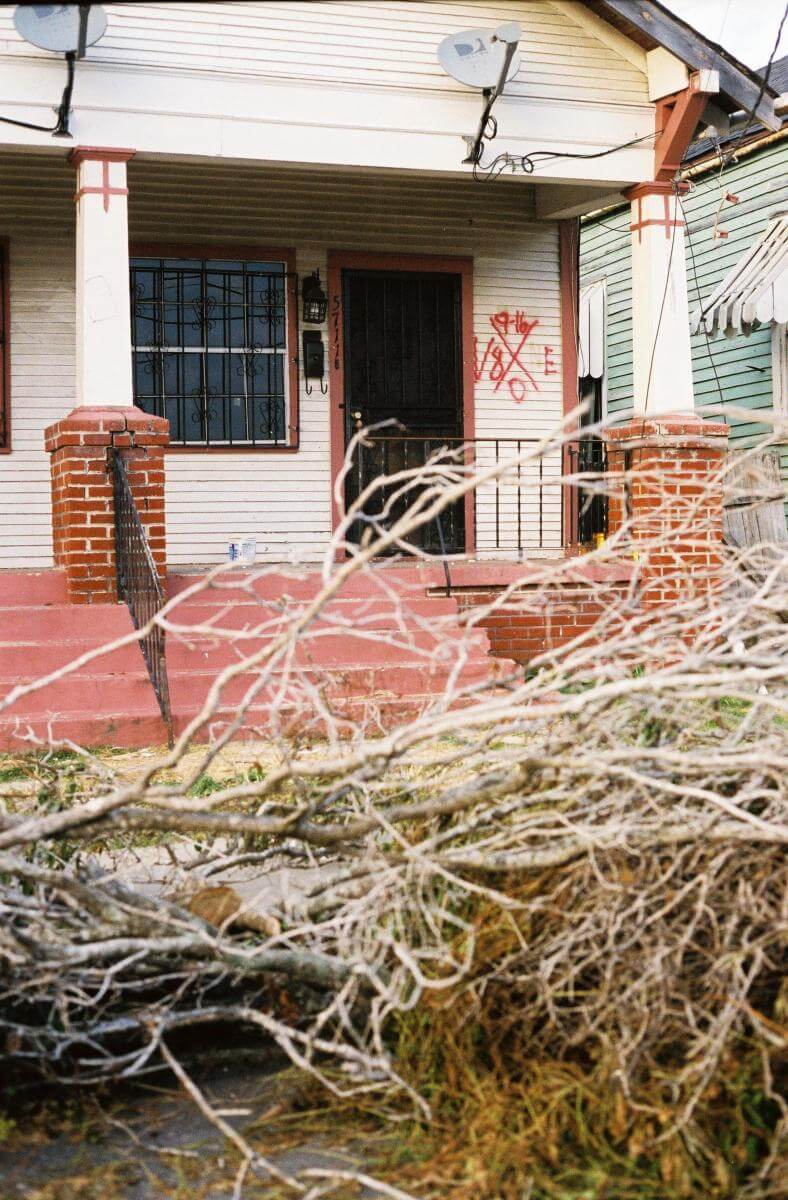
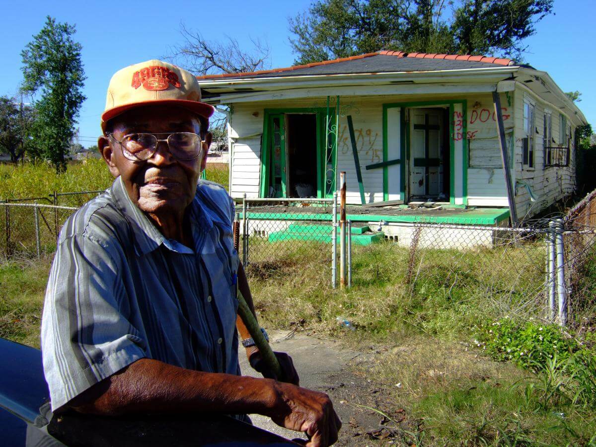
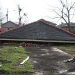
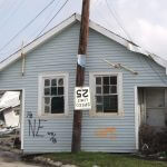
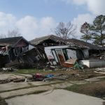
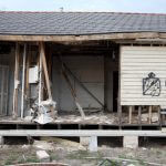
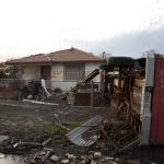
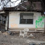

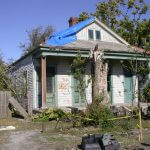
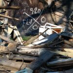
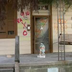
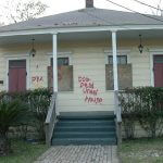

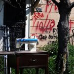
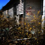
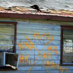
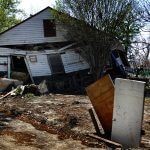
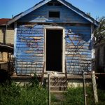
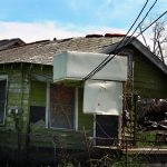
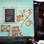
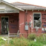
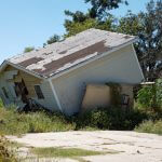


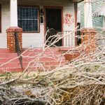
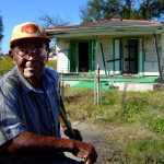
Lakeview, 2005–2006
The force of the storm surge traveled through Lake Ponchartrain, breached the 17th Street Canal, and devastated the upper middle class neighborhood of Lakeview. Developed in the twentieth century on drained and filled-in swamp and marshland, Lakeview is one of the city’s younger neighborhoods as well as one of the lowest points in the entire metro area. Less visible in the media reporting of the storm than the Lower Ninth Ward, Lakeview’s homes and residents were no less drastically affected by the levee failures. As in other neighborhoods, homes were built within yards of the levee walls (the rise visible behind the homes in the top left and bottom right images.)
Street Scene: Near the 17th Street Canal Levee breach


Street Scene: Near West End and Veterans Boulevards
Moving through a section of Lakeview, Brian Gauvin photographed several structures near the intersection of West End and Veterans Boulevards.
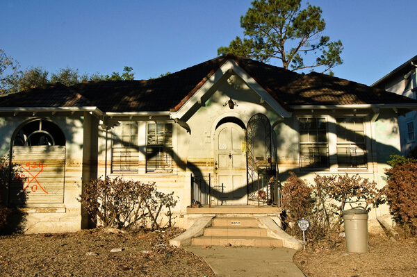

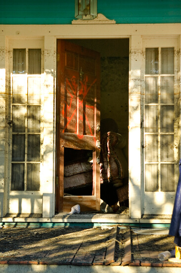
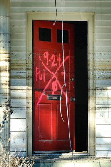


Scenes of devastation here are similar to those of other neighborhoods, except that the architecture is more recent, many structures are larger, and the water lines are much more visible.
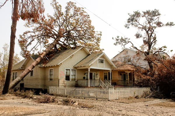
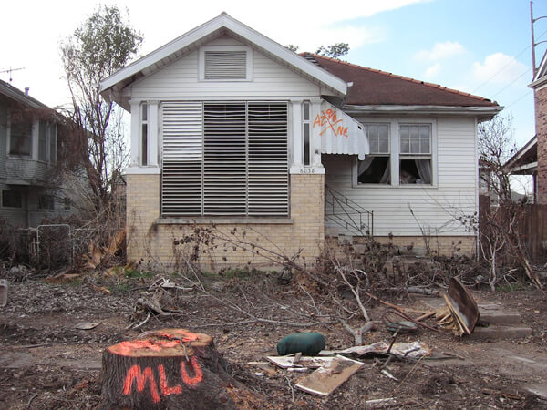
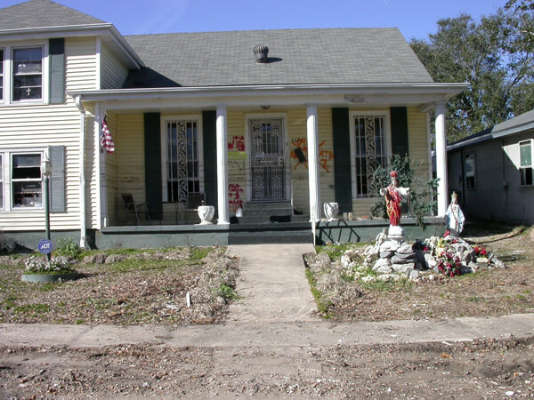
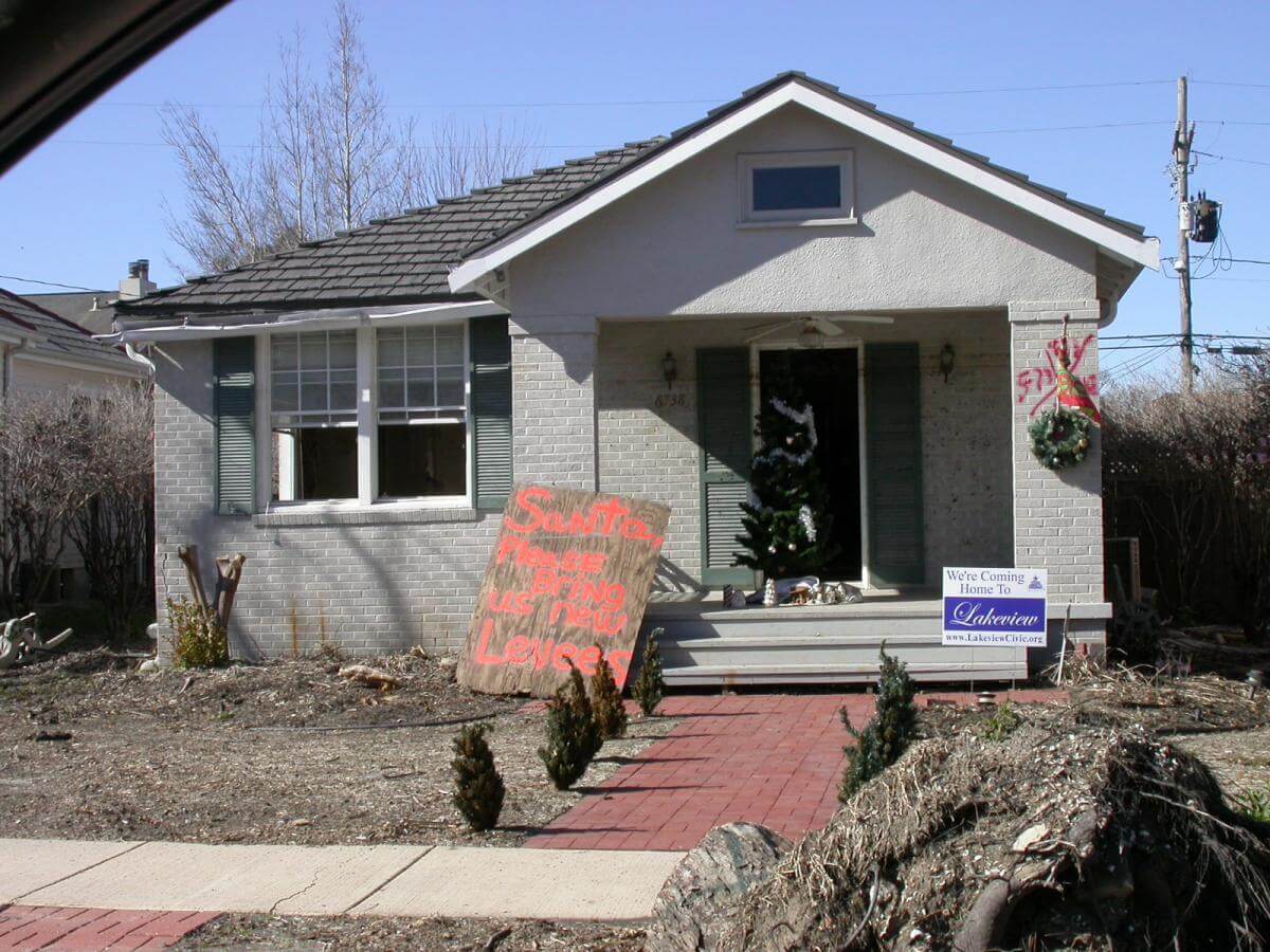
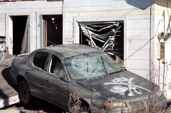
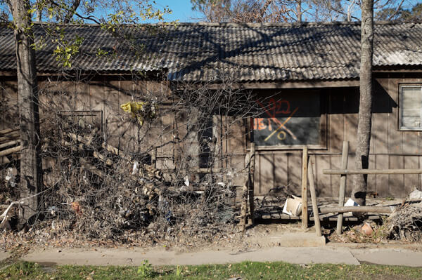
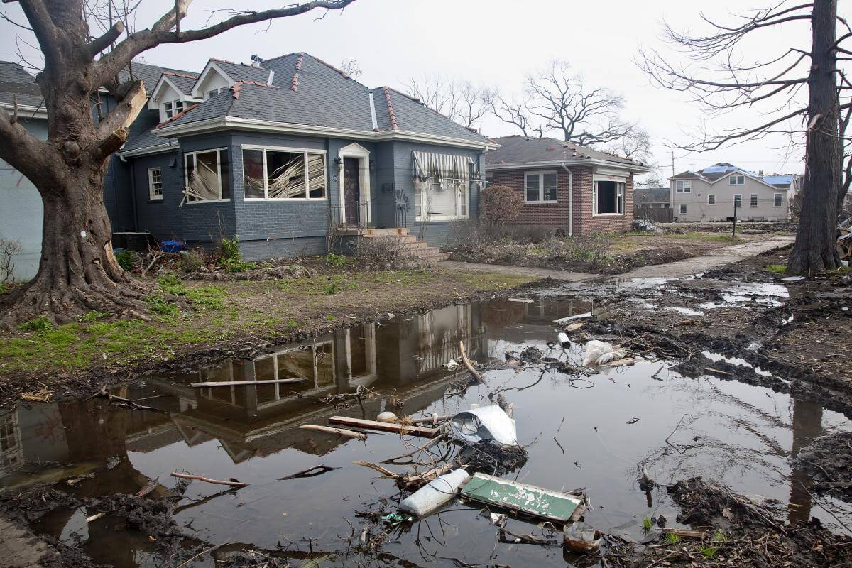
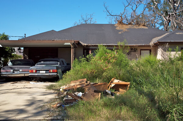
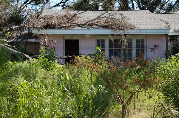
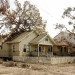
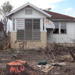


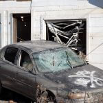
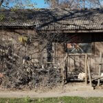
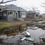
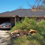

Street Scene: West End Boulevard, Lakeview
Moving down West End Boulevard, Ian J. Cohn photographed several residences.


Street Scene: West End and Harrison Boulevards
Brian Gauvin and Ian J. Cohn photographed the same house near West End and Harrison Boulevards approximately six weeks apart.


Probably applied from a boat, the X-code between the windows dated September 8 is high above the water lines. Cohn’s image shows a later-dated code on the front door, indicating a second crew visited on September 24, after Gauvin's photograph, perhaps to check areas that were inaccessible earlier. The November 4 photo shows the mud line clearly delineated.
Gentilly
Gentilly’s flooding came from all sides—the Industrial Canal on the east, but primarily from the London Avenue Canal that runs through the center of the area, with failed levees on both east and west banks. Like Lakeview, this is one of the more recently developed parts of the metro area, with most structures dating from the twentieth century. The flood here was more than ten feet deep and covered many of the ranch-style homes. When slowly receding waters drained away, catastrophic mold and mildew proved as damaging as moving water.
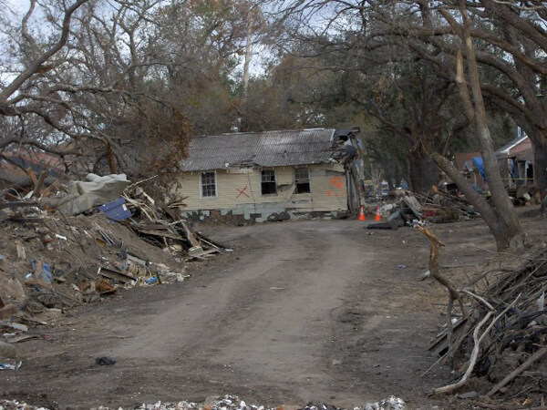
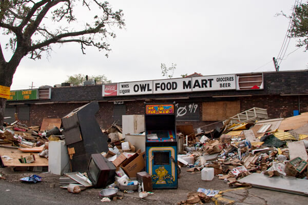
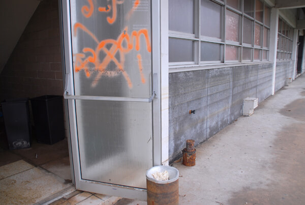
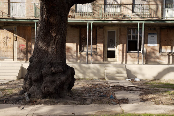
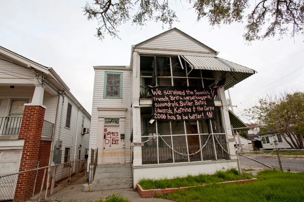
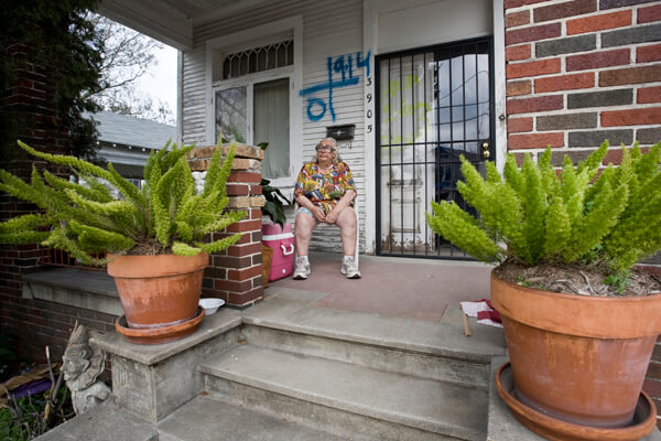
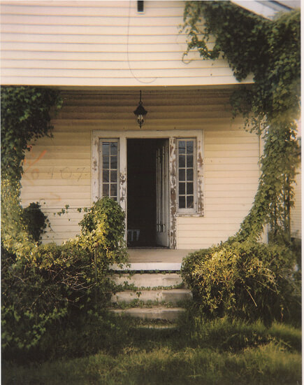
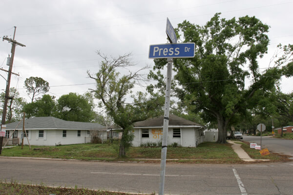
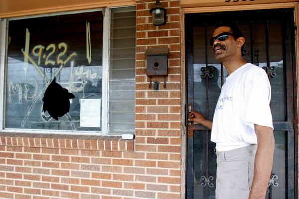
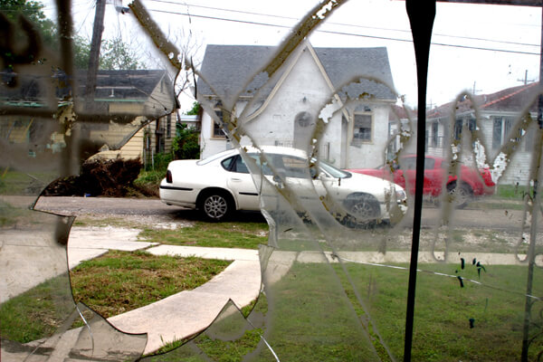
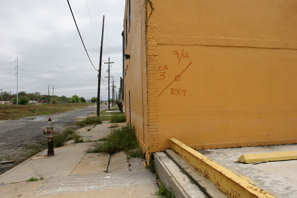
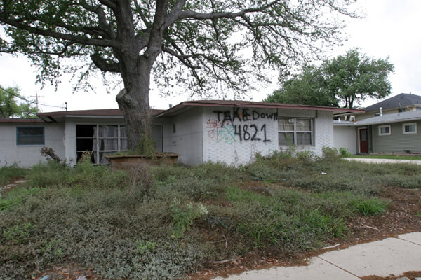
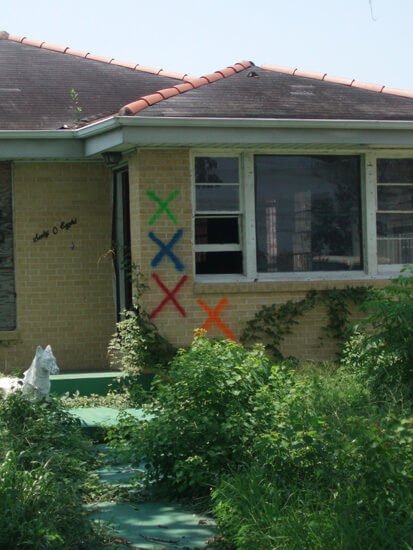


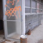
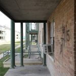
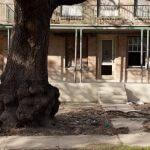
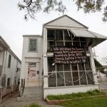

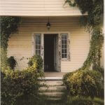

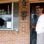
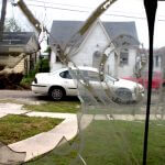
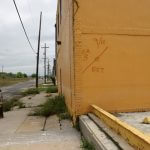
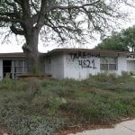
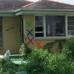
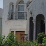
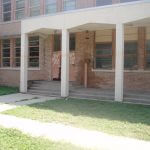

In this neighborhood there is a photograph (slide 12) by Collette Fournier showing a code not recorded elsewhere—a factory wall shows a slash with a circle. The X was not completed and the circle indicates that a team left the building without completely searching it.
Before and After in Gentilly
In 2005 Lauren Tilton photographed a church with a toppled steeple and a code marked from boat height. She returned to the same location in 2010 to record a repaired steeple base and a fading code.


Bywater, 2005–2006
The Bywater district, known alternately as the Upper Ninth Ward, encompasses six diverse neighborhoods. The riverside neighborhoods on higher ground, Bywater and Faubourg Marigny, with their vivid architectural palettes (and a contrasting spectrum of markings), were not as drastically affected by floodwaters as neighborhoods such as St. Roch and St. Claude in the lakeside direction. Standard codes and unusual notes ("Bunny gone" and "1 chicken rescued") are interspersed with official notices from FEMA threatening impossible-to-meet deadlines. Search notations continued into October.
. © Richard Campanella.")
Richard Campanella wrote of discovering the code on his Bywater home, and his attachment to the graphic: “I first saw our X upon returning to our house on September 14, twelve days after my wife and I fled the flooded city. The sight startled me: blood red, perfectly centered, on the pastel pink facade of a 112-year-old house. A professional graphics designer could not have created a more perfect icon of the Katrina catastrophe: striking, well proportioned, loaded with relevant information without being noisy, hectic yet methodical. It was so ugly, it was nearly beautiful.
“I conserved my X for over two years as a historical relict (much to the consternation of my wife), but finally painted it over in December 2007 when rumors circulated that insurance companies were passing actuarial judgments on houses based on visual evidence of their occupancy . . . It pained me to paint it over, but honestly I haven't missed it since. Perhaps I over read its symbolic importance; perhaps I let the pragmatic trump the abstract . . . or perhaps time is softening the searing memories of that time.”22Campanella, Richard. E-mail correspondence, February 2, 2010.
Voudou references
Observers have compared the codes to voudou23Louisiana French spelling. Alternates forms: voudun, vodou, voodoo. markings, and specifically to vévés (linear symbols used to summon spirits in voudou’s religious ceremonies).24Saint-Lot, Marie-Jose Alcide. Vodou, a Sacred Theatre: The African Heritage in Haiti. Coconut Creek, Florida: Educa Vision, 2003, 105. Cynthia Scott contrasts a structural instability code to both a hieroglyph and a voudou pictograph. Paul Conlan has photographed what is probably an authentic vévé next to a Marigny home’s X-code.

. © Paul Conlan.")
New Orleans East
New Orleans East (or Eastern New Orleans) was developed near the lakefront on large swaths of low-lying reclaimed wetlands in the second half of the twentieth century. During Katrina the area was inundated from several sources, including the notorious MR GO canal (Mississippi River Gulf Outlet) on its southern border. New Orleans East straddles the I-10 entrances to the city approaching from the east. The devastation on both sides of the freeway, of see-through apartment complexes, deserted shopping centers, and blue-tarped homes greeted motorists entering the metro area for several years following the storm.
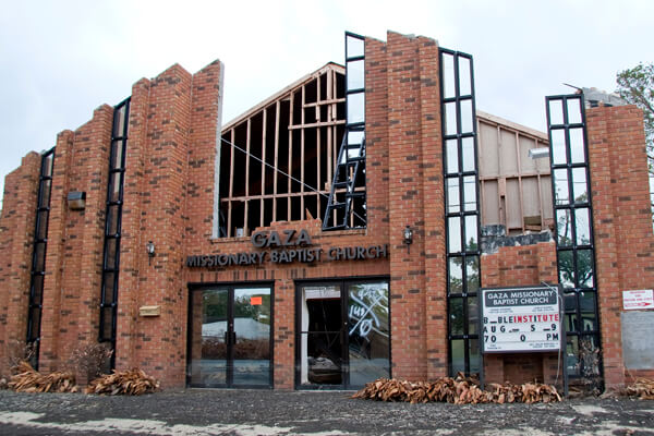
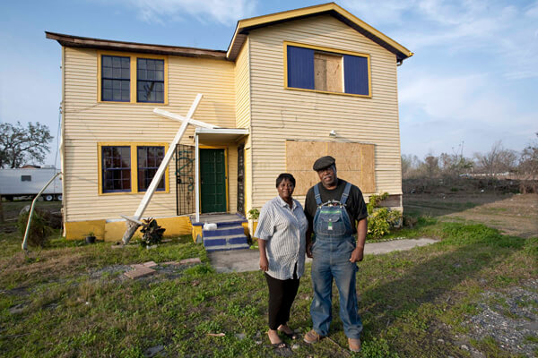
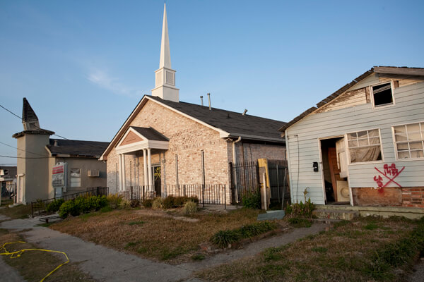
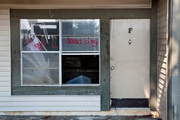
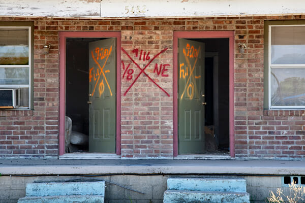
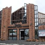

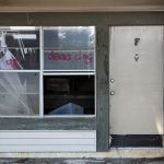


The photographers working in New Orleans East captured images of devastated churches, abandoned apartments, and returning residents. American Studies scholar Lynnell Thomas (slide 6) links a photograph of her own home’s X-code to her neighborhood homeowners’ association website in Kingswood Subdivision, chronicling the mutual support of a recovering community.
Mid-City
Mid-City's name describes its location. Bayou St. John, a natural stream without levees is the only waterway in Mid-City. It overflowed with storm surge entering from Lake Ponchartrain. Much of the area's flooding, however, resulted from influx from the Industrial Canal and the levee breaks affecting Lakeview and Gentilly.
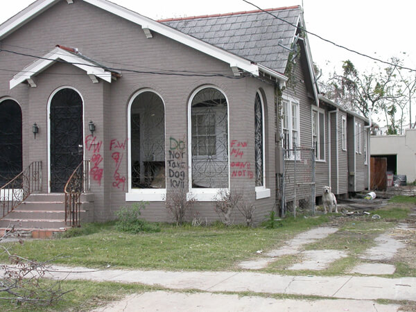
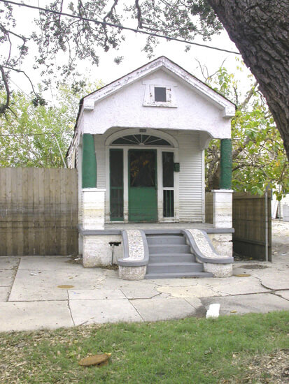
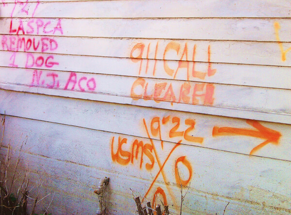
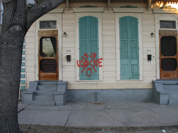
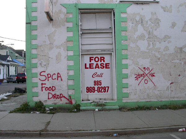
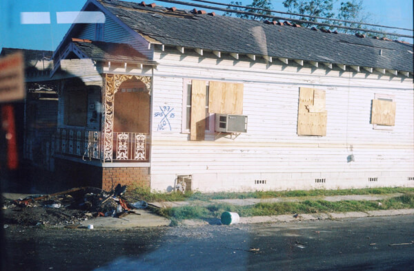

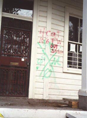
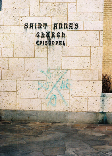
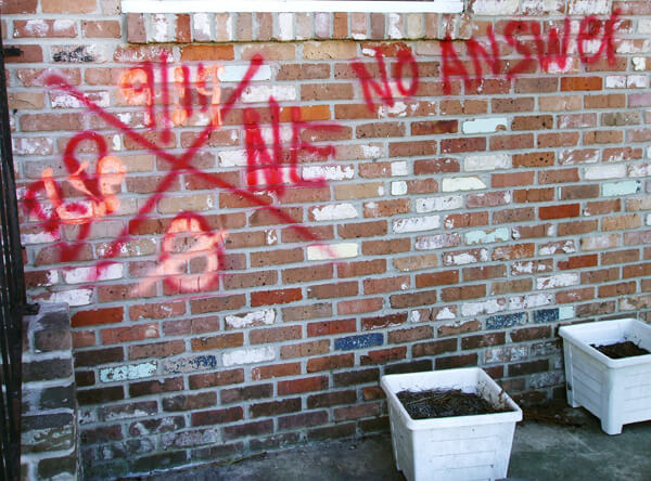


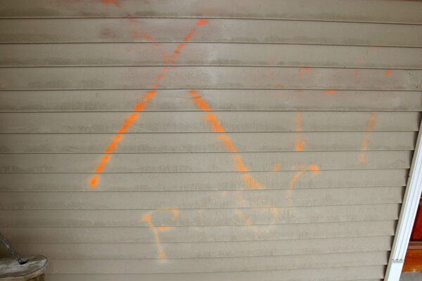

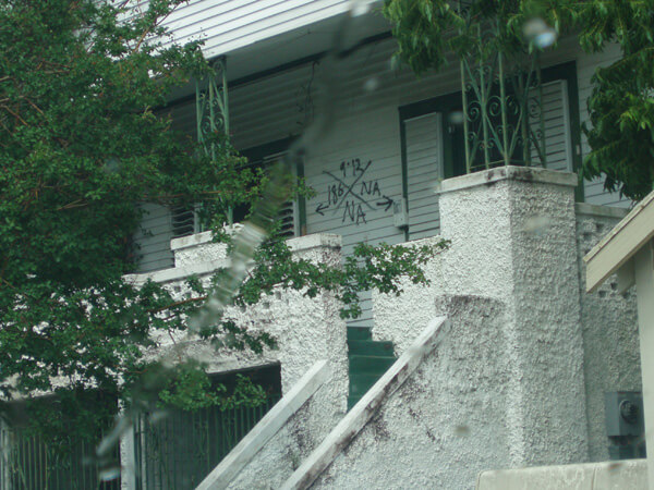
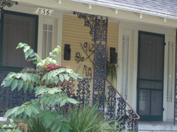
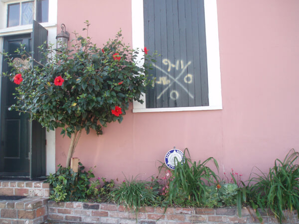
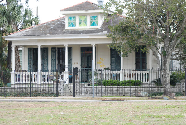
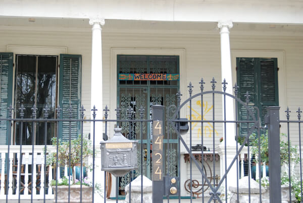

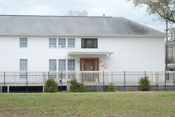

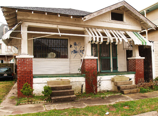

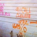
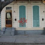


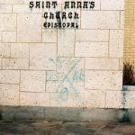
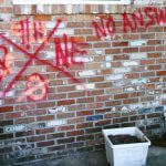


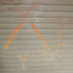


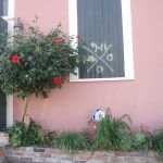
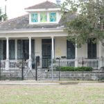


Famed Canal Street and its businesses, schools, places of worship, and surrounding residential areas suffered varying depths of flooding. Geological features running through the area such as the slightly higher Metairie and Esplanade ridges took on much lower water levels.
Street Scenes: Moss Street, Faubourg St. John
In 2010 Cynthia Scott recorded several residences on Moss Street bordering Bayou St. John, providing a microcosm of Faubourg St. John, a neighborhood recovering, but with gaps.

Uptown
The neighborhoods encompassed by the Uptown Planning District were diversely affected—the farther away from the river the more likely the flood damage. The natural levee of the Mississippi River provides a geological advantage, and the higher ground in the crescent that follows the river's curve is often referred to as the Sliver by the River or the Isle of Denial.
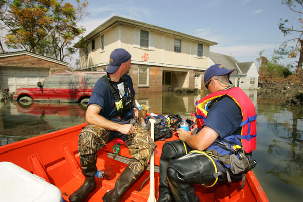
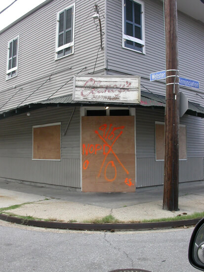
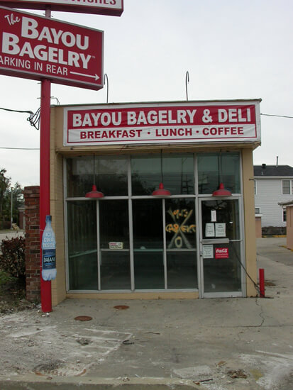

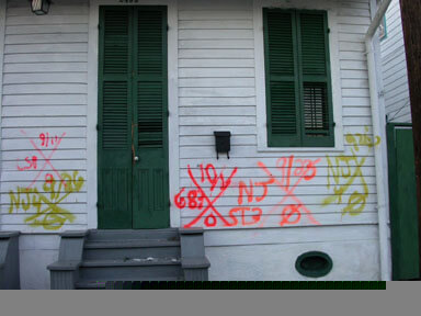
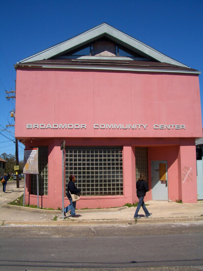


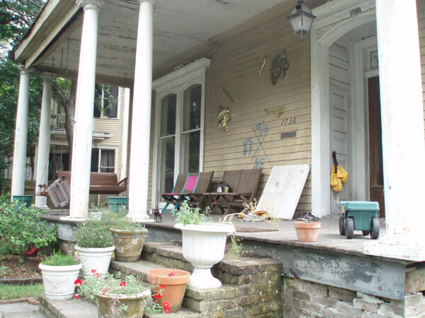
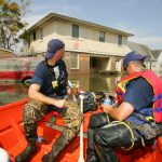
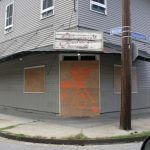
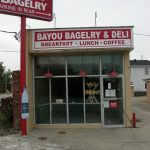


Late in the year many New Orleanians celebrated Christmas 2005 away from home, but a few residents constructed X-codes from Christmas lights (slide 4). Broadmoor is an Uptown area that did flood. In 2007 historic preservation students from University of North Carolina at Greensboro worked with the Broadmoor Community Center to document several affected historic buildings.
St. Bernard Parish
Just downriver from the Lower Ninth Ward, St. Bernard Parish is subject to the same types of natural and unnatural hazards. The MR GO and Intracoastal Waterway are just north of the parish's residential areas and these waterways funneled storm surge at such a rate that there were levee breaks as well as severe overtopping. Walls of water descended on the small-town and suburban landscape, resulting in devastating damage.

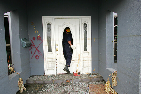
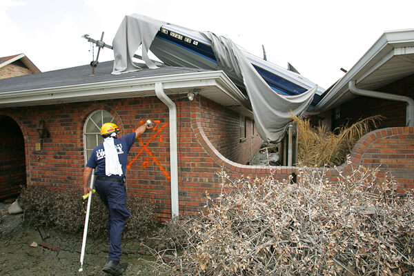
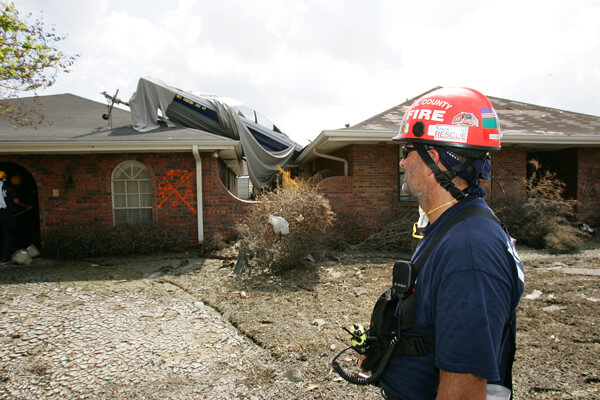

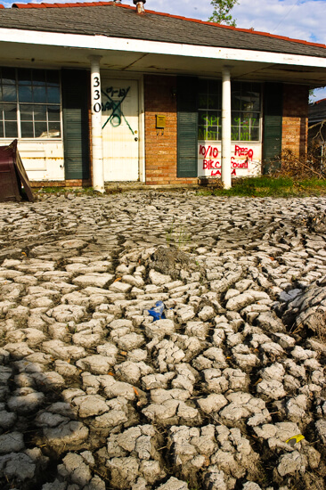
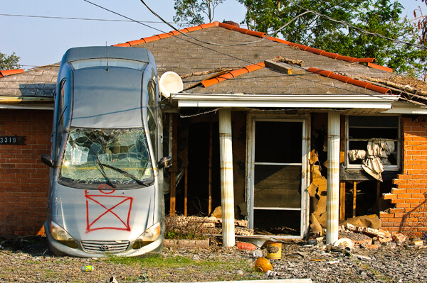
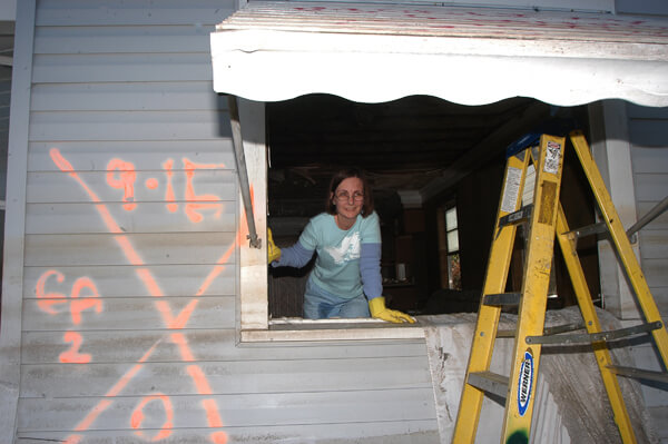
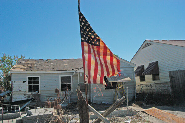
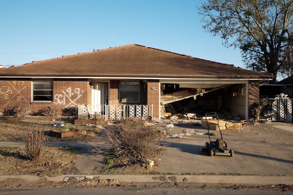
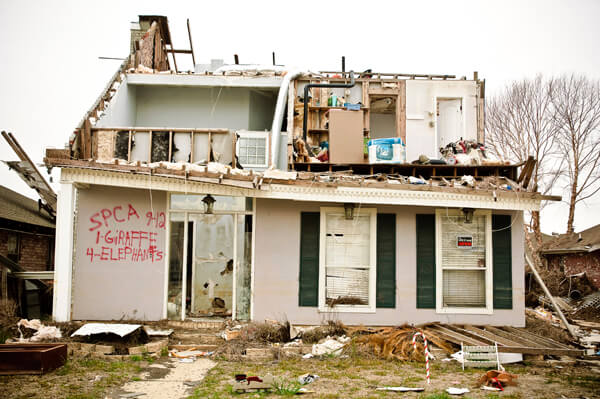

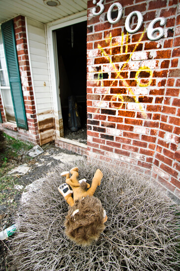
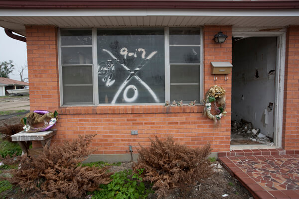
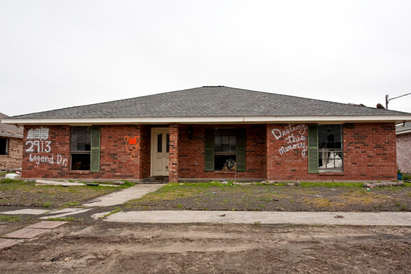
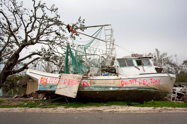
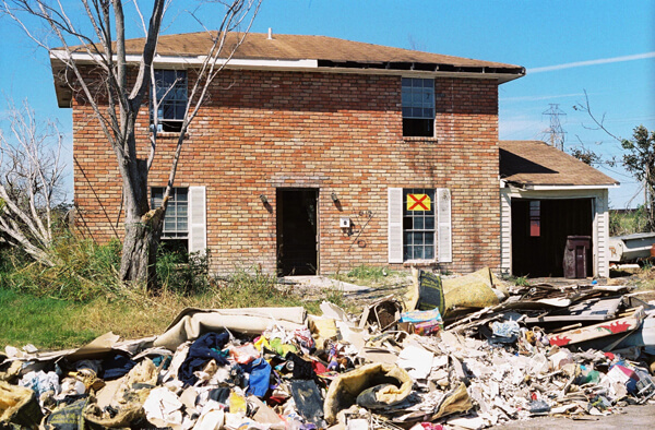
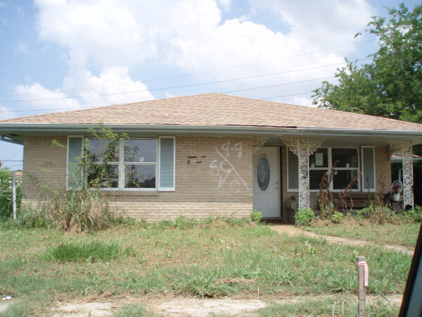
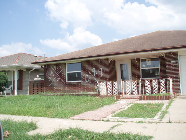
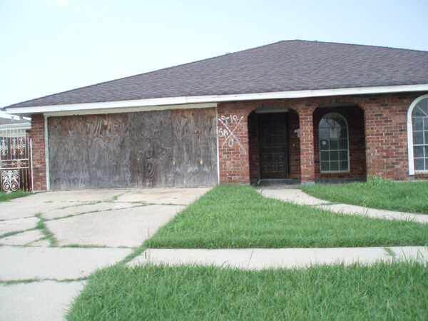
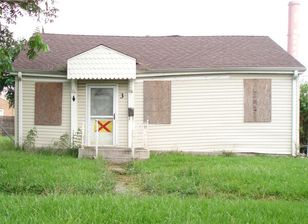
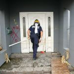
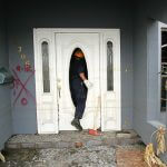
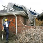
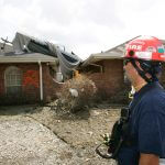
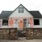
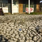
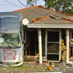
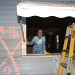
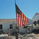

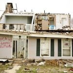
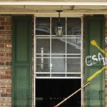
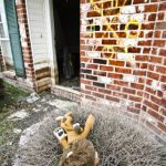

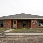
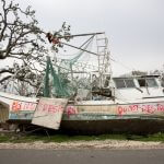
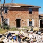
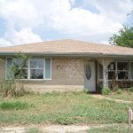


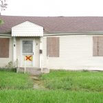
Two photographs in this slide show display a different X-code—a brilliant yellow placard with a red X, indicative of a St. Bernard Notice and Order of Involuntary Demolition. A photograph of a two-story home (slide 17) by Christina Bray shows the standard code next to the placard. A 2010 photograph (slide 22) by Dorothy Moye shows the placard as the only marking on a house scheduled for demolition. The owners of the home in Bray's photograph successfully appealed their notice.25Text of Involuntary Demolition notice: NOTICE & ORDER of INVOLUNTARY DEMOLITION Address: (handwritten) No repair, rehabilitation, reconstruction, or maintenance activity is apparent at this address. This Property appears to be abandoned! This structure has been identified as and declared by the St. Bernard Parish Government to be a public health and safety hazard and INVOLUNTARY DEMOLITION ORDERED. To object to INVOLUNTARY DEMOLITION the owner, or another person with proper legal interest in this property, must file a written appeal with the St. Bernard Parish Department of Community Development, #261 Judge Perez Drive, Chalmette, La. The written appeal must provide a plan for the start of or proof of actual repair, rehabilitation, or maintenance of this structure. Involuntary Demolition will be delayed only when an appeal is being considered and stopped only if appeal is granted. Date Posted: (Handwritten) Posted by: (handwritten) Other: (handwritten)
French Quarter
The French Quarter occupies the high ground of the city, with the natural levee of the Mississippi the obvious choice for the eighteenth century European settlers.


Under constant debate is the fate of the Iberville Projects, public housing adjacent to the French Quarter and the Central Business District.
Lower Ninth Ward, 2007–2010
By 2007 very little rebuilding had happened in the section of the Lower Ninth Ward most devastated by the levee break. Clearing of debris left vacant lots and front steps that led nowhere, while hundreds of deteriorating structures remained untouched. Handmade street signs were the norm, although floated houses blocking streets had been removed. Photographers visiting for the first time were shocked to see how much remained to be done. Those who had visited before could detect small differences, with activities of nonprofit and community groups the most visible.
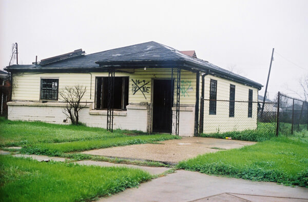

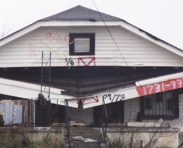
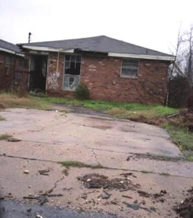
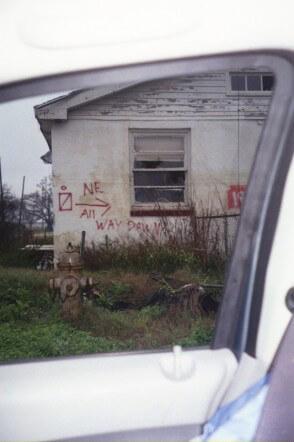
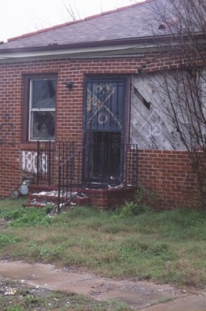

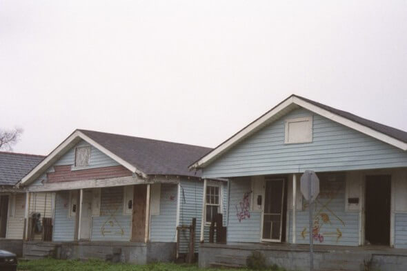
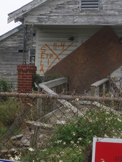
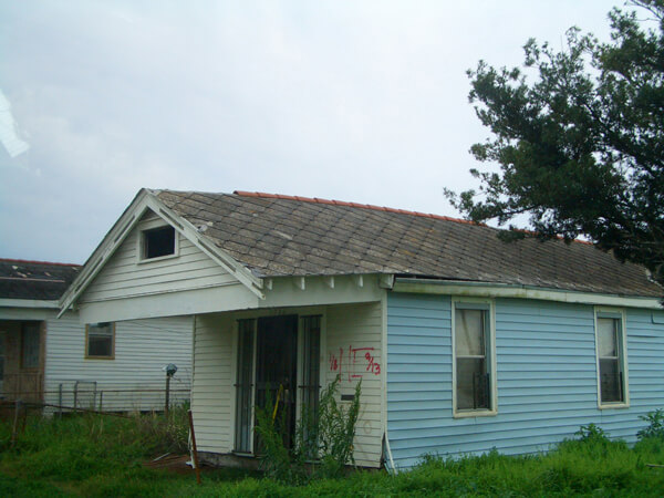
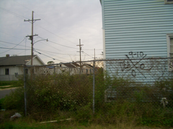

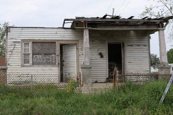
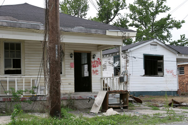
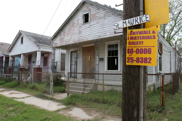
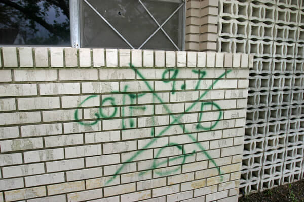
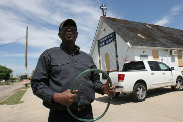
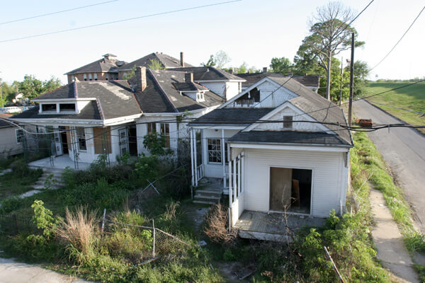
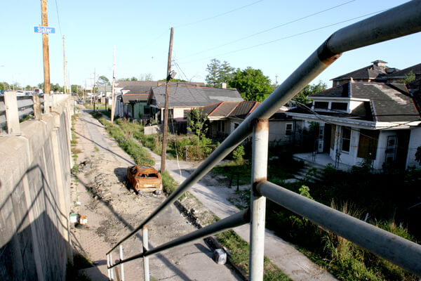
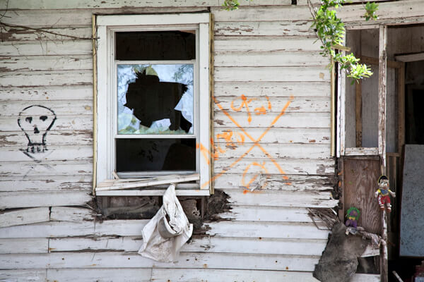
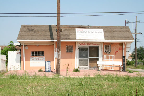
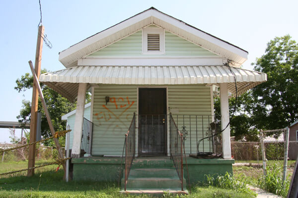
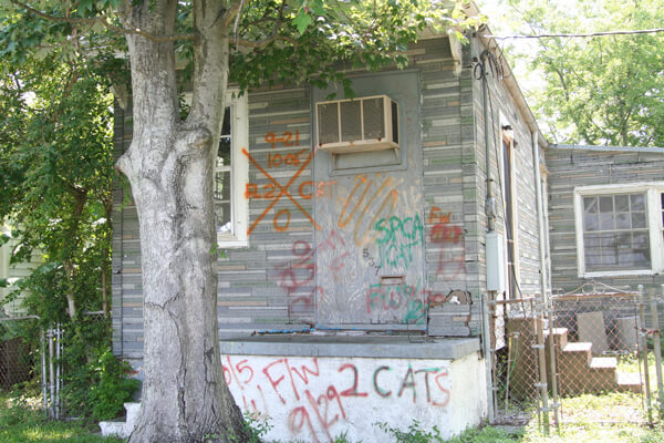
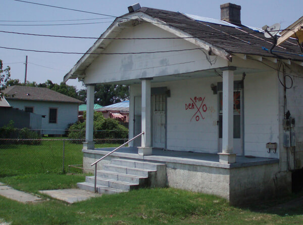
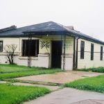
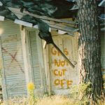
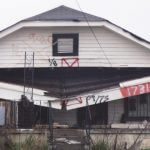
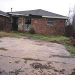
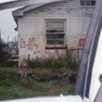


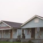
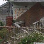
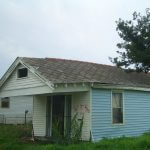
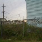
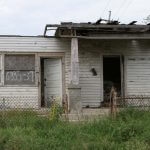
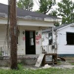
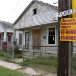

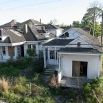
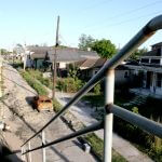
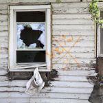
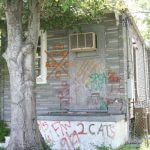
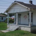
In 2008 renovations were under way and changes were apparent in the Holy Cross section of the Lower Ninth. The flooding there had not been as devastating and more houses remained standing, though waiting for attention. X-code markings were fading, but still evident. Also in the fall of 2008 and early 2009 a major art invitational, Prospect.1, brought art installations and accompanying traffic into the Lower Ninth Ward. A conceptual installation by Berlin artist Katharina Grosse used an abandoned Holy Cross home as a canvas to depict an inferno with the house’s code untouched (slides 12 and 13).
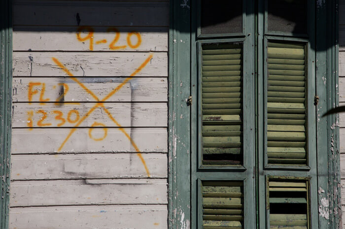
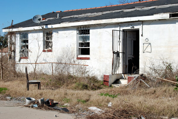
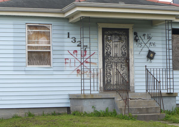
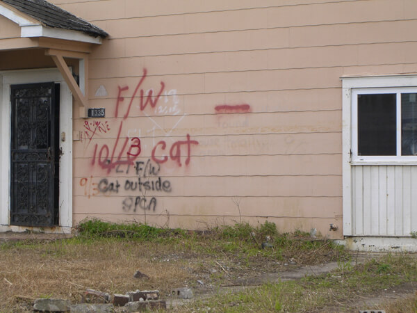
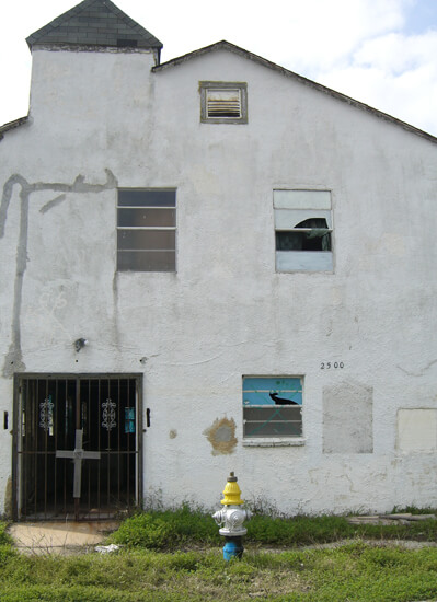
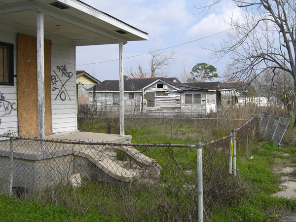
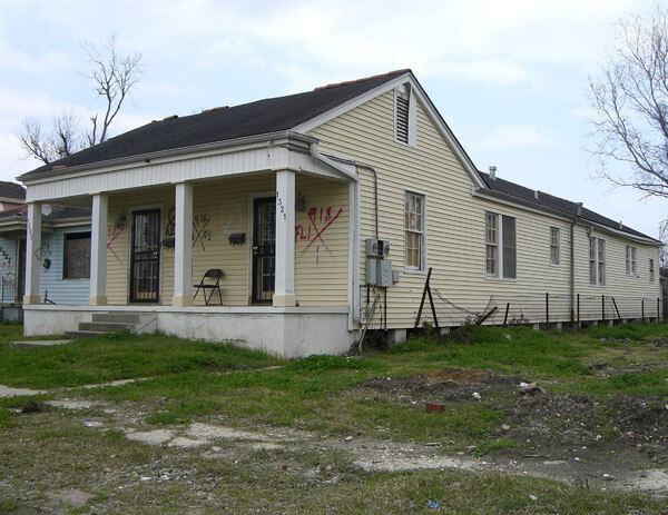
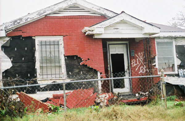
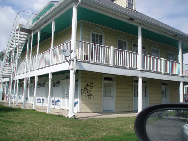
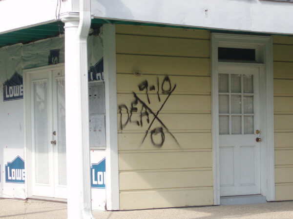
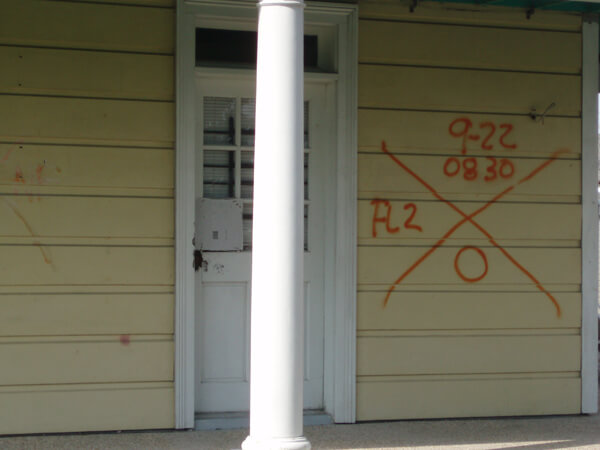
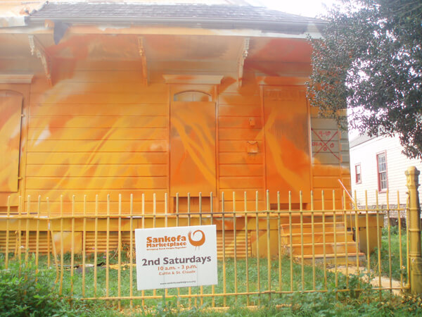
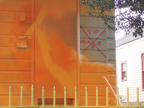
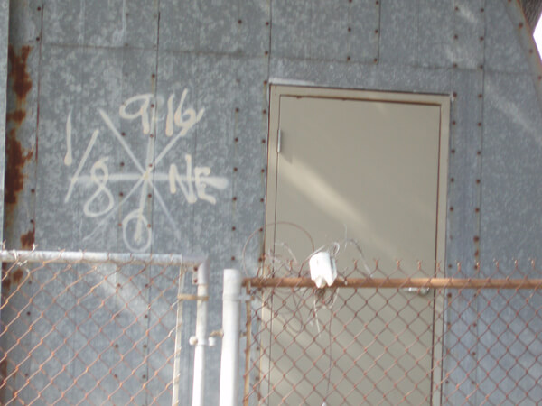
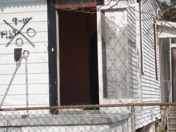
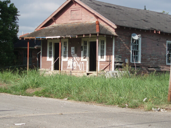
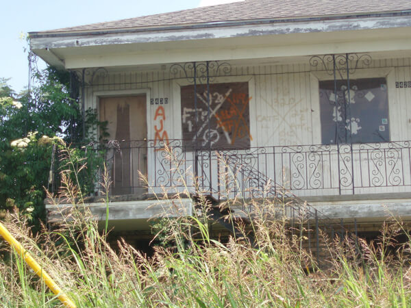
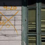
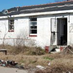

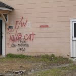
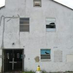
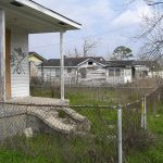
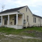
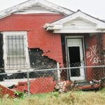
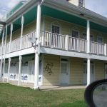
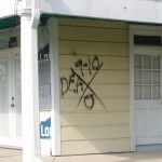

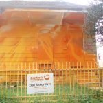
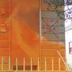
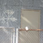

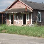
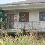
In 2010, approaching the fifth anniversary of the storm, the Holy Cross neighborhood has benefitted more visibly from renovation and rebuilding than the other areas of the Lower Ninth. Clear signs of life contend with still significant numbers of slowly deteriorating structures. There are clusters of new homes near the largest levee break, including several spectacular structures from Brad Pitt's Make It Right project.


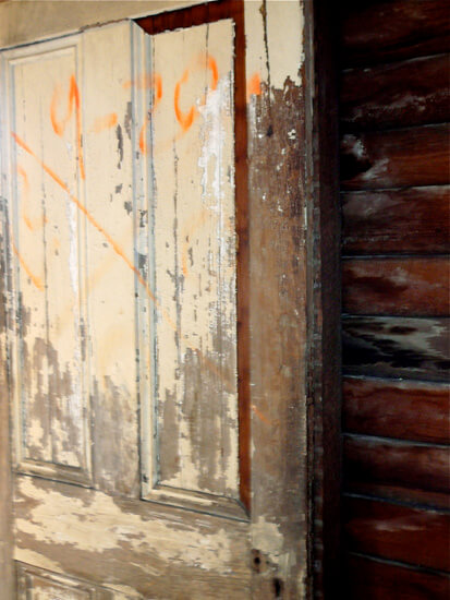
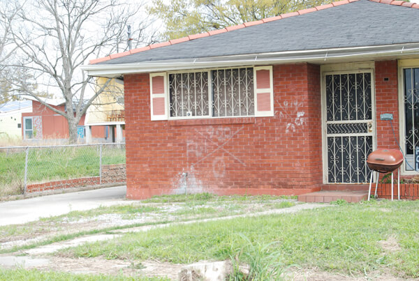
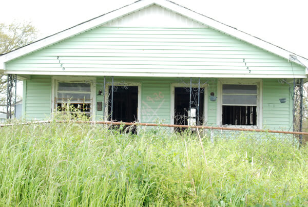
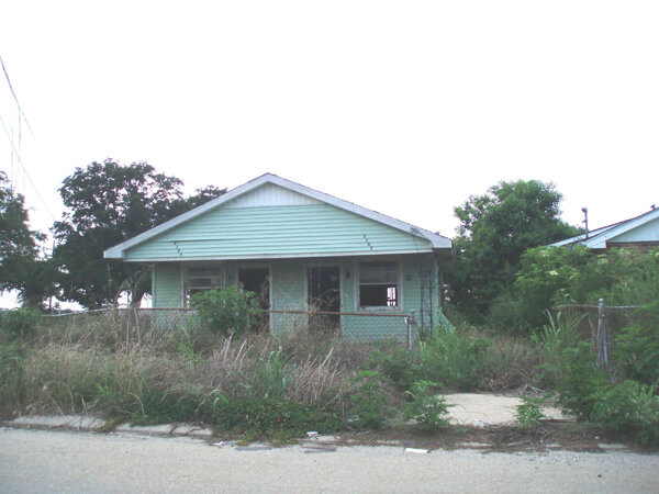
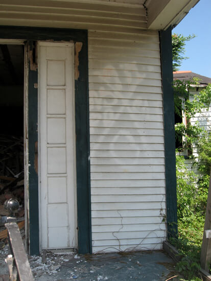
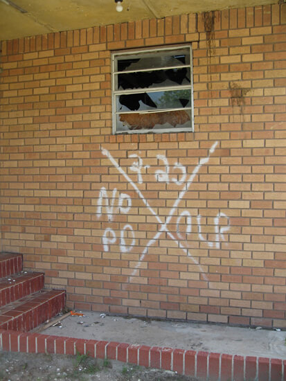
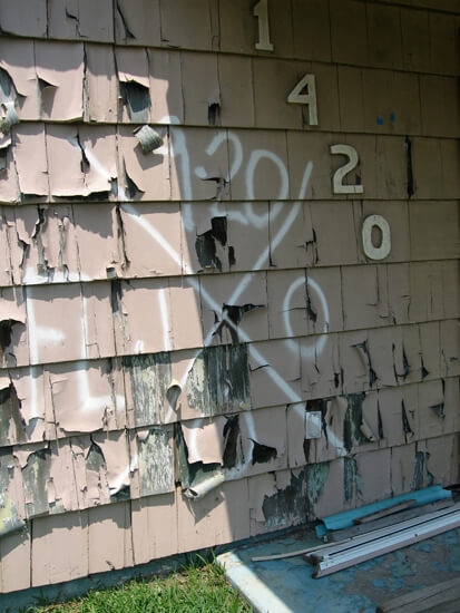
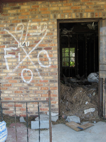
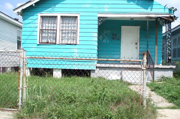
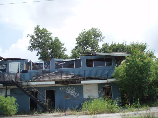
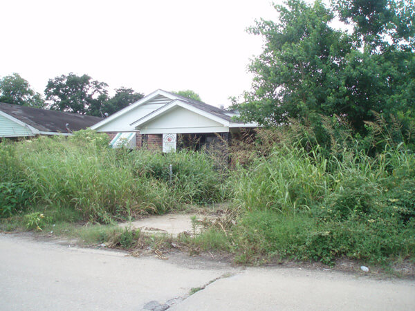
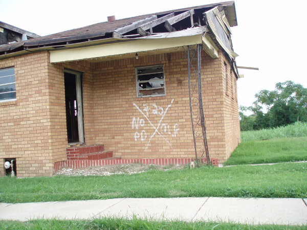
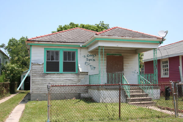


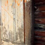
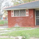
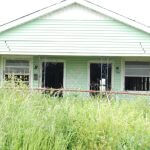
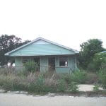
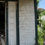
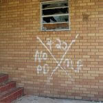


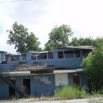
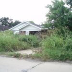
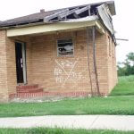

Lakeview, 2007–2010
From the bulldozed remains of old houses in Lakeview new ones have arisen, renovated homes have been elevated to meet insurance demands, and new levee walls are in place in one of the lowest spots in the New Orleans area. There are still gaps in the façade, with vacant lots as well as derelict and see-through buildings, but by the end of 2008 there were few X-codes to be found.
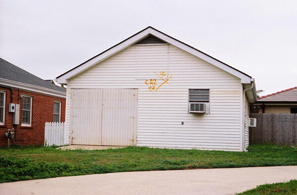
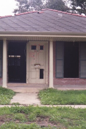
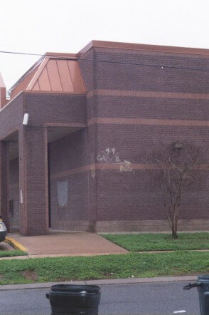
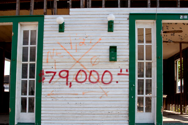

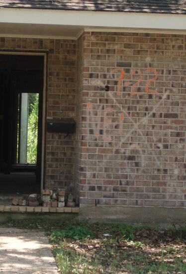

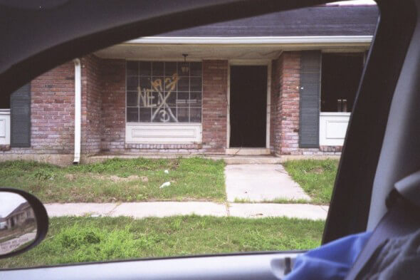
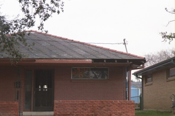
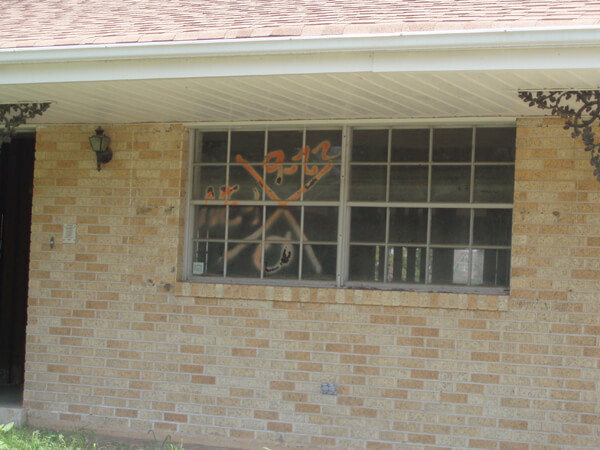
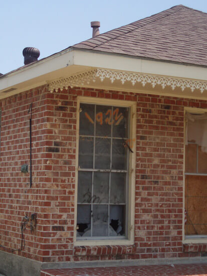
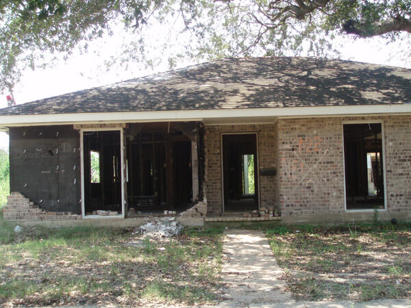
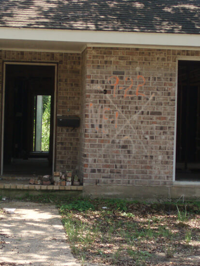
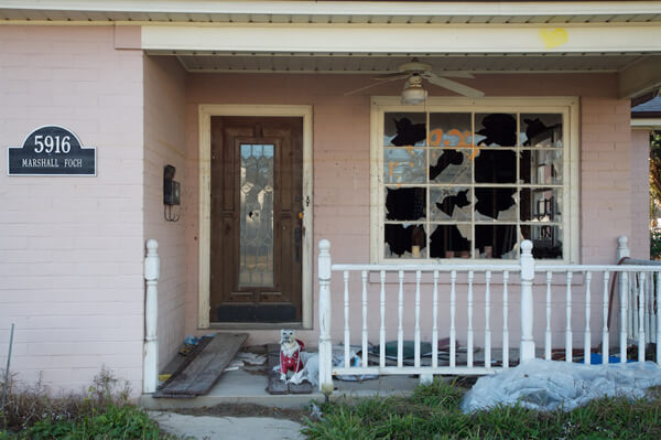


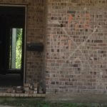


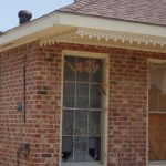
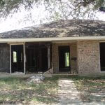
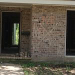

Before and After in Lakeview
Lauren Tilton illustrates the before and after of two 40th Street locations. The first photo, taken in November of 2005 shows houses whose float paths were blocked by a tree and a utility pole. The same location, shot in March, 2010, is a vacant lot.


Tilton also recorded the changes at 446 Spencer Avenue from 2006 to 2010.


Bywater, 2007–2010
The Bywater and Marigny neighborhoods are among the city’s most rapidly gentrifying. They also seem to be the locations that have preserved their codes most carefully. The codes are fading but, as noted by Chris Rose in a 2007 column, they are often displayed as “. . . badges of honor.”26Rose, op. cit.
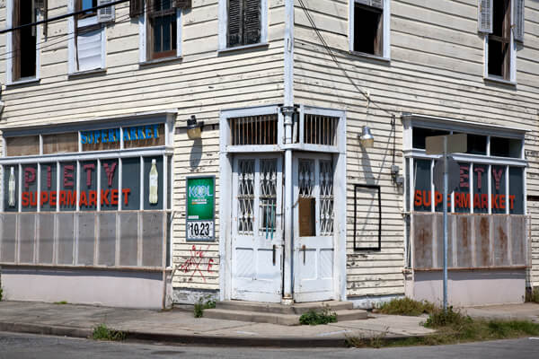
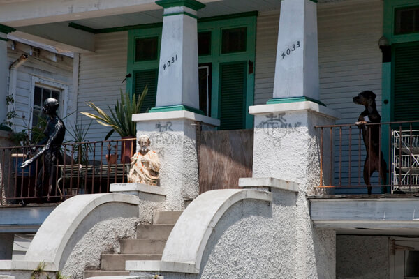
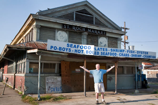
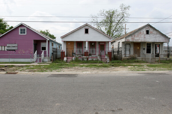
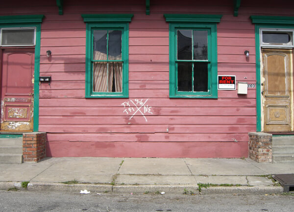
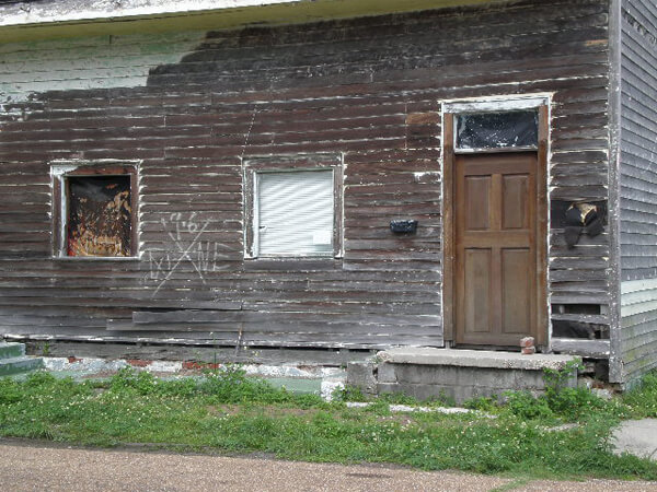


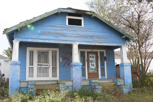
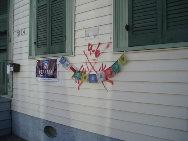

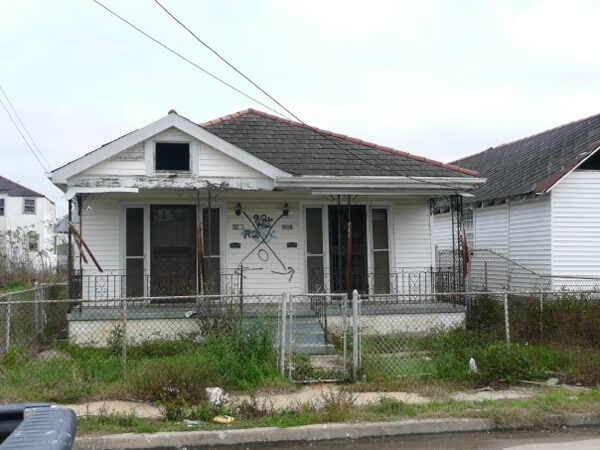
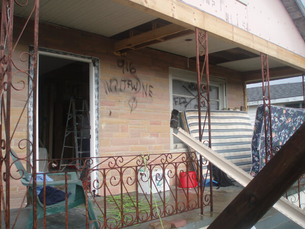
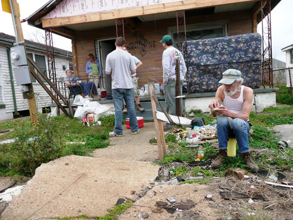
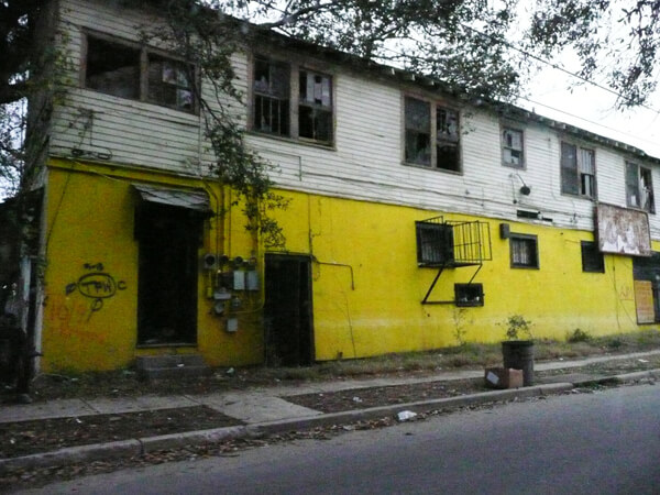
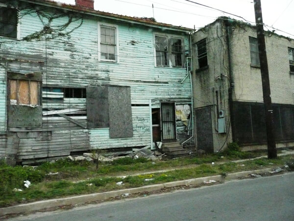
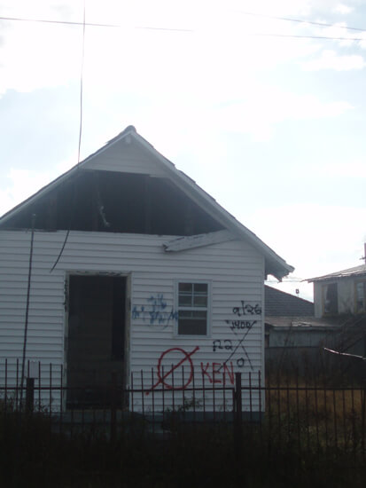
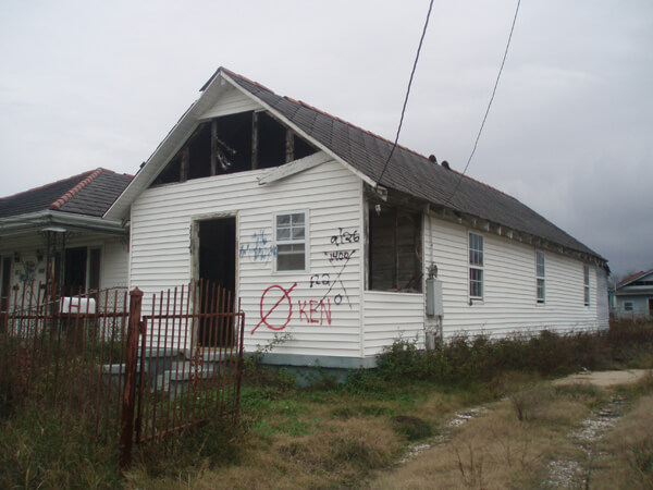
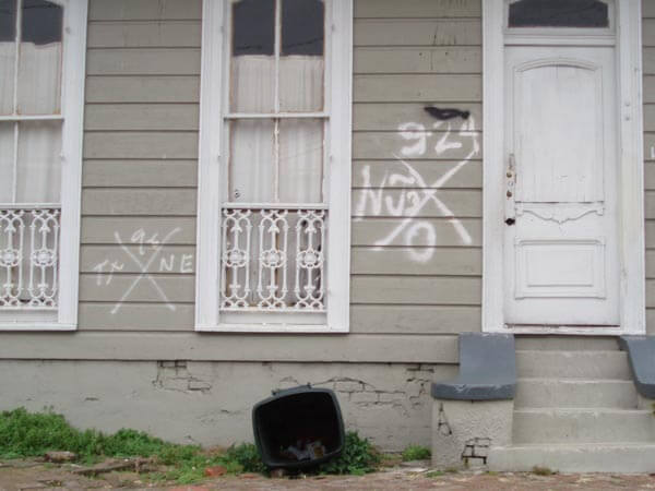
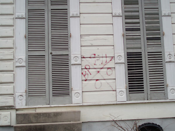
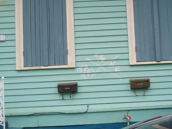

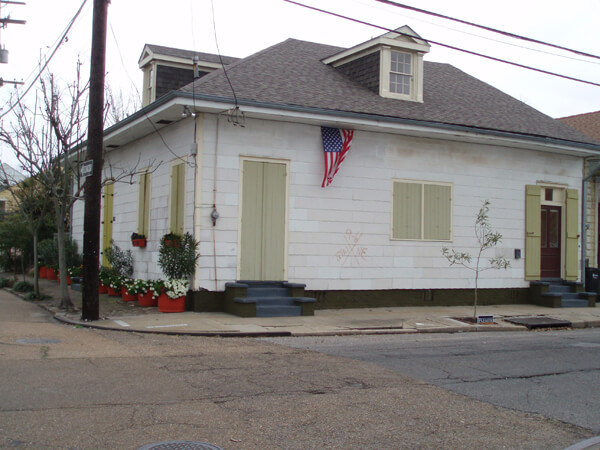

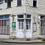

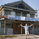

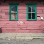
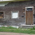
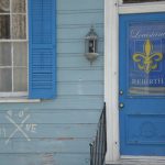

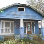

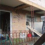
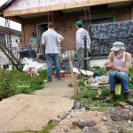
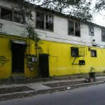
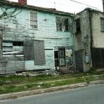
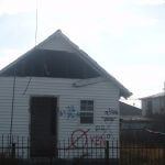
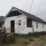
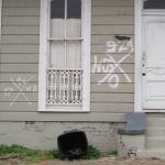
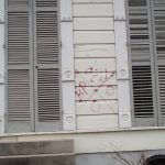
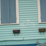

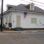


Rose describes an art work by Erica Larkin who created a permanent provenance in wrought iron: “Farther down the block, at the corner of Montegut and Chartres, the glass sculptor Mitchell Gaudet's home is adorned with an iron replica of the existing glyph, superimposed over the original painted marking, a bold statement of intent to never let the memory fade away.”27Ibid. “One of the better examples of embracing the X for its symbolic meaning,” adds Richard Campanella.28Campanella, Richard. E-mail communication August 31, 2009.
Larkin created the duplicate code for Gaudet as a Christmas gift in 2005. She was shocked by the reaction of some neighbors who resented the reminder, but has since received commissions to replicate X-codes for other survivors.29Larkin, personal conversation, June 15, 2010.
Joel Lowy, of Washington, DC, recalls his 2008 photographs of the Bywater: “All photos were taken on a beautiful spring Sunday morning in May. . . Many of the marks were not painted over, despite both time and obvious new repairs. Each is a badge of courage to the emergency workers and residents. Reminiscent, for me, of the NY and DC response to 9/11.”
Before and After in Bywater
Two residents of the St. Roch neighborhood in front of a gutted house in 2006. The second image in 2010 shows the house now boarded up.


Joel Lowy and Dorothy Moye photographed the same location in Bywater almost two years apart. By 2010, it appears from the debris pile that restoration has begun.


Three Spaces Over Time
Repeat visits to three locations by several photographers reveal the progressions of three sites over the five years since Katrina.
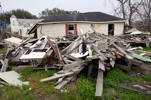
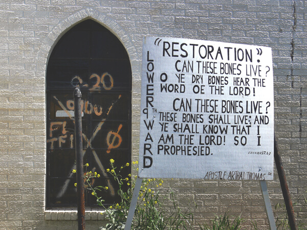
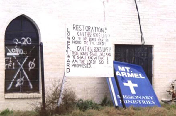
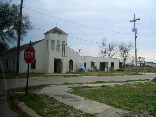
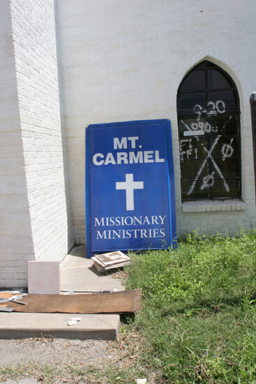
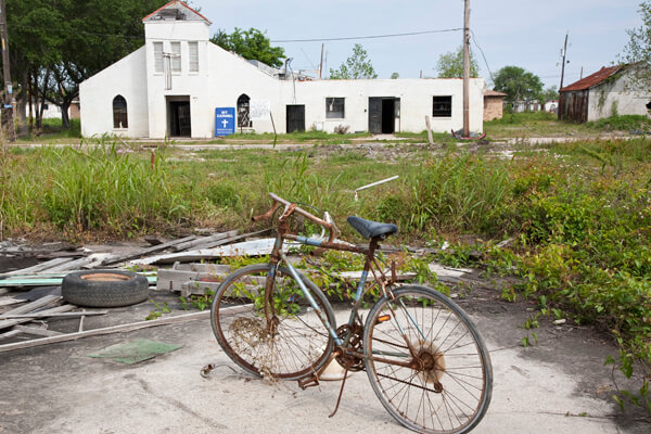
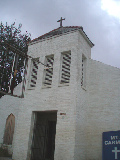

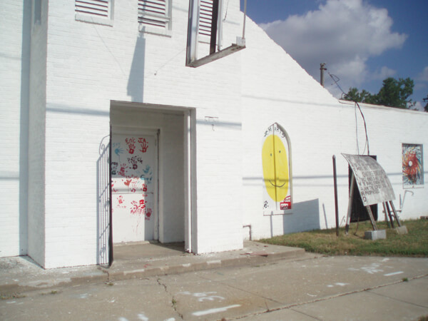
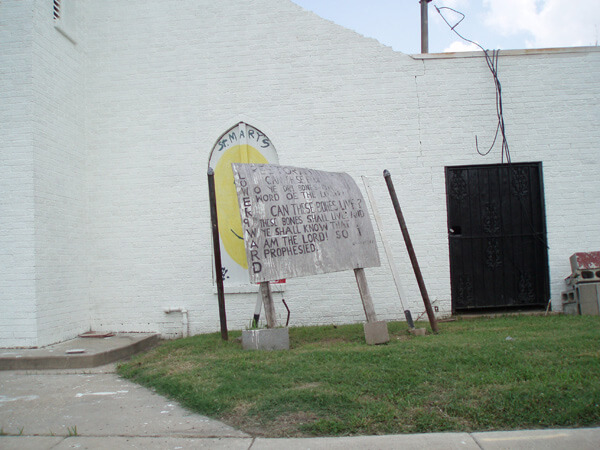
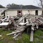
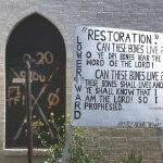
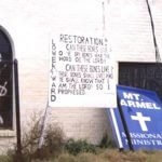
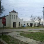
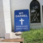
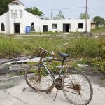
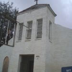

The Mount Carmel Missionary Ministries at the corner of Forstall and Galvez Streets in the Lower Ninth Ward has attracted photographers since early post-Katrina. Stewart Harvey showed the sturdy brick building as a backdrop to demolished houses looking north on Forstall Street in February 2006 (slide 1). The Mount Carmel Missionary Ministries sign is visible still hanging above the front door. In March, Paul Conlan recorded the church’s hand-lettered sign asking, “Can these bones rise again?” next to the X-coded window (a stained glass Jesus).30Full text of the sign in front of Mount Carmel Missionary Ministries building: Restoration: Can these bones live? O ye dry bones hear the word of the Lord! Can these bones live? These bones shall live; and ye shall know that I am the Lord! So I prophesied. (Side) Lower 9th Ward. Ezekiel 37:1–7, Apostle Arthal Thomas He remarked on the chaotic interior, with jumbled furnishings attesting to the force of the water that swept through the building.
By January 2007 light filtered through colored glass windows on a starkly beautiful interior that had been gutted and cleaned. In 2008 the windows were boarded over and the X-code disappeared. The exterior signs remained, although their locations changed occasionally.
In June 2009 it was startling to see a new white paint job, with volunteers’ colorful handprints on windows and the door. The Jesus window now bore a smiley face. A year later the new paint job was beginning to weather, and the deteriorating sign still asked its question. The Mount Carmel Missionary Ministries sign had disappeared.
Board and Battered
Ian J. Cohn, a New Orleans native, has returned to the city repeatedly to assist in his family's recovery, each time photographing a house at 726 Lizardi Street in Holy Cross.
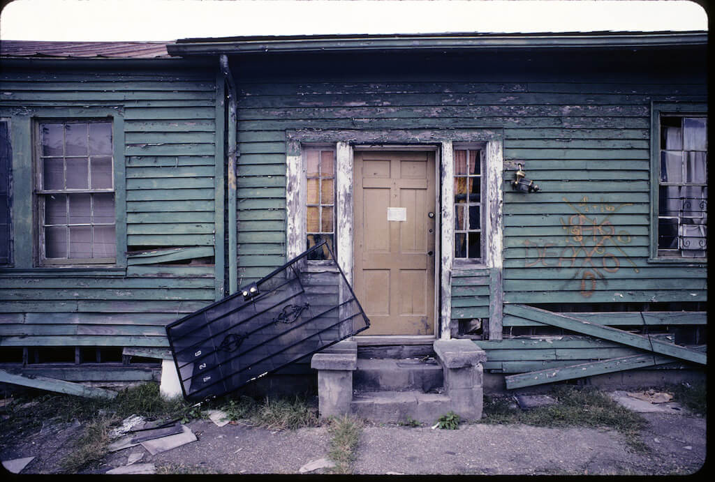
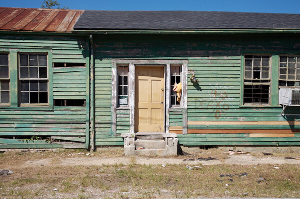

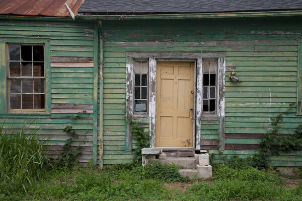
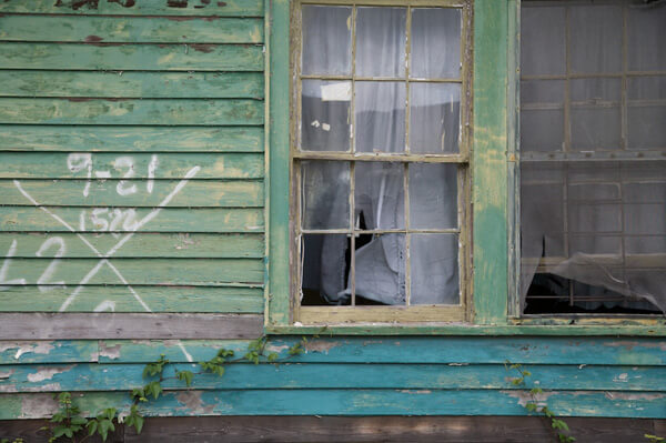
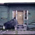
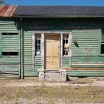
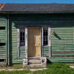
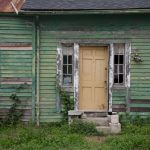
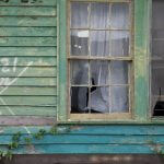
Canal Boulevard, Lakeview
A classic Art Deco-style home on Canal Boulevard in Lakeview demonstrates a progression toward renewal.
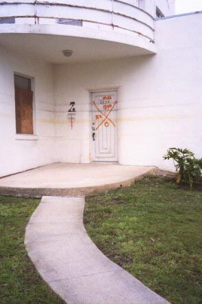

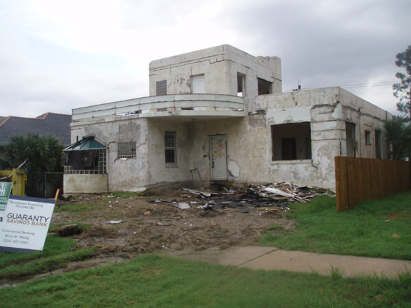


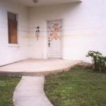
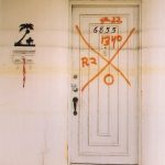
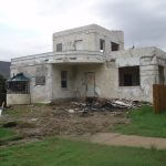


The front door displayed a textbook X-code, completely contained on the period door and marked with successive water lines. Christina Bray's photograph of the door in 2007 is such a good example that it has been licensed for use by HBO for the montage of images in the opening credit of the TV series Treme. The house sat untouched for almost another year, before being gutted, with the coded door in place. By February 2009, the sparkling white restoration was for sale with a new front door; the original door had disappeared. In June 2010 the house was a home, occupied and again a part of the street’s life.
Conclusion
The X-code has become by default a visual icon of post-Katrina New Orleans. Loved or hated, threatening or comforting, a source of survival pride or a negative mark to be obliterated, easily interpreted or enigmatic, a striking graphic or disrespectful graffiti, a major issue or a minor annoyance—all of these reactions persist. In 2010 the remaining markings, even those deliberately preserved, are severely fading and sometimes eroding into “ghost codes.”

These "ghost code" examples, with their distinctive fading pattern the result of some unknown chemistry, leave only a shadow of their original marks. This process of disappearance, as with the other gradually disappearing codes, is comparable to ways that pieces of the past slide into history and memory.
This online exhibition has noted varied reactions to the painted codes, as well as the unprecedented volume of the marks across the city. For more than ten years, search-and-rescue personnel have used the X-code system in many situations nationally, but never to the extent deployed in New Orleans. More recently, in response to complaints of after-effect damage of spray-painted messages on the housing stock, search-and-rescue workers have developed a new tool for marking—a fluorescent sticker to be applied to a door or window, conveying the same information as the painted X-code.31Crawford, Capt. Mike, Maryland Task Force One. E-mail correspondence and telephone conversation, April 20–21, 2009. In future disasters, search and rescue personnel will abandon the painted graphics used after Katrina, and proceed stocked with stacks of low-residue stickers and felt-tipped markers, their progress through the streets marked by a trail of fluorescent rectangles applied to the least damageable surfaces they can find. This practical and more manageable protocol for communication will no doubt have fewer side effects, but from a visual point of view, can never achieve the apocalyptic graphic impact seen in post-Katrina New Orleans.

The documentation of the X-code in New Orleans tells one small piece of the Katrina story. A straightforward reaction to the visual power of the coding has morphed into other stories yet to be fully developed—an examination of the impact of repetition on the visual experience, and the principles of expression underlying coded messages, to name only two. Photographs record the visual impact of repetition and the visceral power of the X, but they do not explain it. We are left to react, ponder, and interpret. The body of documentation leads us to consider the meaning of coding in everyday life. It demonstrates how in tragic circumstances markings that are inadvertently interpreted as symbols can haunt our memory, or how an official graphic repeated endlessly tells a story or morphs in our perception into found art. On one level, it celebrates heroism and memorializes lives. On other levels, the code continues to invite further investigation. On many levels, the X-code leaves us haunted and New Orleans unique.
About the Curator
Dorothy Moye is a Decatur art consultant and a former resident of New Orleans who has retained ties to and an ongoing fascination with the city. Her current project on post-Katrina search-and-rescue building markings is a response to the haunting visual impact of the thousands of these markings after the storm, many of which remain even five years later. Despite years of organizing exhibitions and other large-scale arts projects, Katrina + 5: An X-code Exhibition is Moye’s first virtual exhibition. A preliminary article on the project is at https://southernspaces.ecdsdev.org/2009/x-codes-post-katrina-postscript. Moye holds membership in numerous arts organizations, both local and national. She graduated from UNC–Greensboro and North Carolina State University in Raleigh with degrees in sociology.
About the Photographers
Jane Fulton Alt, Evanston, Illinois. Fine art photographer and clinical social worker. Alt participated as a counselor with the Look and Leave program November 2005, accompanying Lower Ninth Ward residents on their first limited visits back to their homes. Her book, in which many of these photographs first appeared, is Look and Leave: Photographs and Stories From New Orleans's Lower Ninth Ward (Center for American Places at Columbia College Chicago, 2009). http://janefultonalt.com
Ellen Luckett Baker, Atlanta, Georgia. Author and owner of The Long Thread. Baker visited New Orleans for the first time in early 2008 and found the x-codes “end-of-the-world eerie.” http://thelongthread.com/
Christina Bray, Decatur, Georgia. Artist and youth minister. Bray has been traveling regularly to New Orleans since Katrina participating in the Episcopal Diocese of Louisiana’s Rebuild program in the city. http://christinabray.com/home.html
Richard Campanella, New Orleans, Louisiana. Geographer and author, assistant research professor, Department of Earth & Environmental Sciences, Tulane University. Campanella’s two most recent books, Geographies of New Orleans: Urban Fabric Before the Storm and Bienville’s Dilemma: A Historical Geography of New Orleans, illuminate the geographical and social difficulties as well as the rewards of life in a precariously sited urban area. http://tulane.edu/sse/eens/richard-campanella.cfm
Ian J. Cohn, New York, New York. Photographer, designer, and architect. Cohn is a native of New Orleans and states, “My intent in taking the pictures was both documentary as well as ‘artistic,’ but the documentary part is based on the concept that I was there to bear witness.” His blogs on returning visits to the city are insightful journals of days immediately post-Katrina. http://www.diversity-nyc.com/
Paul Conlan, Newnan, Georgia. Photographer, member of New Orleans Photo Alliance, Atlanta Photography Group, and and the Roswell Photographic Society. Conlan specializes in southern subjects. http://www.fstopblues.com/-/fstopblues/about.asp
Elyse Defoor, Atlanta, Georgia. Studio artist. Defoor has emotional ties to New Orleans and has responded to the post-Katrina experience with a multi-media exhibition titled X.U.ME. http://elysedefoor.com/
FEMA photographers: Jocelyn Augustino, Andrea Booher, Patricia Brach, Win Henderson, Patsy Lynch, Bob McMillan, Marvin Nauman, Alberto Pillot, and Liz Roll.
Collette Fournier, Spring Valley, New York. Photographer and member of Kaimonge Photography Collective. Fournier’s work is the result of a Kaimonge grant to cover post-Katrina events. http://www.kamoinge.com/collettevfournier.htm
Brian Gauvin, New Orleans, Louisiana. Photographer. Gauvin’s first post-Katrina images are among the earliest included in the exhibition and convey an on-the-scene immediacy.
Stewart Harvey, Portland, Oregon. Photographer. Harvey had begun a photography series on New Orleans in 2003, and on his first post-Katrina return he struggled to make sense of the visual chaos and devastation. His focus eventually became the character of the people who had survived this experience. http://www.stewartharveyphoto.com
Herbert H. Hill, Pullman, Washington. Chemistry professor, Washington State University. Hill reunited with old friends to work on a Rebuild project in New Orleans in 2009. http://analytical.chem.wsu.edu/faculty/hillh.
Constance Lewis, Atlanta, Georgia. Fine art photographer and gallery owner, independent curator. Lewis’s curatorial projects include the founding of Opal Gallery, an Atlanta based artist collective: and, exhibitions in Paris, San Francisco, and Atlanta. Her most recent book project, Oraien Catledge: Photographs (University Press of Mississippi) will be released this year.
R. Joel Lowy, Silver Spring, Maryland. Lowy is a biomedical researcher who knows what it’s like to miss New Orleans and enjoys calas, BBQ oysters, and funk.
Thomas Mann, New Orleans, Louisiana. Artist and gallery owner. Mann was able to gain early access to the city in order to stabilize his Magazine Street gallery. His exhibition Storm Cycle: An Artist Responds to Hurricane Katrina was created as an immediate response to the storm and has been traveling since 2005. http://www.thomasmann.com/
Gigi O’Shea, Decatur, Georgia. Elementary school teacher and New Orleans co-adventurer.
Liza Politi, New York, New York. Producer, actor, teacher and photographer. Politi photographed a series centering on the first anniversary of the storm. http://www.lizapoliti.com/
Megan Privett, Siler City, North Carolina. Privett was a graduate student in historic preservation at the University of North Carolina at Greensboro in 2007 and participated in a class project of digital documentation of four historic buildings in New Orleans. She now works as a historic preservation specialist.
Shari Seltzer, Westfield, New Jersey. Artist. Seltzer and her son visited New Orleans for the first time in early 2010 with a rebuilding group. They worked in the Lower Ninth Ward and the codes they saw as they traveled through reminded them of the Biblical story of Passover. http://web.archive.org/web/20100910022812/http://blogservices.net/ss/index.php
Cynthia Scott, New Orleans, Louisiana. Artist. Scott has photographed extensively in her Faubourg St. John neighborhood, and produced numerous installations and sculptures from post-Katrina debris. http://Cynthiascott2000.com
Kathy Shorr, New York, New York. Photographer. Shorr founded the Summer in the City Project, which brings adolescent girls from disadvantaged communities in New Orleans to New York for an experience in art, culture, and fun. http://www.kathyshorr.com/
Lynnell Thomas, New Orleans, Louisiana, and Boston, Massachusetts. Assistant Professor of American Studies at University of Massachusetts-Boston. Thomas identifies herself as part of the Katrina Diaspora, and her recent research focus is on the racial components of Louisiana tourism. Her New Orleans East subdivision website is http://web.archive.org/web/20100904030649/http://thekingswoodassociation.com/id4.html
Lauren Tilton, New Orleans, Louisiana and New Haven, Connecticut. Tilton has recently completed an assignment as Virtual Classroom Coordinator at the World War II Museum in New Orleans, and is a PhD student in American Studies at Yale University.
Tyler and Lane Turkle, Tallahassee, Florida. Artists. The father and daughter Turkles have been photographing in New Orleans since 2007. They see their collaborative work as useful in the recovery of the neighborhoods they document, and have returned several times to continue their series. Collectors of their New Orleans images purchase by way of a donation to the rebuilding program of their choice. http://www.tylerturkle.com/
Acknowledgments
The curator would like to thank those who have helped to bring this project to this stage. Special thanks to Allen Tullos, Frances Abbott, and the staff of Southern Spaces who have continued to believe in the value of this project; my family, especially Todd, Rachel, Will, and Sarah Moye who have always had the resources I needed at any given moment; Agnes Scott College intern Leslie Burhenn who assisted in organizing more than five hundred images; friends and colleagues who helped to visualize how to tell this story, including Tom Mann, Amy Landesberg, Rob Amberg, Judith Schonbak, and the twenty-five photographers who are a part of this exhibition; Elaine and John Clements who have never failed to say, “Welcome Home,” when I arrived in the city to enjoy their unfailing hospitality; and the amazing and inspiring people of New Orleans who have been showing me how to keep it real for most of my life.
Publication Update
In the spring and summer of 2018, Southern Spaces updated this publication as part of the journal's redesign and migration to Drupal 7. Updates include image, slideshow, and text link adjustments, as well as revised recommended resources and related publications. For access to the original layout, paste this publication's url into the Internet Archive: Wayback Machine and view any version of the piece that predates March 2018.
]]>Introduction

"Good roads take people both ways," said a Madison County resident, anticipating the completion of I-26 from Charleston, South Carolina, to the Tennessee Tri-Cities area (Bristol-Kingsport-Johnson City). Starting in 1994, I began photographing, interviewing, and collecting objects to document the cutting of a nine-mile stretch of I-26 through some of North Carolina's most spectacular vistas and some of the world's oldest mountains. During the surveying, mapping, core rock sampling, removal, and construction phases, I made over ten thousand negatives and hundreds of finished prints, gathered more than two dozen oral histories, and collected boxes of information and artifacts. I wondered what something so materially "real" as the coming of I-26 might evoke through the framing, detail, and texture of photography. The result was not a pro- or anti-development project, but one that voiced a range of emotion and opinion, often from the same people (whether newcomers or natives).

Like all newcomers, I was often greeted by, "You ain't from around here?" And, people were right to ask, to question my motivation. Why was I here? What right did I have to assume that I could represent in my documentary work a culture I knew little about? I was sometimes embarrassed that my photographs offered no tangible benefits in a place that seemed to value useful things that aided survival: firewood, bean seeds, a cut of cloth. Then, as I grew more certain of my photography, I felt that pictures offered memories full of historical and personal detail, conveying the texture and feeling of the life around me. Rather than seek the perfect photograph, the longer I lived in Madison County, the more I became interested in recording the process of events, and in documenting social and environmental change. When I arrived in Madison County, North Carolina, in 1973, I possessed every stereotype possible about mountain people. And I am certain that my new neighbors had equally suspect notions about me and the small wave of people moving into their midst. At first, I intended to produce the definitive book of photographs on mountain culture. I had very preconceived ideas of what that meant. I was taken with the romantic idea of wizened faces, old women in doorways, men plowing into the sunsets, hog butchering in the misty morning light. That's what I thought the place was about. Those early photographs, as I look at them now, feel like clichés. Given time, my increasing personal involvement, and the challenges of earning a livelihood, I was able to overcome my preconceived notions and try to understand the county's people for who they were and are.

To comprehend the costs of something as transformative as I-26 we must value intangible, but real concerns often dismissed as "nostalgia" — heartbreak for times past and beauty lost — joined with an awareness of environmental degradation, and anger over the direction in which our society often moves. But how do we place a value on a story? Or on a grave marker? How do we choose the narratives that affect our future? What price do we pay for allowing our memories, our environment, our places to be dismantled one step, one mile, nine miles at a time?
About Rob Amberg's Work

Rob Amberg with black snake caught in his barn eating chicken eggs, Paw Paw, North Carolina. Photograph by Earl Dotter. Courtesy of Rob Amberg.
I have been photographing, interviewing, and collecting along the site of the I-26 Corridor since 1994. This has involved coverage of the mapping, core rock sampling, removal, destruction, and construction phases of the project. Highway work, and my documentation of it, continued until 2003. To date, I have produced over 10,000 negatives, 110 finished prints, 25 oral history interviews and collected boxes of other narrative information and artifacts from the Corridor.
My photography and writing from Madison County are concerned with time, place and memory. The work is also about relationships, personal expression, detail and texture, framing, and curiosity about how something "real" might look as a photograph. My work is also about change and, to some degree, about affecting social change. Using pictures as a tool for social change was my earliest motivation in photography, although my illusions about affecting change in anyone have evolved over the years. But mostly, what I do is all about time and place and memory. So, for the next little bit, I would like to share some of my work from Madison County and relate some of what I have learned along the way.
Photo Essay
Click on each lettered site to see the associated images.
About Madison County

Madison County is a rural, agricultural county located in mountainous, northwestern North Carolina. Throughout its history, the county's rugged terrain has prevented easy access to outlying cities such as Asheville or Knoxville. Winding mountain roads and insular hamlets have meant long bus rides for school children and extended trips for basic services such as food and health care. Twenty-five percent of Madison County's land is federally owned, which, coupled with a small manufacturing sector, has meant a minimal local tax base. Historically, the county has had one of the lowest per capita incomes and educational levels in the state. Home to small-farm families growing a diversity of household crops and livestock, and sustaining a variety of traditional culture forms (music, foodways, religion, storytelling, handicrafts), Madison was also the state's leading producer of burley tobacco.
| Interview with Mars Hill mayor Raymond Rapp about the prospects for planned development. (November 17, 2000. Approx. 1 1/2 hours. Streaming audio and transcription of interview. Source: Documenting the American South, Southern Oral History Program, Southern Historical Collection, University of North Carolina at Chapel Hill) http://docsouth.unc.edu/sohp/K-246/menu.htm |
In the latter part of the twentieth century, like rural counties across the United States, Madison experienced rapid change. In the 1960s, a significant number of newcomers entered Madison County from outside the Southern Appalachian region. The earliest of these were back-to-the-landers and individuals seeking a slower pace as well as a sense of community and belonging in the mountain culture. Adjustments in the federal tobacco program and an aging population took a toll on the county's family farms. The majority of Madison residents now work away from home and their grown-up children are choosing to live elsewhere. Access to higher-paying jobs has often come with the severing of deeply-rooted local connections.
| Interview with Richard Lee Hoffman, Jr., a real estate broker who expresses his ambivalence about Madison County changes. (November 8, 2000. Approx. 1 1/2 hours. Streaming audio and transcription of interview. Source: Documenting the American South, Southern Oral History Program, Southern Historical Collection, University of North Carolina at Chapel Hill) http://docsouth.unc.edu/sohp/K-252/menu.html |
Since the early 1980s, a steady stream of new residents has arrived, including retirees and young professionals, with no ties to the area and, often, with little interest in its past. Tourism plays an increasing role in the county's economy through river rafting, hiking, and events such as music and craft festivals. In the early twenty-first century, life in Madison County combines the persistence of established local networks with the transformations accompanying new technologies, a diversifying and more transient population, new money, and the effects of I-26, a transportation corridor that connects the Ohio Valley with the Atlantic Coast.
The Arrival of I-26

With construction of the Tennessee portion of I-26 nearing completion in 1995, the North Carolina Department of Transportation surveyed the route the road would take across Madison County. The I-26 Corridor was promoted as a safe alternative to the existing road and as an economic boon to the area. Old US Route 19-23 was a steep, winding, unimproved two-lane shared by school buses, elderly residents, and tractor trailers, where accidents and fatalities were a regular occurrence. By early 1997, the project was underway with rights-of-way secured, timber being removed, and bulldozers chewing on Reed Mountain and Ramsey Ridge. The blasting of mountainside and the filling of valleys for this link of new highway displaced more than forty families, and forced the relocation of three churches and their cemeteries. From the three thousand foot elevation of Sam's Gap on the North Carolina-Tennessee border, engineers designed I-26 to descend at a maximum six-degree grade to the college town of Mars Hill (at 2,200 feet). Construction of the six-lane, $230 million section of road was finished in 2003.

The I-26 Corridor was the largest earth-moving project (fifty-million cubic yards) ever contracted by the state of North Carolina. It includes the tallest bridge in the state and the largest single order for culvert pipe ever recorded in the United States. The nine-mile section of road cuts through some of the most rugged country in the eastern US, along centuries-old routes used by Natives and settlers. Construction required the removal of hundreds of acres of hardwood forests, high upper pastures, and farmland. The highway cut through National Forest land as well as prime black bear habitat, and crossed the Appalachian Trail.
Most Madison County residents remain skeptical about the promised economic benefits. While I-26 provides a direct link between the southern Ohio Valley, the mountains of western North Carolina, and the coastal plains of South Carolina, given the county's topography and history, job growth is likely to be minimal, beginning with fast food franchises, and chain motels, and the service jobs that accompany them. Land prices, however, have already markedly increased, as have taxes, and residential growth. Priced-out of the purchase of land, longtimers struggle to keep what they have, and find it difficult to pass land on to their children.
| Interview with Jerry Lee Plemmons, a Madison County native, about the highway construction's effects upon the environment. (December 10,2000. Approx. 1 1/2 hours. Streaming audio and transcription of interview. Source: Documenting the American South, Southern Oral History Program, Southern Historical Collection, University of North Carolina at Chapel Hill) Interview with Taylor Barnhill, an environmental activist with the Southern Appalachian Forest Coalition, who expresses distress for how the I-26 project affects North Carolina communities and wilderness. (November 29, 2000. Approx. 1 1/2 hours. Streaming audio and transcription of interview. Source: Documenting the American South, Southern Oral History Program, Southern Historical Collection, University of North Carolina at Chapel Hill) http://docsouth.unc.edu/sohp/K-245/menu.html |
About the Author
Rob Amberg is an artist and photographer living in Madison County, North Carolina. His work documents social life and customs in the rural US South, focusing specifically on North Carolina. He is the author of The New Road: I-26 and the Footprints of Progress in Appalachia (Center for American Places at Columbia College Chicago, 2009), and Sodom Laurel Album (University of North Carolina Press, 2002). Current work and updates can be found on his website, Pictures and Words.
Publication History
Completed work on I-26, Corridor of Change has been presented in a number of formats. An exhibition of photographs, captions, and text panels, titled "I-26, A Work in Progress," was mounted at the North Carolina Museum of History in 1999 and traveled to other venues since then. Essays and portfolios of photographs have been published in the Marshall News Record, Southern Changes, the Southern Quarterly, and Audubon Magazine. This work was also presented as a performance and lecture piece that includes music, slides, and an oral history dialogue, to the Oral History Association 2000 Conference and the 2001 Appalachian Studies Conference. The project is also presented to public libraries, universities and community groups with the Speakers Bureau of the North Carolina Humanities Council.
Publication Update
In fall 2017, Southern Spaces updated this publication as part of the journal's redesign and migration to Drupal 7. Updates include image and text link adjustments, as well as revised recommended resources and related publications. For access to the original layout, paste this publication's URL into the Internet Archive: Wayback Machine and view any version of the piece that predates August 2017.
]]>Introduction
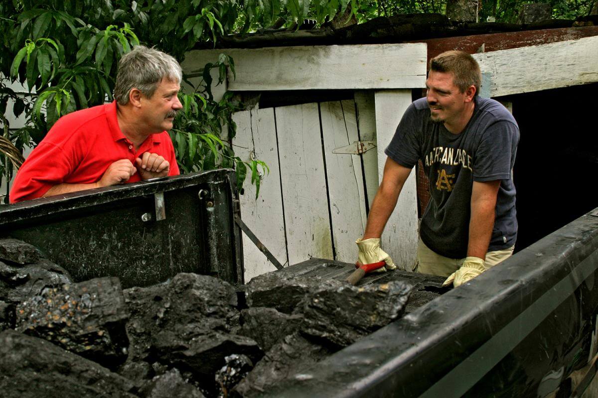
Taking pictures in conjunction with Volunteers In Service To America (1968-1970), then continuing with Miners for Democracy and the United Mine Workers Journal, Earl Dotter was one of the first to document miners' fights for better healthcare, pensions, working and living conditions. As his work expanded to the textile and fishing industries, Dotter maintained an emphasis on the multi-faceted, dangerous, and detrimental conditions facing rank-and-file workers and their families. In the photo essay featured here, Dotter continues his attention to miners, having photographed some individuals, such as black lung pioneer Dr. Donald Rasmussen, for decades, and families, such as the Hipshires of Logan County, West Virginia, for generations.
"Coalfield Generations: Health, Mining, and the Environment" presents images taken in 2005 and 2006 during Dotter's trips to towns in eastern Kentucky and southern West Virginia. He documents transformations in the mining industry, including health and safety initiatives and technological changes. Selected images from this essay have appeared in two exhibitions at Wheeling Jesuit University: "The Genesis of Downtown: Logan-Welch West Virginia Urban Coalfield Life, The Photographs of Russell Lee and Earl Dotter, 1946 and 2006" and "Our Future in Retrospect: Coal Miner Health in Appalachia."
"Coalfield Generations" provides new images, organizing them around themes that Dotter has explored for three decades: Town Life, Health Issues and Healthcare, Working at the Mines, and Mining and the Environment. The accompanying commentary from a 2008 interview with Southern Spaces provides insight into his work.

Downtown Logan apartment dwellers. Logan, WV, 2006.
In Town Life, Dotter photographs residents in eastern Kentucky and southern West Virginia as they go about daily lives and leisure pursuits. He visits a local swimming pool, a baseball field, family gardens, a supermarket, and a Wal-Mart built on a strip mine bench, using each setting to highlight the ways in which commerce and consumption are transforming the mountain landscape.

Health Issues and Healthcare acknowledges the prevalence of chronic disease in the region, including black lung, but also such illnesses as heart problems, diabetes, and hypertension. Dotter distinguishes generational differences in miners' healthcare: retired and actively-working miners have benefit plans with affordable access to local care, while many working-age coalminers have been laid off, leaving them with few, if any, healthcare options.

Working at the Mines sketches the contemporary coal industry and life in the mines. While technological advances have made work safer, Dotter records the aftermath of catastrophes, such as the 2006 Sago Mine disaster. His images of laid-off and out-of-work miners suggest current tensions between miners and coal company management.

Mining and the Environment delves into surface mining processes and their impact on Appalachia's mountains, waterways, and landscapes. Heavy coal trucks and erosion damage the region's roadways, contributing to dangerous driving conditions and automobile fatalities. Dotter also finds a new generation of volunteers coming to the region to test water quality and assess the environmental costs of industrial mining.
.")
Town Life
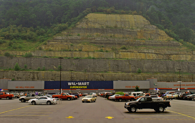


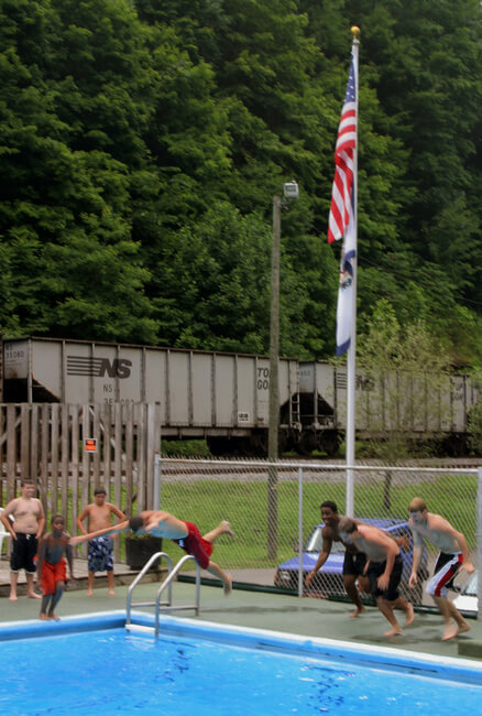
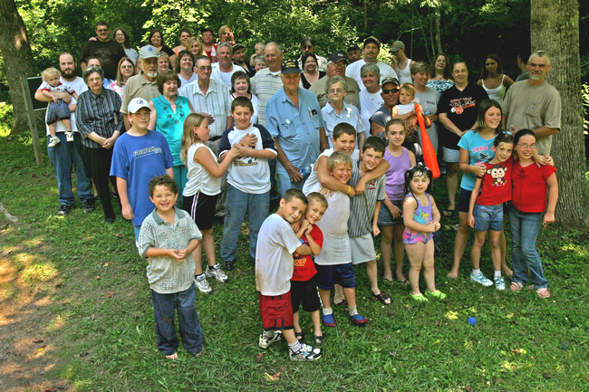
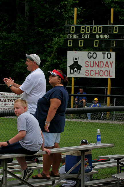
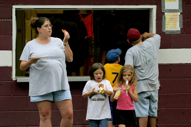

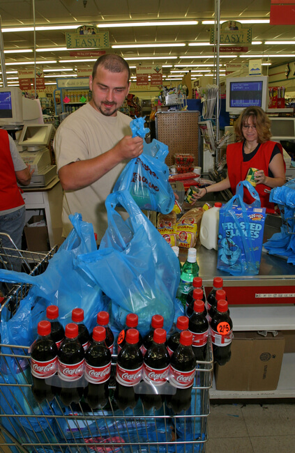
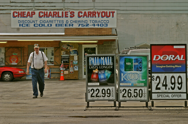
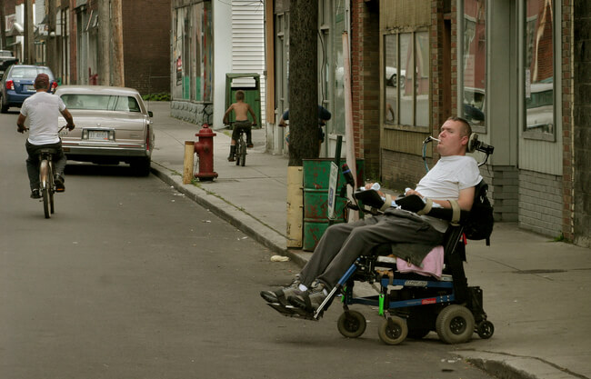
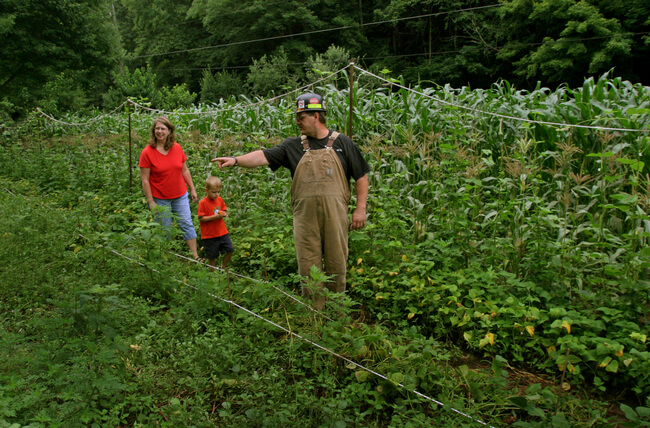

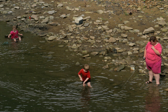
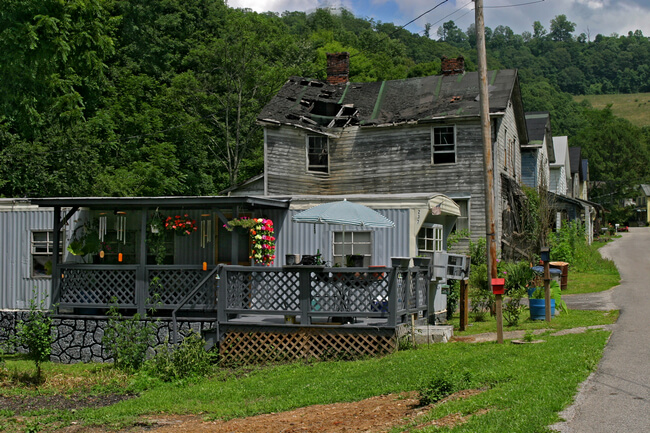
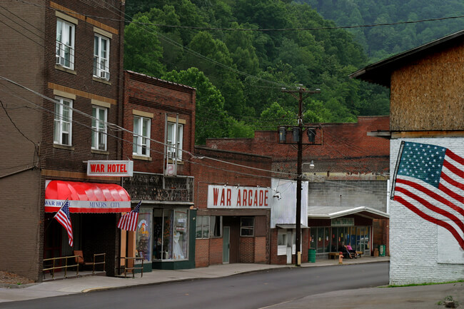
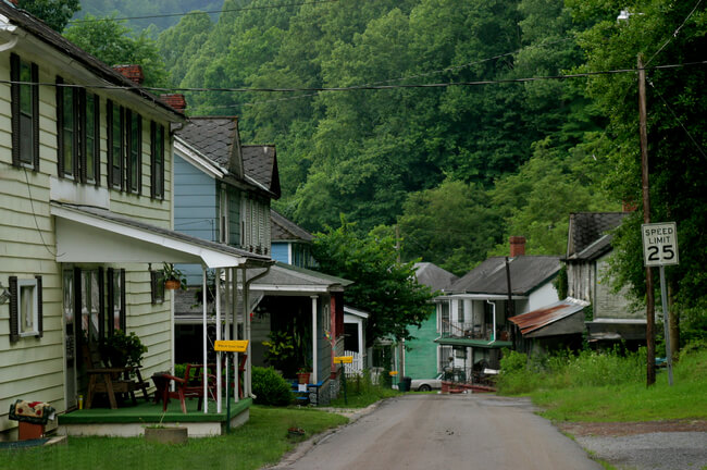
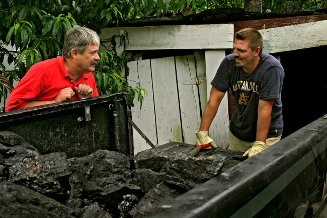
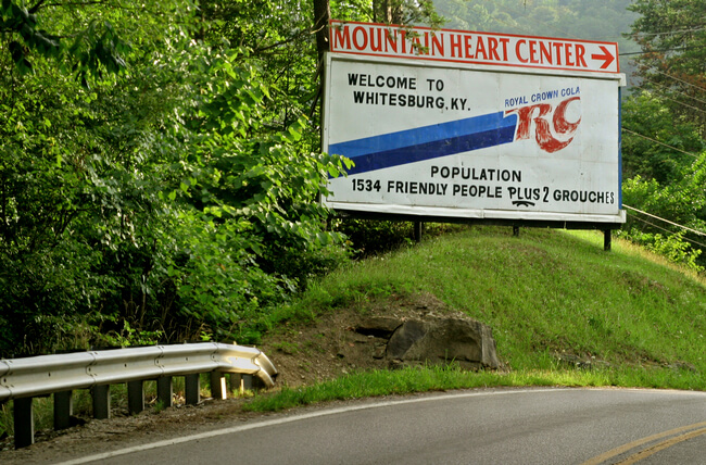

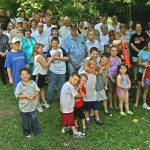
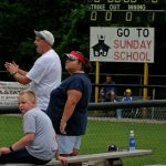


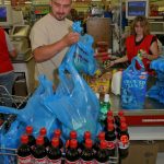


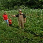
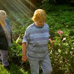
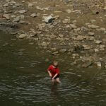
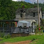
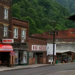
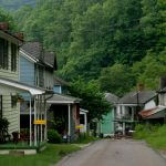
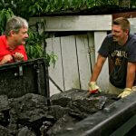

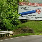
Connecting with people in specific places lies at the heart of Dotter's project of documenting miners. The photographs in this section sample daily life in the coalfields, from family reunions and baseball parks to changing patterns of consumption and town structures. Through his photographs of the everyday, Dotter challenges stereotypes of Appalachia while calling attention to contemporary problems.
Changes in the coal industry have affected the area in myriad ways, some of them depicted in these images. While coal keeps the lights on, businesses like Wal-Mart are becoming the major employers. When mines close and the number of miners decreases, company housing may deteriorate, be abandoned, or replaced by mobile homes. But this is not just a story of desolation: homes remain, with hanging plants and wind chimes. A consistent element of Dotter's work locates his subjects' effects on their communities despite difficult conditions.
Dotter's work chronicles other concerns in these coalfield towns, particularly problems of health — obesity, tobacco use, and disability. Due to automobile accidents, work-related accidents, and substance abuse, disability rates are high here. Working conditions, unemployment rates, and poor roads also take their tolls.
Many of Dotter's photographs of daily life tell stories of consumption, particularly the ubiquity of tobacco and the epidemic of obesity. Sugar-laced soda is a constant in this area as demonstrated by the women on their porch, the boy at the baseball game, the man in the grocery store, and the RC sign that announces Whitesburg, Kentucky. Other photos in this series feature outdoor pursuits such as gardening and fishing. In the captions below, Dotter speaks about some of these images.
Earl Dotter
Employment: Wal-Mart has become West Virginia's largest employer. That's a pretty surprising statistic in light of the impact the coal economy has had on West Virginia for generations. That this Wal-Mart is situated on a strip mine bench underscores the irony. Jobs that used to be in the mines are moving to corporate big box stores like Wal-Mart.

Community: Downtowns that used to be a hub of community life in the coalfields are also impacted in a major way by the movement of commerce to national chains and big box stores. You see adjacent to the Wal-Mart a Holiday Inn Express. We've all probably stayed in that kind of hotel, but back in the days when I was a shooter for the United Mine Workers Journal, I would stay in the Pioneer Hotel in downtown Logan, which supported the downtown of that county seat town.

Consumption: It's a fact that throughout our society, families often need two wage earners. If one adult in a family setting would be largely responsible for the garden, someone also needed to take a job at Wal-Mart or a local fast food restaurant at a minimum wage to support a modest lifestyle. There's a wave of diabetes throughout the coalfields that relates to the food consumption habits of coal mining families. In following shoppers at the local supermarket, I saw heavy emphasis on prepackaged food, on soda pop, and items low in food value. That's a difference that's glaring.

Diet and obesity: My conception of an Appalachian individual when I first came to the coalfields during the war on poverty was a lean, gaunt, skinny individual. Today obesity is a major issue in the coalfields. Lifestyle changes, even the mechanization of work, have altered the physique and the health of mining folks that I rub shoulders with. Diet plays an important role. Used to be most folks had garden plots outside their homes in these company towns, but that's almost history. The older generation still puts them out, but not so much the current working population.

Changes in housing structures: My photos of buildings are emblematic of the change that's occurred from the days when I regularly stumbled upon intact coal camps in the 1970s. That was at the end of an era. Today I return to Dehue, West Virginia, just outside the county seat of Logan in Logan County, and find just a bare field with a prep plant being built on that site. Where I can, I show the old and the new in juxtaposition — in McRoberts there's the newer mobile home, trailer, against the falling-down row of old camp houses with the mountain in the background. That picture is useful in showing the difference.

Health Issues and Healthcare
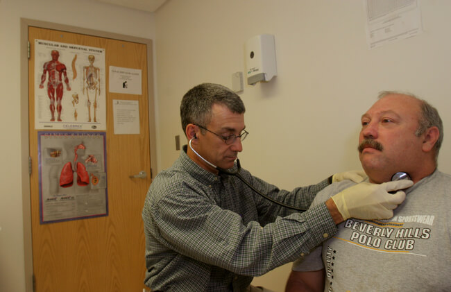

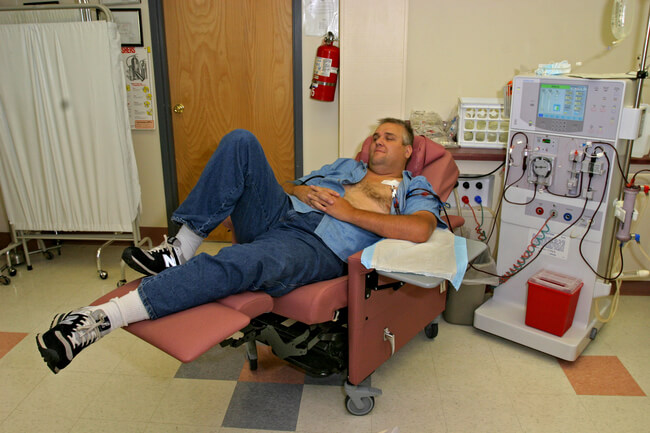
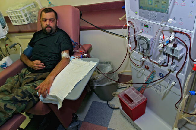
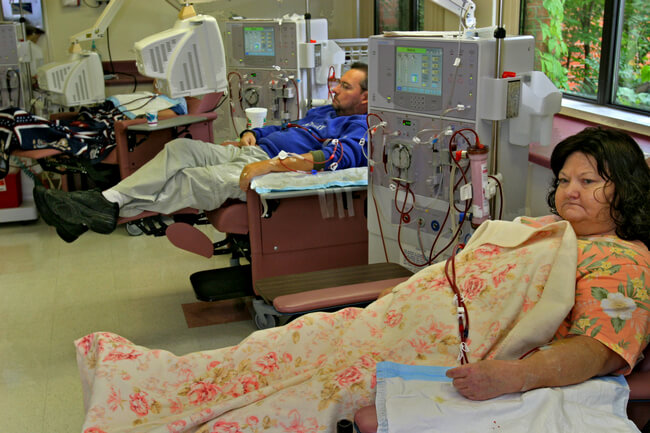
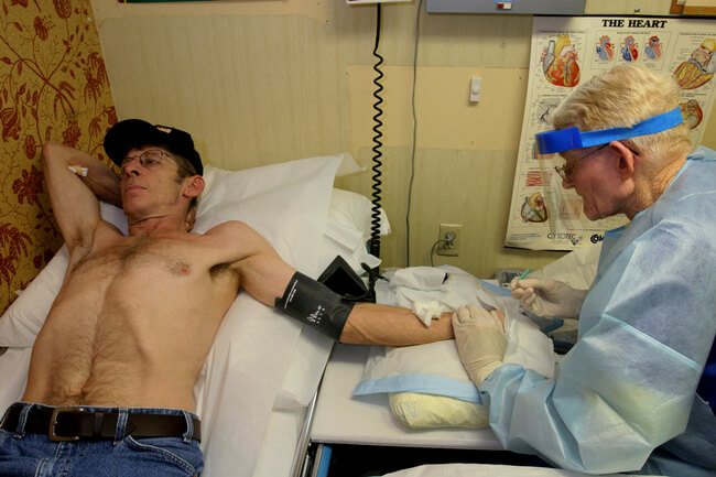
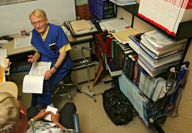
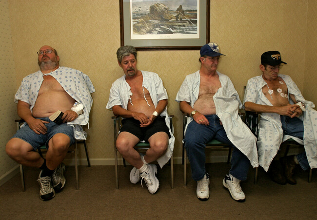
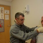
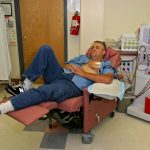
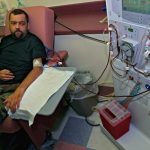
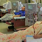
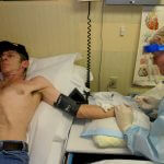
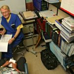
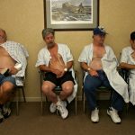

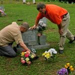
This sequence of photographs begins in Appalachian clinics, highlighting the emblematic mining disease black lung, as well as the rise of diabetes. Healthcare, its quality and access, has changed thanks to the work of people like Dr. Donald Rasmussen; however, health problems still trouble coalfield communities. There is a physician shortage and patients often have to travel considerable distances on poor roads to reach healthcare providers. Lack of adequate insurance also impedes disease prevention and treatment, particularly as the coal industry restructures, laying off younger workers and leaving them and their families without medical coverage.
Chronic and rapidly increasing rates of obesity-related diseases, as illustrated in the first pictures in this series, are the result of changing working conditions, lifestyle choices, and consumption patterns.
Although black lung is not as prevalent as it was twenty years ago, the remaining pictures in this series attest to its persistence among miners. Dr. Rasmussen, pictured administering care and in his office, has worked with miners since the 1960s, collaborated with lawmakers on legislation for black lung compensation. The final two pictures evoke earlier generations of black lung through the remembrance of two miners' fathers.
Problems associated with older generations of miners, such as a lack of healthcare providers, under-nutrition, inadequate medical benefits, and black lung treatment, have improved; however, new diseases, particularly those relating to consumption and to changing working conditions, are causing new problems. In his 2008 interview with Southern Spaces (excerpted below), Dotter discusses some images and issues in more detail.
Earl Dotter

Changes in healthcare: The whole healthcare system has changed to a great extent. The miners who are actively working continue to have a fairly useful health benefit plan that provides them with healthcare and with medications. They have local providers, their own physicians, or their primary care facilities in their communities to access. What's different is there are so many coalminers of working age who have been laid off and left high and dry and whose health benefits soon disappear. I profiled a local UMWA worker who was so impacted in Kanawha County, West Virginia. There were coalminers in their fifties and late forties who had lost their jobs at a mine where they had worked for fifteen or eighteen years, just short of retirement and of being eligible for lifetime healthcare. One miner had lost his house and was sleeping in the local union hall. I followed him to a free clinic in Clay County, some distance away, where he was getting medication for hypertension, heart problems, and early-onset diabetes.


Healthcare also becomes a major issue when coal companies purchase facilities, shut down the operations, lay off the miners, then reopen under new corporate settings. These new companies do not rehire the miners who were active under the previous contract. Instead of hiring the local workers who have worked in a mine for generations, the new management will employ workers who drive fifty, sixty miles from adjacent counties to work in that facility. That's a strategy that plays on the fact that miners are not all working from the same community that was adjacent to the mines.

Generations of miners: This project was an opportunity for me to reconnect with the next generation of coalminers that I had worked with back in my days with the UMW Journal. The cover of my book, The Quiet Sickness featured the photograph of Lee Hipshire, a deep miner who had died of black lung at the age of fifty-seven. I had met several of his sons at the time I photographed Lee. This exhibit gave me the opportunity to look up his sons who were still working in the coalmines. I found Lee Hipshire, Jr., and another brother who was working at the mountaintop removal site in Boone County. I was able to profile their family life some forty years since my initial coverage with the Mine Workers Journal.

Distance and healthcare: One of the problems that leads to severe cases of illness is the distance residents have to travel to healthcare facilities. Because it's a high cost item to have to travel these days from a remote location to a health care facility, health problems tend to get addressed later rather than sooner in the coalfields. This leads to higher rates of cancer, diabetes, and other chronic diseases.

Pioneer black lung doctor, Donald R. Rasmussen says, "The disease continues to be a problem at smaller mines in the region." Beckley, WV, 2005.
On Dr. Donald Rasmussen: To the extent you have a network within the coalfields, you can open doors that would not ordinarily be available. I knew Doc Rasmussen back in 1978 and he appreciated the work that I did in that era when I was active in not only helping miners but also advocating improvements in state and federal mining dust laws and compensation law. He appreciated the fact that I was returning three decades later to resume my documentation of his work with black lung victims.
Working at the Mines
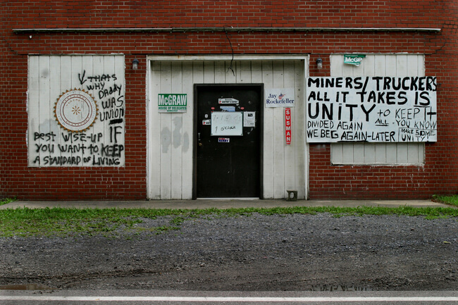
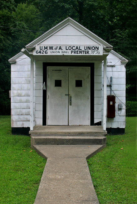
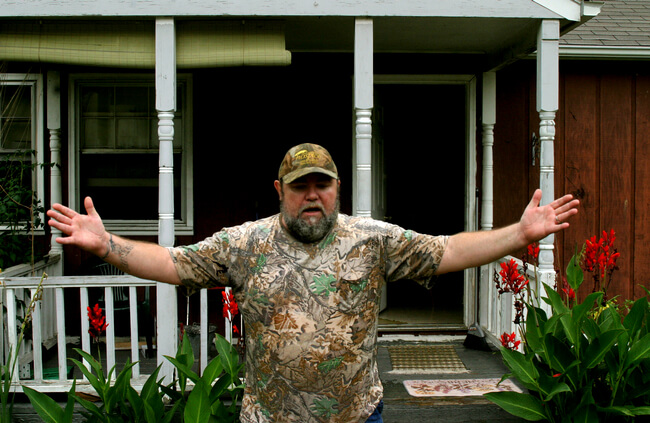
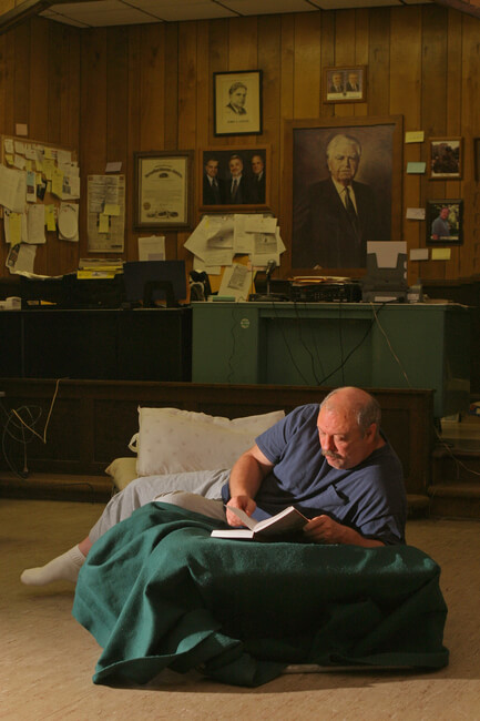
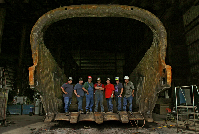
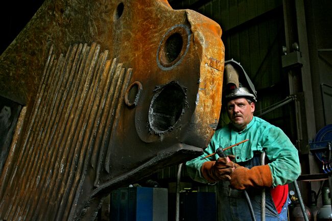
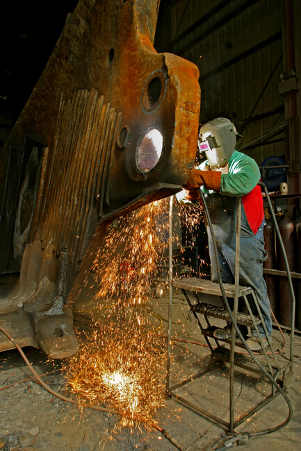
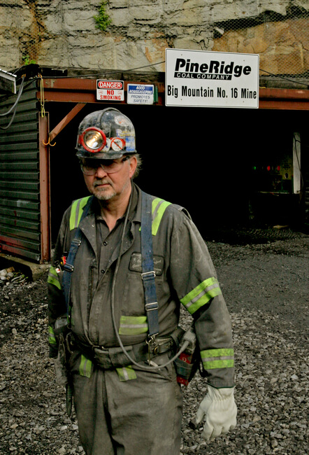
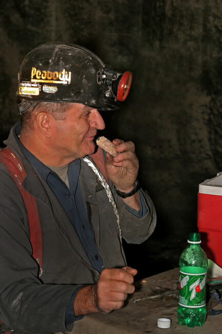
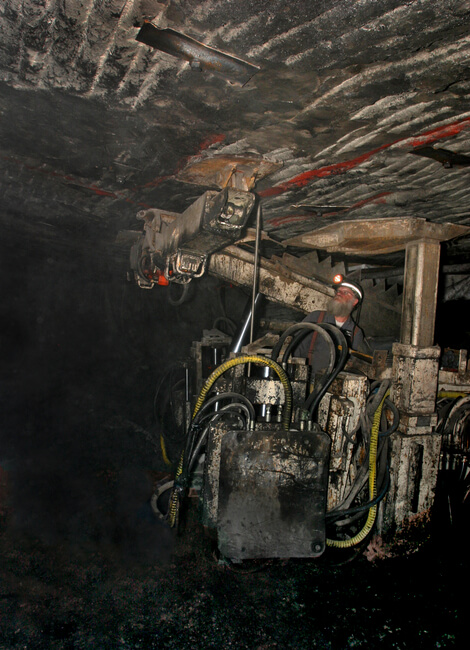
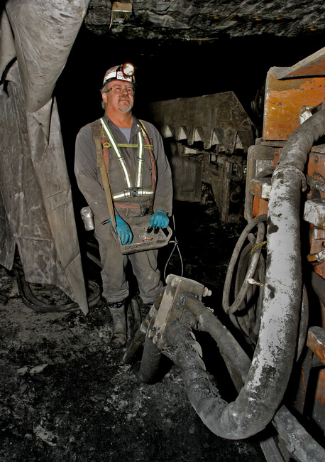
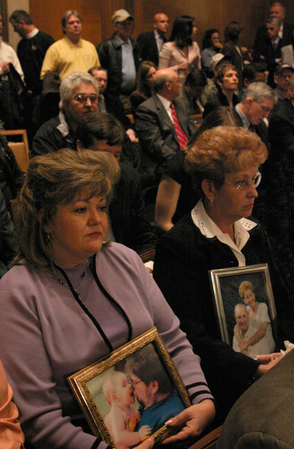
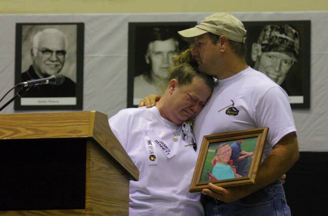

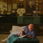
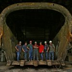
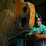
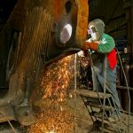
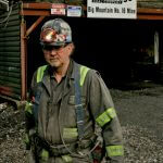
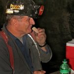
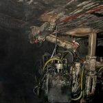
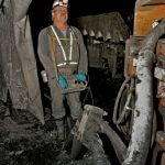

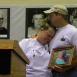
In the 1970s, Dotter worked in the coalfields as a photographer for the United Mine Workers Journal. In these photographs, he returns to the working lives of miners. Particularly, he documents changes that have occurred since his earlier engagement with these communities. In the first four images, he outlines contemporary economic, technological, and organizational factors that have altered the face of mining in Appalachia. Symbolized by shuttered union halls with poignant graffiti, the decline of UMWA membership undermines worker control over relations with coal companies. Such control is necessary to combat the changing dynamics of power in the labor force. Coal companies employ legal strategies, such as bankruptcy reorganization, to trim down their labor forces and replace career miners with new ones. Many career miners find themselves without jobs and without the pensions and benefits they worked a lifetime to earn. Although the UMWA has taken some measures to fight these company strategies in court, its dwindling numbers render such struggles difficult.
Another factor hurting union membership is the general downsizing of the labor force with the advent of new surface mining technologies that replace a large mining workforce with a smaller group of machine operators. In the Appalachian region, surface mining technologies for mountaintop removal impact the economy most profoundly. Dotter captures these shifts in technology that have diminished the labor force in a series of images about miners in Boone County, West Virginia. The small group of miners posed with their dragline bucket suggests the impact of mountaintop removal technologies. Later images of individuals operating and repairing machinery testify to the decreased number of working miners.
Dotter's images of new technologies also illustrate the advances in mine safety. In his photograph of the miner operating a roof bolting machine, he points out improvements that allow miners more support in the mine and less proximity to coal dust agents. These are step towards healthier working environments. Yet, these advances have not eliminated mining tragedies, such as the 2006 Sago Mine disaster, and their tragic consequences for miners and their families. Through images of disaster hearings, Dotter documents these human losses. Below, Dotter discusses changes in working at the mines.
Earl Dotter

Technological advances in mining: One of the things that is quite different is the fact that there are fewer workers in a mine today than when I first went underground in 1973. I see longwall mining operations, and one worker is at the shear — a football field length long machine that traverses the coal face shearing off the coal. There's just one individual and all that coal is spilling onto an automated belt. That's different. Roof-bolting is a much, much more secure job than it used to be because of these machines that hydraulically support the roof where the roof-bolt is being inserted, so the miners are much better protected than they used to be. The continuous mining operator operates the machine with a remote control device further back from the face so he's much less at risk from roof falls as well as from respirable dust. Those are just a few examples.

Mining disasters: My picture-taking strategy is to include family members, spouses, and younger children in the tragic settings because they are devastated by these events. I feel that viewers of the photographs have a better way of relating to the loss when they see other family members included in the scene. For instance, the pictures of the family members at the Sago Mine Disaster hearing in 2006 holding pictures of their lost father and showing the grief that overwhelms them. I feel that these photographs should be seen by individuals outside of the community because I want them to have ways to identify with the tragedy.

Miners' livelihoods: This photo shows the mine-worker community expressing the stress at their livelihood being at risk, and all that represents — healthcare, a decent income, housing. The backdrop is a house that this miner had acquired. It was designed by a program of Yale architects to provide affordable and substantial rebuilt housing for coal field residents in Cumberland, Kentucky. While this miner was still active and working, he was expressing concern about his neighbors' losing their jobs and their homes.

The UMWA: The shuttered union hall is symptomatic of the decline of unionized coal mining in Appalachia. It is under siege. The mine workers union, in its entirety of active miners, is the size of a large local of the Teamsters — around forty thousand today. That's ten percent of what it was when I was first involved with the reform movement in the 1970s. So the shuttered local union hall is a profound symbol for the decline of the UMWA. Its viability is mostly in its retirement protections and the health benefits it offer retirees. Significant political support continues those protections, but active miners who are members of UMWA are far fewer today.
Mining and the Environment
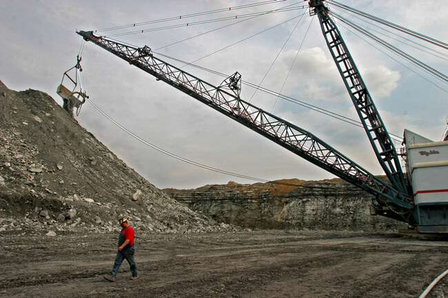

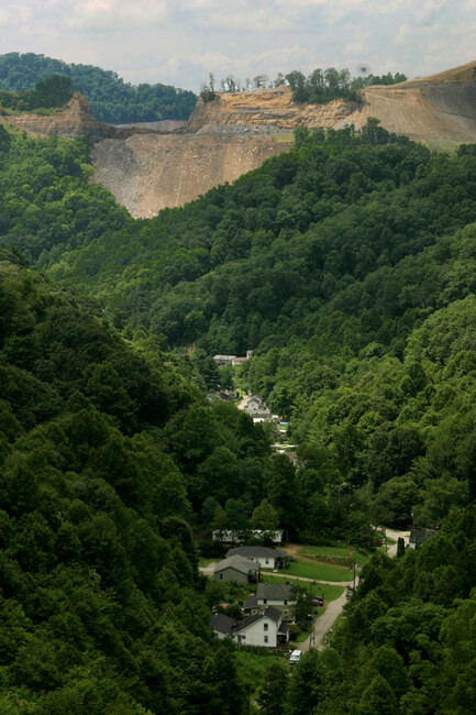

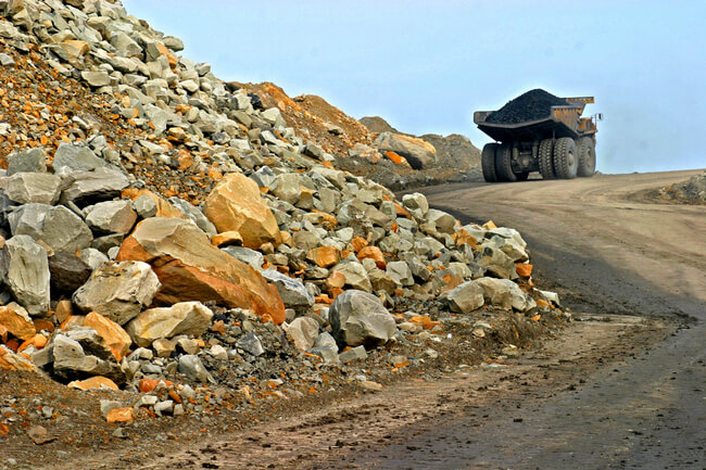
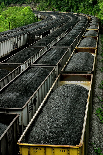
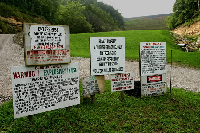
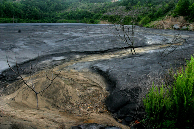
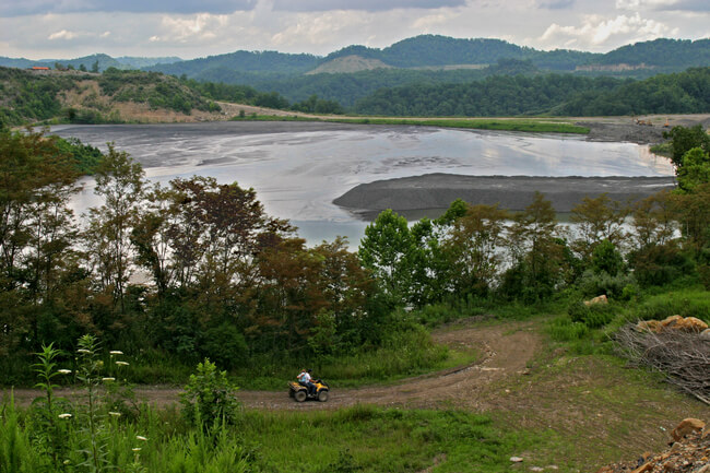
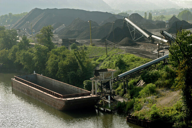
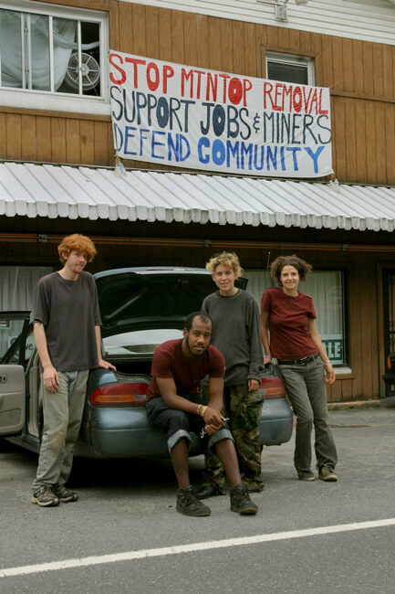
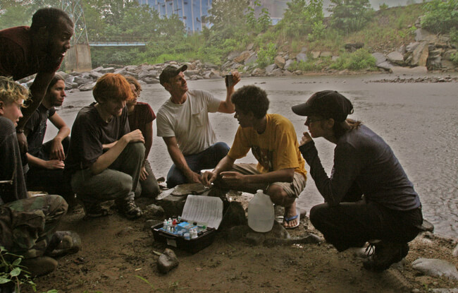
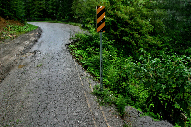
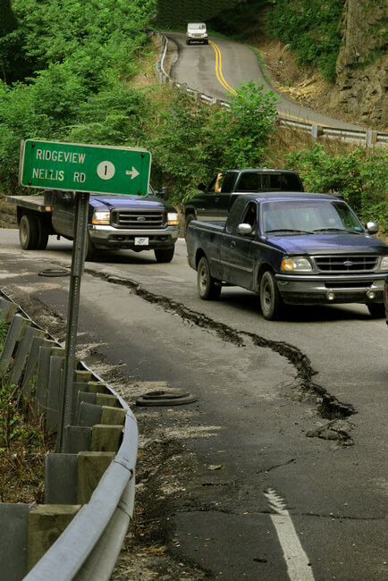
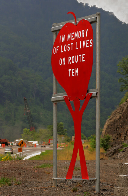
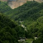

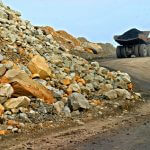
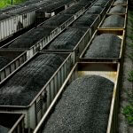
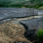
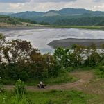


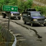
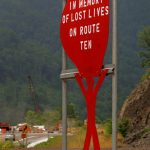
In this series of photographs about the impact of new surface mining techniques on the environment, Dotter captures the threat that mountaintop removal strip mining poses to the natural environment, residents and their communities, and constructed features such as roadways. Initial images portray the mountaintop removal process in progress, as miners operating dragline shovels remove the overburden covering a coal seam on a mountaintop in Boone County, West Virginia. A vertical shot captures the devastation of the natural skyline and the proximity of the ecosystem's upheaval to a nearby residential community in McRoberts, Kentucky. Dotter's images follow the process of coal extraction and removal as trucks haul mined coal from mountaintop sites and deposit it on rail cars and barges leaving the region. The proximity of these operations to waterways highlights questions about water pollution at sites like the Kanawha Coal Load Out Facility in Montgomery, West Virginia.
Another group of images depicts valley fill waste impoundments, where coal companies dump refuse from mountaintop removal and coal extraction. Dotter's images capture the shroud of privacy in which such sites exist with warning signs, as well as the ways in which coal sludge and other waste erode land and water. Such impoundments threaten towns with waste disaster devastation (as happened in Martin County, Kentucky in 2000) because of the sheer volume of refuse dumped there. New generations of environmentalists protest these conditions in the Appalachians. Dotter highlights these activists in images of Raleigh County, West Virginia, home of the Brushy Fork Sludge Impoundment — more than seven billion gallons of coal slurry sitting precariously above schools and homes.
Dotter reveals the damage that large machine coal operation exacts on the built environment through images of roads destroyed by the constant traffic of treacherously overloaded coal trucks. Coupled with an endemic disregard for seatbelt use in the region, these unsafe routes contribute to traffic accidents and dangerous travel conditions. Dotter talks about the contemporary impact of mining on the environment in excerpts from the 2008 interview, below.
Earl Dotter

Mountaintop removal: Of course, strip mining goes back to the 1950s in Appalachia on a much smaller scale. But with the emergence of larger machinery and the mountaintop removal technique, the impact is hard to miss today. Communities where there is no coal are spared and remain with their beautiful mountaintop skyline, but it's not hard to find that skyline interrupted dramatically when you go to a hollow that has several seams of coal that have been accessed by removing the overburden and moving that overburden into the only available location in the hollows that are adjacent to that mountaintop. That has impacted runoff and created dramatic incidents such as occurred in Martin County, Kentucky eight years ago and other communities that you hear about on a smaller scale. I worry that we'll have another hundred-year storm like the Buffalo Creek flood and the impact of that will be quite severe because of what has occurred with mountaintop removal.

Dangerous roads: Fifteen percent of adults in McDowell County are disabled and I think that relates to a number of situations: dangerous workplaces, dangerous highways, risky lifestyle at various ages. You travel secondary roads and you see these memorials put up by family survivors of accidents where relatives have lost their lives on a hairpin turn. You see overloaded coal trucks plowing head-on into cars with families inside, and you see individuals who are intoxicated behind the wheel. There are problems that need to be addressed with healthy eating and healthy living.


Activism: This new generation of environmental activists came from all over the United States—mostly the eastern United States—but there were kids from New England, from the South, and they were working with a local activist who was concerned, most specifically, with a school built under a very significant mine-waste impoundment — and a very large coal silo built almost immediately behind this school. These activists had scientific backgrounds and were doing tests of water quality in the area. They had other expertise that they were sharing with locals. It's not too different from my era when VISTA and Appalachia volunteers were on the scene providing specific expertise and assistance when requested.
Acknowledgements
Frances Abbott, Katie Rawson, and Sarah Toton contributed the written portions of this piece.
About the Photographer
Since 1968, Earl Dotter has photographed miners in Appalachia. Trained at the School of Visual Arts (1967-1968), Dotter became interested in photography, publishing his early work in New York magazine. In 1968, he joined VISTA (Volunteers in Service to America), working with miners and their families in Cookville, Tennessee. In 1972, Dotter became a staffer of the mine-reform newspaper, The Miner's Voice, before photographing for the United Mine Workers of America's United Mine Workers (UMW) Journal. Dotter documented miners' health and safety conditions as well as the changing aspects of miners' lives. Leaving the UMW Journal in 1977, he continued to photograph the Appalachian coalfields, as well as Carolina textile towns and other sites of hazardous work, producing his 1996 exhibit, "The Quiet Sickness: A Photographic Chronicle of Hazardous Work in America," and a 1999 exhibit, "Appalachian Chronicle, 1969-1999: The Photographs of Earl Dotter." Dotter has won numerous awards for photojournalism and contributions to the labor movement.
]]>